

-
 13025 Hits
-
 73.06% Score
-
 3 Votes
|
|
Route |
|---|---|
|
|
35.23850°N / 107.6077°W |
|
|
Hike |
|
|
Half a day |
|
|
Class 1 |
|
|
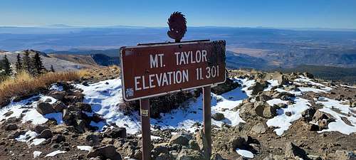
Mount Taylor
At 11,306 feet, Mount Taylor is the highest peak in the San Mateo range, located about 15 miles northeast of Grants, New Mexico. In the winter its snow-capped peak is especially noticeable. During the Spanish rule of the region, the mountain was called Cebolleta (little onion). In 1849, after the U.S.-Mexico War, it was renamed after President Zachary Taylor. For the indigenous peoples of the area, Mount Taylor is a revered and spiritually significant location. In Navajo it is known as Tsoodzil (Turquoise Mountain) and is one of the four sacred mountains that mark the Navajo homeland.
According to Hillerman's version of Navajo mythology, First Man buried turquoise in this range, hence its symbolic blue color. Under Hillerman's interpretation, the chief of the Enemy Gods, Yé'iitsoh, once resided in this peak. When the Twin War Gods (Born for Water and Monster Slayer, sons of Changing Woman) killed Yé'iitsoh, his blood spilled down the slopes and hardened into the lava flows of El Malpais in the area surrounding Grants. The mountain features as a central and meaningful location for Blessingway and Enemyway ceremonies.
Visit this link:
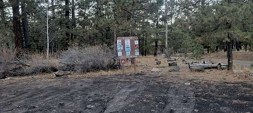
Trailhead
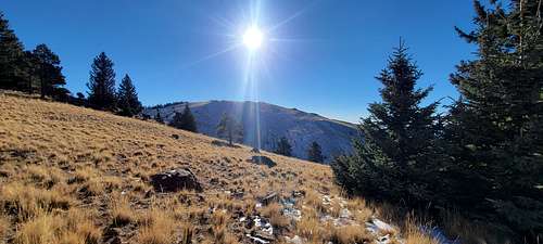
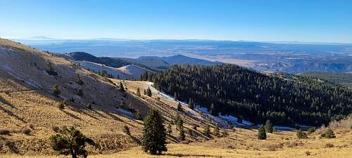
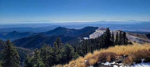
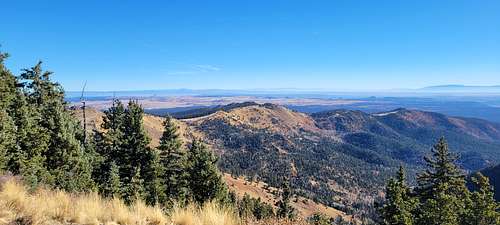
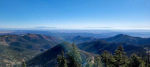
The Gooseberry Springs Trail takes hikers from the slopes of Horace Mesa up to the peak of Mount Taylor - the highest peak in northwestern New Mexico and a sacred mountain to many of the regional Native cultures. It is one of the four sacred peaks that define the Navajo ancestral lands. Views from the summit of this ancient stratovolcano are spectacular; the peak is wide open in three directions, with dense forest on the northwestern slope.
The peak is also the high point, literally, of the annual Mount Taylor Winter Quadrathlon (separate entry), a 43-mile endurance challenge by bike, foot, ski and snowshoe.
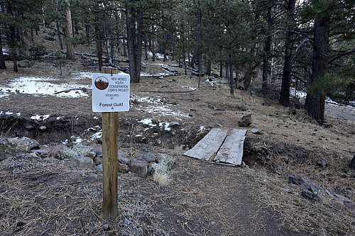
The Gooseberry Springs Trail is a steady, moderately steep hike that climbs 2000 feet in 3.1 miles to the summit at 11,301-foot elevation. The trailhead, at the 9300-foot level, is reached by driving 13 miles northeast from Grants on Lobo Canyon Road ( NM 547) then at pavement's end, go 5 miles southeast on Forest Road 193. The trailhead marker (Trail 77) is on the left while parking is on the right (If you come to a right-hand road fork, you've gone a bit too far).
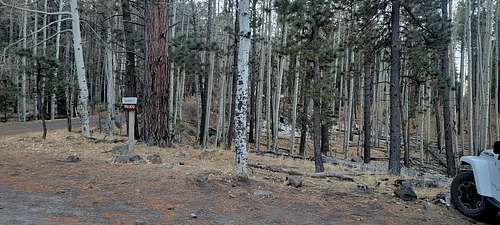
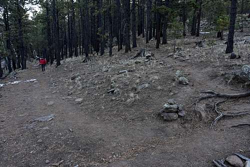
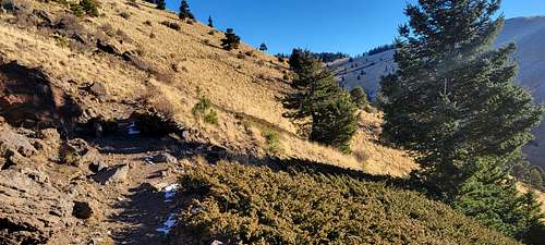
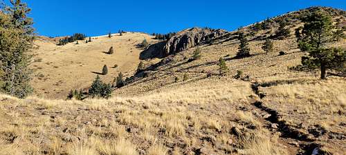
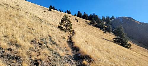
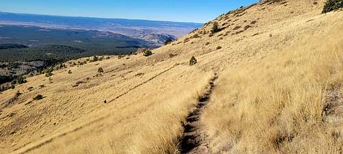
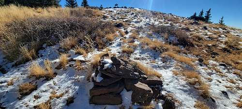
This hike is on Cibola National Forest lands. It begins in mixed pine and aspen forest and climbs steadily up-canyon for a half-mile or so, passing Gooseberry Spring below the trail on the left. It soon breaks out of the forest and crosses areas of broad meadow with sweeping views to the west and south. Crossing a saddle, the trail sidehills in the open above deep Rinconada Canyon, then beyond another saddle it switchbacks northward and upward across a steep grassy slope. A final short rocky stretch leads to the summit.
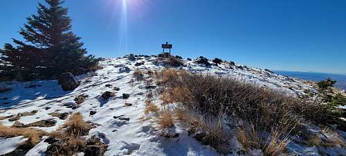
At the peak is a metal elevation sign and hikers' log; it's a great lunch spot with endless views. The summit winds can be a bit "intrusive," but thick trees on the north side offer good shelter for that lunch break. The La Mosca Fire Lookout and antenna farm are visible a mile to the northeast; a faint trail off the summit leads east, down to FR 453, the lookout access road. Return west again from the summit to the trailhead parking area.
Be aware that the summer monsoon season brings storms to the high peaks, and lightning. Always check with the local Forest Service for the weather and road conditions.
|
|
|
Route Description
 |
 |
 |
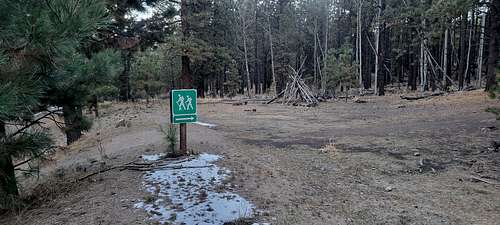
Routefinding on this trail is very straightforward: simply follow Trail 77 to the summit of Mount Taylor and then reverse the route to descend.
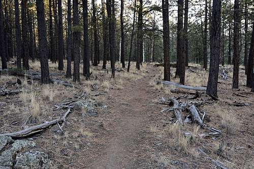
From the trailhead, the trail heads east through a pine grove and then begins to parallel a shallow creekbed through which the waters from Gooseberry Spring flow (sometimes). After a short while, the trail passes a large, metal watering tank, crosses over to the right side of the shallow creekbed, and emerges from the trees onto open, grassy slopes.
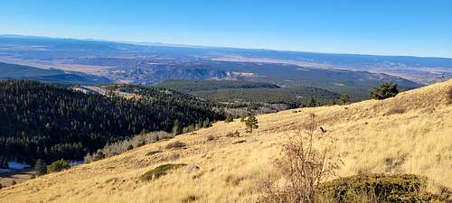
The trail continues eastward and begins to climb up the southside of a broad valley that feeds into the creekbed you have been following. The trail continues to climb up to the valley's southern rim, which is actually a ridge separating the valley you are in from another valley to the south. From this ridge, beautiful views to the south and east are found.
 |
 |
 |
 |
 |
 |
The trail then veers to the northeast and passes to the southeast (right) of a small unnamed peak on this ridge. After you pass this small peak, the trail emerges on to a saddle between the unamed peak and the ridge leading up to Mount Taylor. Again, there are excellent views from this saddle.
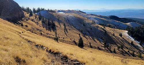
The trail continues northward and begins to climb up the west (left) side of a broad ridge extending southeast from the summit of Mount Taylor. The trail switches back a couple of times and continues heading northward on the west side of Taylor's south ridge. The trail then passes through a fence and continues on for a quarter mile or so to the summit.
Most of the hike to this point has been on bare slopes, but you will see that there are a great deal of pine and aspen trees near the summit and on the slopes to the east of the summit.
 |
 |
 |
 |
 |
 |
To descend, simply reverse the route. Or, if there is good snow and you brought skis, you can do a descending traverse to the south until you reach the broad valley you ascended earlier, at which point it would be a nice 1,800' descent to the trailhead on open slopes
Essential Gear
 |
 |
 |
No technical gear is required. Bring rain gear and water in summer months. Winter ascents will require appropriate clothing and footwear. After significant snowfalls, bring skis or snowshoes.
Miscellaneous Info
ECO-FRIENDLY NOTES
The lower slopes of Mt Taylor near the trailhead do host a limited amount of grazing, and small steel stock tanks are found in the lower canyon section, which are fed by Gooseberry Springs.
PET FRIENDLY NOTES
Be aware of grazing stock in lower areas of the trail.
TRAIL DISTANCE
Sources vary, about 3.5 miles one-way.
VERTICAL GAIN OR LOSS
2000 ft total climb - from approx 9,300 feet to 11,301 elevation.
Sacred Mountain
Who Considers it Sacred?
American Indians of the pueblos of Acoma, Laguna, Hopi and Zuni. It is also sacred to the Navajos. It is a pilgrimage place for as many as 30 American Indian tribes including the Apache, Arizona Oodam groups, Pai and Utes.
Significance: To the Navajo, who call it Tsoodzil or the turquoise mountain, it is one of four sacred mountains marking the cardinal directions and the parameters of Dinetah, the traditional Navajo territory. Tsoodzil is considered to be the southern edge of their territory and is associated with the color blue and female gender. In Navajo oral histories, the four sacred mountains were created by First Man from the earth of the holy Fourth World molded together with sacred matter in the perfect likeness of mountains from that world.
Mount Taylor is the home of the Acoma Goddess of Creation. Mount Taylor is the source for Acoma people for sacred pine bows held by dancers in rituals and for logs used in the construction of kivas. Short pine branches from the top of the mountain are also held by dancers at Acoma.
The Threat: Uranium mining on federal, state and private lands. Mount Taylor sits on one of the largest sites of uranium ore and mining is under consideration for federal, state and private land. The 1872 Mining Law governs much of the land and permits mining without environmental review or assessment of its impact on cultural resources. Mining would also adversely effect the primary source of water for the Acoma Pueblo. Their water comes from the Rio San Jose that is primarily fed from the snow-melt from Mount Taylor. Wind blows radioactive dust throughout the region, children play with tailing pipes strewn about the landscape, and houses have been built with radioactive waste tailings built into cement used in housing.
There is also a small coal mine on the north side of the mountain that degrades the site.
Preservation Status: As of February 2013, the US Forest Service has been engaged with the National Trust for Historic Preservation and other organizations, including pueblo and tribal representatives regarding potential environmental and cultural impacts from the proposed La Jara Mesa and Roca Honda uranium mining projects. The Forest Service announced that they would supplement the La Jara Mesa Draft Environmental Impact Statement with more materials when additional information is discovered.
An application for inclusion of the mountain on the State of New Mexico’s Register of Cultural Properties as a Traditional Cultural Property is being held up due to litigation by mining companies challenging the designation. An application for nomination to the National Register of Historic Places has been prepared but has not been submitted.