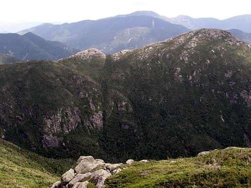
Gray Pk, Mt Skylight & Mt Marcy from ADK Loj
I'd read up on the trails to Gray Peak, Mt Skylight and Mt Marcy in my ADK High Peaks book and researched what I could find about doing a loop hike of these 3 mountains from Adirondack Loj. I knew it would be about 18 miles and around 5,000 ft elevation gain overall, and expected portions of the trails to be steep, rough, rocky, rooty and muddy. It's the Adirondacks after all, right? I got a chance to try out this loop hike and I wasn't disappointed. There was a little of everything and the views along the way were excellent. I noticed there was no route or trip report of this loop on Summitpost, so I decided to write one that will hopefully be useful to others contemplating this hike.
I was full of anticipation and unfortunately couldn't get to sleep despite my best efforts, only getting 3 hours of sleep. But I woke up on time, got to the Loj and started out on the trail at 6:37 am. I made it past Marcy Dam and to the Lake Arnold trail by 7:43. This was the easy first leg of the loop and a good warm-up for the rest of the day to come. Next, after a quick break to drink and snack, was the very rocky ascent up to Lake Arnold. I noticed the Lake Arnold Crossover trail 1.1 miles along, on the left, which I had completely missed on my way down from Mt Colden back in June. At 1.5 miles was Lake Arnold and the trail, right, to Mt Colden, which I reached at 8:38. This was a somewhat challenging ascent of 1200' up to Lake Arnold Pass at 1.8 miles on this trail.
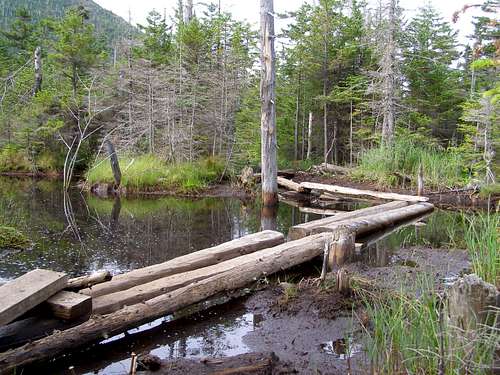
![Swamp Bridge]() Swamp Bridge
Swamp Bridge After the top of Lake Arnold Pass, the trail started a slow, steady descent which was very easy after the last 1.8 miles! The views of the back side of Mt Colden and it's slides were interesting. Then, about 1/2 way along this descent, there was a large, swampy area. Many log bridges and planks aided in this area and I was glad it had been a dry summer thus far. Under normal, wet Adirondack conditions, I could tell that some of these log bridges would be somewhat submerged and one could expect wet feet. I spoke to another hiker along the way who said it took him 14 hours to do this loop the weekend prior. I was a little concerned, as I didn't plan on it taking that long. However, I reached the Mt Marcy trail (trail 121) at 9:18 and so far was very happy with my progress. But I still had three summits ahead of me!
After a break at the trail junction, I started off again at 9:38 on the moderately steep trail and reached Lake Tear of The Clouds at 10:21. I spotted the herd path to Gray Peak across the stream coming out of the lake and followed it probably about .5 miles to the summit of Gray Peak at 10:50. The trail was well worn and easy to follow, with a couple short scrambles along the way. I snapped some pictures and chatted with a couple other hikers on the small, wooded summit. Mt Marcy looked really close from up here, but Mt Skylight looked like it was a good distance away still and would be challenging to get to the summit.
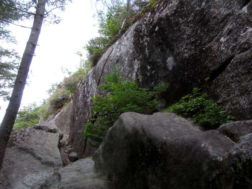
![Gray Peak Scramble]() Gray Peak Scramble
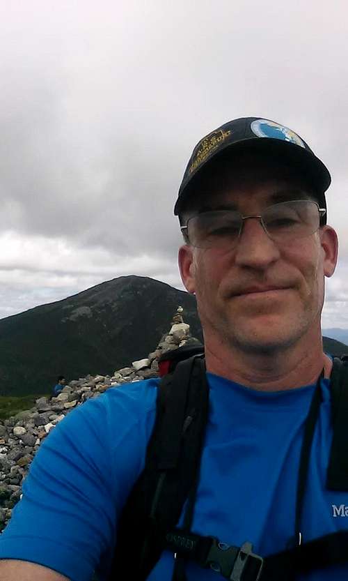
Gray Peak Scramble I left Gray Peak at 11:17 and reached a very well marked intersection known as "4 Corners" at 11:43. The trail was relatively level after coming down from Gray Peak. I grabbed a quick drink and headed up the .5 mile trail to Mt Skylight. The trail was moderately steep but not too rugged and I soon reached treeline and then the summit at 12:08. I didn't see a summit sign, but there's a huge rock cairn that can't be missed. The 360 views were great and I sat and rested while I took more pictures. Once again, there were a lot of people up here. But the summit is spread out and it was nice to socialize but not feel crowded. It was nice to see so many people enjoying the beautiful day up in the mountains.
![My Skylight Summit]() Mt Skylight Summit
Mt Skylight Summit At 12:40 I was off again on an easy decent, returning to 4 Corners at 12:56. From here it was .8 miles up to Mt Marcy, the top of New York! The trail to Mt Marcy wasn't too rough and surprisingly not extremely steep as I had suspected it would be. About 1/2 way up there was a nice lookout on the right side of the trail with great views looking into Panther Gorge. After this point I reached treeline and the final push to the summit. But it was also right after getting above treeline that my lack of sleep hit me. Suddenly I just felt totally wiped out and wondered for a moment if I had underestimated this hike. I persevered however, after taking probably 4 short breaks in this last .3 mile section and made it up to the apex of my trip...and a well deserved rest! Time: 1:50 pm
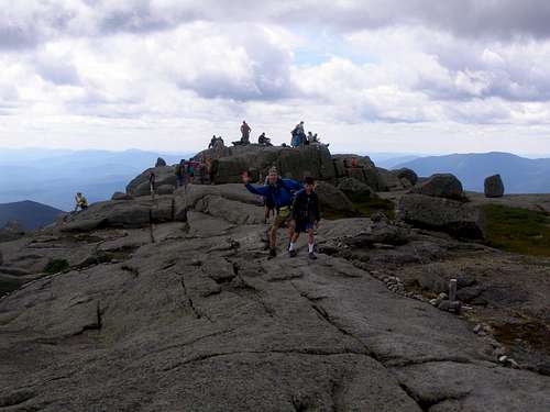
![Summit Party]() Summit Party
Summit Party There were at least 40 people on the summit of Mt Marcy this day and I didn't blame them. It was a really beautiful weekend day in the middle of summer. While I usually enjoy the solitude of the mountains, seeing the multitude of people was pretty neat and didn't really detract from the views and the feeling of reaching the highest point in New York. After a few minutes, I walked over to a less crowded area, snacked and laid down and relaxed for a little while with my eyes closed. After my rest, I of course took more pictures. The views from up here were amazing and gave me a totally different perspective of all of the other peaks I had summited over the years.
I left Mt Marcy at 2:25 and took a little break at Indian Falls on the way down at 3:50. Too bad the weather had been so dry this summer, as there was barely any water going over the falls now. I can't wait to come back and see the falls during the spring snow melt or anytime it's really flowing. I had to laugh at myself a little because earlier in the day I was thankful for the dry conditions. At 4:00 I started the last leg of my journey and reached the Loj at 5:36. Loop Time: 11:00 hours, Map Mileage: 18.3 miles
![Mt Haystack]() Looking Across Panther Gorge to Mt Haystack
Looking Across Panther Gorge to Mt Haystack A pretty awesome day and a challenging, yet reasonable and very scenic day hike. I'm not a speed hiker, probably average I would say. I like to take pictures and enjoy the scenery and some time on the summits as well as meet people along the way. This last explanation of my hiking style I feel is relevant to my hiking time and may help others estimate how long this loop may be for them. If you're looking for a challenging day hike to a few high peaks, then this loop will definitely suit you! Enjoy!
Comments
No comments posted yet.