
-
 6621 Hits
-
 87.76% Score
-
 25 Votes
|
|
Mountain/Rock |
|---|---|
|
|
46.96982°N / 11.74578°E |
|
|
Trentino Alto Adige, Alpi Aurine/Zillertal Alps |
|
|
Mountaineering |
|
|
Summer |
|
|
11056 ft / 3370 m |
|
|
Overview
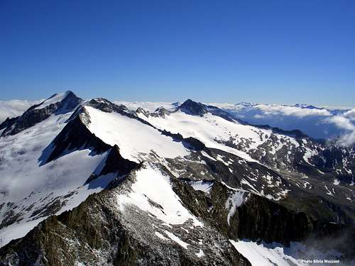
Hoher Weisszint - Punta Bianca 3370 m
As all the mountains in the region South Tyrol/Bolzano Alto Adige, located near the boundaries between Italy and Austria, this peak has two names: Punta Bianca, the italian name, and Hoher Weisszint, the original tyrolese place-name. The mountain is situated in the Aurine Alps or Zillertal Alps, on the boundary ridge between Italy, Alto Adige province, Southern side and Austria, Northern side. This summit is a mighty and extended mountain covered by an icecap, overlooking the superb basin of Lago di Nèves and lying in a fine high mountain environment, nearby several other summits overcoming the 3000 meters of altitude, like the superb Hochfeiler/Gran Pilastro to NW, the Breitnock or Dosso Largo to NE and the Niederer Weisszint to SW. Punta Bianca three main ridges – NE, NW and SW - delimitate the three glaciers surrounding the mountain: the Gliderferner Glacier to the West, the mighty Schlegeisknees to the North and the Weisszintferner – in strong retreat – to the South.


From the summit we can enjoy an extraordinary view all around over the neighbouring valleys and towards the peaks running along the Italy-Austria border and towards the Dolomites. The route running on the SW ridge is a classic and interesting ascent, one of the most popular routes of the group, involving a varied climb in a wild and spectacular environment. The route can be approached from Valle Aurina, spending the night at Ponte di Ghiaccio-Eisbruggjochhutte shelter.
Getting There
Road Approach
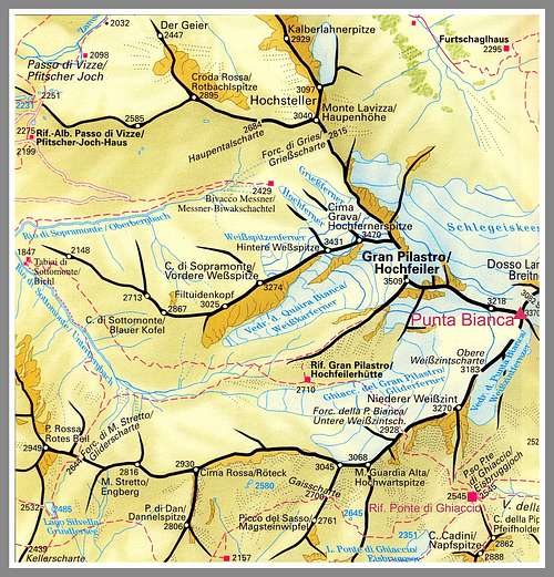
The starting point is the basin of Lago di Néves m 1856, km 18,5 from Molini di Tures (m 853, Valle Aurina/Ahrntal), lying in the suggestive Valle Selva dei Molini, near the little village of Lappago m 1439.
Getting to Valle Aurina/Ahrntal - From Bolzano - Take the Brennero Motorway, exit Bressanone and follow the road SS 49 along Val Pusteria, getting to Brunico; in Brunico leave the SS 51 and take the road SS621, entering the Valle Aurina. Pass San Giorgio, Villa Ottone and reach Molini di Tùres-Muhlen in Taufers m. 853 (12 km. from Brunico). In Molini di Tùres leave the main Valle Aurina road and enter on the left the Valle Selva dei Molini. The road runs suggestively in along the beautiful valley, crossin the villages of Selva dei Molini, Lappago and Lappago di Sopra. Here turn to right, following an impressive narrow road getting to the artificial lake of Nèves. Wide parking.


Walking Approach to Rifugio Ponte di Ghiaccio m 2545
The shortest way to get to the shelter is from Lago di Nèves m 1856. Skirt the Eastern shore of the lake, then the North-western one along a wide track, getting to the little alp named Malga Comunale m. 1878. Pass the alp and leave the Nèves basin taking on the right a path entering Valle della Pipa and rising inside the wood with several hairpins to a grassy terrace. The path rises skirting the stream and reaching another grassy terrace; the upper section rises through huge blocks and a little moraine valley reaching the nice Ponte di Ghiaccio-Eisbruggjochhutte m. 2545, lying nearby a blu glacial lake. From 2 to 2,30 hours from Lago di Nèves.
History
First summiter: Erich Graf Kunigl 1871, August, 8th
Hoher Weisszint-Punta Bianca Normal Route report
Hoher Weisszint - Punta Bianca South-West Ridge (Normal Route) report - UIAA Scale
Summit altitude: m 3370
Difficulty: Alpine PD-, I and II UIAA
Vertical gain: 1514 m from Lago di Nèves, 825 m from Rif. Rifugio Ponte di Ghiaccio
Exposure: SW
First ascent: S. Kirchler – V. Sieger 1875, September 11th
Hut: Rifugio Ponte di Ghiaccio-Eisbruggjochhutte m. 2545
Starting point: Lago di Nèves m 1856, Valle Selva dei Molini
This route, running on the South–West ridge, is the normal way to get the summit of Punta Bianca. The climb is interesting and allows to enjoy stunning views over the surrounding peaks. Quite a popular “course”, alternating snowy ridges and easy rocks, frequently iced.
From the shelter take a good path in the North direction (signpost Hoher Weisszint), climbing a steep scree slope, then heading towards right to get a secluded basin lying at foot of Niederer Weisszint. Climb a moraine ridge (cairns and white-red marks) getting to the lower edge of the Weisszintferner (Weisszint Glacier). Enter the glacier and cross it heading towards the saddle called Obere Weisszintscharte m 3183.
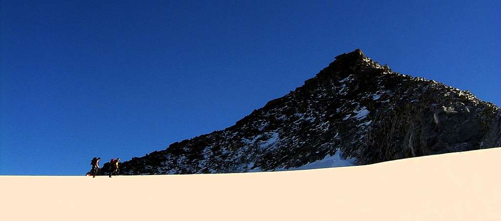
Before getting the saddle turn to right (East), gaining the base of the first rocky spur. Climb it to its summit on easy ground, then follow for a long time the South-West ridge negotiating various easy and short rocky moves – which may be frequently iced - getting to Hoher Wesszint foresummit m. 3322. After a little descent along a rocky ridge towards a wide saddle, a last exposed ice-slope and a snow ridge lead to the summit cross.
Descent: reversing the same route
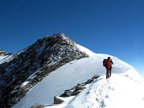
Snow ridge along Punta Bianca Normal route |
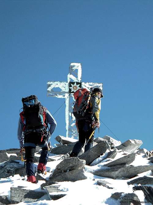
Near the summit |
Essential gear
Rope, ice-axe and crampons
Red Tape
No particulary restrictions in climbing and hiking.
Hut
Rifugio Ponte di Ghiaccio - Eisbruggjochhutte m. 2545
Owner: Provincia Autonoma di Bolzano
Size: 60 persons
Open: from middle June to middle September
Hut Phone: 0039-0474-653230
Approach: 2 hours from Lago di Nèves
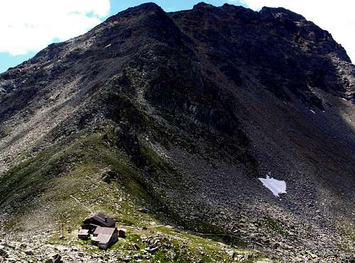
Ponte di Ghiaccio shelter |
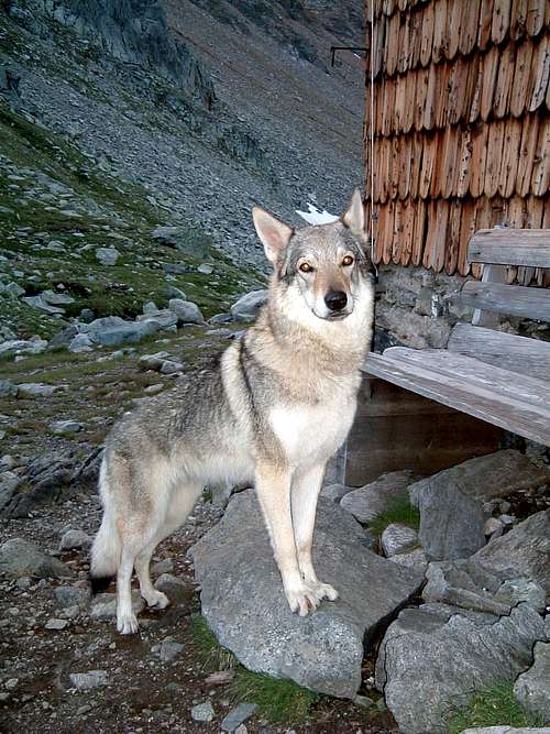
The guardian... |
When to climb
Best season goes from the end of June to the end of September.
Meteo
Guidebooks and maps
 |
 |
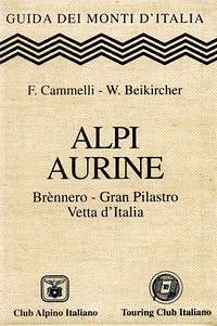
“Alpi Aurine” by F. Cammelli – W. Beikircher – Collana Guide dei Monti d'Italia C.A.I.-T.C.I.
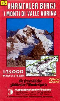
"Ahrntaler Berge - I monti di Valle Aurina" map 1:25.000 - Mapgraphic Bolzano