-
 3923 Hits
-
 73.06% Score
-
 3 Votes
|
|
Mountain/Rock |
|---|---|
|
|
61.58427°N / 142.23364°W |
|
|
Hiking, Mountaineering, Scrambling |
|
|
Summer |
|
|
8000 ft / 2438 m |
|
|
Overview
On July 2019, Sadie Skiles and Brice Pollock established this route. The “Hole in the Goat” route travels half on the ‘Goat Trail’ before crossing a pass to gain the Hole in the Wall Glacier followed by five of crevassed glacier, five miles of rock glacier and one knee high river crossing to return to the start at Skolai Airstrip.
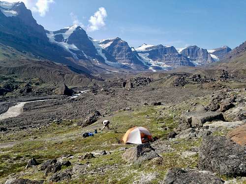
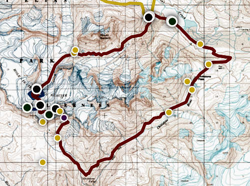
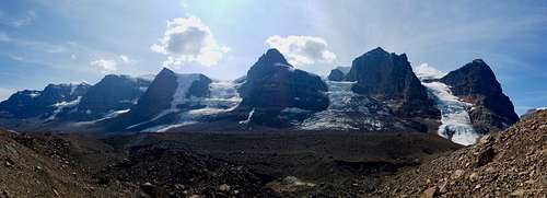
It took us four days to accomplish this route with 8-10 hour, seven mile days. The route is 25 miles and 7,000 ft elevation gain as the raven flies (route map), but we aren’t ravens so probably more like 30 miles and 9,000 ft. It hosted caribou, marmots, a red backed ermine, dozens of mountain goats, a mother and pair curious blonde-brown bear cubs, fifty unique geodes and views of puffy white 15,000 ft peaks.
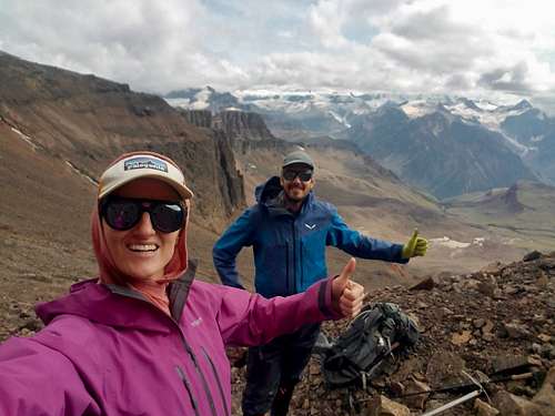
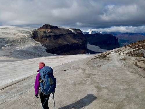
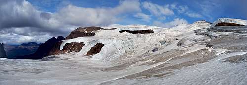
This page will contain mostly route details, for the full adventure details see Brice Pollock's Blog. All the same, here are some photos to get you excited:
Getting There
Get to McCarthy from the two hour long dirt McCarthy road. There is only a foot bridge into McCarthy which is ~ 1 mile from the bridge. Book a backcountry bush flight and pickup from to Skolai Airstrip.
Wrangle Mountain Air is the only air service out of McCarthy and likely the only one that services this south side of the park. We didn’t book ahead and had to take what we can get which was the impetus to create the “Hole in the Goat” route since we could only be dropped off and picked up at Skolai. Book ahead if you can.
Risks and Conditions
Best attempted in the summer for warmer weather and more stable conditions. The weather in McCarthy is very misleading. 70 degrees was the average high while in the backcountry 50 degrees was the high each day. Bring warmer layers than you expect.
In the summer, the glaciers are always melting and water is always available from creeks. Sometimes these rivers have moved from where they are on the map.
Beware of rock fall, near glaciers you can hear rock fall several times an hour. Some as loud as thunder.
Route Risks include: Rock Fall, 4th class / scree climbing fall, glacial crevasses, bears.
Required Skills: Self arrest with ice axe, crampons on steep surface, backpacking, route finding without trail, crevasse rescue, comfort with 4th class climbing.
Route
Note: Take your backpacking daily milage and divide by two for what your pace will be in the Wrangell’s.
(Follow along using this route map)
Start from the Skolai Airstrip up and over Chitistone Pass on the unmaintained, unmarked Goat Trail before leaving it at Chitistone Gorge (61.55683, -142.19832).
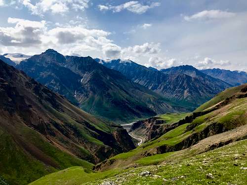
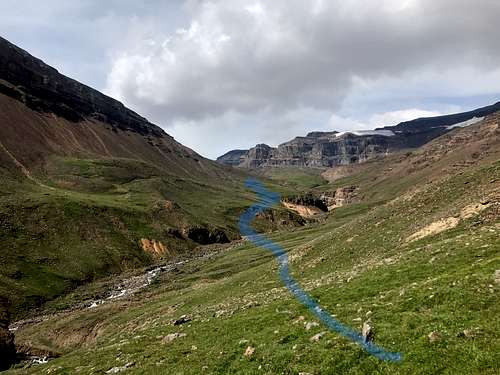
Head straight towards ‘The Bubble’ (61.58222, -142.21364) which is the weakness in ‘The Fin’ rock wall. At this point, you will be on your own in increasingly technical terrain. From the moraine, gain the scree sloped ‘Bubble’ from the right side diagonal to the far left side where a break in the rock band is visible. Above ‘The Bubble’ again take a rightward diagonal towards the black rock wall close to the glacier.
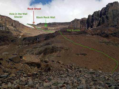
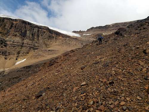
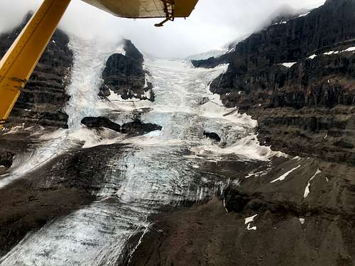
Near the black wall climb 80 ft up easy 4th class. AVOID the right scree shoot to the right of the glacier. It is a very active rock shoot commonly producing head-sized rocks zooming down it. The scree here is over-top glacial ice and now is a good time for crampons and ice axe due to the slide risk and inability of the scree to produce walkable berms.
Finally you can gain the Hole in the Wall Glacier. Despite the slope profiles on the TOPO there are plenty of glacial crevasses. The first major crevasse was between this first flat, snow-covered glacier and the upper one. It had snow bridges that crossed and hid this crevasse even in mid-July. Brice punctured one such snow bridge with a foot at 260 lbs combined equipment-person weight.
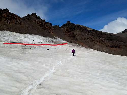
“The following observations on crevasses were made in mid-July 2019, an exceptionally warm Alaskan summer. Conditions may be different at other times of year therefore it is recommended to do a fly-over before attempting the route to gain more information and bring crevasse rescue gear.”
Next a major crevasse follows a TOPO line on the rim of this upper glacier that connects two glacier planes. By navigating around other craveses except this major one you can cross it as it closes near a rock outcropping (61.58876, -142.24085).
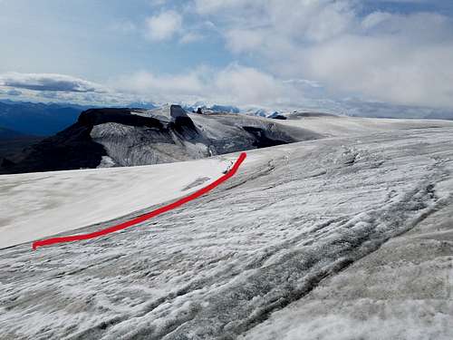
Here the glacier lost its snow layer, cutting across the ice shooting for the lower angled drop.
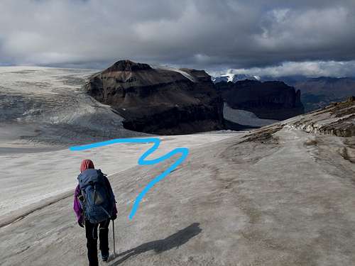
The far side of the glacier bowl has the most gentle descent, the smallest crevasses and contained no snow topping. On the first traverse of this glacier we dropped too early into a little more steep slope that was much more heavily crevassed then expected requiring much navigation to avoid the steep cracks. (See boxed area on map)
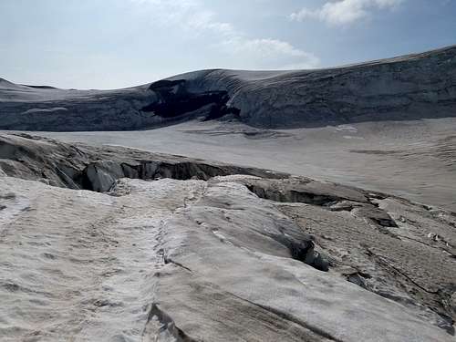
On the flat (61.59889, -142.24274), the glacier is snow-free and it becomes easy and fun to jump small, deep cracks down until the rock glacier starts and we made Camp 3 at the split of the glacier left and right around Mt. Baldwin.
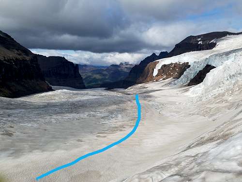
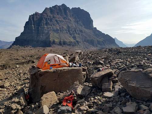
The left branch will have significantly more technicality down a hanging glacier that may require rappelling and more crevasses down its staircase icefall.
The right glacier is what Brice and Sadie took, sticking close to the left side on the tedious 5 miles of rock glacier waves.
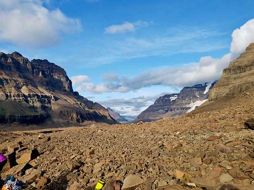
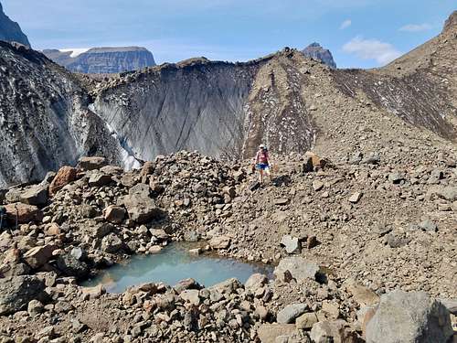
The left side has more elevation gain and drop, but becomes soil an hour before the right hand side. Alternatively, the right hand side looked flatter, but maintained rock glacier for longer. However, the right side avoids crossing the exit glacier river that was up to the thigh for an average person in the high water summer of 2019.
It is less than one mile from the glacier exit to the Skolai airstrip.
