
|
|
Mountain/Rock |
|---|---|
|
|
25.26583°S / 48.83843°W |
|
|
Campina Grande do Sul |
|
|
Hiking, Mountaineering |
|
|
Winter |
|
|
5364 ft / 1635 m |
|
|
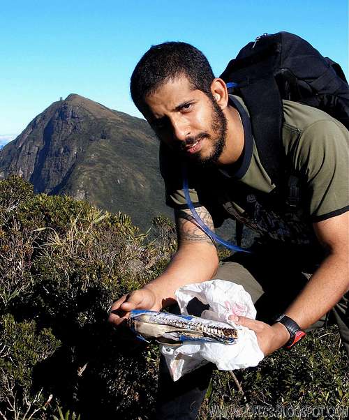
Me at the summit, that was the summit register. Too bad!
Main photo: I took that one from the summit of Tucum Peak and it came out really nice, but it’s the only one i have from the mountain at long distance so that should do.
Getting There
Take BR-116 to North till Campina Grande Do Sul, and search for Posto do Tio Doca (Tio Doca Gas Station). Ask for directions to get to the Bolinha Farm. From that farm is the starting point to the trail to some mountains of Ibitiraquire range. The trailhead is behind the property on a grassy field with some trees, well marked. The owner of the property will show you very friendly. From that farm you can reach the summits: Camapuan, Tucum, Cerro Verde, Pico Luar, Ciririca Peak, and Agudos de Cotia.Times:
From the farm to Camapuan Peak: about 2 - 3.5 hours, it's up to you. Three false summits before the summit of Camapuan! At some time after start walking, at the "Y" point on the trail, take the LEFT.
From Camapuan summit to Tucum summit: 15 min - 40 min
From Tucum summit to Cerro Verde summit: 1 - 3 hours. It's up to the terrain conditions and you. The way is quite tricky and easy to get lost, follow the red ribbons and you'll be just fine.
From Cerro Verde summit to Luar Peak summit: 1 - 2 hours. There is no trail! Fight with the woods.
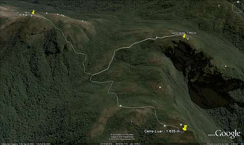
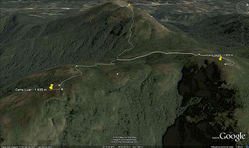
I marked the trailhead at Google Earth and the file is available for download below.
Helpful sat images:
Red Tape
As soon as you get to the Farm, register yourself and pay a fee of R$ 3,00 (about USD 1.80) for the hike.Parking lot at the farm just before the trailhead;
Well marked trails;
What’s forbidden:
To make fire; Deforest any places. Respect the nature and wildlife please! Sometimes the farm owner walks around to check if everything's okay and to check for violations, if he sees you making fire, he'll call the cops!
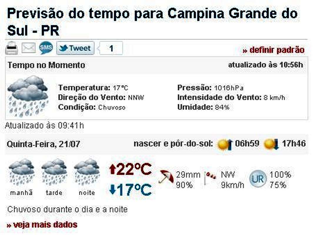
Weather Forecast
You can hike this mountain in all seasons, but in summer there are rains every day. In winter is cold, but the days are clearer. The temperatures going from -10°C to 15°C.Best time to climb: April to September.
Camping
Camping available at these places:1 - Bolinha farm;
2 - Camapuan summit;
3 - Tucum summit;
4 - Cerro Verde summit.
There's no camping spot at the summit of Luar Peak, but there's another great spot for camping below the summit about 200 vertical meters, in front of a big valley towards Ciririca Peak. Very exposed to winds.
Google Earth KML file for download
Be my guest, i marked the two main summits and the trail.For the download, please access: http://www.4shared.com/file/oZ_FJ1Qs/Cerro_Verde_-_Luar.html
Legal Issues
To hike/ climb is a dangerous activity and requires proper equipment and clothing, the owner of this page cannot be blamed by injuries caused to anyone who read this page for its info about the mountain, and eventually got hurt by doing so with reckless behaviour or bad weather conditions.
Paulo Roberto Felipe Schmidt – AKA: PAROFES
External Links
My youtube channel: www.youtube.com/parofes - Now with 270+ videos online!
The biggest brazilian website about climbing and mountaineering, for which I'm a columnist: