-
 14540 Hits
-
 81.18% Score
-
 13 Votes
|
|
Mountain/Rock |
|---|---|
|
|
45.02661°N / 109.54379°W |
|
|
Hiking, Mountaineering, Trad Climbing, Ice Climbing, Mixed, Scrambling, Skiing |
|
|
Spring, Summer, Fall, Winter |
|
|
11977 ft / 3651 m |
|
|
Overview
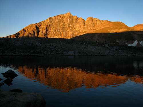
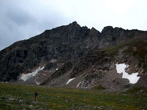
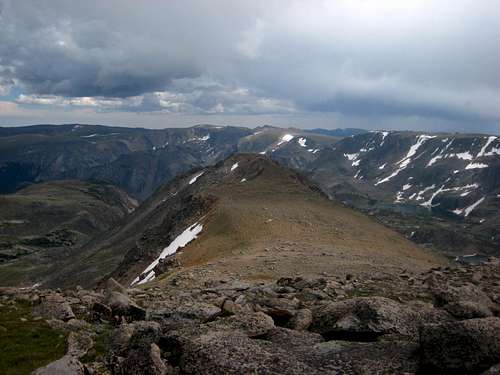
Metcalf Mountain is the highest 11,000 foot peak in Montana and dominates the views from the approach hike up to Shelf and Moon Lakes above the Main Fork of Rock Creek. Located in the southeastern portion of the Beartooth Mountains, it lies very close to the border with Wyoming. The rock on this peak is typically very solid and offers some of the most difficult multi-pitch alpine routes in the state. In Ron's "Select Climbs in Montana" guide that came out in the fall of 2012, he notes two aid routes on the east face of the mountain. There is no doubt this is one of the finest peaks in the Beartooths. The peak offers one particuairly fantastic mountaineering route which is the north ridge having difficult scrambling with plenty of exposure on very blocky rock with lots of awesome holds. The standard and easiest way up is the south ridge which is nothing more than a talus hike and this is really the only route with considerable loose rock. No matter what your point of view may be, Metcalf is an awesome peak to climb with great views of nearby Spirit Mountain. Having 837 feet of prominence it rises a substantial amount above its connecting ridge to Spirit. Finally, this is probably one of the shortest ascents in the entire Beartooth Range in terms of mileage. A fast party can get up and down the standard route in a half day which is a trait that no other high Beartooth summit can offer.
Getting There
Rock Creek Trailhead – From the Montana Road 308 and US Highway 212 junction in Red Lodge, go west on US 212 for 11.4 miles and turn right onto FS 2421 (Rock Creek Road) and measure from this point. Follow this paved road for 0.9 miles where it turns to dirt and passing by three National Forest campgrounds. Here the road forks, take the left fork and continue on the good dirt road and pass the M-K Campground at mile 2.8. Here the road becomes rougher. Continue 8 miles on this road as it drops into Wyoming and reaches the trailhead at the Montana/Wyoming state boundary at 8,700 feet. This road is passable for tough passenger cars with good ground clearance. There are many good places to pull off and camp on either side of the road.
Approach - This is one of the shortest approaches to any 12,000 foot peak in the Beartooth Mountains. From the Rock Creek trailhead, begin up the steep switch-backing trail through an old burn area and reach a nice footbridge crossing Rock Creek after 0.6 mile at 9,080 feet. Cross the bridge and continue up the trail for eight more switchbacks and locate a side trail heading off to the right (north) at 9,230 feet, a quarter mile from the bridge. There may be a cairn here to mark the turnoff. Follow this steep but well traveled boot path along the left(west) side of Rock Creek for 0.35 mile to where it crosses back to the east side of the creek on large boulders at 9,600 feet. Past this crossing, the slope eases and the path continues through open grass above and on the right side of the creek. At 9,850 feet cross the creek back to its left side right below a small tarn and continue up the trail through meadows, passing another small tarn a few minutes later. The approach essentially ends here just below Shelf Lake and Metcalf Mountain is the dominant peak above and to the northwest.
South Ridge Standard Route - Class 2
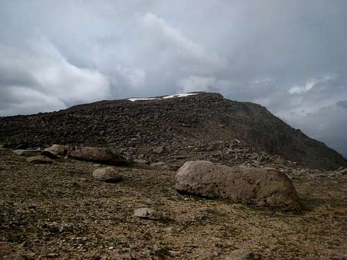
From the tiny tarn south of Shelf Lake, continue up the boot path a short ways and begin hiking up boulders and grassy terrain for 200 feet to where the terrain steepens at 10,220 feet. Continue up steepening talus in a westward direction. The orange colored scree on this slope makes for a horrid ascent but with determination, you'll hit the very broad south ridge at 11,030 feet. There is a huge saddle with Metcalf Mountain off to the north and an unnamed Point 11,080 just to the south. The final bit of the steep talus slope used to gain the south ridge can often have snow on it that may be difficult to bypass at times. In early season be sure to have an ice axe and possibly crampons as you may have some climbing on moderate snow. Once on the broad ridge, head to the right and ascend the now gentle sloping (but enormous) talus blocks up the south ridge to the summit. Actually, at times the scrambling on the boulders on the final 400 feet of the route can have a little Class 3 depending on which boulders you climb over! The summit boulder can be slightly tricky for shorter people to surmount. Enjoy the views from this fine perch.
RT Distance from TH - 6.5 miles
RT Elevation Gain from TH - 3,300 feet
Camping/Red Tape
Metcalf Mountain is located in the Absaroka-Beartooth Wilderness, Custer National Forest, Beartooth Ranger District. No fees are required to climb, hike, or camp. You must have a permit to cut live trees for firewood. No mechanized vehicles allowed in the wilderness area. Fantastic camping can be found at either Shelf or Moon Lakes.Beartooth Ranger District
6811 U.S. 212, Red Lodge, Mt 59068
(406) 446-2103
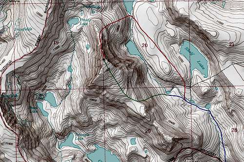
Map
BLUE: Rock Creek/Shelf and Moon Lake Approach - Class 1
GREEN: South Ridge Standard Route - Class 2
RED: North Rib - Class 5.9
When to Climb
The best time to climb this peak is from June through October. This is the time when the Rock Creek road will most certainly be open. From the end of the road, this climb is very short so it makes a good peak to do in early season as a ski tour or in late season after a few inches of snow blanket the mountains. Winter ascents are feasible however it is crucial you check the avalanche forecasts and go prepared for very harsh conditions.
External Links
Metcalf Mountain on Lists of John


