|
|
Area/Range |
|---|---|
|
|
52.98450°N / 4.0004°W |
|
|
Hiking, Mountaineering, Mixed, Scrambling |
|
|
Spring, Summer, Fall, Winter |
|
|
2526 ft / 770 m |
|
|
Overview
The area known as the Moelwyns is a complete range.The main group of Moelwyn summits is looked at as one of Snowdonia's secret area's that not many people seem to explore or climb.
The range of the Moelwyns consist of the following main summits.
The Moelwyn Summits.
The main summits themselves pictured below on a lovely cold clear day consist of Moelwyn Bach (bach meaning small in Welsh) at 711metres to the left of the picture. Moelwyn Bach has a beautiful shape to it when seen from virtually all angles and is alot more shapely than its big brother Moelwyn Mawr seen to the right of the picture.
Moelwyn Mawr (mawr meaning large in Welsh) is 770metres and from the south takes the shape of a rounded pyramid. From most other angles it is a very round and bland looking summit. The picture of the Moelwyns at sunset on this page again show Bach to the left and Mawr to the right. In this picture Bach again is the shapely one.
Between the two summits there is an outcrop of crag's that links the Bwlch between them and these crags are called Craigysgafn and give a nice easy scramble when heading from Moelwyn Bach across the ridge to Moelwyn Mawr.
This range also covers a vast area of upland and unspoilt wilderness which has other major summits within it. The highest of them all at over 800metres in the north east corner and dominating the village of Capel Curig is called Moel Siabod.
MOEL SIABOD
Moel Siabod's SP-Page via this link
This although in the Moelwyns area is primarily looked at as a seperate summit due to its size and isolation.
CNICHT
This is another much smaller but just as shapely summit within the Moelwyns and is more commonly referred to as The Welsh Matterhon. Cnicht SP-Page via this link. This is much closer to the Moelwyn's and can if need be combined with them for a great days walking and scrambling.
The area in general has many other smaller isolated summits and ridges deep within the vast area of upland that this region covers.
The vast wilderness in split between the following Welsh towns.
Betws y Coed, Blaenau Ffestiniog, Porthmadog, Beddgelert and Capel Curig.
The pictures below are from a cold day i spent climbing the Moelwyn main Ridge covering Bach and Mawr.
Getting There
The Moelwynion are located in the centre of the Snowdonia National Park, just to the south east of Snowdon. The main peaks are clustered in the northern and southern parts of the range, separated by an extensive area of hills and hummocks in-between. They are circled by a good road network, taking the form of the A5, A470, A487, A498, A4086 and B4085 and access may be achieved at various points along it. Reaching the range therefore, really depends on where you want to start your experdition’.Moel Siabod is probably the easiest of the range’s mountains to reach. There are various has various parking places along the A5, the best being the car park at the Café and B&B at Bryn Glo (SH 736 570) near Pont Cyfyng. Parking may also be found along the roadside at Capel Curig (SH 715 578) if one wants to approach the mountain from the west.
For Moelwyn Mawr, Moelwyn Bach and the crags near Tanygrisiau, leave the A470 at the roundabout in Blaenau Ffestiniog (SH 697 460) and take the A496 in a southerly direction over the railway line. Continue along the A496 for a kilometre or so to a small junction on the right hand side (SH 688 448). Take this junction and then turn left immediately, following the signs for the Ffestiniog Power Station; 500 metres down the road there’s a café on the left hand side; it’s a great place to start and end a day in the hills. Pass the café and follow the curving road up the hill to the car park at the top of Tanygrisiau (SH 683 453).
Cnicht may also be reached from this location, however it does have another good starting point in Cwm Croesor. If you’re coming from the east therefore, leave the A487 in Penrhyndeudraeth (SH 611 389) and take the A4085 north in the direction of Beddgelert (SH 590 481). Just after the village of Garreg (SH 612 416), there is a right hand turn (SH 614 420), which is signposted for the village of Croesor (SH 630 447). The village is reached after around 3km. Park in the small National Park run car park in the village.
Camping and Accommodation
There’s an almost unlimited supply of accommodation within the Snowdonia National Park so it would be inappropriate to list it all here. For budget accommodation it’s worth checking out some of the following sites:Youth Hostel Association in Wales
Independent Hostel Guide
Campsites in Gwynedd
Those looking for something a bit more luxurious will find plenty of hotels, guesthouses and bed and breakfasts in the nearby towns of Bettws y Coed to the north and Porthmadog to the south. Pubs, restaurants and shops may also be found here.
Red Tape
Unlike the national parks of North America and certain parts of Europe, there are no permits required for entry into the Snowdonia National Park, no visitor limits or any other kind of red tape designed to restrict access. Therefore, there are no significant red tape or access issues affecting the Moelwyns.Since the passing of the Countryside and Rights of Way Act (CRoW) 2000, the public have the right to access almost all the land within the national park boundary regardless of ownership. Open access land is denoted by the signs below.
 | Access symbol Used to indicate the start of access land, be this CRoW access land or access land under other agreements. |
 | Negative access symbol Used where the boundary between access land and land with no access rights needs clarifying, or where there are persistent problems with trespass. |
 | Dogs on lead symbol On all CRoW Act access land, dogs must be kept on a short fixed lead (2m or less) between 1st March and 31st July (the main bird breeding and lambing season), and at all times near livestock. |
On occasion there are temporary restrictions on movement within localised areas of the park. These are usually associated with public safety issues, quite often involving forestry operations. Information regarding restrictions is available on the Countryside Council for Wales' (CCW) website in the form of a frequently updated countryside access map.
Countryside Access Map
For climbers, hill walkers and mountaineers, the British Mountaineering Council (BMC) runs a Regional Access Database, which holds mountain/crag specific information on matters of conservation and access, including issues such as nesting restrictions, nature designations and preferred parking.
Regional Access Database
If you are in any doubt about any particular access arrangement, or need to report an incident, you should contact your local BMC Access Representative or the BMC Access Officers for Wales: Elfyn Jones.
Maps
Guidebooks
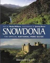 | Snowdonia (Official National Park Guide) by Merfyn Williams with contributions from Ian Mercer and Jeremy Moore A handy book full of useful information and interesting facts about the National Park. |
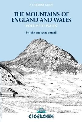 | The Mountains of England and Wales: Vol 1 Wales by John and Ann Nuttall A classic book covering the Welsh ‘Nuttalls’, which obviously include the Moelwynion. |
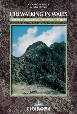 | Hillwalking in Wales Vol 2 by Peter Hermon The second of two guidebooks describing walking routes up every 2000-footer in Wales – covers the Moelwynion to the Tarrenydd. |
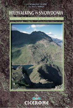 | Hillwalking in Snowdonia by Steve Ashton A guidebook to nearly 70 hillwalking routes throughout Snowdonia, including the Moelwynion. |
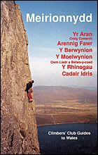 | Climbers Club Guide Wales: Meirionnydd by Martin Crocker, John Sumner, Terry Taylor, Elfyn Jones, with contributions from Mike Rosser, Mike Lewis and Dave Wrennall The definitive climbing guide to the area. Contains detailed descriptions and excellent diagrams of all known rock routes in the Moelwynion. An essential purchase if you plan to do a lot of climbing in Mid Wales. |
 | Rock Climbing in Snowdonia by Paul Williams A slightly dated but popular guide to climbing in North Wales. Not quite as good as the new Ground Up or Rockfax books though |
 | North Wales Rock: Selected Rock Climbs in North Wales by Simon Panton A superb, lavishly presented general guidebook to the best North Wales has to offer. Read, gawp and drool! |
 | Rockfax Guide: North Wales Classics by Jack Geldard Another superb and lavishly illustrated general guide to North Wales. A superb addition to the already excellent selection of guidebooks available for the area. |
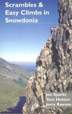 | Scrambles and Easy Climbs in Snowdonia by John Sparks, Tom Hutton and Gerry Rawson An excellent and well illustrated guide, which neatly links scrambling with rock climbing and in doing so covers some of the best long routes in Snowdonia. |
 | Cicerone Guide: Welsh Winter Climbs by Malcom Campbell and Andy Newton The only dedicated winter climbing guide to Wales. A bit dated now but nevertheless still relevant. The only problem is finding the right conditions. |
External Links
 Cnicht (Photo by daveyboy)
 D.Y.A.M. (VD) (Photo by Nanuls)
 Cnicht (Photo by Bryan Benn)
Government Bodies and Official Organisations
Snowdonia National Park Authority
Council for National Parks
Association of National Park Authorities
Conwy County Council
Gwynedd County Council
Powys County Council
Countryside Council for Wales
Forestry Commission Wales
Environment Agency
CADW
Royal Commission on Ancient & Historical Monuments in Wales
Gwynedd Archaeological Trust
Snowdonia Society
The National Trust
Hiking, Climbing and Mountaineering Organisations and Companies
British Mountaineering Council
The Climbers Club
UKClimbing
Plas y Brenin National Mountain Centre
Snowdonia-Active.com
Hightreck Snowdonia
Weather
Mountain Weather Wales
Weather from the Met Office
BBC Weather
Weather Channel UK
Tourist Information
Visit Wales
North Wales Tourism Partnership
Local Information from Gwynedd.com
Local Information from Snowdonia Wales Net
North Wales Index
Travel
Welsh Public Transport Information
Uk Train Timetable
Accommodation
Youth Hostel Association in Wales
North Wales Campsites
Maps and Guidebooks
Ordnance Survey
Harvey Map Services
Cicerone Guidebooks
Climbers Club Guidebooks
North Wales Bouldering
Mid Wales Climbing
Cordee Travel and Adventure Sports Bookshop
Wildlife and Conservation
Joint Nature Conservation Committee
Natur Gwynedd
North Wales Wildlife Trust
Royal Society for the Protection of Birds
Welsh Language
Welsh Language Board
Cymdeithas yr Iaith Gymraeg Welsh language pressure group
Cymuned Welsh language pressure group
Yr Urdd (Welsh Youth Association)
Welsh-English / English-Welsh online translator
Welsh-English / English-Welsh Online Dictionary
Welsh-English / English-Welsh Online Lexicon


Dan Bailey - Mar 5, 2006 2:20 pm - Voted 9/10
campingI'd say the best camping option would be a wild camp by one of the many little lakes in the wild knobbly area between the main Moelwyn summits and Moel Siabod: it's one of the best places to camp out in Wales.