
-
 13780 Hits
-
 83.1% Score
-
 16 Votes
|
|
Route |
|---|---|
|
|
48.87186°N / 113.78638°W |
|
|
Mountaineering |
|
|
Summer, Fall |
|
|
A few days |
|
|
GMS Class III |
|
|
Overview
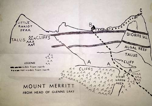
The easiest and most popular route for parties looking to summit Mount Merritt originates from Mokowanis Lake, a serene alpine lake tucked deep in Glacier National Park's backcountry. Due to the lengthy approach (14+ miles), most parties will chose to climb Merritt as a multi-day outing. The off-trail portion of the route involves a mix of classic Glacier bushwhacking, talus hopping, scree slogging and route finding through broken cliffs. Elevation gained from the trail is nearly 5,000 feet, and one can expect to spend the better part of a day (8-10 hours) attaining the lofty summit.This route was first climbed by famed mountaineer Norman Clyde on July 28, 1924 (1), and has been since documented by J. Gordon Edwards in his A Climber's Guide to Glacier National Park. The most recent edition, published in 1994, makes explicit reference to a detailed route diagram that is curiously omitted from the book. A photo of the route description, obtained from a member of the Glacier Mountaineering Society who owns an old copy of the guide, will be included in this route description as it is a very helpful tool!
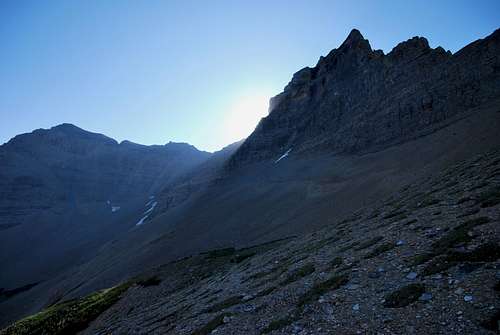 Sun rising over the northeast ridge, with Mount Merritt's summit at right.
Getting There
Mount Merritt is located in the remote northeastern corner of Glacier National Park, not far south of the Canadian border. The shortest route to Mokowanis Lake originates from the Belly River Trailhead, which is located off MT-17 immediately south of the border crossing at Chief Mountain Customs. The trailhead is very remote; the nearest small towns are Browning, MT (~50 miles by car) and Cardston, Alberta (~35 miles by car).Route Description
Belly River Trail
Although this trail is well-traveled and easy to follow, I'd like to offer a few words of caution before detailing the route. First, this is wild country, and bear and other large game (moose and elk come to mind) are frequently encountered in this part of the park. Hike in a group, make noise, and carry bear spray and know how to use it! Second, the lower portions of the trail can be extremely wet and muddy in early season or after periods of rain. Pack trains use this trail regularly, so needless to say it can become a sloppy mess under the right conditions. I recommend bringing gaiters to help keep dry in the event the trail is wet.
From the trailhead, the Belly River Trail descends gently downhill through forest before a series of switchbacks is encountered. The terrain steepens, and by mile marker 2 a total of 700 feet of elevation is lost. As the trail continues on, it skirts the Belly River in a few places and yields spectacular views to the west. The trail rolls through several large meadows and patches of broken forest and by mile marker 6.1, a junction is reached at the historic Belly River Ranger Station (active to this day).
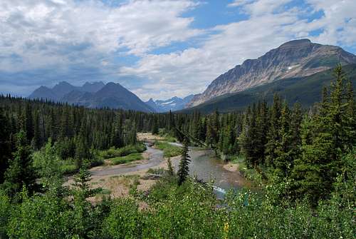
By enlarging the photo, it is possible to make out Old Sun Glacier and Mount Merritt amidst the cluster of peaks at left. Photo taken ~3 miles along the Belly River Trail.
Stoney Indian Pass Trail to Mokowanis Lake
Three trails confluence at the ranger station; bear right on the trail towards Stoney Indian Pass. A large suspension bridge (installed seasonally) crosses the Belly River, and in 2.7 miles the backcountry site at Cosley Lake is reached. From there, it's an uneventful 4 miles through forest to the site at the head of Glenns Lake. From a few vantage points along the lake, much of the route up Mount Merritt's northwest slope comes into view. In another 0.5 miles, Mokowanis Junction is reached; turn left and hike an additional mile to Mokowanis Lake. The off-trail portion of the route begins near the backcountry campground. The total one-way mileage to Mokowanis Lake is 14.4 miles. The backcountry sites at Glenns Lake (Head), Mokowanis Junction, and Mokowanis Lake are the most practical places to establish a basecamp for this route. See below for a brief summary. Note that a permit is required for all backcountry stays in Glacier National Park. More information can be found in the "Special Considerations" sections farther down the page.
Glenns Lake (Head) - 12.8 miles, 3 sites, campfires permitted. Very scenic, with fantastic views of Mount Merritt and Pyramid Peak.
Mokowanis Junction - 13.3 miles, 5 sites, campfires NOT permitted.From what I've heard, this site is lacking on scenery.
Mokowanis Lake - 14.4 miles, 2 sites, campfires NOT permitted. The lake itself is quite stunning, but the highlight of this site is staring up at the sheer east face of Pyramid Peak.
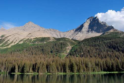 Mount Merritt (right), from the head of Glenns Lake. A good portion of the route up the northwest slope is visible.
Northwest Slope
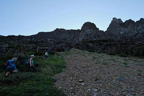
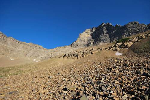
Follow the trail south to the head of Mokowanis Lake. Pass the food prep area and pit toilet until the two individual camping sites are reached. The off-trail portion of the route begins here; look for trails through the thick bush to the left (east) and begin making your way uphill. Try to locate a large drainage that will make the going significantly easier. As you gain elevation, take time to marvel at the scene behind you, as the view of Margaret Lake and its thundering outlet waterfall is mesmerizing. Ascend 700-800 feet or so until a set of steep, impassable cliffs is reached. Bear left and follow game trails to the north, staying underneath the dangerous cliffs. Eventually, the cliffs give way to easier terrain, and the goal is to trend east over a vegetated shoulder of rock into the talus-covered northwest cirque of Mount Merritt. From here, much of the route up the loose northwest slope comes into view. Continue east across class II terrain to head of the cirque. Aim for some lingering snowfields at the bottom of a cliff band to stay on route; otherwise, look to the skyline and use the low point on the northeast ridge for a bearing.
Nearing the impassable cliffs high above Mokowanis LakeThe loose, rocky northwest slope of Mount Merritt
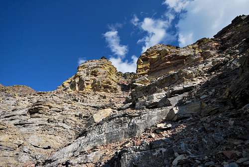
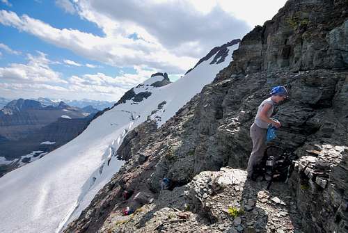
At the head of the rocky cirque, there are 3 distinct drainages. The one on the right is easiest, and much of the route from here involves scrambling up gullies and broken ledges. A prominent band of slick grey rock, called the algal reef, is encountered near 8,000 feet in elevation. The reef poses a significant barrier to climbers, as it forms steep cliffs. Look for the easiest break, which should be no worse than class III, to continue onward. Above the reef, the terrain is loose, steep, and rocky. It's almost impossible to avoid spraying rocks down the slopes at times, so a helmet may prove necessary on this portion of the route. Eventually, the route clambers up through some impressive yellow lichen-covered cliffs, and shortly after it tops out on the northeast ridge.
Photo taken on the descent, but at left is the prominent band of algal reef that will be encountered on the northwest slope.
A lichen-covered alleyway to the northeast ridge
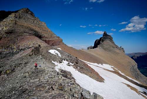
Northeast Ridge
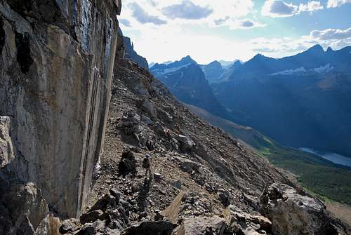
Views from the northeast ridge are absolutely stunning, with Old Sun Glacier directly below to the east. Turn right (southwest) and hike along the ridge until a deep notch and steep cliff are reached. From here, a solid game trail continues across a ledge straight towards the glacier. Unless you are equipped for steep snow climbing, it's essentially a dead end, so the key is to look for a class III route through broken cliff bands prior to reaching the snow. Careful route finding is necessary at this point, as a slip could easily turn into a prolonged tumble onto the crevassed glacier.
Northeast ridge of Mount Merritt, with summit at upper right.
Steep class III cliffs above Old Sun Glacier. Taken on the descent.
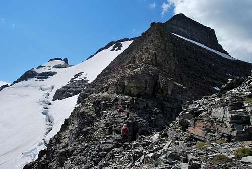
Once the cliffs are climbed, a moderate angle snowfield will likely be encountered before August (and perhaps all summer long in snowy years) near the 9,500 foot mark. Some groups may feel the need for ice axes at this point. Climb up the snow until it transitions into steep scree slopes near the upper reaches of Old Sun Glacier. There are 3 prominent summits on the skyline; the one at right (northernmost) is the highest.
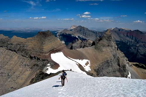 Snow encountered a few hundred feet below the summit on the northeast ridge.
Slog to the top and take in the astounding views in every direction. There is an incredible notch between the true and middle summits with spellbinding views down to Margaret Lake that is worth the short detour. Make every attempt to retrace the route on the descent.
Nearing the saddle on the northeast ridge, where the route joins with the northwest slope (at left).
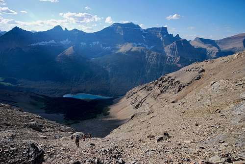
Descending the northwest slope, Glenns Lake in the distance.
As mentioned, the most recent edition of A Climber's Guide to Glacier National Park references a detailed route diagram, which for some strange reason was entirely omitted from the guide. I have included a copy below as I found it to be a useful tool during my group's outing in August of 2011. Note that the copy I printed was a little faded, so I traced over the Edwards drawing to make it more legible. I have also included a Google Earth overview to help illustrate the off-trail portion of the route from Mokowanis Lake.
J. Gordon Edwards Mokowanis Lake Route Diagram
Mokowanis Lake Route Diagram - Mount Merritt

Essential Gear
For climbing gear, I recommend the following: gaiters (a must for any off-trail venture in GNP), climbing helmet (lots of loose rock on class III slopes) and ice axe (for the snowfield beneath the summit). Some folks may find an ice axe completely unnecessary, but it would be awfully unfortunate to get to within a few hundred feet of the summit only to turn around because of potentially sketchy snow.
Since most parties will spend a minimum of three days climbing Mount Merritt, climbers will need to be prepared to spend a few nights in Glacier's backcountry. A few mandatory items are as follows: water filtration system (giardia is a very real risk in the park), rope and stuff sack to string up food (this is bear country), as well as clean clothes for sleeping. I always change out of my stinky hiking/cooking clothes and wear clean clothes whenever I am in my tent to avoid bringing any food odors with me at night. This is grizzly country, after all, and I for one do not want to give their curious noses any reason to come sniffing around my tent!
Special Considerations
Backcountry Camping in Glacier National Park
As mentioned, a permit is required for all backcountry stays in Glacier. As of November 2016, permits are $7 per person per night and can be obtained at various ranger stations (St. Mary and Many Glacier are nearest). There is an advance reservation system (and associated fee), or sites can be obtained on a walk-up basis. Please visit the NPS backcountry camping webpage for more detailed information.
Wildlife
Glacier National Park is home to healthy grizzly and black bear populations; hence, it is necessary to take special precautions while hiking and camping. It is not uncommon to encounter bears on the Belly River and Stoney Indian Pass trails, so remember to make noise, hike in a group and carry bear spray (and know how to use it!). Special precautions must be taken at any backcountry campsite, as food storage and management of odors will help keep bears away. Please visit the NPS bear safety page for more information
This is prime moose habitat as well, and I've had an unpleasant encounter with an ornery bull near the Glenns Lake (Foot) backcountry campground. Remember that moose can be VERY dangerous, especially during the fall rut. Pay attention to your surroundings and give a wide berth to any animals that you may encounter. Oh yeah, and there is mountain lion country too... Glacier is truly a wild place! It never hurts to check the local trail postings for area warnings/closures regarding wildlife.
Weather
Glacier Rock Grading
Due to the sedimentary nature of the rock in Glacier National Park, unique rock grading systems have been established by both Gordon Edwards and the Glacier Mountaineering Society. Please refer to the Glacier National Park Rock & Grading Systems Summitpost page (authored by Fred Spicker and Saintgrizzly) or the website of the Glacier Mountaineering Society for detailed information. If you are new to climbing in Glacier, I highly recommend checking out this info before attempting any climbs in the park. The rock on the northwest slope of Mount Merritt is quite rotten, and there are steep cliffs that need be climbed along the northeast ridge. I would highly recommend donning a climbing helmet for the upper portions of the approach from Mokowanis Lake.
Weather
Things change suddenly in the mountains, and every alpinist has seen clear blue mornings turn into violent, stormy afternoons in the matter of an instant. Check local weather forecasts (I use the NOAA website), be aware of your surroundings, and find shelter or turn around if the weather worsens.
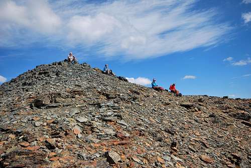
Fine folks chilling on the summit of Mount Merritt