
|
|
Mountain/Rock |
|---|---|
|
|
39.32080°N / 106.1511°W |
|
|
13865 ft / 4226 m |
|
|
Overview
Next time, try Mt. Buckskin instead of Lincoln, Bross & Democrat. Find your own route and stay away from the crowds.
Mt. Buckskin and its southeast neighbor, Loveland Mountain (13692 ft), rise to the southwest of Buckskin Creek in the Mosquito Range near the town of Alma. Across the Buckskin Gulch, you will find the famous 14ers: Mt. Democrat, Mt. Lincoln and Mt. Bross.
Mt. Buckskin is most easily accessed from Kite Lake at the NW end of Buckskin Gulch. This lake sits at an elevation of 12000 ft and serves as a trailhead for the mentioned 14ers. From the lake, you will hike to a grassy and relatively flat area at 12800 ft where you can tackle the NE slopes of Buckskin. These slopes are covered by boulders/large rocks that are generally stable (ie no slippery scree) allowing for a pleasant hike.
From the summit of Mt. Buckskin you will have great views of Mounts Bross, Democrat and Lincoln/Cameron. To the northwest, the wall-like slopes of Buckskin drop into a huge glacially carved valley that is flanked by other impressive peaks such as: McNamee Peak (13800 ft), Traver Peak (13854 ft), Mt. Democrat (14148 ft), Mt. Tweto (13672 ft) and Mt. Arkansas (13795 ft). The colorful Climax Mine near Route 91 can be seen beyond this valley. To the west and southwest, you will have a unique perspective on the northern peaks of the Sawatch Range while to the south, an endless array of high 13ers rise beyond Mosquito Pass.
The USGS Map shows that Mt. Buckskin has two summits. The words "Mount Buckskin" appear over the northwest summit but the elevation is written over the southeast summit. The two summits are 0.3 miles apart and are separated by a 13780 ft saddle. From the northwest summit, you can follow the ridgeline to the southeast summit, then down to a 13500 ft saddle and up to the 13692 ft Loveland Mountain before returning to Kite Lake. This can provide a refreshing three peak alternative to the traditional Lincoln/Bross/Democrat combo.
This mountain has probably been named after a character known as Buckskin Joe. Click to read about Buckskin Joe.
 |  |  |  |  |

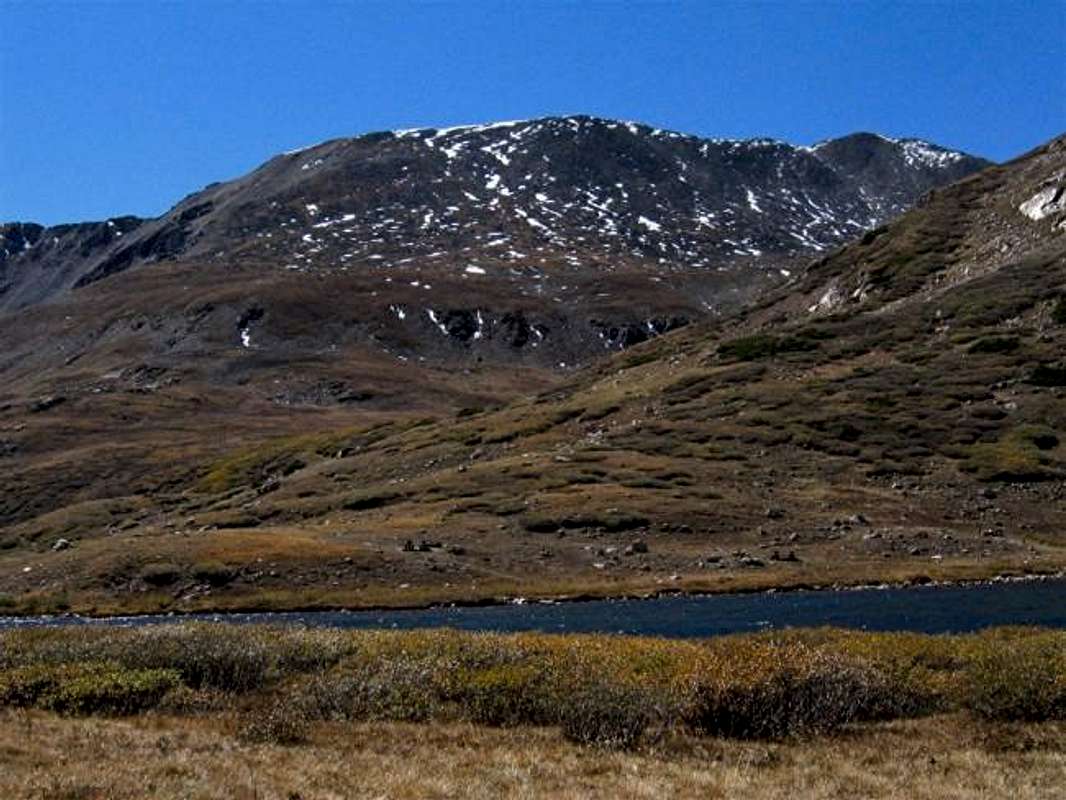
Buckskin on the right
Getting There
Go to the small town of Alma on Route 9 where you will see a sign, on the west side of Route 9, for Buckskin Creek Road/Kite Lake across from Placer Trading Company.Follow this road 6 miles to Kite Lake. The road begins as a well-graded dirt road. Although it becomes a little rougher toward the end, it is still passable by most passenger cars. Older texts talk about creek crossings but recent construction of bridges have solved that problem.
In snow season, the road is typically plowed up to the Sweet Home mine which leaves about 1.5 miles to Kite Lake.
 |  |  |  |  |
Red Tape
A small fee is charged at Kite Lake for parking. Call Pike National Forest for updates (719) 553-1400 |  |  |  |  |
When To Climb
Easiest in summer. |
miztflip - Nov 21, 2004 5:22 pm - Voted 10/10
Untitled CommentThe road is typically plowed up to the Sweet Home mine which leaves about 1.5 miles to Kite Lake.