My Way to Inabnit
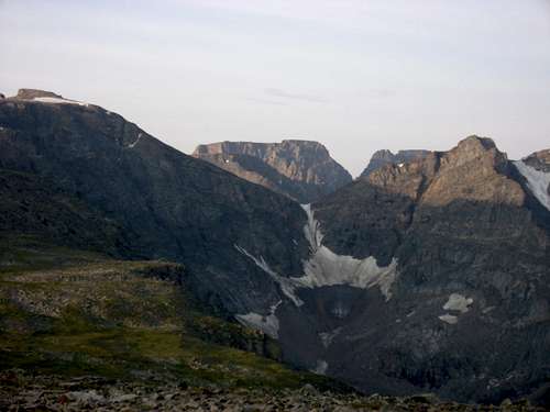
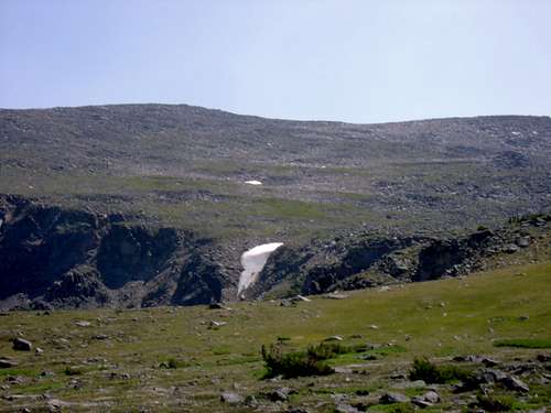
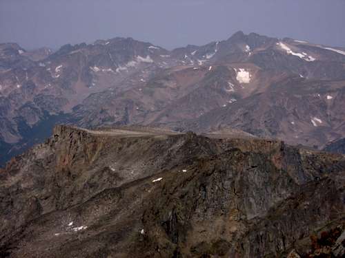
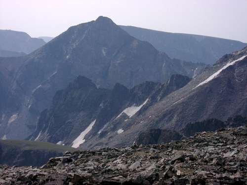
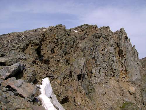
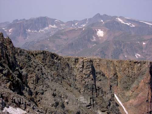
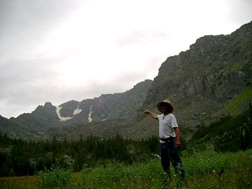
![Morning Sun on Inabnit from the center of the East Rosebud Plateau]() First light on Inabnit as seen from my high camp in the center of the East Rosebud Plateau in early August of 2015
First light on Inabnit as seen from my high camp in the center of the East Rosebud Plateau in early August of 2015
First, allow me to offer an apology for my inapt page design and equally unskillful mountaineering. I might as well apologize for my spelling, and grammar while I'm at it. I am new to this site, and this is my first post.
I seem to always end up doing things alone. This might have to do with the company I keep, the fact that none of them can, or want to, keep up with me, or it could have more to do with my defiant individuality, and arrogance. I say that with utmost humility. I am painfully aware of my character defects. Most of the time I am wrong. And there is nothing like an agonizing descent down Snow Creek in the rain to keep me right sized. Regardless of my personal ruminations here, my point is that I was once again on my own doing an adventure. I left my out of shape, and untrained companions in the primitive campground at East Rosebud Lake, told them I'd be back in 2 or 3 days, and took off up the Spread Creek trail with some trail mix, and Mountain House. This was in the late morning of Aug. 2nd 2015.
![Meadow at the West Branch of Spread Creek]() I paused here to eat the last of some fresh fruit so I wouldn't have to carry it up the grueling incline
I paused here to eat the last of some fresh fruit so I wouldn't have to carry it up the grueling incline
I proceeded up the Spread Creek Trail until I got to the spot where the stream crosses the trail. Here I took a right hand turn and bushwacked up stream until I reached an ancient (wet) glacial moraine. Knowing I was packing too much weight, and dreading the next phase of the journey I stopped and ate all the fresh fruit, peanut butter, and such that I had lugged up the hill. I reduced my water jug to the very least amount I thought I'd need to reach the plateau, paced back and forth with dread for the suffering that I knew was coming, and finally strapped the pack on and started the serious climbing.
They say that suffering is the one promise that life always keeps.
I am 54 years old. I weigh in at 195. I jog 4 miles a day, but maintain some stubborn belly fat. I also live at 1200 ft above sea level in the Bog. I swim an hour a day. But nothing I do at 1200ft can prepare for the suffering I Will experience at 12,000. I know this because these mountains and me go way back. Anyway the trees peter out at around 10,000. I am probably around 8500ft when I paused in the meadow to lighten my pack.
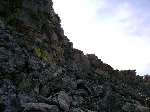
If you are a masochist like me, and feel the need to volunteer for suffering go ahead and follow in my foot steps. From the wet glacial meadow of upper Spread Creek I simply went straight up the flank of the East Rosebud Plateau between two large out crops of Precambrian Granite/Gneiss. The suffering was legendary even in hell.
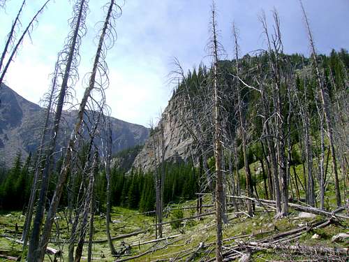
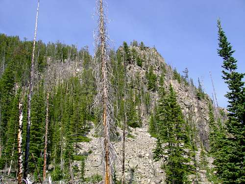
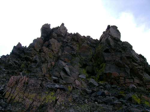
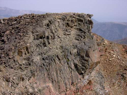
![One of the outcrops of Precambrain Granite / Gneiss]() One of the outcrops of Precambrian Granite / Gneiss that flank my accent to the timberline and the beginnings of the East Rosebud Plateau. It happens to be right on the edge of the burn area.
One of the outcrops of Precambrian Granite / Gneiss that flank my accent to the timberline and the beginnings of the East Rosebud Plateau. It happens to be right on the edge of the burn area.
By the time I made the timberline and the beginning of the plateau I had a tremendous and unglamorous urge to farther lighten my load. Now feeling rather ill, I had wanted to photograph the escarpment over the East Rosebud lake from the edge, but was unwilling to lose any altitude walking over and Down to it so I turned my back on the photo opts, and my sights toward the higher ground of Sylvan Peak. The ramparts over the lake will be there next time.
The ground was much gentler on the plateau. I made my way toward the summit of Sylvan Peak
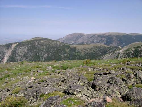
![Crow Mountain]() Plateau Views shortly after clearing the timberline. Here we are looking north toward the summit of Crow Mountain (my Father's favorite mountain)
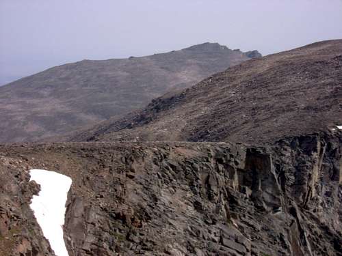
Plateau Views shortly after clearing the timberline. Here we are looking north toward the summit of Crow Mountain (my Father's favorite mountain)![East Rosebud Plateau]() These are the views after just making the lowest edges of the north end of the plateau. Looking toward Sylvan Peak. Water had just become a problem. I see some but it is a mile away.
These are the views after just making the lowest edges of the north end of the plateau. Looking toward Sylvan Peak. Water had just become a problem. I see some but it is a mile away. I was pretty dry at this point. I had sipped the small amount I'd carried from the meadow, but now I was hurting. The tiny patch of snow in the center of the last photo had some darker green under it, so I pointed off toward it. "Oh look something shiny" It seemed like hours later I was finally drinking my hearts content of cold fresh water.
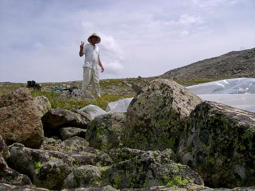
My plans were to summit four peaks. The first on the itinerary was Sylvan. Without a GPS, and with only photo copies of topographical maps off the internet, and google earth images I took off in the general direction. I'd climbed Crow, and been to Sylvan Lake enough times to basically know from memory where the summit was. I meandered around the flanks finally dropping my pack in a patch of green grass ( near where I thought there was water) and took off toward the summit unburdened. I was now approaching the summit from the W. or SW.
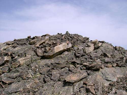
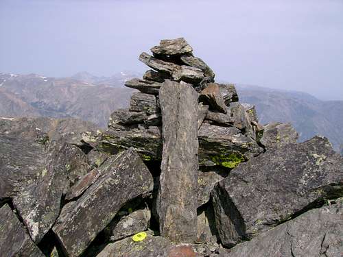
As is so often the case one is tricked by a series of false summits, each proving to be an out crop or a ridge. The real summit is when one can no longer go up. My body was pretty racked from the climb out of Spread Creek, but I knew that to keep to my schedule I'd have to bag this one the first day and check it off the list. Finally I reached the cairn and the spot where I could go no higher,
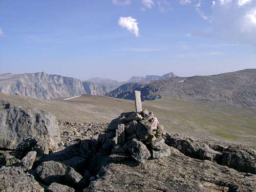
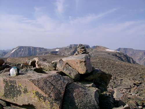
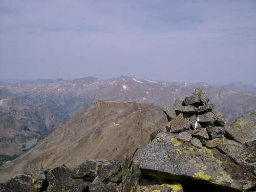
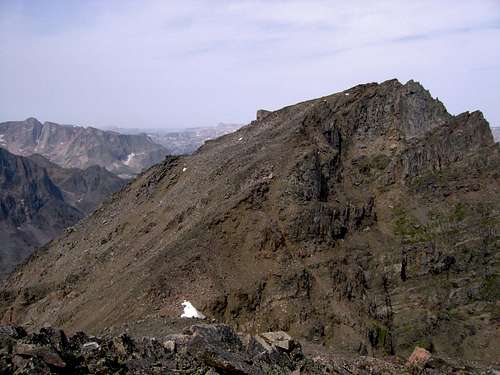
![Sylvan Peak]() The Sylvan Peak Cairn on the East Rosebud Plateau. Looking SE toward the flanks of Elk, and behind that Whitetail, Beartooth, and Rearguard.
The Sylvan Peak Cairn on the East Rosebud Plateau. Looking SE toward the flanks of Elk, and behind that Whitetail, Beartooth, and Rearguard.
I know Sylvan is just a wimpy 11,935er, but I really wanted to stick her in the back pocket, and I wanted to see the summit views. With a certain sense of accomplishment, and self pride I stood on the summit. Additionally it was still pretty early in the day, probably around five pm. My bag was about a half mile away, and I wanted to get back, find water, and bed down in some nice goat grass.
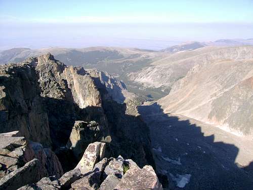
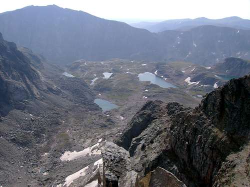
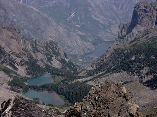
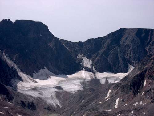
![Summit Views from Sylvan]() Looking NE down a glacial cirque toward Butcher
Looking NE down a glacial cirque toward ButcherI finally found some water, but I had to dig a hole to make a little waterfall, and get my jug under it. I bedded down in a lumpy grass mat, and dealt with mosquitos all night long. My appetite was gone. I choked something down, Ramen I think. Piss poor planning had overlooked salt, so I had only a couple packets from a fast food joint that I robbed from the minivan. My flatlander body was racked with pain from the climb up from East Rosebud. Most interestingly my heart continued to beat hard, even when I was laying down at rest. Boom Boom Boom all night long keeping me awake. I did however get some rest, and the balance of the time I practiced breathing meditation.
![Summit views from Sylvan]() Summit views from Sylvan. The object(s) of my desire. Bowback, Elk, and Inabnit. Also in the background The Castle Group, Darlene, maybe even Snowbank, which I'll have to save for next year.
Summit views from Sylvan. The object(s) of my desire. Bowback, Elk, and Inabnit. Also in the background The Castle Group, Darlene, maybe even Snowbank, which I'll have to save for next year.
In the morning I ate Mountain House, and made instant coffee. I broke camp, and walked my bag down to the center of the broad plateau at about 11,500 or so. I dropped it next to a nice pool of clear water. I made up a day bag, with some nylon line for shoulder straps, and the top section of my Lowe Alpine Contour backpack. I included trail mix, a video camera, a sony cyber shot, and brought my trusty milk jug for water. With the first light of the new day shining on the top of Inabnit I took off on a broad zig zag up the side of Elk Mountain. See the first image I loaded in the trip report. That was the view I saw in the morning, and my objectives for the day. My plan was to bag Elk, both summits of Bowback, and Inabnit. I planned to return to the broad green valley and my bag in the evening, and perhaps, if I had time, make my way back into the treeline so I wont have to listen to my heart thunder all night long. It was ambitious. I commenced.
A couple hours later, with a tight chest, and a pounding heart I made the summit of Elk.
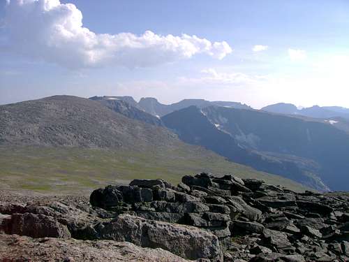
![summit views from Elk]() Summit Views from Elk looking south at Bowback, and the Castle Group behind
Summit Views from Elk looking south at Bowback, and the Castle Group behind
Not wasting much time there I proceeded to the saddle between the mountains. An hour or so later I had descended to that point. As usual I could not see the summit from that vantage but I knew it was there. The south summit of Bowback scared me some, but I was determined to check it off my bucket list. After making some video, and taking some stills I started climbing again. Eventually I made the summit of the NE Bowback threading through large boulders and scrambling to the top.
![Summit views from NW Bowback]() Summit Views from NW Bowback Lakes with names like Kookoo, and Triangle
Summit Views from NW Bowback Lakes with names like Kookoo, and Triangle
![Traverse Between The Bowbacks]() Traverse Between the Bowbacks
Traverse Between the Bowbacks![Castle Group from Bowback]() Castle Group from Bowback (zoomed)
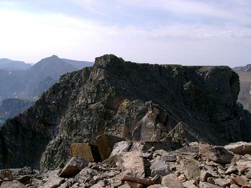
Castle Group from Bowback (zoomed)![Summit Views from Bowback]() Summit views from Bowback. Much like Mr Inabnit, I am an not a spring chicken, and I have turned back within a few hundred feet of the summit of my true desire, imaged here for those who know. Also the Summit of Inabnit is seen below me now, and in the fore ground.
Summit views from Bowback. Much like Mr Inabnit, I am an not a spring chicken, and I have turned back within a few hundred feet of the summit of my true desire, imaged here for those who know. Also the Summit of Inabnit is seen below me now, and in the fore ground.
So, pressed for time I descended into the traverse, scrambling, and with some handholds and climbing I made my way to the other summit of Bowback.
![Bowback Traverse]() Bowback traverse
Bowback traverse![S. Bowback Summit]() S. Bowback Summit
S. Bowback Summit![Summit of Bowback S.]() Summit of Bowback S. (Granite,Tempest, Block)
Summit of Bowback S. (Granite,Tempest, Block)
![Summit Views from Bowback S.]() Summit Views from Bowback S. (Whitetail)
Summit Views from Bowback S. (Whitetail)
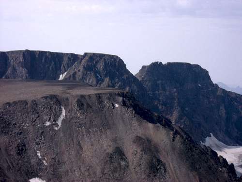
![Summit Views from Bowback S.]() Summit Views from Bowback S. (N. Summit)
Summit Views from Bowback S. (N. Summit)
![Summit Views from Bowback S.]() Summit Views from Bowback S. (Sylvan and Elk)
Summit Views from Bowback S. (Sylvan and Elk)
I made some video, and took some stills and headed down and across to the ridge between Bowback and Inabnit. There is the head of a couloir there in the saddle between the mountains. A lot of people use that to access the mountain Inabnit. My skill level, and equipment, the late season, and the location of my pack would prohibit an escape off the mountain using this route. To climb Inabnit, I would have to re summit Bowback to stay out of her cliffs, and partly re summit Elk to also stay out of the rough there. This was the crux of the entire trip- My strength. Would I have it in me to essentially climb those mountains twice? Once I started down, there was no turning back. And precious little water sloshed in my jug.
![Inabnit from Bowback's Flank]() Inabnit from Bowback's Flank
Inabnit from Bowback's Flank![Climbing the slopes of Inabnit]() Climbing the slopes of Inabnit
Climbing the slopes of Inabnit![Slopes of Inabnit]() Slopes of Inabnit... Finally the Summit Cairn in sight
Slopes of Inabnit... Finally the Summit Cairn in sight![Summit of Inabnit]() Summit of Inabnit
Summit of Inabnit![Summit Views from Inabnit]() Summit Views from Inabnit The Snow Lakes, and East Rosebud in the very bottom....
Summit Views from Inabnit The Snow Lakes, and East Rosebud in the very bottom....
![Summit Views From Inabnit]() Summit Views From Inabnit -The real object of my desire.....
Summit Views From Inabnit -The real object of my desire.....
Summit Views From Inabnit I finally had my fill of Inabnit, signed the summit register, and carefully replaced the lid and the jar under the cairn. I started my way back down the mountain dreading the return to the summits of Bowback and Elk. I resolved to just take my time, and not press it. If I could only do ten steps and rest, then that was what it was. As it turned out, that was exactly what I did. And I was sucking dirty snow out of my water jug from the couloir for water. Finally back at the summit of Bowback I found water under that snowfield there.
Many grueling hours later I spotted my gear in the center of the broad ramp that leads down to the Snow Lakes, with an elk grazing nearby. Finally I reached my pack and just in time the weather was rapidly deteriorating. I made a quick meal, and packed my gear.
With thunder rumbling around me I headed down into the Snow Creek drainage. An hour or two later I was huddled under my plastic sheeting in a hail storm. Many hours after that I was camped out for the night, eating Mountain House, and trying to relax. Back at 9000+ feet my heart quit with the pounding. A curious buck in Velvet came by several times to investigate the monkey camped in his lawn, as did his doe.
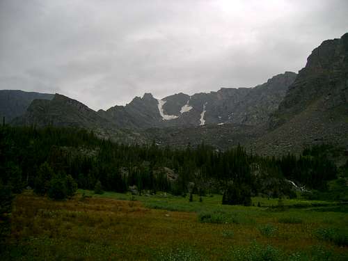
![Snow Creek]() Snow Creek
Snow Creek![Snow Creek]() Snow Creek
Snow Creek
Snow Creek![Snow Creek]() Snow Creek
Snow Creek
![Snow Creek]() Snow Creek
Snow Creek
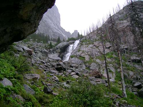
The next morning I broke camp and limped down Snow Creek in the rain. It was day three, and I needed to get back before all those women at base camp freaked out called the authorities. I had given instruction not to freak until day five of my absence, but they tend to hysteria, so I thought I better stick to the schedule. I really needed another day to recover, and it turned out that scramble down Snow Creek was absolutely the very hardest part of the whole trip. I was very lucky not to break a leg or worse in that canyon. My suggestion to any who venture up that way is to stay to the left all the way up, unless you want to climb mossy wet cliffs. Or in my case, stay to the right all the way down.
When I finally spotted the East Rosebud Trail I was very relieved. When I finally got on that trail I was even more so.
I limped into the campground at around two in the afternoon with a couple of barks on the shin but happy to be back even with all the crying babies, and bitching women. They made me buy them dinner at the Grizzly Bar down in Roscoe. I'm feeling abused. Ex-wives, Daughter, Grand Children, Family Friends, Kitchen Sinks, and everything. At least they didn't bring their cats. Lordy. Let me back up the Mountain.


Comments
Post a Comment