
|
|
Mountain/Rock |
|---|---|
|
|
42.69570°N / 71.8927°W |
|
|
1832 ft / 558 m |
|
|
Overview
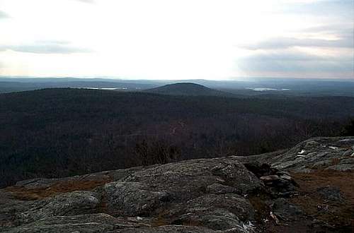
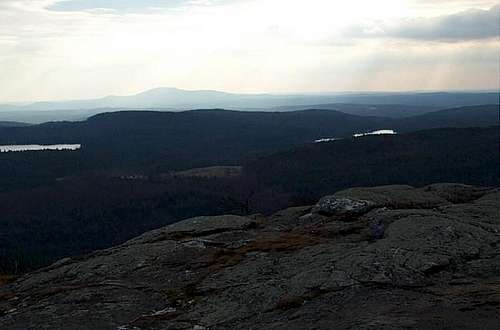 More views from the summit
One of the most popular hikes in Massachusetts, Mt. Watatic stands as the southernmost summit on the 22 mile Wapack Trail and lies just east of the end of the Midstate Trail. Formerly home to a ski area this mountain is very rewarding in terms of views. The ski resort has been open from time to time in the past until 1988 when all chances for opening the ski resort finally ended.
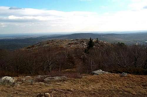
 View looking up all the summits on the Wapack Trail
Today there is an excellent direction from trail with the most direct way coming from Route 119. The summit area fetures two bald summits each with decent views of towards the Manadnock Region and downtown Boston. It is a classic low summit hike with a classic 270 degree panorama. The summit is not wooded which is surprising due to it's low elevation. This mountain can be easily done in an afternoon and can be done throughout the year.
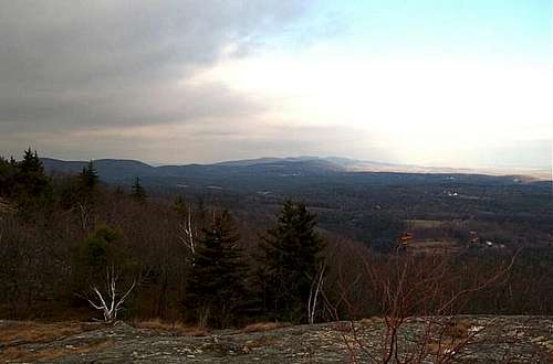
 View from Mount Watatic
The Class 1 Wapack Trail is the preferred way up to the summit of Mt. Watatic. The trail is moderate with some steeper sections but nothing on the trail comes close to approaching Class 2. Via the most direct route this summit is only 1.1 miles one way and 1000 feet of elevation gain. A 4 mile loop hike can be made of this mountain as well adding more scenery and views. Toward the top the trail eases and the panorama awaits. To the north, the rest of the Wapack Range rises with the trail highpoint of North Pack Monadnock and Pack Monadnock rises in the background. To the easy most of Massachusetts hilly countryside rises. On clear day the skyscrapers of Boston can be seen. To the south lies Mt. Watchusett and it's ski run. Due to the close proximity to Boston this mountain always has a crowd. Best time for solitude is on a winter weekday.
 The true summit
Map Information
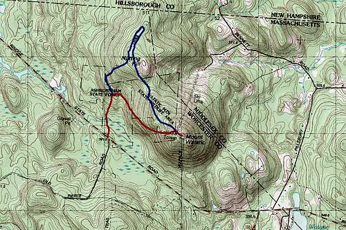 Map of the routes
As of right now my map generator program is down. Here is a good MAP LINK of a loop hike up Mount Watatic.
Getting There
TO WAPACK TRAIL TRAILHEAD: Take Route 119 through the hill country of northern Massachusetts. If coming from the east go past the town of Ashby and stay on the road past the summit of Mt. Watatic (a round and bald summit on your right). The trailhead with be on your right with marking to both the Midstate Trail and the Wapack Trail.
Red Tape
There are no fees here.
When To Climb
This summit can be climbed at any time of the year. Remember to bring snowshoes or crampons in the winter though.
Camping
Camping is not permitted on the summit of Mt. Watatic.
Mountain Conditions
Check out this page for this mountain and all Wapack Trail information
Here is a detailed page about the hike up Mount Watatic.
THis website features opinions on Mount Watatic.