|
|
Mountain/Rock |
|---|---|
|
|
39.19820°N / 120.2869°W |
|
|
Hiking |
|
|
Spring, Summer, Fall, Winter |
|
|
9006 ft / 2745 m |
|
|
Overview
Granite Chief is located on the northeast edge of the same named 25,680-acre Granite Chief Wilderness near the west rim of the Tahoe Basin. It is also located just west of the Palisades Tahoe ski area, home of the 1960 Winter Olympics. The peak is very popular and has spectacular views in all directions. It previously was considered the highest point in Placer County until a new linear point was discovered in 2008 on the Placer County - Washoe County line.
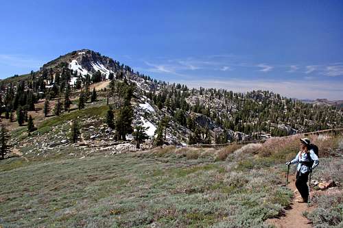
Granite Chief stands out as its light granite composition contrasts with the darker volcanic rock of the nearby peaks. The hike up the primary route passes through some nicely wooded forests (including a University of California Ecology Study Area) as well as across open granite hillsides and through some pleasant meadows. The trail skirts along the north edge of the ski area and along a segment of the Pacific Crest Trail. The final segment of the hike passes under a ski lift and then heads for the summit from the upper lift shed.
A good segment of the hike can be cut off by using the gondola to High Camp area at 8,200 ft.

Getting There
From Truckee and Interstate 80 you head south on CA State Route 89 for 8.5 miles to Olympic Valley Road. From Tahoe City you go 5.2 miles north on CA State Route 89 to Olympic Valley Road. Follow Olympic Valley Road for 2.3 miles to a fire station on your right. There is a huge parking area for the ski area nearby. It is free parking. Stay to the right and head towards the Olympic Valley Inn and there are two parking areas on the right. The hike via the primary route is 11.2 miles round trip.
Red Tape
There are no wilderness permits required to hike or backpack in the Granite Chief Wilderness. A valid fire permit is required to operate a stove on any National Forest land. The permits can be picked up at any National Forest Ranger Station. However, most of the hikes out here are day hikes; particularly Granite Chief.
When To Climb and Weather
Granite Chief is summited year-round. The most popular time to hike Granite Chief is from late May through October when there's little to no snow on the ground. Although the whole area west and north of Granite Chief is fairly popular in winter. There is a huge OSV area north of the wilderness boundary, and numerous winter outdoor skills courses use this same area. A popular winter ski tour climbs Granite Chief in conjunction with Needle and Lyon Peaks to the west along the connecting ridgeline. The bowls and chutes found on the north side of the ridge are particularly popular with backcountry skiers. Be cognizant of ski area boundaries particularly if you have not paid for a lift ticket during ski season. Thanks to Bob Burd for winter information.
For current weather and 5-day forecast click here
Camping
There are many places to camp in Granite Chief Wilderness itself, taking care to follow all regulations about keeping back from water and protecting meadows. There are also numerous first come / first served National Forest Campgrounds in and around the greater Tahoe basin including 3 along the Truckee River on CA State Route 89 between Truckee and Squaw Valley Road. There are 3 state parks requiring reservations along CA State Route 89 south of Tahoe City and Donner Memorial State Park just off Interstate 80 near Truckee. The area isn't particularly rustic given the ski slopes and developments and highways.


