|
|
Mountain/Rock |
|---|---|
|
|
48.93558°N / 19.65523°E |
|
|
Hiking, Mountaineering, Trad Climbing, Sport Climbing, Skiing |
|
|
Spring, Summer, Fall, Winter |
|
|
6713 ft / 2046 m |
|
|
Overview
|
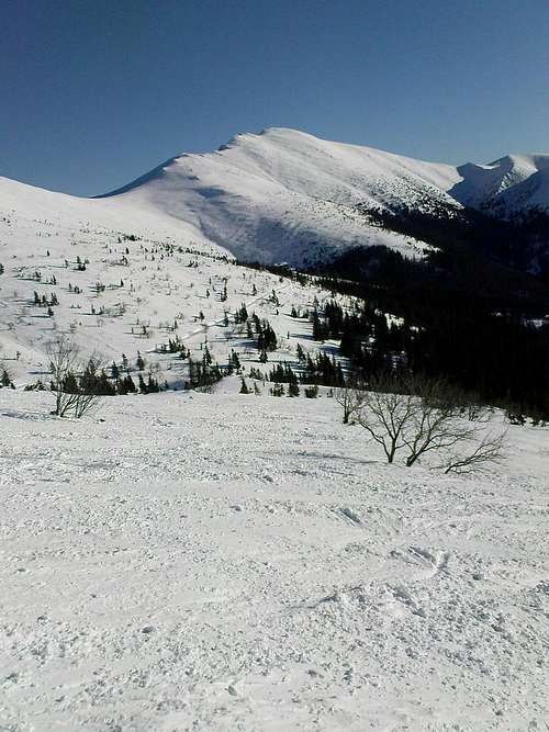
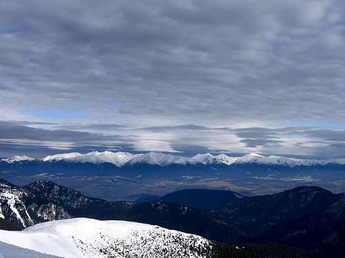
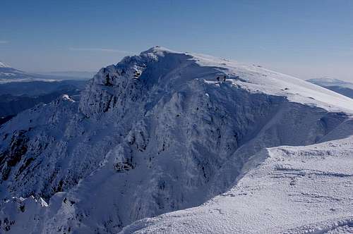
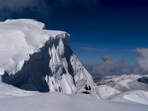
Ďumbier, whose name derives from ginger, is the highest mountain in the Nízke Tatry (Low Tatras) range. It is located on the main ridge near the east end of the western part of the range, known as the Ďumbierske Tatry (Ďumbier Tatras). The elevation of the main summit used to be given as 2043m but was recently corrected to 2046m. Ďumbier has 1176m of prominence and its topographic isolation is over 27 kilometers. The peak is formed of granite, and has moderate southern slopes falling to the valley of Bystrianka brook and a steep, nearly five hundred meters tall, north wall falling to the Ludárova dolina (dolina = valley). The north face of broader Ďumbier Massif, along with the cirques at its foot, which cradled glaciers during the Ice Age, make up the finest chunk of alpine scenery in the Low Tatras. The slopes of Ďumbier were once heavily mined for iron ore, gold and antimony. 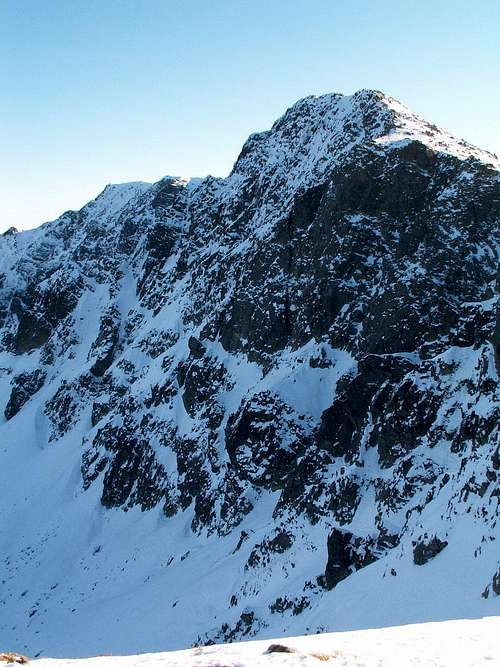
What can be called the massif of Ďumbier is a bigger bulk of mountains whose west end will be Krúpové sedlo (sedlo - saddle/pass) at about 1910m, or - if the nearby summit of Krúpova hoľa (1922m) is included - Demänovské sedlo at 1756m further west. Between Krúpové sedlo and the main summit of Ďumbier sits its western summit (Ludárova kopa) at 2020m (approx. 25m of prominence). The spur it sends to the north separates the Ludárova Valley from the Litvorova Valley. About half a mile east of the main summit (2046m) lies the summit of Štiavnica at 2025 m (over 30m of prominence), which is the second highest peak in the Low Tatras. Štiavnica is not located on the main ridge of the Low Tatras but forms an easterly spur of the Ďumbier Massif. Between Ďumbier and Štiavnica the main ridge takes a sharp turn to the south and quickly drops to Ďumbierske sedlo at 1728m, beyond which lies the massif of Králička/Besná. 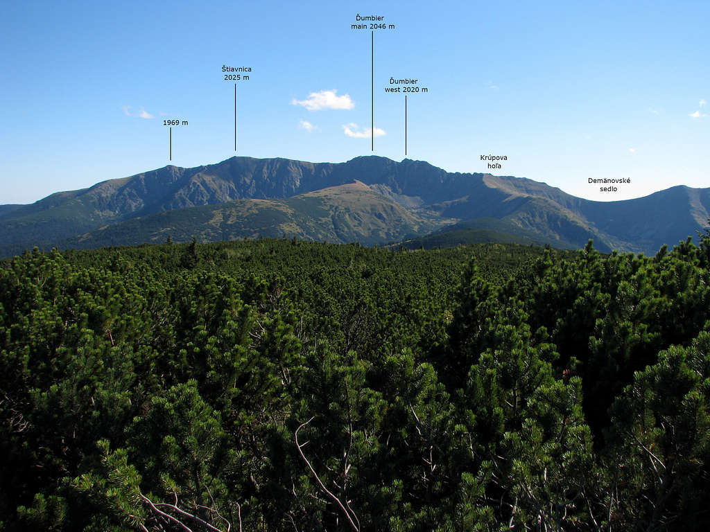
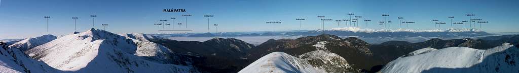
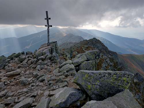
On the main summit of Ďumbier are an ugly concrete triangulation pillar and a wooden Patriarchal cross with two crossbars (the upper is shorter) - the national emblem of Slovakia. Views from the summit and other places within the massif are extensive.
|
Maps
|
Getting There, Trails & Huts
|
For information about how to get to the area please see here. 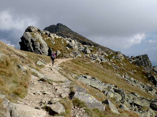
To the south of Ďumbier, at Ďumbierske sedlo sits Chata generála M. R. Štefánika (General Štefanik Hut) (chata = hut), a convenient base for the summit. The hut can be easily reached from both the south (a walk from the car park / bus stop at the Trangoška Hotel on Road 584 takes less than 1.5hrs) and the east (from Čertovica Pass: car park, bus stop, mountain hut - over 3hrs). The old trail leading from the Štefanik Hut directly to the summit is closed in summer, due to erosion caused by hikers. In winter it is marked by wooden poles. The new red trail runs in a northwesterly direction to Krúpové sedlo and from that point in an ESE direction to the summit – 1 hr 15 min. 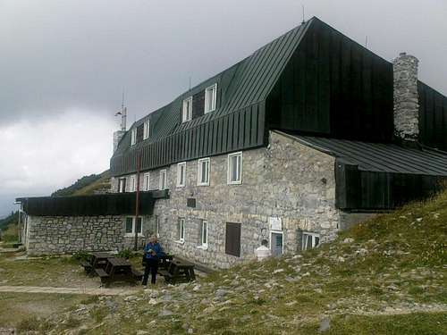
Generál Štefánik, who died in a plane crash in 1919 while returning home from the West, was a Slovak scholar and activist fighting for an independent Czechoslovakia, which was born as a federation of two nations after the First World War and lasted until the early 1990s, when it split up – peacefully! During the Second World War, in the winter 1944, near the Štefanik Hut there was intense fighting between the partisans and the German army. In memory of the partisans who died in battle a Monument to the Fallen Partisans was erected here. 
Some 300m off the trail from Trangoška is an interesting cave, which you can visit after making a reservation over the telephone or by e-mail. The cave is interesting for two reasons. The first is that limestone can rarely be found south of the main ridge of the Low Tatras. The second is the way of exploring the cave: please click here. 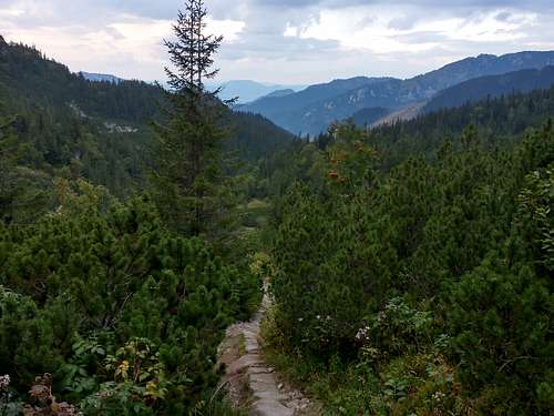
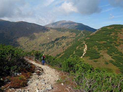
From the north the summit is accessible via the Demänovská Valley, from which green marks will take you off the main road at a place called Lúčky. A long stretch of a forest road, then a maintained path will lead you up the Široká dolina (Broad Valley) to Krúpova hoľa (1922m), then along the main ridge to the summit of Ďumbier – nearly 4hrs. 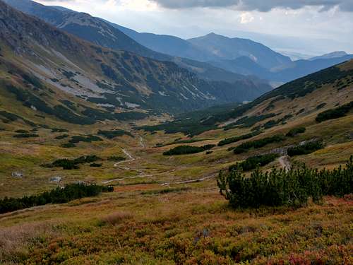
The shortest route is from the upper cable car station / the Stone Hut at the summit of Chopok (Kamenná chata pod Chopkom) - along the main ridge of the Low Tatras in an easterly direction - 1.5hrs. 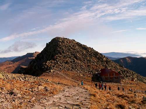
An elegant option might be a visit to the summit of Ďumbier while hiking/skiing along the main ridge trail of the Low Tatras.
|
Red Tape & Wildlife
|
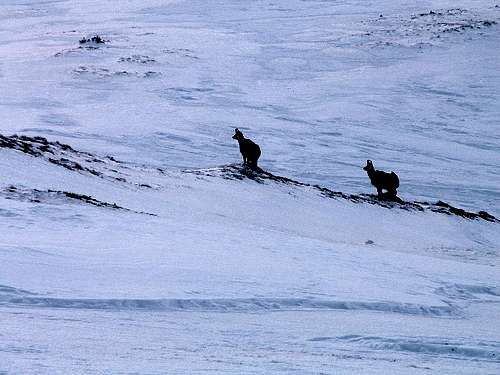
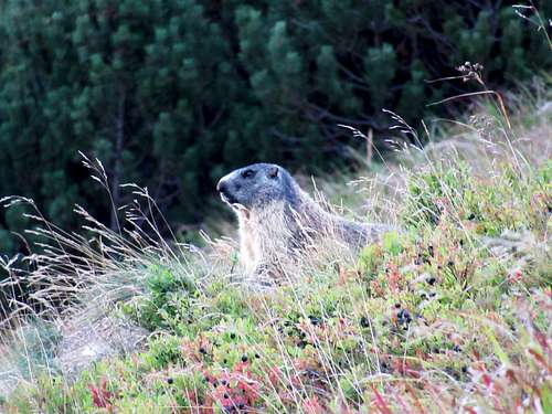
The massif lies in a national park, so you can only walk along the marked paths. Since 1973 the north and east part of the Ďumbier Massif has been a national nature reserve closed to hikers. (To find out when and where rock climbing is allowed, please see the next chapter.) The place is home to chamois and marmots, brought here from the Tatras a few decades ago. The future of the chamois population is uncertain. The animals seek shelter on the craggy slopes of the highest peaks of the Low Tatras as the animals have a really tough life in these mountains, especially in winter, when - apart from the weather hazards - they fall prey to the wolves and lynx.
The path leading from the Štefánik Hut directly to the summit of Ďumbier is closed in summer due to trail wear. You have to make a detour via Krúpové sedlo. For more information about red tape and wildlife, including bear danger, please see here.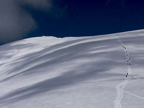
|
Rock Climbing
Interesting for climbing is only the north side of the Ďumbier Massif. Summer climbing is not permitted. (If it were, it would be difficult due to patches of grass and loose rocks.) Despite the area lying in a strict nature reserve, climbing is allowed from 10 December until the end of February, but only for members of a Slovak club JAMES and their partners. On the east the area is bounded by Štajnerova vežička and Lehotský komín. The latter (komin = chimney) only marks the border of this area and cannot be used for climbing. In the west the boundary of the climbing area is marked by Ludárova kopa and Kamzičie sedlo. Descent is possible only via Huťkov žľab (žľab = couloir) or Východný žľab.
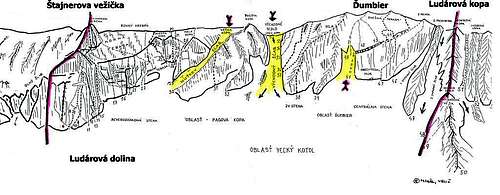 The climbing area - image from JAMES.
Another picture can be seen here.
Here are some of the routes on the north face:
- Štepánskeho cesta, 4+
- Delová rúra, 5
- Stredom steny, 4+
- Stredom platne, 6A0
- Koniec prázdnin, 5+
- Pravý pilier, M6-
- Zelený kút, 5A1
- Černice, 5+
- Iba raz, 6-
Mountain Conditions & Rescue
- In Slovakia those who do not carry commercial insurance have to pay for any rescue services rendered by Mountain Rescue Service (HZS).
- HZS phone number: 18 300
- Mountain conditions on HZS site
- Weather forecast for nearby Chopok on meteobox.sk
Select External Links
- In Czech: Ďumbier on turistika.cz
- In Slovak: Ďumbier on planetslovakia.sk
- Jasná Ski Resort