
-
 5085 Hits
-
 77.3% Score
-
 8 Votes
|
|
Mountain/Rock |
|---|---|
|
|
48.62477°N / 18.63516°E |
|
|
Spring, Summer, Fall, Winter |
|
|
4416 ft / 1346 m |
|
|
Topographic isolation: 40 km
Nearest higher peak: Smrekov (1441 m)
Prominence: approximately 740 m
Overview
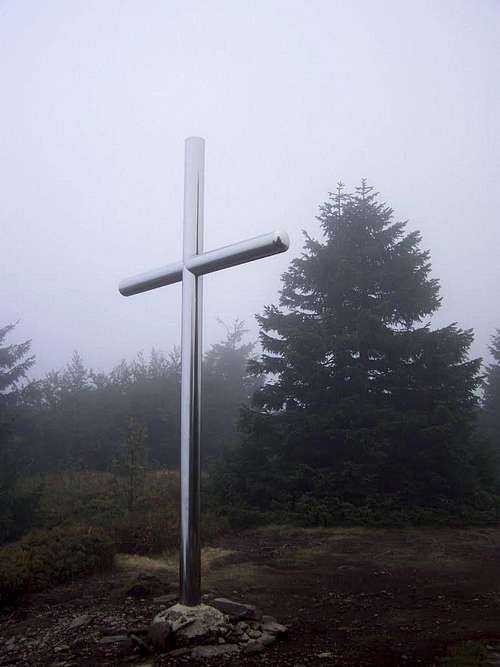
Summit cross on Vtáčnik
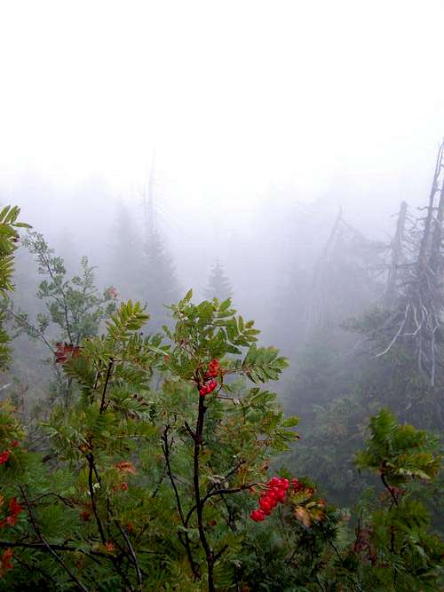
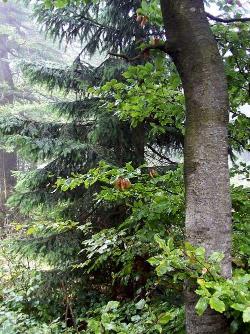
Foggy view with sorb
German name: Vogelgebirge
In the following text I give both the Slovak and the Hungarian versions of the geographical names.
Vtáčnik/Madaras is a mountain range in the Western Carpahians. The name of its highest peak is also called Vtáčnik/Madaras. The mountain range has an approximate diameter of 35 km. From SE and from NW it is bordered by the rivers Hron/Garam and Nitra/Nyitra. The bordering mountain range on the NE is called Kremnické vrchy/Körmöci-hegység, while the bordering mountain on the SW is called Tribeč/Tribecs.
These are the highest summits of the mountain range:
- Vtáčnik/Madaras (1346 m)
- Malá Homôľka (1298 m)
- Kláštorská skala (1279 m)
- Veľká Homôľka 1274 m)
- Jarabá skala/Foglyászhegy (1169 m)
- Biely kameň/Fehérkő (1136 m)
- Orlí kameň (1126 m)
- Kuní vrch (1112 m)
- Rúbaný vrch/Rubanó (1097 m)
- Buchlov (1041 m)
- Tlstý diel (1016 m)
- Tatra (1015 m)
The lower parts of the mountain is covered with beech forest, while the upper regions are mostly covered by fir forest. The majority of this mountain range is within the boundaries of Ponitrie Protected Landscape Area. This park was created in 1985. The forest is specifically protected as a primeval forest around the peaks Vtáčnik/Madaras, Biely kameň/Fehérkő and Veľká skala.
Another area with extra protection is Ivanov salaš – a remnant of a mountain meadow, covered by groups of junipers.
The mountain is not covered by forest everywhere: there are many spectacular volcanic rock outcrops for example at:
- Dobrotínske skaly
- Ostrovic
- Sladná skala
- Veľká skala
- Buchov
- Kláštorská skala
- Vtáčnik/Madaras
- Makovište
- Kuní vrch
- Skalka
- Jarabá skala/Foglyászhegy
- Biely kameň/Fehérkő
- Tlstý diel
- Jančekova skala
- Veľký Grič
- Malý Grič
The dense forest gives home for many kinds of animals, including wolves, bears and lynx.
Some History
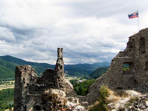
Castle Reviste
Castle Revište/Revistye
This castle is only a ruin now, on a 305 meter high hill. The castle was built in the 2nd half of the 13th century by the Miskolc clan. The castle was not modernized in the later centuries, so a Turkish troop easily conquered it in 1647. It was only a raid and soon the Turks withdrew their forces. The castle was not maintained, and it was abandoned in 1792. The ruin can be visited but no marked route leads up to the hill.
Castle Žarnovica/Zsarnóca
The Dóczy family built a castle in this small city in the 15th century. This castle was maintained in the later centuries and now it looks like a palace rather than a castle. The city is famous about the battle between the Turkish and Habsburg army. Both sides had approximately 11000 soldiers, and both sides lost approximately 1500-1500 people. This battle stopped the Turks to advance further to north in Hungary.
Castle Sivý Kameň/Keselőkő
This castle is only a ruin now, on a 640 meter high hill near the village Podhradie/Keselőkő. The castle was built in the mid of the 14th century and owned by the Majthényi family. Smaller Turkish troops sieged it a few times in the 17th century but they couldn’t conquer it. The castle was not maintained from the beginning of the 18th century and soon it collapsed. The ruin can be visited but no marked route leads up to the hill.
WWII
During WWII there was active partisan activity against the Nazis in the mountain range Vtáčnik/Madaras. Theestimated number of the partisan were 18000 operating in this mountain range, in the towns and villages near the mountains and in the neighboring mountain ranges. The German troops captured and killed many partisans and their local supporters during their counterattack. One sad example was their raid in the village Kľak/Madarasalja on 21 January 1945 when they killed 84 local people – and 38 were kids amongst them!A monument has been erected on the site in 1963 as a memorial.
Population
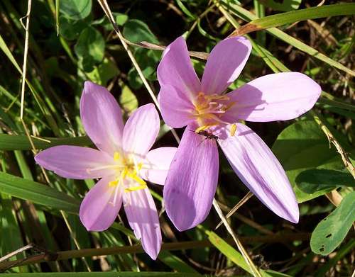
Colchicum autumnale
Now the area is populated by Slovak people. But in its earlier history it has a colorful population: Slovaks, Magyars and Germans. The rural population consisted of Slovaks and Germans. Noble families, people of administration and soldiers were generally Magyars, while most of the miners and many of the craftsmen were Germans. The population was homogenized between 1918 and 1950.
Please see here some examples of towns with mixed population according to the census in 1910. I listed the villages that had the highest population according to this census:
| Slovak name | Hungarian name | Population in 1910 | Magyars | Slovaks | Germans |
| Handlová | Nyitrabánya | 4248 | 6% | 5% | 87% |
| Prievidza | Privigye | 3349 | 18% | 75% | 6% |
| Veľké Pole | Pálosnagymező | 3266 | 1% | 2% | 96% |
| Žarnovica | Zsarnóca | 1998 | 15% | 81% | 3% |
| Píla | Dóczyfürésze | 1857 | 2% | 7% | 92% |
| Oslany | Oszlány | 1789 | 18% | 78% | 4% |
County Highpoints
The summit of Malá Homôľka - not too characteristic
A few words about Bars County
Bars County was founded by the first Hungarian king, Stephen I around 1000 a.d. In 1920 the total area of the county was occupied by Czechoslovakia. The southern part o the county came again under Hungarian control in the period 1938-1945, but the earlier county highpoint – Vtáčnik/Madaras – remained in Slovakia.
A few words about Nyitra County
Nyitra County was founded by Stephen I, around 1000 a.d. In 1920 the total area of the county was occupied by Czechoslovakia. But the county still existed until 1927 within the same borders. Nyitra county was re-created in the period 1939-1945 in the Slovak state, with somewhat modified borders.
How to Get There
As the European transit route E77 goes along the valles southeast to the mountain range, it is recommended to approach the mountain from this direction. Žarnovica/Zsarnóca is a city along route E77 that we can take as a reference point.- Budapest: 147 km distance. Take route 10 to Dorog, and then route 111 to Esztergom. Here cross the Hungarian/Slovakian border on the bridge above Danube.Take route 76 to Hronský Beňadik/Garamszentbenedek. And finally drive 17 km to Žarnovica/Zsarnóca on the highway R1.
- Bratislava/Pozsony: 155 km distance. Take the D1 highway to Trnava/Nagyszombat and from there the R1 speedway to Žarnovica/Zsarnóca.
- Cracow: 270 km distance. Take the European transit route E77 to Banská Bystrica/Besztercebánya. From there take R1 speedway to Žarnovica/Zsarnóca.
Routes
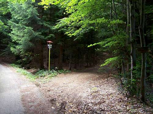
Road junction. Please note the retro style information post from the 70's of the socialist era of Czechoslovakia!
- From Kľak/Madarasalja. "Green" marked trail. Distance to the summit: 5 km. Elevation gain: 730 m
- From Prochot/Kelő. "Yellow" and "red" marked trails. Distance to the summit: 8 km. Cumulated elevation gain: 840 m
- From Bystričany/Besztercsény. "Blue" marked trail. Distance to the summit: 12 km. Elevation gain: 1080 m
Camping
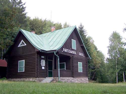
Tourist Hut "Partizánska"
Website: http://www.chata-kollarova.ic.cz
Tourist hut Partizánska (1010 m) on the southeastern hillside of Vtáčnik/Madaras
Mountain cabin Míľa na Plešine (1050 m) near the summit of Plešina.
Autocamp Drevenica Revište (220 m) near Žarnovica/Zsarnóca.
Website:http://www.camp.cz/en/campings-czech-republic/reviste/detail/377-camping
Camping Bojnice (435 m) at Opatovce nad Nitrou/Bajmócapáti.
Website:http://www.camp.cz/en/campings-czech-republic/bojnice/detail/390-camping
Camping Tajch Centrum LOSOS (345 m) near Nová Baňa/Újbánya.
Website:http://www.camp.cz/en/campings-czech-republic/tajch-losos/detail/409-camping
Online Map
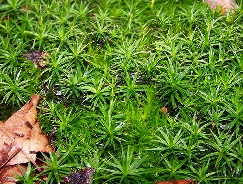
Moss