
-
 22492 Hits
-
 81.18% Score
-
 13 Votes
|
|
Mountain/Rock |
|---|---|
|
|
44.19440°N / 10.69933°E |
|
|
Hiking, Skiing |
|
|
Spring, Summer, Fall, Winter |
|
|
7103 ft / 2165 m |
|
|
Overview
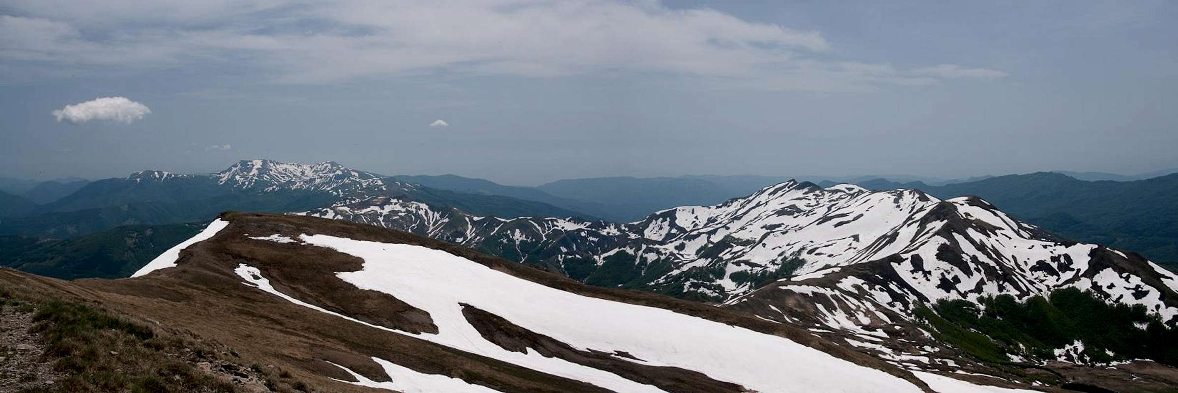
 Monte Cimone from the Monte Lagoni east ridge Monte Cimone from the Monte Lagoni east ridge |
If ugliness had a name, Monte Cimone would be high on the list. The highest mountain of the Appennino Tosco-Emiliano carries the weight of several constructions on its top, among them military radar installations, a meteorological station as well as a chapel. Moreover the ruins of several buildings are scattered across the wide plateau of this mountain. In fact the military presence made the whole mountain off-limits during the times of the Cold War.
Times have changed, so that the summit is open for the public again and during the winter ski season many people climb to its top to ski down to the ski resorts at its base. Above the village of Sestola there are quite a number of ski runs, and the lifts can take you to within 1 1/2h of the summit. Moreover, the installations on top are served by a support road (unpaved) which makes access very easy indeed. While this road offers the easiest access it is in no way the best way to reach the summit of Monte Cimone.
 |  |  |
Without the installations, Monte Cimone could be called one of the most beautiful mountains of this part of the Appennino. Even with the installations it is one of the most distinct shapes, which can bee distinguished from very far away. Its form is that of a low pyramid with a flat summit on its top. The pyramid has three sides with the three ridges pointing towards the west, north-east and south. While the north-eastern ridge is used for the support road, the long west ridge has no trail. The south ridge, however, is one of the most beautiful traverses in this part of Italy.
It stretches from Libro Aperto, the mountain, shaped like an open book, which stands above Abetone Pass across two additional summits towards Monte Cimone. On the way most of both Italian coasts (Tyrhenean and Adriatic Seas) can be seen with the other Appennine subsections stretching to the north and south. The south ridge climbs across the false summit of Monte Cimone, called Il Cimoncino. The hike from Abetone to Monte Cimone and back is a long daytrip.
 Madonna del Cimone on the summit, Monte Cusna behind
On the top of Monte Cimone Roman artefacts have been found, indicating that the mountain has been climbed very early on. The first touristic climb has been recorded in 1567, when Guidinello Montecuccoli, a local nobleman reached the top. Later, the Jesuits funded several expeditions to study the atmospheric conditions at an elevation of more than 2000m. In 1908 a chapel was erected dedicated to Madonna delle nevi, to which still a yearly procession id performed each August 5th. On the very summit a statue Madonna del Cimone has been placed facing south.
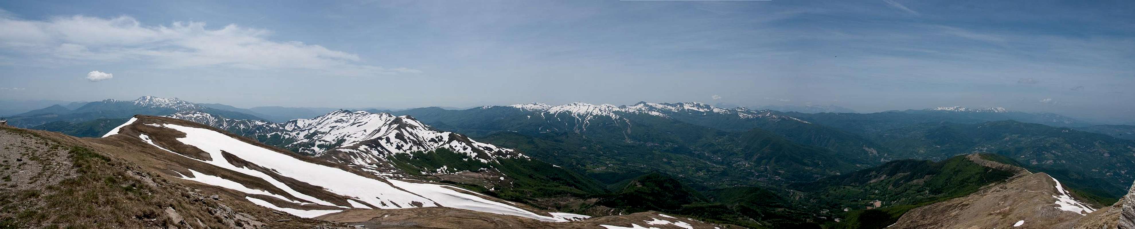
Summit Panorama
  |
Getting There
 Monte Cimone from Pania di Corfino
The most obvious starting point for Monte Cimone is the Sestola at the north-eastern base of the mountain. Here a lift can take you to within 1 hour of the summit. More interesting is the long traverse from Abetone pass, which separates Tuscany from Emilia Romagna. However, the hike is long, especially as you will have to retrace your steps. The two trailheads can be reached as follows from the closest international airports at Bologna, Pisa and Firenze (Florence).
- Sestola
- From Bologna
- Take motorway A1 direction Modena
- At the southern exit of Modena turn onto SP4 south, which will take you to Fanano.
- Switch to SP324 north to Sestola
- From Bologna
- Abetone
- From Bologna
- Take motorway A1 direction Modena
- At the southern exit of Modena turn onto SS12 south, which will take you all the way to Abetone.
- From Pisa
- Take motorway A11 to Lucca
- Turn onto SS12 north which takes you to Abetone.
- From Firenze
- Take motorway A11 in direction Pisa.
- At the exit Pistoia switch to SS66, direction San Marcello Pistoiese
- At La Lima, behind San Marcello, turn onto SS12 to Abetone
- From Bologna
Red Tape
 Common White feeding on Crocus
Monte Cimone is located at the southern end of the Parco Regionale dell'Alto Appennino Modenese. The usual restrictions for such parks apply. Visit the park's site for more information.
The parking lots at Abetone are charged during the ski season. Having been there outside the season I can't tell the fees. The lots are large and go on for about 1km or more so the approach to the trailhead is the first challenge in winter ;-)
As I haven't been to Sestola I can't tell about fees and regulations there but would assume similar rules apply.
Accommodation
 |
There should be ample accommodation at either Sestola or Abetone during the winter time. However, in spring and autumn things look quite different as most apartment buildings and hotels are closed. During the Italian vacation season in August, there are rooms to be had but they are often booked in advance. The closest town to Abetone is San Marcello Pistoiese on the Toscana side of the pass. However, you won't find much lodging there. The big cities - Modena and Bologna as well as Firenze and Lucca are about an hour away from the pass so staying there is a definite possibility.
If you want to stay closer you can make use of Agriturismo, holiday farms, which offer rooms, apartments and food. Good places are somewhat hard to find if you don't speak Italian. The site of the Parco Regionale dell'Alto Appennino Modenese has a listing here:
Lodging inParco Regionale dell'Alto Appennino Modenese
Weather Conditions
Maps & Books
Let me know if you know more books or better maps. This is the set I used.Maps
I have not been able to find detailed maps of this area so the following one is a road map, scaled 1:150000
- Tuscanny - Florence
Freytag & Berndt
1:150000
ISBN: 978-3-7079-0281-5
Maps Online
Books
- Tuscany North / Toskana Nord
Wolfgang Heitzmann / Renate Gabriel (translation: Gill Round)
Rother Verlag
ISBN: 978-3-7633-4812-1 (English)
ISBN: 978-3-7633-4115-3 (German)