
-
 7045 Hits
-
 84.27% Score
-
 18 Votes
|
|
Mountain/Rock |
|---|---|
|
|
46.48646°N / 15.23426°E |
|
|
Hiking |
|
|
Spring, Summer, Fall, Winter |
|
|
5062 ft / 1543 m |
|
|
Topographic isolation: 17 km
Nearest higher peak: Uršlja Gora, 1696 m
Prominence: 945 m
![On the summit of Črni vrh]()
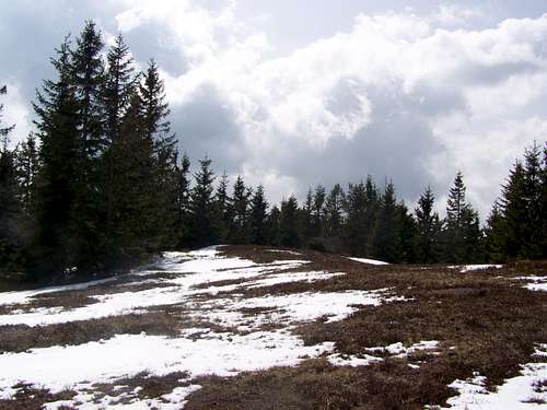
Near the summit of Črni vrh
Črni vrh is the highest summit of Pohorje. Pohorje is a mountain in Slovenia, along the river Drava, between Dravograd and Maribor. Pohorje is a 50 km long mountain range covering an approximate area of 1000 square km. So Črni vrh with 1543 m altitude is the highest summit of this mountain range.
Črni vrh means ‘black summit’. In German it is called Schwarzkogel. It means black summit, too. This mountain really looks black from a distance, due to the dense spruce forest covering almost its whole surface.
This summit doesn’t have a shape of peak. Like the other summits of Pohorje, its shape is more like a dome: deep valleys around the mountain, steep slopes emerging from the valleys, and round, almost flat hilltop.
The mountain is built of dacite that is an igneous, volcanic rock. It doesn’t absorbs water, so there are many steams on the mountain. The streams on the north side go directly into Drava. The streams on the south side flow into the small river Mislinja. This small river confluences with Drava 25 km further, at the end of its valley. The precipitation is around 1000 mm/year, though it also depends on the altitude where it is measured.
![Farm house on the steep hillside of Ärni vrh]()
Farm house en-route from Mislinja![Near the summit of Ärni vrh]()
Walking is easy along the ridgePlease note that the tourist paths are not marked very well. The marks are not too frequent, not applied consequently and not exact, so there is chance to lose way.
From Ribniška Koča mountain hut (1507 m)
2.5 km, 40 minutes. Total altitude difference: 100 m
Access to the trailhead:
We drive to Maribor and then keep on driving upwards the Drava valley towards Radlje ob Dravi. We must pay attention when we arrive to village Ožbolt. 5 kilometres after Ožbolt a road towards Ribnica na Pohorju goes left (across a bridge). When we arrive to the center of Ribnica, a signpost for Ribniška koča directs us left upwards. We follow this road which soon becomes a macadam. In winter time the road is driveable only till the ski slope on Ribniško Pohorje. This extends our walk with 20 minutes.
Route description:
From the hut we must follow the route on the slopes slightly upwards towards Mali Črni vrh. It is only a few hundred meters’ distance. There is a house and an artificial pond on the summit. This latter one serves the ski centre below with water. From the summit you can enjoy one of the few panoramic views, because later the path goes among trees. After ten minutes’ walk downhill there is a slight climb. 1200 m far from the pond you find a junction of the tourist paths: the left one leads to Mislinja, while the right one takes us to Črni vrh. A further 1200 m walk, and we reach the monument on the summit of Črni vrh.
From Mislinja (620 m)
6 km, 2 h 30 minutes. Altitude difference: 923 m
Access to the trailhead:
From Ljubljana: Take the A1 highway to the direction of Maribor. At Žalec you maust leave the highway and drive 23 km to north to Velenje. From Velenje it’s a further 13 km driving and you reach Mislinja. You will see a beautiful church after entering the city. 100 meter after the church take the first street to the right, and then cross the river. A fewhundreds meter further you reach the foot of the mountain.
Route description:
This route gous north-northeast from Mislinja. The route is sometimes only a tourist path, while sometimes it is along local macadam roads. In the first 2 kilometres the route crosses a spruce forest, then some meadows. Don’t be surprised: it crosses also the courts of 3 farmhouses. After 2 km of walk you reach Križevski vrh (1004 m). The marked path don’t go up to its peak but go around it (west to it), following the macadam road. At the saddle north to Križevski vrh you must leave the road to the right direction and walk 2400 m first on a path, then on a forestry roads, and finally again on a macadam road. You will have to leave the macadam road to the left where the tourist sign indicates it. Soon you will arrive to a junction of tourist paths: the one to the right would take you to Ribniška Koča while the one to the left takes you to Črni vrh. Not much later there will be another junction of tourist paths: the left one would take you to Grmovškov dom (hut) – but you have to take the right one going up to the summit of Črni vrh. Not far from here the dense forest is not so dense eny more and soon you reach the open summit of Črni vrh with the monument on it.
From Grmovškov dom (mountain hut, 1371 m)
2.5 km, 1 hour. Altitude difference: 172 m
Access to the trailhead:
From Ljubljana: Take the A1 highway to the direction of Maribor. At Žalec you maust leave the highway and drive 23 km to north to Velenje. From Velenje it’s a further 24 km driving and you reach Slovenj Gradec. From Slovenj Gradec take the mountain road going up to Grmovškov dom, and leave yourcar in the parking place of the mountain hut.
Route description:
It’s a very simple route, with moderate ascend on the ridge of the mountain range, in south-east direction. Mainly on meadows, flanked with some trees. On the way to the summit of Črni vrh there is the not very characteristic summit of Otiše (1416 m).
![Ärni vrh, 1543 m. Highpoint of Pohorje.]()
The summit with a monument erected in 1991![Petasites albus]()
Petasites albus - nice decorationČrni vrh has an almost flat hilltop. It doesn’t provide the usual Alpine peak feeling. It’s more like a playing ground. It’s mainly a grassy area, though there are trees east to the highpoint, preventing the view in that direction. The view to west is good. The best view is to the majestic peak of Uršlja Gora (1696 m), and in clear weather there is a good view also on the Kamnik-Savinja Alps (2558 m).
There is a monument on the summit, erected in 1991. There is also and a metal box with a log book and stamp in it.
![RibniÅ¡ka koÄa mountain hut]()
Ribniška Koča mountain hut![Crocus neapolitanus]()
Crocus - the flower of April hereCampings:
Camping Center Kekec, Maribor
Campsite Menina, Rečica ob Savinji
Campsite Park, Prebold
Mountain Huts:
Ribniška Koča
On 1507 m. Opened in whole year. Phone: 0602/68246 (from 1996)
Photos: here.
Grmovškov dom
On 1377 m. Phone: 02 8839860 and 031 680547; e-mail: lenka.jeromel@kope.si
Web page in Slovenian here
Nearest higher peak: Uršlja Gora, 1696 m
Prominence: 945 m
Overview
Near the summit of Črni vrh
Črni vrh is the highest summit of Pohorje. Pohorje is a mountain in Slovenia, along the river Drava, between Dravograd and Maribor. Pohorje is a 50 km long mountain range covering an approximate area of 1000 square km. So Črni vrh with 1543 m altitude is the highest summit of this mountain range.
Črni vrh means ‘black summit’. In German it is called Schwarzkogel. It means black summit, too. This mountain really looks black from a distance, due to the dense spruce forest covering almost its whole surface.
This summit doesn’t have a shape of peak. Like the other summits of Pohorje, its shape is more like a dome: deep valleys around the mountain, steep slopes emerging from the valleys, and round, almost flat hilltop.
The mountain is built of dacite that is an igneous, volcanic rock. It doesn’t absorbs water, so there are many steams on the mountain. The streams on the north side go directly into Drava. The streams on the south side flow into the small river Mislinja. This small river confluences with Drava 25 km further, at the end of its valley. The precipitation is around 1000 mm/year, though it also depends on the altitude where it is measured.
Getting There - and Routes
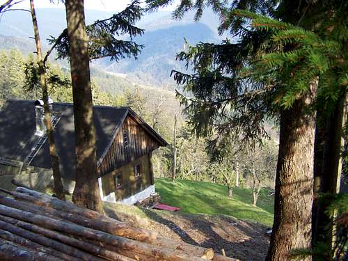
Farm house en-route from Mislinja
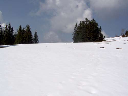
Walking is easy along the ridge
From Ribniška Koča mountain hut (1507 m)
2.5 km, 40 minutes. Total altitude difference: 100 m
Access to the trailhead:
We drive to Maribor and then keep on driving upwards the Drava valley towards Radlje ob Dravi. We must pay attention when we arrive to village Ožbolt. 5 kilometres after Ožbolt a road towards Ribnica na Pohorju goes left (across a bridge). When we arrive to the center of Ribnica, a signpost for Ribniška koča directs us left upwards. We follow this road which soon becomes a macadam. In winter time the road is driveable only till the ski slope on Ribniško Pohorje. This extends our walk with 20 minutes.
Route description:
From the hut we must follow the route on the slopes slightly upwards towards Mali Črni vrh. It is only a few hundred meters’ distance. There is a house and an artificial pond on the summit. This latter one serves the ski centre below with water. From the summit you can enjoy one of the few panoramic views, because later the path goes among trees. After ten minutes’ walk downhill there is a slight climb. 1200 m far from the pond you find a junction of the tourist paths: the left one leads to Mislinja, while the right one takes us to Črni vrh. A further 1200 m walk, and we reach the monument on the summit of Črni vrh.
From Mislinja (620 m)
6 km, 2 h 30 minutes. Altitude difference: 923 m
Access to the trailhead:
From Ljubljana: Take the A1 highway to the direction of Maribor. At Žalec you maust leave the highway and drive 23 km to north to Velenje. From Velenje it’s a further 13 km driving and you reach Mislinja. You will see a beautiful church after entering the city. 100 meter after the church take the first street to the right, and then cross the river. A fewhundreds meter further you reach the foot of the mountain.
Route description:
This route gous north-northeast from Mislinja. The route is sometimes only a tourist path, while sometimes it is along local macadam roads. In the first 2 kilometres the route crosses a spruce forest, then some meadows. Don’t be surprised: it crosses also the courts of 3 farmhouses. After 2 km of walk you reach Križevski vrh (1004 m). The marked path don’t go up to its peak but go around it (west to it), following the macadam road. At the saddle north to Križevski vrh you must leave the road to the right direction and walk 2400 m first on a path, then on a forestry roads, and finally again on a macadam road. You will have to leave the macadam road to the left where the tourist sign indicates it. Soon you will arrive to a junction of tourist paths: the one to the right would take you to Ribniška Koča while the one to the left takes you to Črni vrh. Not much later there will be another junction of tourist paths: the left one would take you to Grmovškov dom (hut) – but you have to take the right one going up to the summit of Črni vrh. Not far from here the dense forest is not so dense eny more and soon you reach the open summit of Črni vrh with the monument on it.
From Grmovškov dom (mountain hut, 1371 m)
2.5 km, 1 hour. Altitude difference: 172 m
Access to the trailhead:
From Ljubljana: Take the A1 highway to the direction of Maribor. At Žalec you maust leave the highway and drive 23 km to north to Velenje. From Velenje it’s a further 24 km driving and you reach Slovenj Gradec. From Slovenj Gradec take the mountain road going up to Grmovškov dom, and leave yourcar in the parking place of the mountain hut.
Route description:
It’s a very simple route, with moderate ascend on the ridge of the mountain range, in south-east direction. Mainly on meadows, flanked with some trees. On the way to the summit of Črni vrh there is the not very characteristic summit of Otiše (1416 m).
On the Summit
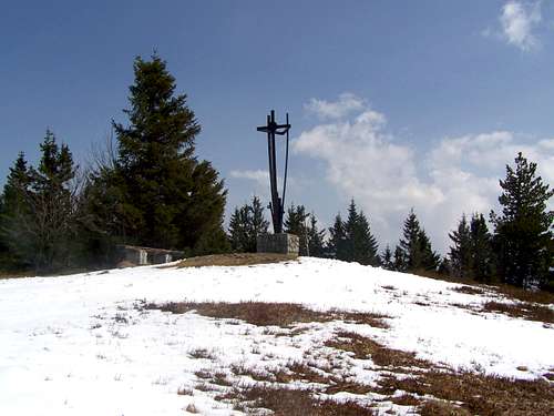
The summit with a monument erected in 1991
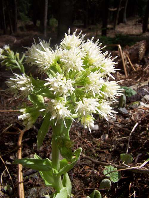
Petasites albus - nice decoration
There is a monument on the summit, erected in 1991. There is also and a metal box with a log book and stamp in it.
Campings and Mountain Huts
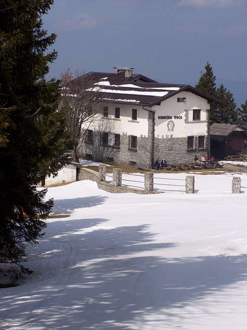
Ribniška Koča mountain hut
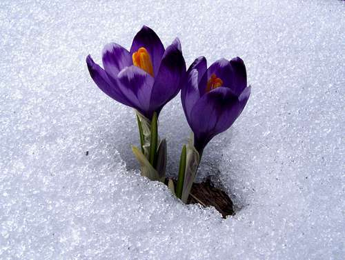
Crocus - the flower of April here
Camping Center Kekec, Maribor
Campsite Menina, Rečica ob Savinji
Campsite Park, Prebold
Mountain Huts:
Ribniška Koča
On 1507 m. Opened in whole year. Phone: 0602/68246 (from 1996)
Photos: here.
Grmovškov dom
On 1377 m. Phone: 02 8839860 and 031 680547; e-mail: lenka.jeromel@kope.si
Web page in Slovenian here