Overview
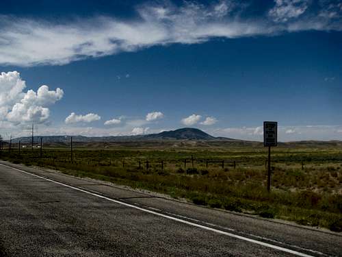
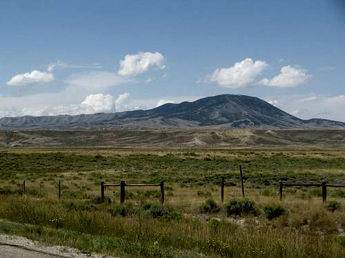
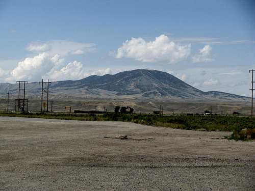
Along the Continental Divide Basin stretches a long ridge. Starting out in the Basin west of the town of Bairoil as Stratton Rim, this ridge reaches the northern rim of the Great Divide Basin and abruptly turns eastward. A few miles after its sharp turn the name of the ridge on the maps morphs into Whiskey Ridge, though like the song, the ridge remains the same. As it runs further east and rises higher and higher from summit to summit (give or take a few) the ridge terminates abruptly at Whiskey Peak above Muddy Gap, at 9,225 ft above sea level. Viewed from the east on US-287, the ridge looks like a long train running along a slight curve, Whiskey Peak being the locomotive at its head. East of Muddy Gap the trend continues, as the Ferris Range runs along an east-west route for another 20 miles or so.
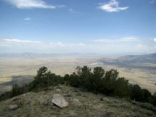
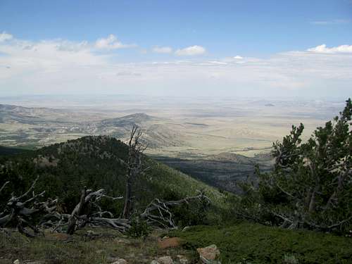
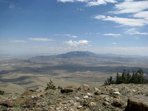
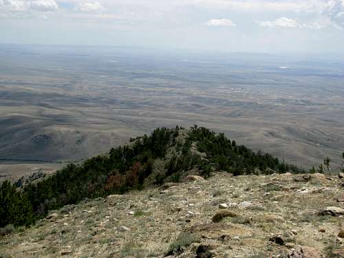
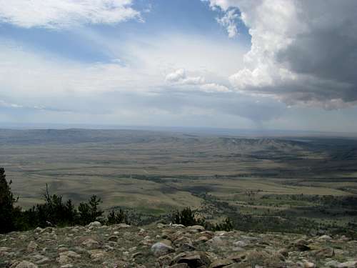
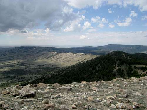
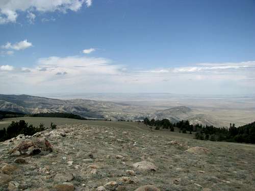
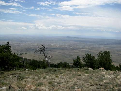
For prominence chasers, Whiskey Peak is one of Wyoming’s 2000 ft + prominence peaks. Parts of the summit straddle the Continental Divide Basin Rim, though I’m not sure whether or not the highest point might sit a little outside of it. I personally divide the main summit into three subsummits: The North (highest), South, and West. The reason for this is since some of your views might be blocked by the other subsummits, each subsummit has unique and different views unique from the others. The West summit showcases the territory south and southwest into the Great Divide Basin, Whiskey Ridge, and the Stratton Rim. The South Summit allows you to peek southeast towards Rawlins. The North Summit gives you unlimited views from the NW to the NE horizons.
North Summit Views
South Summit Views
West Summit Views
Unfortunately, the giant plateau of Green Mountain, to the northwest and only 200 feet lower, blocks what could be a view of the Wind River Range from all 3 subsummits.
The peak derives its name from an incident sometime in the 19th century, when a zealous army officer, noticing something odd about his entourage, discovered a contraband barrel of whiskey and emptied into a creek nearby. This move obviously backfired on the Colonel, as all the soliders promptly ran to the creek to fill up their canteens and have a rip-roaring good time!
Getting There
From Rawlins, take US-287 N towards Muddy Gap. Before reaching Muddy Gap, at the town site of Lamont take a left (West) onto WY-73 towards Bairoil. Coming from the north drive south on US-287 from Muddy Gap to get to Bairoil junction. It is 4 miles from Lamont to Bairoil. At Bairoil center take a right onto Antelope Drive. Starting measuring at this point.
At 0.1 miles arrive at a T-Junction. Right is Blue Bells Lane (paved). Take the Left. Pavement ends at this point. Stay straight on what is somewhat apparent as the main road, avoiding the temptation to wander off into the drilling and gas facilities to your right and left. At 1.6 miles bear left at the junction, right after a cattle guard. At 2.4 miles bear right at another junction. Around 3.0 miles there is a little pond/watering hole. I’m not sure whether it’s seasonal or not, but it was full in August when I was there.
The road curves around and brings you to something of a 4 way junction at 3.2 miles. Stay straight; the other options are pretty faint anyhow. Around 3.4 miles bear right. At around 3.7-3.8 miles two side roads branch off on your right in quick succession. Take the second right. The road gets increasingly rougher from here, as it descends into a small wooded drainage and reemerges. I parked at around 4.5 miles, where the road forks again. The road gets even rougher from here. You want to bear right at this junction, whether you are on foot or still in the car.
From this point it’s about 3 miles to the top and 1,550 ft of net elevation gain.
![Junction at 4.5 Miles]() Junction - 4.5 miles Junction - 4.5 miles |
Passenger cars can definitely drive a couple miles past Bairoil. A higher clearance passenger car driven carefully might, and I emphasize might, be able to make it to the pond at mile 3 or to the 4-way at mile 3.2.
There might be other ways to approach the mountain, either from the west via the ridge, or from the north. I am not aware of the conditions of those roads. I would not advise trying to gain the ridge/saddle from the south/Bairoil approach; none but the most intrepid jeep (and driver) would be able to make it. I had trouble enough trying to maintain my balance walking down, never mind driving.
Before we head up...
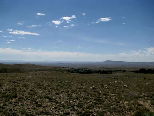
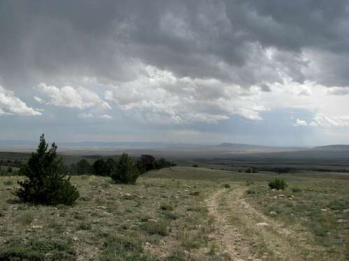
Standing in the pastures south of Whiskey Peak is a unique experience. You are closed in on 3 sides by the various ridges of the Divide, and it feels like you’re standing in a basin of your own, a mini-basin inside the Great Divide Basin, a basin perched high in the air. The latter part is obvious once you look south to see the land dropping below you, the remaining vastness of the Continental Divide Basin hidden from view by the north-south running ramparts of the Stratton Rim. Here, lightning strikes, wild horses roam, and your own personal sense of awe is unbounded by mere ridges and rocks.
Routes
There are two routes you can take from here to reach the summit.
Option 1: You can follow the 4WD road straight to the top.
Option 2: Indulge me and allow me to call this route the “Five Wise Men” Route (Johnnie Walker, Jack Daniels, Jim Beam. I’m sure you can find a couple generic whiskey brands, or expand the boundaries a little and include Jose Cuervo and Captain Morgan). Anyhow, the reason is that this route will take you through 5 mini-summits, the last one being the highest one. This route allows you to stay on the rim/ridge of the mountain the entire way up to the top and provides every view that could be had in all directions.
Despite what you would think, the Five Wise Men Route does not involve too much elevation loss and regain. In fact the elevation gain is probably similar to the 4WD road, since the road itself descends a little after the saddle. In either case the elevation loss is minimal, no more than one or two hundred feet. In the spirit of Gerry Roach, you can do a loop tour going up the Five Wise Men and down the 4WD road and call it a Tour d’Whiskey, or a Round of Whiskey, if you will.
![Whiskey Peak Routes]() Route Options Route Options |
From the intersection at mile 4.5 bear right and follow the road for a little more than a mile as it approaches the summit ridge. The road goes into the woods then climbs steeply around 600 feet to gain the saddle between Whiskey’s 1st False summit to the right (east) and Pt. 8893 to the left (west).
Standard 4WD Route
For the 4WD route, follow the road straight from the saddle as it descends into some trees. Merging on it from your left is another 4WD road that traverses the length of Whiskey Ridge to the west. Keep going straight and come to another split near an open meadow a little bit later. Bear right and follow this road straight to the summit.
![Take Right Here]() Bear Right Bear Right |
After traversing through a few more woods the road finally comes out in the open in a giant meadow, and the rest of the way is pretty obvious. Near the top a side road takes you to the West Summit. Bear left to continue to the North Summit, the actual high point. Make sure you hit up all three subsummits.
Five Wise Men Route
As soon as you gain the saddle take a right through some open sage brush. You see a large triangular meadow before you leading up to a rounded hill. This is the 1st false summit. Make your way up the triangular meadow towards the top of the hill.
As you enter the woods near the ridge crest you’ll see a faint trail. Feel free to follow it as it takes you near the top of the 1st summit. From here you can see a 2nd false summit with some kind of electrical station as well as the main summits ahead, with the radio towers at the high point. Follow the ridge down and walk across the open ridgeline leading you to the second false summit. Views abound to the north and south, and on your left you’ll see the 4WD running a parallel route beside you, separated by a small drainage.
Descend the 2nd false summit a little and reach an open saddle area. There are several ways you can gain the main summits from here. Take a hard left and descend into the small drainage/ditch separating the 2 false summits from the main ridge. Gain the right side of the main ridge easily and contour right along the pastoral ridge as you head for the West Summit.
This is the lowest of the 3 main summits, and has great views south to Bairoil and the Continental Divide Basin. Stay along the ridge crest as you go towards the North Summit. Reach the South summit, where there’s a small cairn. Views are great to the south, east, and west. Continue along the ridge crest to the North Summit and the radio towers. This is the high point. There are great views to the north, east, and west.
The Five Wise Men Route is mostly out in the open after the saddle and is highly exposed to the weather. Only take this route in good weather. If thunderheads are around take the more wooded 4WD route, or better yet, stay off the mountain altogether and come back another day!
Wildlife
In addition to herds of deer and antelope running amok, Whiskey Peak is home to a large number of actual wild horses. I saw several packs on the way up and on the way down. Don't be surprised if you hear them neighing at you before you even see them. Remember, though they're horses they are still wild animals, so observe all wilderness rules and don't feed or approach them.
Red Tape
None, as far as I can tell. You're either on BLM or State Land most of the way past Bairoil. Stay away from the drilling facilities near the town, don't mess with the radio towers and other equipment on the mountain, and you should be all set.
When to Climb
Late Spring, Summer, and early Fall guarantees access. August is Bow-Hunting Season, and Fall is Rifle Hunting Season, so wear bright colors and be aware.
Winter the peak is likely snowcovered, but the road to Bairoil will definitely be paved. The first few miles of the road past Bairoil are privately owned, so it could be possible that the energy company maintains the road periodically during the winter. Either way it's only 7 or 8 miles from Bairoil center to the peak, so if you're willing to snowshoe or skin it and are aware of avalanche dangers I'm sure all the open meadows up on top of the peak would make for some great backcountry skiing.

 20299 Hits
 85.36% Score
 20 Votes


 Junction - 4.5 miles


 Route Options


 Bear Right


