-
 71595 Hits
-
 88.08% Score
-
 26 Votes
|
|
Mountain/Rock |
|---|---|
|
|
42.70800°N / 109.128°W |
|
|
Hiking, Skiing |
|
|
Spring, Summer, Fall |
|
|
13197 ft / 4022 m |
|
|
Overview
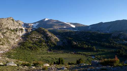
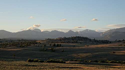
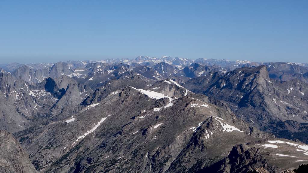
Wind River Peak is a Wyoming thirteener, and is the highest and most massive peak in the south half of the Wind River Range. It is part of the Wyoming 13ers list, and the lone 13er in the southern Winds (see the list here). A dominant landmark of the region, it is the highest peak viewed by hikers approaching the very popular Cirque of Towers and the most identifiable peak to regional residents (mainly due to Surveyor's Notch, visible from both sides of the range). Its first recorded ascent was by Hayden Survey topographer A.D. Wilson, in 1877, shortly after Wyoming became a territory. Due to its size, elevation and position, the surveyors made it the namesake peak of the range. Walkup routes are possible from most directions (all involving a hefty approach trek to the base) but several technical routes have also been accomplished on the mountain's numerous granite headwalls. Though it is a 'hikable' Wyoming 13er, the routes are long and sometimes requiring a full day from camp depending on group speed. Climbers are rewarded with a view that includes mountains, glaciers, plains, deserts and, when clear, as far as the Uintas. The peak is relatively popular and is visited by hikers and mountaineers as well as goat and llama packers.
Getting There - Roads
There are a handful of different ways one can access this peak including western, southern and eastern approaches. The southern approaches will be described in detail on this page.
For eastern approaches, the Louis Lake Loop road (#131) from Lander through Sinks Canyon is followed for 17 miles to the Worthen Meadows road which ends at the trailhead. The Big Sandy Opening is used for the western approach.
The peak is most efficiently reached from the south, where there are two options. There is the Sweetwater Trailhead option just on the east side of the crest, and there is the less popular (but less overall effort) Block and Tackle Hill option just on the west side of the crest. Both options begin by leaving Highway 28 about 12.5 miles further southwest from the Louis Lake turnoff, just west of the Sweetwater River crossing. Turn NW onto Lander Cutoff Road, a nice graded gravel road. Follow this divide-straddling road for 15 miles, then turn right onto the Sweetwater Gap Road (Road 890). Follow this road (also easy gravel) for another 3.4 miles to where the road forks. Here you'll decide whether to take the Sweetwater or Block and Tackle approach options, pros and cons for each outlined below.
Block and Tackle/Little Sandy Trailhead
From the fork in the Sweetwater Gap Road, turn left and head west for 2 miles on a sandy road, then turn right onto Road 889. Continue on this gravel road for 2.4 more miles to the Forest Service land boundary, where a campground is found. The road at the FS boundary gets much rougher very quickly, and turns into a 4WD road within a few hundred meters of the boundary. If you have a 4WD, you can continue 4 miles up to the end of Road 889, most of which is very easy as far as 4 wheeling is concerned. In fact, if it wasn't for the 250 foot long stretch that ascends steeply up Block and Tackle hill, this road would be accessible to the majority of SUVs and higher stationwagons. After the hill, it's a 2WD flat sandy road through sparse forest to the Little Sandy Trailhead where the road ends. Biking this road from the NF boundary is a great way to save time and effort.
The pros of this trailhead over the Sweetwater Trailhead is that you do not have to gain the extra 2000 feet round trip to hike up and over the divide to Little Sandy Lake. The cons is that without a 4WD, you will have to either walk or bike an additional 7 miles round trip (depending on how far you were able to drive up from the NF boundary). I was able to take by 2WD stationwagon 0.4 mile past the FS boundary (it was very rough and slow going though), giving me what would have been about a 7.2 mile extra round trip walk. However, from where the road crests the hill after the steep section ends, you can save 0.9 miles each way by cutting off the large bend in the road that extends off to the west. Simply walk due north through the open trees for 0.45 mile until you meet up with the road again at a large open meadow. Doing this, my total round trip road walk was only 5.4 miles.
I made the decision that 5.4 miles of extra easy walking was easier than 2000 feet of extra gain on a rocky trail (the overall mileage from where 2WD vehicles would park is actually the same than the Sweetwater Trail would be). If you have a 4WD or a bike though, both the mileage and the elevation gain are notably less from the end of this road (Little Sandy TH) than the Sweetwater TH, making this trailhead the fastest and shortest approach to Wind River Peak.
From the fork in the Sweetwater Gap Road, continue straight for 0.1 mile, then bear right (eastward; continuing straight will take you to the White Acorn Ranch). Follow the road for 4.7 more miles to the Sweetwater Guard station, where you'll find a T in the road. Turn left (north) at the T and continue for another 2 miles to the end of the road. The trail continues north from the roads end, and ascends to the continental divide before dropping back down to intersect the trail from the Little Sandy Trailhead on the SE side of Little Sandy Lake.
Shortest Route - Little Sandy Gorge to South Slopes - Class 3
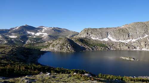
From the Little Sandy Trailhead (end of Road 889) follow the nice trail north, quickly entering the wilderness marked by a sign. The trail follows fairly close to, and along the east side of Little Sandy Creek. At a point on the trail due west of Sheet Lake, the trail will cross Little andy Creek to the west side which usually requires shoe removal to wade across the knee deep water. The trail continues now through thinning forest across/around many granite slabs and slowly curving northeastward. You'll meet the junction where the trail from the Sweetwater TH meets coming up from the southeast. Continue straight (north) for a few more minutes until meeting an old sign pointing right to Little Sandy Lake. It's important to note that on this entire approach hike, you will not be able to see Little Sandy Lake as it sits in a bowl, and due to the trail being higher and recessed on rolling slabby terrain it's never visible unless you take the short detour to the right at this sign where a handful of camp spots by the lake are found. At one point I heard a moose dive into the lake that was startled by my footsteps when I took the 5 minute detour to see the lake. By the time the lake was visible, I saw her swimming around!
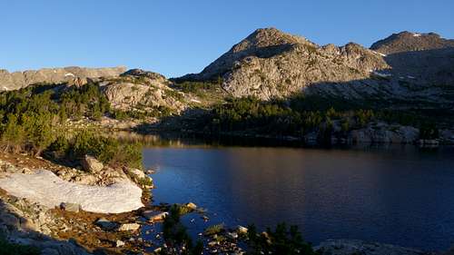
At this old sign pointing right to Little Sandy Lake, the main trail continues left, and seems like it is going the wrong way. It will turn back north soon enough though, and ascend some rock slabs, where the trail can be tricky to follow. It begins to ascend steeply and passes through a small notch though, which is the only real obvious route it could go. Past the notch, it descends slightly following through a small valley until reaching the east edge of a small lake at 9800 feet that sits backdropped by a 1000 foot cliff.
Shortly past this lake the trail reaches the long, flat portion of Little Sandy Gorge, where over the course of a mile the long open meadow gains 10 feet of elevation. Numerous small ponds and meandering streams are found here, with soft grasses and towering walls of rock rising on both sides of the valley. At the north end of this long flat area, the trail curves slightly west and slowly ascends gently. At 10,000 feet of elevation leave the trail and cross to the east side of Little Sandy Creek.
Begin ascending up the NW to SE oriented ramp that leads to Coon Pass, which rises 800 feet from the valley floor. There are a couple short class 3 sections to navigate around some short cliffs, and a section with large boulders to hop across, but overall it's a steep hike on a boot path. Cairns generally mark the way. At Coon Pass, the view back west of the steep granite domes across the valley will inspire the rock climber you didn't know you had. Descend SE from Coon Pass and hike around the south side of Coon Lake on decent booth paths. A few meters beyond the easternmost point where the outlet stream can be crossed, cross to its north side and ascend over the broad shoulder separating Coon and Tayo Lakes. Crest over at about 10740 feet and descend 180 feet to a large meadow and cross the stream draining Tayo Lake and meet up with the Tayo Lake trail. Hiking over this shoulder saves you many miles and extra gain than if you just continued down the trail from Coon Lake, which intersects the Tayo Lake Trail well off to the east and down below treeline.
Continue a few minutes up the trail to Tayo Lake, and enjoy the views. The rest of the route to the summit is very straightforward from here, following the crest of the very borad, grassy south ridge. Between 11,900 and 12,300 feet, stay above the small south facing cliff (it's obvious) and ensure you make the jog back to the east on your descent to continue down the ridge. The final 600 feet is slightly steeper than the rest, and involves more boulder hopping. A small, narrow south facing snowfield typically lingers into late July, which you can avoid by ascending up the left side of it. Earlier in the season, it may extend down a little further and require a short snow crossing to get to its west side but should never exceed 25 degrees in steepness.
Seasons
Summer season in the Wind Rivers is generally July-September with snow lingering on the higher trails into July. A snow storm is traditional between the last week of August and the second week of September. This is often followed by a dry period with crisp temperatures for 1-4 weeks. Wind River Peak has been successfully skinned and skied from winter to early June.
Map
This map shows the shortest route up Wind River Peak with a pink line from where you leave the trail at 10,000 feet in Little Sandy Gorge.
Trivia
- The latest goverment survey lists the elevation as 13,197' (4022m)
- It is the 21st highest in Wyoming and the 20th highest in the Winds
- The peak, visible for many miles to travelers on the Emigrant/Oregon Trail, was a dominant landmark for a week's travel and shows up in many of their historical journals as the "Snowy Mountain" or "Great Snow Peak"
- 'Popo Agie' is a French-phonetic spelling of a Crow (native tribe) word and is pronounced "po-po-zsha"
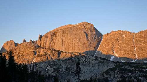
- Wind River's tandem peak, Little El Capitan (12825'), is the fourth highest in the southern Winds. The SE face, directly across the v-notch, is the sheerest face, rising 700' from the glacier. It contains a route at V, 5.10 A2. (1asc Robert McGown and Jeff Alzner, 8/91)
- Surveyors Notch, between this peak and Lil El Cap, makes the peak identifiable from as far as 60 miles distant from the east or west. Some locals simply call it "The V".
- Wind River Peak has over 2000' of prominence and is over 40 miles from a higher peak
- The Wind River, whose name was given to this range and peak, officially changes it's name to 'Bighorn River' at the mouth of Wind River Canyon. It is a tributary of the Yellowstone
- The Wind River itself was named by the Crow tribe who had noticed the frequent wind in the basin. Groups would occasionally endure the frigid winters in the basin by lodging near the Washakie Hot Springs.

