
-
 20700 Hits
-
 77.47% Score
-
 8 Votes
|
|
Mountain/Rock |
|---|---|
|
|
43.23589°N / 109.68849°W |
|
|
Hiking, Mountaineering, Ice Climbing, Scrambling |
|
|
Spring, Summer, Fall |
|
|
13114 ft / 3997 m |
|
|
Overview
Klondike Peak is a beautiful massif that towers above Baker Lake and flanked magnificently by the Sourdough Glacier. This is a very large glacier for continental US standards and is flocked with crevasses. This glacier has been very slowly retreating and the emerald green lake at its base is Iceberg Lake. The deep blue colored Baker Lake sits very close by only a few feet lower. Climbing Klondike Peak is a little tougher than nearby Point 13,062 and Yukon Peak. Klondike, as its name suggests involves some class 4 climbing and steep climbing on snow and ice. I can guarantee than most continental divide through hikers skip this peak because of the added gear required to climb it. One slip while climbing the snow on this peak and you'll could be riding the Sourdough Glacier all the way down to Iceberg Lake. Due to the dangers of the nearby glacier and the possibility of crevasses or mushrooms even along the east ridge it is recommended you have good snow climbing and glacier travel gear and skills to climb Klondike, even if you don't plan on ascending the Sourdough Glacier itself which can be avoided by climbing the east ridge.
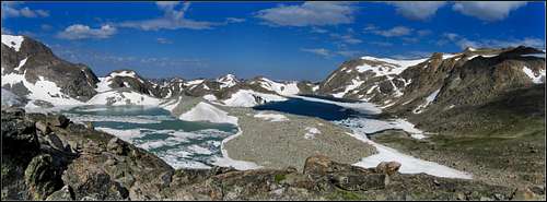 Iceberg Lake and Baker Lake Iceberg Lake and Baker Lake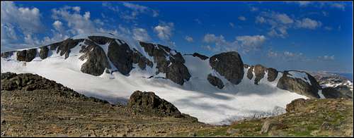 Klondike Peak panorama Klondike Peak panorama |
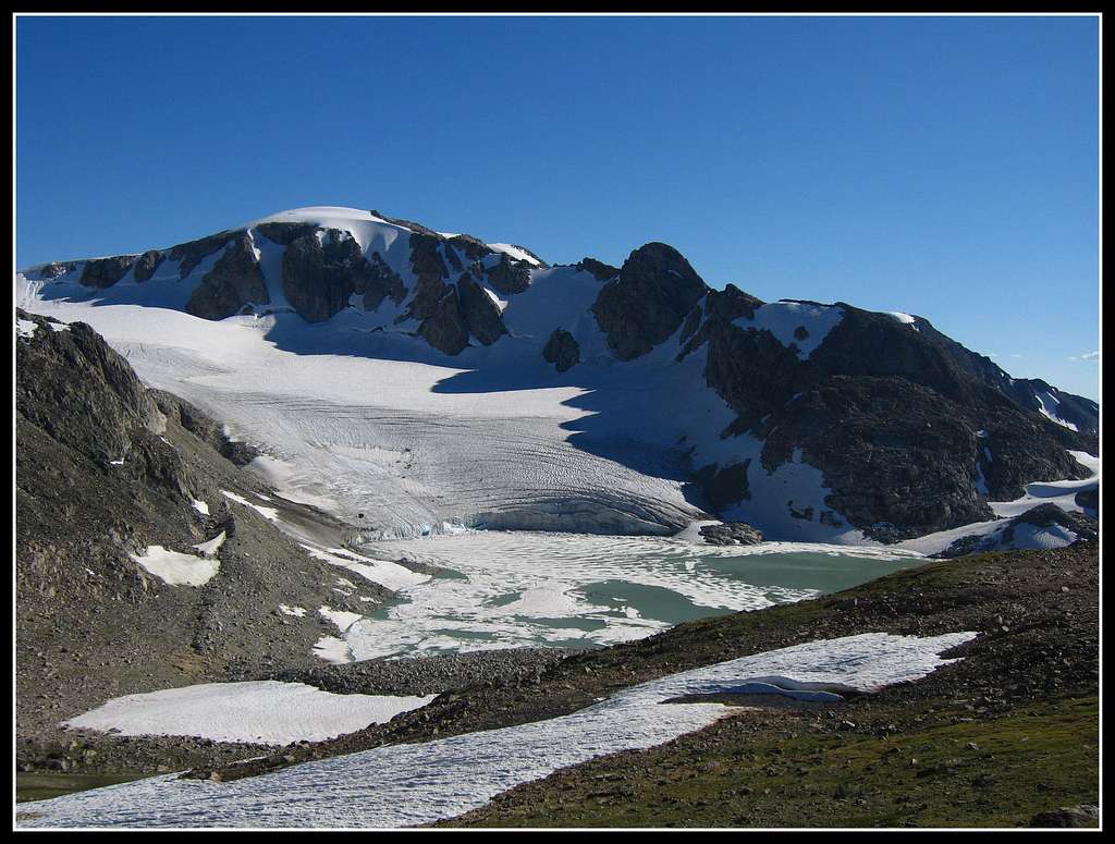 Looking up at Klondike Peak and the Sourdough Glacier Looking up at Klondike Peak and the Sourdough Glacier |
Getting There
This is a peak that is best climbed as a group with other nearby peaks. It's one of Wyoming's 13ers and can be done in conjunction with Pedastal and Flagstone from the head of Tourist Creek. It is also the most technically challenging Wyoming 13er in this area of the Wind Rivers. Further south towards Gannett Peak the peaks get considerably tougher. If you're looking to climb Gannett but are unsure if you are ready, you can get ready on Klondike Peak. Start this climb at the Green River Lakes trailhead and campground. From Pinedale, Wyoming head west out of town on US 191 for 6 miles and turn right (north) onto Wyoming road 352W. The pavement ends soon after the small town of Cora. Continue for 25 miles from US 191 and continue 18 more miles on the Green River Lakes Road until the road ends at the Green River Lakes campground. This road is passable for any vehicle although it gets very wash-boarded. Follow the Green River trail south for upwards of 14 miles to Three Forks Park which is a large grassy meadow about a mile long. Pick up a small booth path through the grasslands and marshes and cross the Green River. Continue climbing up the grueling Tourist Creek drainage. With route-finding, this drainage never exceeds class 2 hiking. There are many places where hopping over large boulders is necessary though and a misstep can result in serious injury especially with a large pack on your back.
 Klondike Peak and its northwest ridge Klondike Peak and its northwest ridge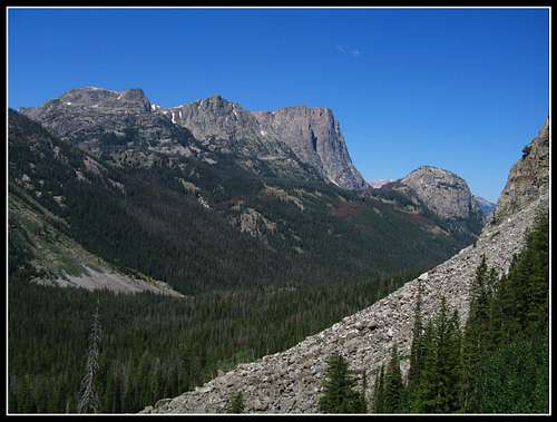 Looking down at Three Forks Park from Tourist Creek Looking down at Three Forks Park from Tourist Creek |
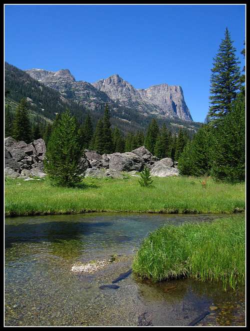 Three Forks Park and Square Top Peak from the mouth of Tourist Creek where is meets the Upper Green River Three Forks Park and Square Top Peak from the mouth of Tourist Creek where is meets the Upper Green River |
Continue up the creek as it slowly mellows and pass by 3 or 4 small tarns. Crossing Tourist Creek numerous times will be necessary. Once you get to the base of a very steep talus slope ascend it stating to the right (looking up) where the slope isn't as steep. You will eventually get to a low spot on the continental divide at a saddle between Klondike and Pedastal Peaks. Keep in mind that it can take days just to get here for anyone not in perfect shape.
From this saddle head left (north) and climb more talus to the east end of Klondikes east ridge. This ridge is actually short, only a half mile long but it will likely be ice/snow covered and rugged. You'll also be looking steeply below you at the mass that is the Sourdough Glacier. Crampons, ice axe are advised. Follow the ridge on rock and snow to the permanent snowfield right at the summit. Once at the summit enjoy the views of Sourdough Glacier below and the high Wind River Peaks to the south.
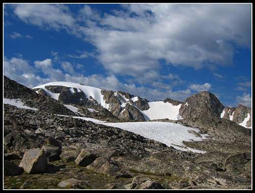
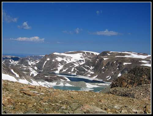 Looking down at Baker and Iceberg Lakes and Yukon Peak
Map
Shown above is a map of the eastern route up Klondike with a blue line from a camp just south of the Grasshopper Glacier. The Tourist Creek approach described above meets the same broad saddle just east of the summit.
Red Tape
No red tape. This area is very remote. Leave No Trace
External Links
See Joe Kelsey's book "Climbing the Wind River Mountains" for more route information about many peaks in the Wind Rivers.
Great Outdoor Shop
Weather Forecast
See my Trip Report Here