Wind River Wildness - June 23rd, 2012
I’ve always felt myself drawn to the Great Northern Rockies. Some of it was residue left over from a childhood visit to Yellowstone, the Tetons, and a swing 'round Beartooth Pass. A lot of that was recovered and amplified by some of the wonderful pages here on this website, as well as from reading Turiano’s masterpiece cover to cover.
And yet I had yet to venture into the Northern Rockies. The fact that SLC was within driving distance to these magical places (as well as many other western environs) was one of the reasons I had made my decision to move there (for better or for worse). I had vague plans of heading north as Summer approached, but know not when I would have executed them had I not gotten a call from Greg about Wind River Peak.
I had broken my own elevation gain record the weekend before on the Triple Traverse. Confidence thus a little higher than before, I beheld the prospect breaking in consecutive weeks my distance record (no more than 20 on one day, 22 in two). It wouldn’t come easy, but as we researched and debated routes, it seemed doable.
We would come in from the South. The question was which approach. One option, which seemed perhaps more straightforward, would be from the Little Sandy Lake Trailhead. The other option would be via Sweetwater Gap. One could reach Little Sandy Lake from the latter trailhead too, but that seemed to involve some unnecessary gain and loss and regain.
It had been a relatively dry winter, so we were expecting unseasonably dry conditions in the Winds. How dry though, we were sure. Factors that worried us about the Little Sandy Lake approach included high river crossings past the Lake, wet marshes that would bog us down, and the possibility of snow or cornicing on the steep ascent to Coon Lake. As for Sweetwater Gap, the negatives was that it would be longer, with an undefined off trail section that could possibly be time consuming.
I purchased bear spray for the first time in my life, and we left Salt Lake City Friday after work and drove into the Winds amid darkness. Greg would continue up the rough, 4WD road to the Little Sandy Lake Trailhead where he and his friend would set up camp for the weekend (his friend intended to drink, fish, and shoot while we climbed). I parked my car amid the open prairie at an intersection and slept in the back, my nightmares that night reflecting my apprehensions about the next morning.
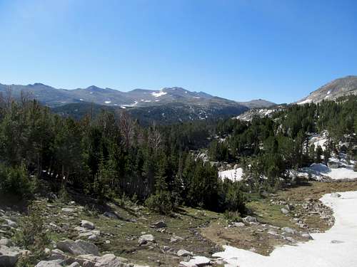
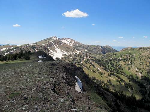
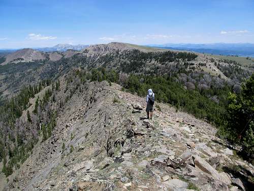
I got up around sunrise and started getting ready when Greg rolled up. We finally decided upon Sweetwater and I hitched a ride as we continued up the road to the trailhead. It surprised me how quickly the plains transitioned to a thick evergreen forest. We started up the trail towards Sweetwater Gap, still six or seven miles ahead. These miles went quickly as the trail, gentle, but with its up and downs, ascended gradually to the 10,300 ft or so saddle sitting snugly between the Mt. Nystrom massif to the west and the Atlantic Peak massif to the east. I marveled at the solid granite walls as we ventured deeper and deeper into the range, and into territory I had only once dreamed of immersing myself within.
Bill Reed’s excellent TR here at this site indicated a very good climber’s path that shortcutted northwest from here, hugging the pinnacles before descending down towards Poison Lake. The existence of this certainly helped us decide on the Sweetwater approach, and we were able to follow it easily as it went through several up and downs, past a small lake, then finally down a gully lined on one side by granite cliffs. The main drawback was a 600 feet descent to Poison Lake that we would have to reclimb on the way back, and this was amplified by the fact that we lost the climber’s trail somewhere in the last hundred feet and, as we contoured through brush and marshland west past Poison Lake, could never find a good place to cross the river to rejoin the trail on the other side.
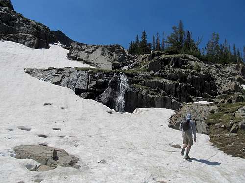
Eventually we bit the bullet, took off our boots and socks, and made the near waist-high crossing. The mosquitos, mild in the morning but militant by the time we started our descent towards Poison Lake, ate us alive as we waited for our feet to dry on the other side. After some more bog walking we found the trail and continued along it west for a bit before some more river crossings, this time across a makeshift, and rather sketchy, bridge.
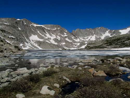
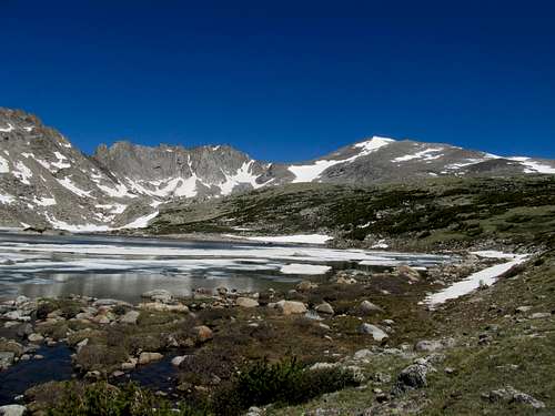
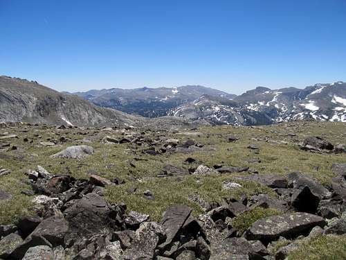
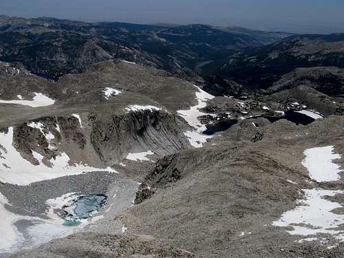
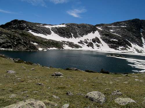
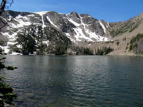
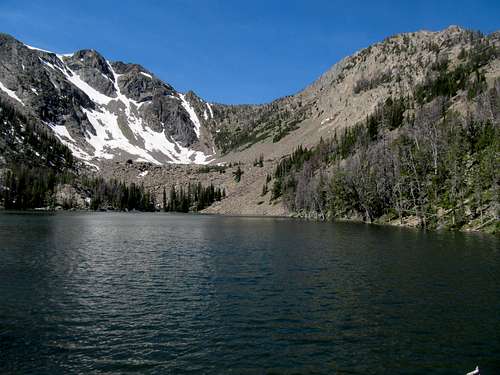
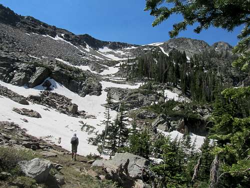
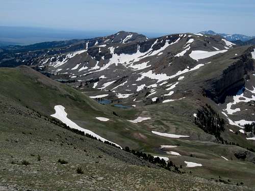
Here under the trees we ran into our first bits of significant snow, which covered up the trail. Even in clear areas the trail, so recently melted out, was tough to discern. We ended up traverse a little too much to the west before contouring north towards Tayo Lake. A little bit of brush, up a steep section, then some easy going through a beautiful open meadow as the terrain finally opened up for the first time, and we found ourselves finally at the beautiful 10,800 ft. lake. Note that despite probably well over 1000 feet of gain and loss since Sweetwater Gap, our net gain in this last four or so miles had been less than 500 feet.
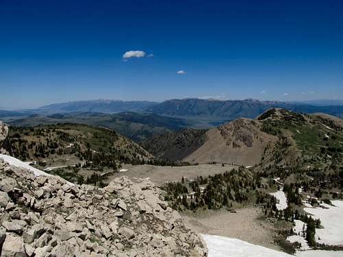
I had packed a lot of waters and they were really starting to drag me down. I stashed a few at the lake, we took a quick rest, and beheld the scene before us. Over ten miles of hiking to this point, and we still had climb the actual goddamn 2,300’ rest of the mountain. The initial ascent past the lake was gentle and pleasant strolling through high prairie.
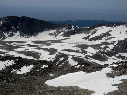
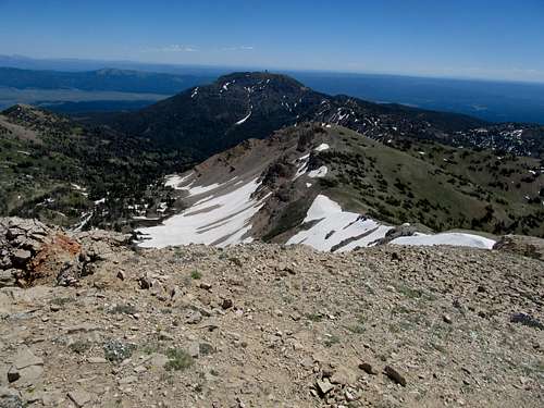
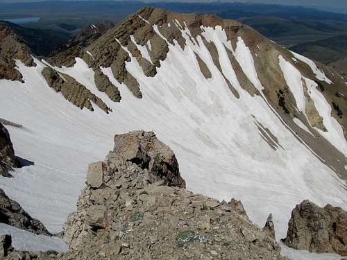
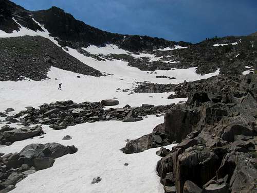
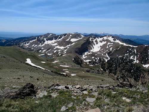
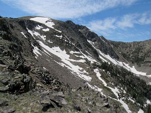
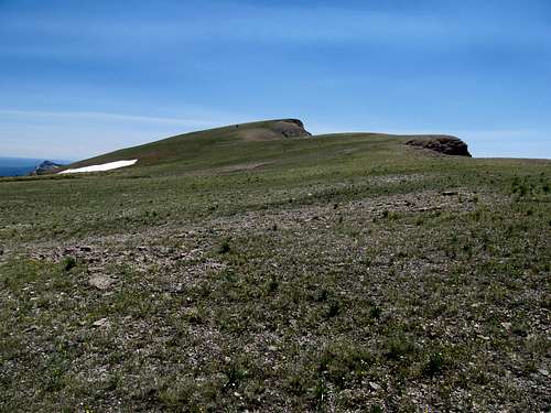
It then steepened somewhat, going up a hill and past a gangplank until we finally reached the 1,200’ of tedious boulder hopping to the top. It had already been a long day, and this last bit seemed to last forever. Strips of snow scattered amid the boulders. I took a stab at ascending these, but found them too slippery in the afternoon sun to be a better alternative to the mostly solid boulders.
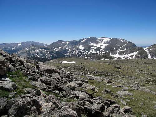
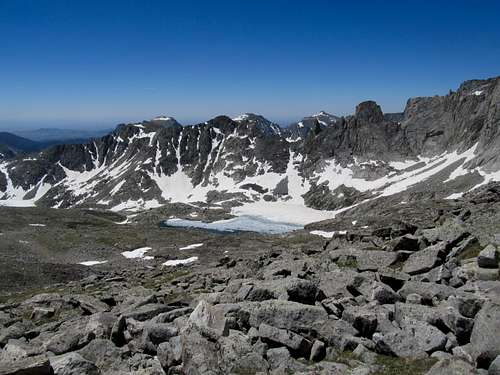
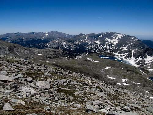
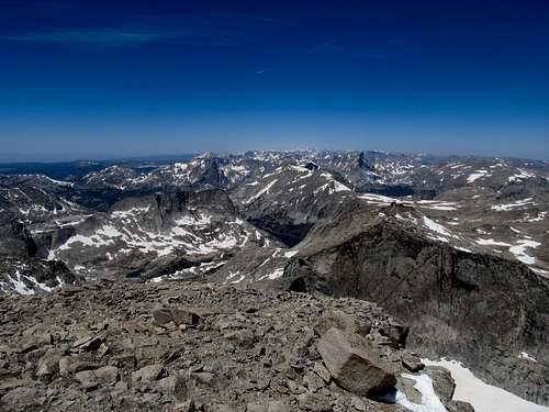
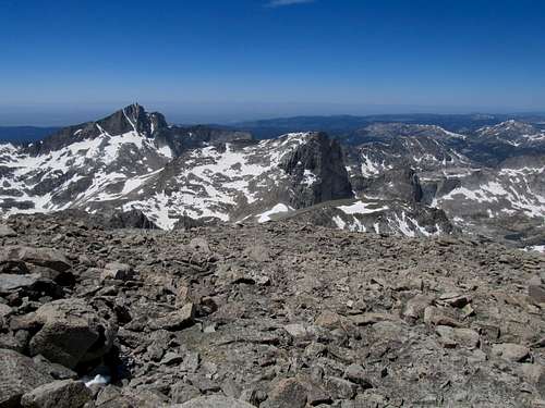
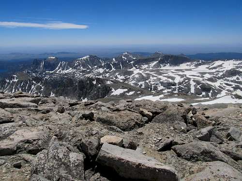
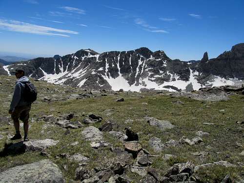
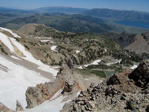
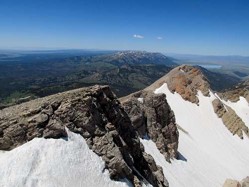
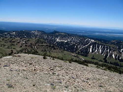
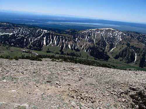
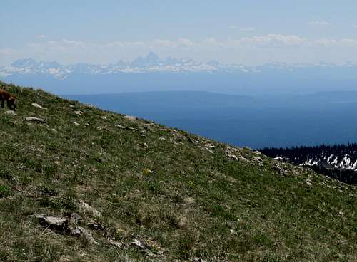
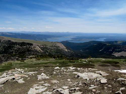
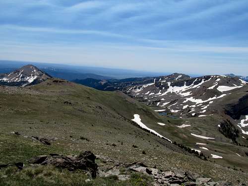
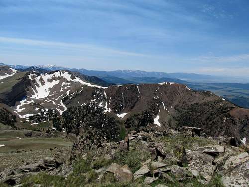
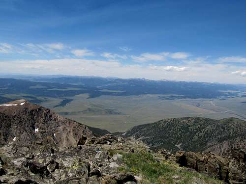
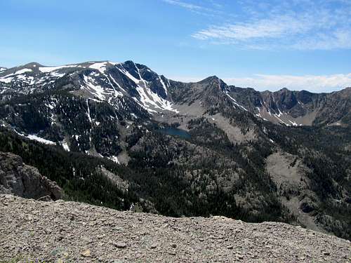
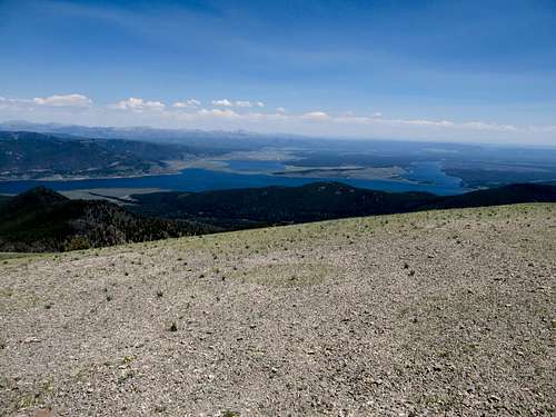
Greg and I took different lines up until the summit got smaller and smaller. We made the summit area where the slope lessened, but it took forever walking across the boulders here to get to the actual summit. Which was just as well; along the ascent I we had been greeted with spectacular views of Nystrom and Atlanta, and later, Temple Peaks to the west. The true summit stood on the northern tip of the very wide summit area; the views south were barely discernible past summit rocks, but to the north stretched my first ever glimpses into the interior Winds. Gannett, Fremont, the Cirque of the Towers, and all the legendary peaks of the range stretched before me. The sight was marvelous as it was unfathomable.
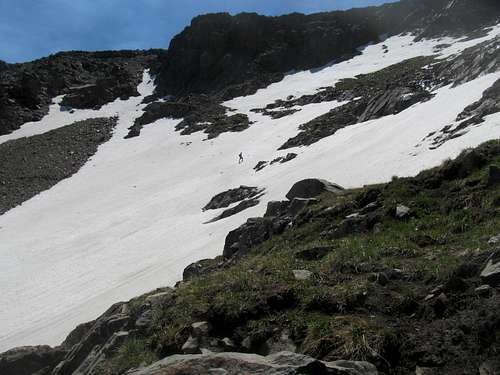
But time to descend, and time enough, as we still had another 12 miles or so to go. Down the boulders, and we contoured right to a snowfield that Greg thought would make a good glissade down. We got there, but up close the snow looked steeper and choppier than it did on the ascent, so we traversed left again to eventually end up near the same ridge we ascended. As we lapped towards the lake I tripped and took a big fall forward. I managed to avoid hitting my head on some rocks nearby, but banged my left knee on one of them badly. It hurt, but there was no choice but to nut up and keep going.
I grabbed the cached waters at the lake and, descending from there, managed to successfully follow some sparsely placed cairns to be able to follow the faint trail all the way back down to the valley. Another mile or so of easy trail walking, then it was, approximately at least, time to recross the river. The process repeated itself, as we waded waist deep through the cold current. The riverbed was a little sharper this time, and the mosquitos evem more rabid than before while we waited for our feet to dry. We picked through the brush and had some trouble finding our way back towards Sweetwater Gap, going through some up and downs and false starts trying to find the climber’s trail and instead falling for what were probably goat paths.
Eventually we were back on track, and the climb back up the shortcut hurt my lungs and my soul, while the downhills were just as rough on my banged up legs and left knee particularly. I was relieved to get back to Sweetwater Gap, but damn those last miles back to the trailhead sucked. Small up and downs that seemed insignificant on the way in were each now major obstacles. After an eternity and a half from Sweetwater Gap, and a little less than 13 hours after when we first set off in the morning, we rolled back up to the trailhead. I guess the final mileage was something like 25 miles RT (with our detours) and probably well over 6,000 ft. of gain. Greg dropped me off back at my Camry and proceeded back to his campsite, while I huffed it to Rock Springs.
I had originally planned something “easy” like Wyoming Peak or Chepeta Point for Sunday, but my legs were way too fatigued to do anything but drive myself around Flaming Gorge and walk around Fort Bridger. Fortunately, the one day’s rest allowed me to be back and ready for another shot at the Northern Rockies the following week.
Borderline Jeffersonian - June 30th, 2012
The plan was for Mt. Jefferson Saturday along the Montana/Idaho border and Sheep Point on Sunday. I was excited to try and grab my first ever peaks in Montana or Idaho, and the first day would be a possibility for both. I left in the wee early hours of Saturday morning. I was pleasantly surprised to see the Tetons while driving from Idaho Falls to West Yellowstone, the first time in twenty years that I had seen these massifs and the first time viewing the Idaho profile. By mid-morning I was driving up the Sawtelle Mountain Road and soon met up with Greg and Kadee, who had camped there the night before. We decided to drive to the top of Sawtelle first before coming back down to the Jefferson trailhead, and began following a white SUV, which had passed us while we were chatting, up to the top of the gravel road. We said hello to the driver of the SUV and enjoyed the views from Sawtelle.
As Greg and I began pointing out somewhat obscure peaks up north in Montana, the white SUV driver came and approached us. “You guys don’t happen to be peakbaggers, do you?” Turns out we had happened upon the summit of Sawtelle at the same time as Ken Jones, a proficient prominence climber (who puts up some great TR's and beta on peakbagger.com) on the first of a five day swing through Idaho. We decided to join forces for the hike of Jefferson.
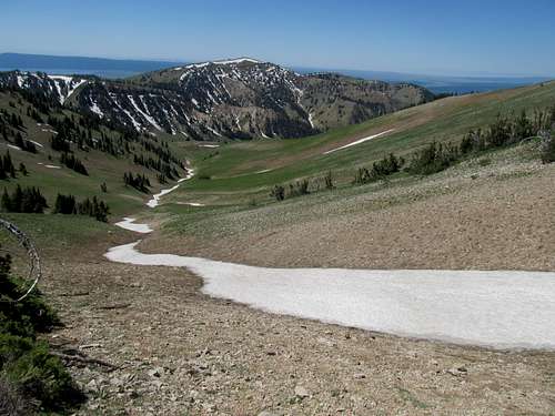
And a pretty basic hike it was, with a great trail winding from the saddle below Sawtelle Mountain. There were some ups and downs as often the trail winds along both the spine of the Continental Divide as well as the Montana/Idaho border. I was shocked to learn a bit later that, due to a fluke of geography, the hills to the south of us were actually Montana while Idaho was actually north of us.
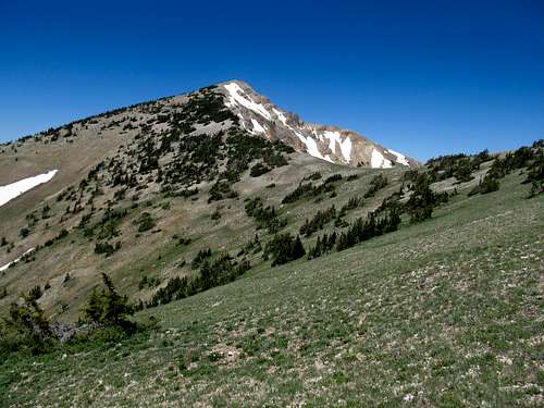
We left the trail amid the traverse and had to climb a small but steep snowdrift, then sidehilled south around a minor summit to arrive at the last 600 feet of climbing to the top of Jefferson. There was a good climber’s trail for that last section.
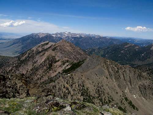
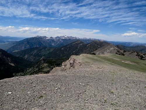
From the top we could see, despite the easy ascent, the rottenness of the west ridge of Jefferson as well as the north face, from which a more difficult scree ascent route is outlined in Cedron Jones’s Montana guide. Views were abundant, from the Tetons to the south, through Yellowstone then north to Hilgard, the Madisons, then west to the Gravelly and Snowcrest Ranges.
From the summit, Greater Yellowstone beseeched and beckoned for more.
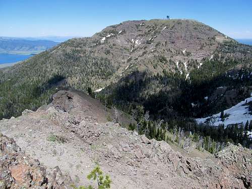
Along the descent Greg and I ended up talking each other into doing an unranked P-300’er between Jefferson and Sawtelle, while Ken and Kadee followed reluctantly.
The peak, near the headwaters of the Missouri River, had some worthwhile views in either direction towards Sawtelle and Jefferson.
We regained the trail and the rest was cake.
We bid adieu to Ken, then I headed to West Yellowstone, found a relatively cheap motel, then drove along the pristine Madison River into Yellowstone National Park and gave myself the evening to being a casual tourist, visiting Old Faithful, walking along the hot springs and geysers, and recalling my childhood trip here 20 years prior.
Counting Sheep - July 1st, 2012
I woke early Sunday and drove around Hebgen and Quake Lake before arriving at the Sheep Lake trailhead. The objective for today was Sheep Point, and we decided upon the approach from Sheep Lake mainly because it was shorter than the Targhee Basin approach from the south.
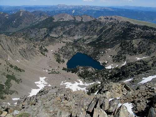
Still it was a good five or six miles just to the lake, though on an excellent trail. It was hot and almost humid down low, but pretty soon the trail climbed gradually to some pretty meadows, the upper reaches of the mountain still unseen. The trail finally steepened and traversed a talus field as it finally circled around to beautiful Sheep Lake, and the steep north face of Sheep Point behind it. The sight of an obviously manmade dam here deep in the wilderness was an odd sight.
We traversed around the east side of the lake and headed towards the mountain. Per Cedron’s guidebook there one could find a decent class 2-3 route up this north face by ascending a grassy ramp from the lake. We could see where the grassy ramp likely was, but things were complicated by snow drifts still clinging to the face.
Still, we spotted a few possible lines of ascent, and we applied our makeshift route up, sometimes through snow, sometimes through grass, sometimes through rocks.
Halfway up Greg chose a line up a steep snowbank while I climbed the rocky, class 2-3 stuff to the right.
The scrambling was fun and not too loose, and with persistence the payoff was soon evident when we reached the ridge crest.
The final ascent was gradual yet painful, walking up tedious slope after slopes before reaching a false summit, descending, and finally ascending the rocky outcrop to gain the true summit.
We enjoyed the unparalleled views, then started the descent. Jones’s guidebook outlined a loop over nearby Coffin Peak, which beckoned us as we walked downhill. We decided once more to grab an extra summit, and traversed down and through the brushy saddle to gain the steep slopes of Coffin before reaching its prairie-like ridge crest.
We enjoyed walking up this distinctly different terrain to arrive at the summit, and the route here presented us with a uniquely different view of Sheep Point.
The guidebook route had a descent straight north, but we decided to descend directly down the slopes of Coffin to try and regain the trail for a more straightforward approach. The cross-country descent was sustained and steep, but we avoided getting cliffed out and eventually found the branch trail. The last five miles back to the trailhead dragged, but certainly not as much as the last miles of Wind River Peak did a week ago.
It was a long but satisfying drive back to Utah on a Sunday night.


Comments
Post a Comment