-
 48719 Hits
-
 81.17% Score
-
 13 Votes
|
|
Mountain/Rock |
|---|---|
|
|
39.98780°N / 9.32440°E |
|
|
6013 ft / 1833 m |
|
|
Overview

Punta La Marmora is Sardinia's (Sardegna's) highpoint and belongs to the Gennargentu Mountain Range. Gennargentu is by some 400m the highest mountain range of the island. It consists of several smooth ridges - resembling Scotland's highlands (and sharing the logging part of their history) - which alone in winter get a share of the island's snowfall. This explains the name Gennargentu: Silver Saddle Mountains (Genna = Pass, Saddle; Argentu = Silver). Neighbouring Bruncu Spina, Sardinia's second highest summit, even boasts a ski lift with two downhill courses. Don't ask me for the number of days on which you actually ski up there - Gennargentu is located exactly on 40° latitude - just like Naples.
The Gennargentu main ridge - to which Punta La Marmora belongs - runs from north to south and contains Sardinia's five highest summits. Access is easy - the upper ski lift station on Bruncu Spina can be reached by a service road (gravel) and from there all five summits can be reached by a very nice hiking trail running along almost always on top of the ridge.
As stated above the mountain range resembles the Scottish Highlands - grassy hills which have been depleted of their original forest cover during the last centuries. On Sardinia the reason was char burning - the major employment of much of the country folk during the 18th and 19th century. You can still see a lot of traces of this history on the island - charcoal kilns and old mulatterias - mule trails which lead from the mountains directly to the natural harbours on the eastern coast. These mulatterias are nowadays used as hiking trails since they are perfectly adapted to the terrain, leading in and out of the numerous gorges of the island.
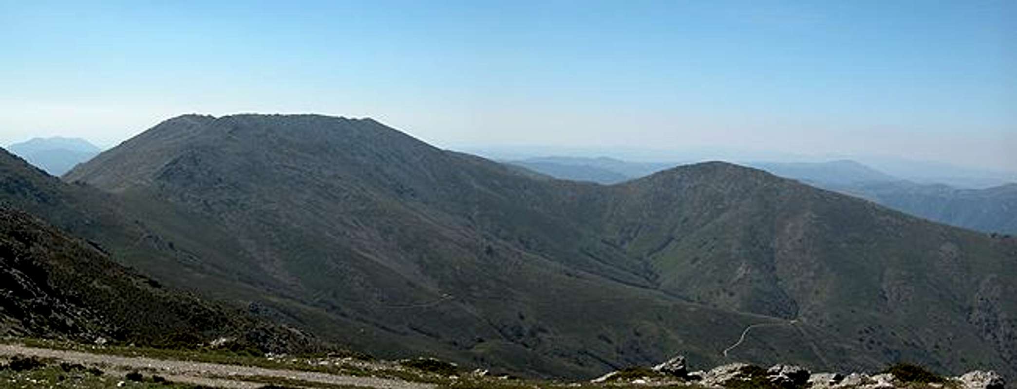
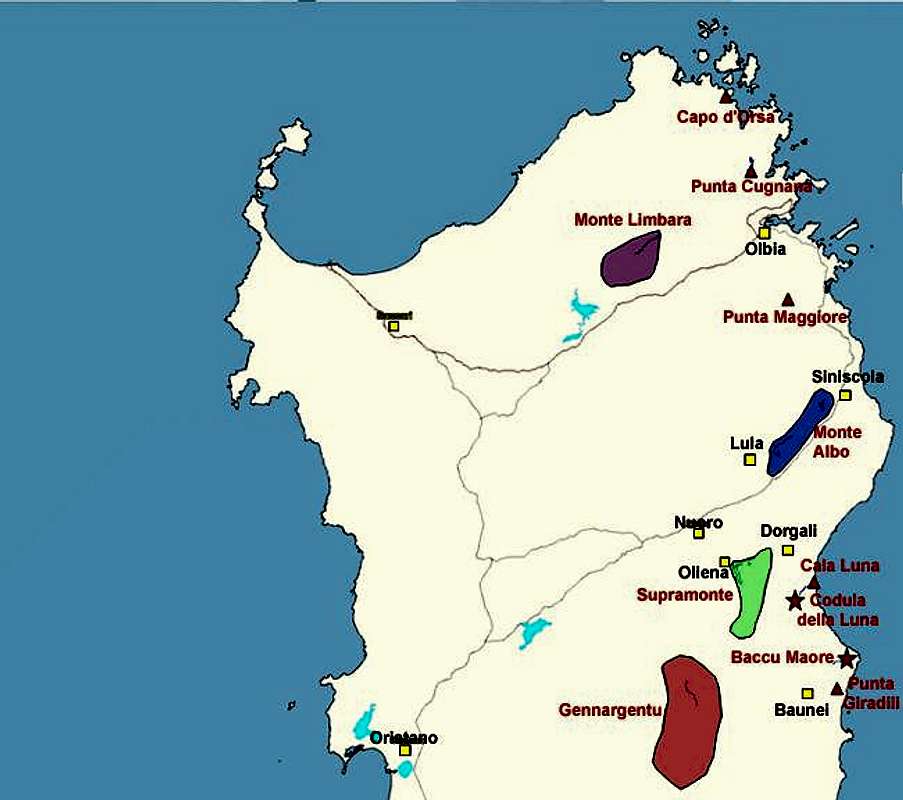
Naturally Punta La Marmora offers great views of the whole island. It is located almost directly in the centre of Sardinia (a little to the east, though) so that on a fine day you can see all coasts from up there. Also the surrounding mountains are visible - the high Supramonte (Sardinia's second highest mountain range) drawing most of the attention to the northeast. Wildlife has already an alpine character - the range is high enough to suppress (or slow down) the growth of many of the wildflowers. There are supposed to be mufflons and golden eagles up there but we only encountered goats and cows :-(
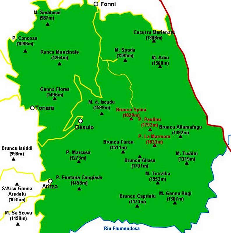
Interactive overview map of the Gennargentu mountain range. The summits which have been posted to SP are marked in red.
Getting There
Sardinia can be reached either by plane or by ferry. The main ports are Porto Torres and Olbia in the north and Arbatax and Cagliari in the south. Airports are at Alghero and Olbia in the north as well as (again) Arbatax and Cagliari in the south. For exploring the north eastern part of the island where most of the mountains are the best entry point is Olbia, which is where most flights go anyway.
Approaching the mountain from Arbatax airport
From the airport take SS125d west towards Tortoli and onwards on SS198 to Lanusei. There switch to SS389 north direction Nuoro until you reach Passo di Caravei. At the pass turn west again un SS389, direction Fonni. Shortly before you reach the town SP7 (a small side road) turns off left (south) and leads in direction Desulo. After 5km turn left (signs Monte Spada, Bruncu Spina). 7km will lead you to the trailhead which is not at the end of the road at the ski lift but rather some 1km before, where there is a dirt road to the right and a parking place to the left.
Approaching the mountain from Olbia airport
Get on motorway SS 131 south in the direction of Siniscola / Nuoro. At the second exit for Nuoro get off and turn onto SS389 south direction Mamoiarda. First get around Nouro to the west and then follow the road to Fonni. After the town, turn on SP7, direction Desulo and follow the descriptions given above.
SP member Wuschl provided me with a second trailhead and the following description (from Fonni, the remainder is as given above):
From Fanni go to Desulo. There, exactly in front of the hotel "Lamarmora" take the road that leads to a pass called "Arcu Guddetorgiu" (1.121m). Further then on a "strada bianca" until you reach some shepherds' huts (~1.500 m). There you can leave your car. Attention, the road is in a very bad condition
Red Tape
The whole Gennargentu range belongs to Parco Naturale di Gennargentu / Golfo di Orosei. So the usual restrictions concerning wildlife apply. Camping is strictly forbidden within park boundaries but you can take advantage of "agriturismo": many farms offer rooms and apartments.
When To Climb
Gennargentu can be climbed all year round. Winter might see snow on the ridges but still hiking the summits still is possible. If you bring your skis to Sardinia ;-) you can do the tour as a ski ascent. Enjoy the two downhill courses - each about 1km long.
Accommodation
Accommodation...
...in the mountainous region of Gennargentu is not quite so easy to find. Some farms offer "agritourismo" - rooms and apartments with or without breakfast. Some of them will let you camp on their grounds.
Camping...
is not allowed in the natural park so you need to consider staying farther away.
Look for locations on the coast, using www.sardegna.com.
Weather Conditions
Go for the following link, which is in Italian but with ALL the information you might want to have on weather on the island:
www.sar.sardegna.it.
Head for the "meteo" button and then on the "Bollettino dettagliato" link in the left frame.
Maps 'n' Books
As for Maps I used only a road map scale 1:200000 since the guidebook I used has maps and is really quite good. Don't be fooled by the durations they state, you'll be much faster but the "getting there's" and "route description's" are very good.
The book is:
Sardinia (Sardegna / Sardinien)
M. Omidvar
Rother Verlag
ISBN: 3-7633-4800-X (English)
ISBN: 3-7633-4143-9 (Italian)
ISBN: 3-7633-4023-8 (German)


