-
 42625 Hits
-
 84.82% Score
-
 19 Votes
|
|
Mountain/Rock |
|---|---|
|
|
43.53100°N / 110.98°W |
|
|
Teton |
|
|
Hiking, Mountaineering, Scrambling, Skiing |
|
|
Spring, Summer, Fall, Winter |
|
|
10352 ft / 3155 m |
|
|
Overview
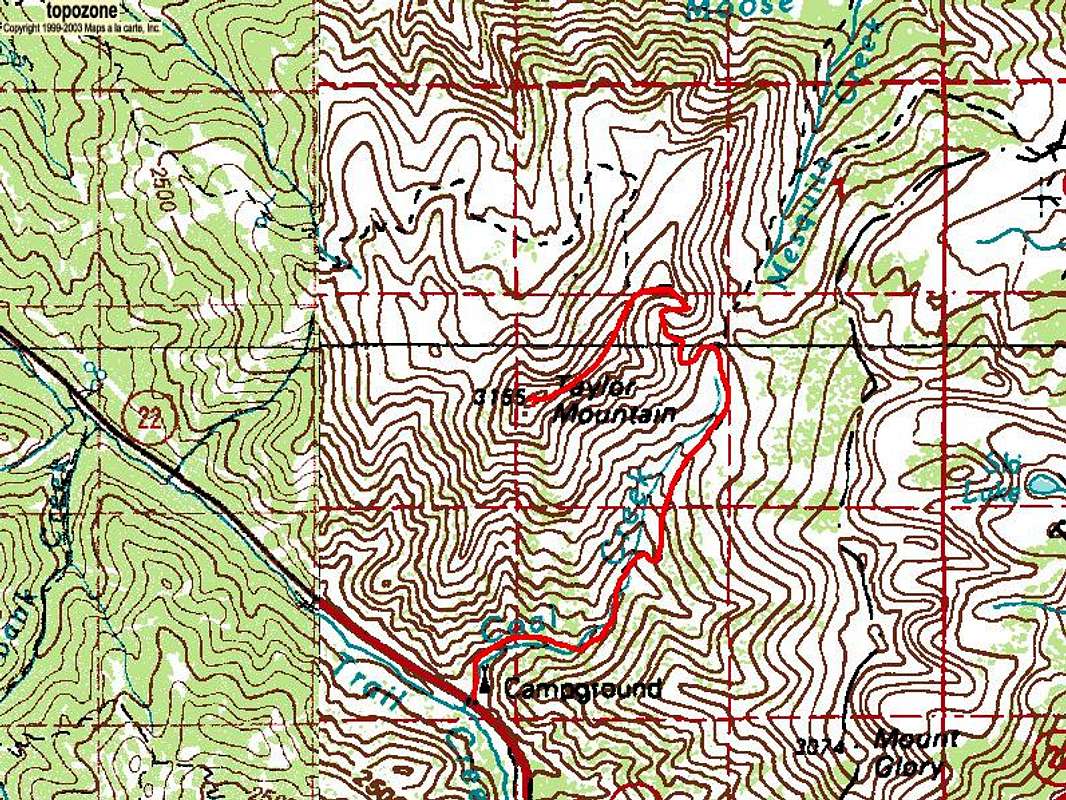
Taylor Mountain is located in the Teton Range about two miles northwest of Teton Pass and close to Wilson and Jackson Wyoming.
Taylor Mountain is the 935th highest peak in Wyoming, but the 95th most prominent in the state and the 330th highest 10er in Wyoming.
Taylor Mountain provides a fun hike and easy scramble in summer and a plethora of ski descents in fall, winter and spring. Two avalanche-related fatalaties have occurred on Taylor Peak's east face, perhaps the most aesthetically-pleasing line Taylor has to offer.
The summit provides great views of the northern Tetons, Idaho and Utah.
Getting There
Summer
From Wilson, Wyoming, drive west on US 22 7.5 miles to the Coal Creek Trailhead, shown as the Coal Creek Creek Campground on the map, just west of Teton Pass on the north side of the road. Follow the Taylor Mountain Trail up Coal Creek to Mesquite Divide (9,197'), then west up to Taylor Mountain's north ridge. From the ridge, leave the trail and follow Taylor Mountain's north ridge to its summit. Return via the ascent route.
Round Trip Distance: 10 miles
Elevation Gain: 3,112'
Fall, Winter & Spring
With good snow cover the most direct route up Taylor Mountain is the southwest ridge. An easier ascent on skis can be made up the south-southeast ridge (Mooreski.)
Red Tape
Taylor Mountain is in the:
Teton Basin Ranger District
Targhee National Forest
P.O. Box 777
Driggs, ID 83422
(208) 354-2312
External Links
7 Day Forecast
Bridger-Teton National Forest Avalanche Center
Guided Hikes up Taylor Mountain


