
-
 17524 Hits
-
 80.49% Score
-
 12 Votes
|
|
Mountain/Rock |
|---|---|
|
|
49.71600°N / 125.343°W |
|
|
Hiking, Skiing |
|
|
4921 ft / 1500 m |
|
|
Overview
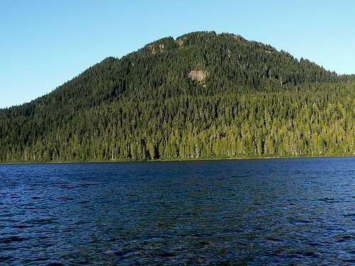 Mt Allan Brooks from Lake Helen McKenzie Mt Allan Brooks from Lake Helen McKenzie |
Brooks is the closest of the Plateau mountains to BC Parks’ Paradise Meadows trailhead and is a familiar sight to the thousands of skiers who visit Mt Washington Alpine Resort every year. Ask them about it, however, and they probably couldn’t even tell you its name.
Unheralded and mostly overlooked, there’s little in the way of a trail up Allan Brooks and even less in terms of route details. Probably for this reason, the mountain receives few visitors and those that do come usually visit in winter on skis when the bush and deadfall is covered and the going less obstructed.
Little regarded or not, Brooks has a few pleasant surprises in store for the occasional summer visitor. While there’s plenty of forest to get through it’s almost completely open and there are also several sub-alpine draws along the usual south ridge approach to the summit. Nearer the top the route unexpectedly crosses two limestone boulder fields before reaching the summit cairn. In fact an earlier name for the mountain was “Limestone Ridge”.
The most unexpected and pleasant surprise, however, is the views. From below the summit looks to be completely treed. In fact the summit cairn sits directly above the steep drop-off to the Goss Creek valley below and commands an uninterrupted view right across the west part of Forbidden Plateau to the high mountains that border the Eric/Ralph River watersheds, Mt Albert Edward, Mt Frink and Mt Regan amongst them.
The summit of Brooks just pokes its nose into the high alpine zone. To the north of the cairn is a small flat alpine plateau that seems completely out of place. A little “alpine island” amongst all that forest - again, with lots of limestone in evidence.
Allan Brooks (1869-1946) was a renowned naturalist, ornithologist and artist. Brooks travelled extensively throughout western Canada and called many places home but he spent at least part of every year at his home in Comox, doubtless birding in the area around the mountain that now bears his name. Brooks was also a well known and avid hunter and gun collector. Given modern attitudes towards such things, I wonder if Mt Brooks might be called something else if it had required naming today.
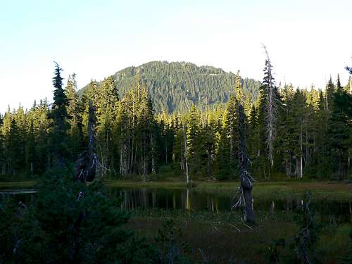
Mt Allan Brooks from Paradise Ponds
Getting There
Vancouver Island can be reached directly by air from Toronto, Vancouver, Seattle, Calgary, Edmonton and recently from San Francisco to either Victoria, Nanaimo, Comox or Campbell River and by ferry from Port Angeles to Victoria on The Coho and on BC Ferries from Vancouver to Victoria or Nanaimo. Public transport on the Island is notoriously poor and anyone arriving by air would be advised to rent a car. Access in this case is all on paved roads and, therefore, fine with a normal sedan.Approach from north or south on the inland Island Highway 19. Near Courtenay take the Strathcona Parkway exit west to Mount Washington Alpine Resort. Drive up 20km and just before reaching the resort make a left turn onto Henry Road, following Parks signs for Paradise Meadows. Pass the bottom of the ski lifts after 1.5km and drive a further 0.5km to the end of the paved road at the cross-country facility Raven Lodge.
Parks have established a new trailhead and information booth right beside the lodge. If you get back from your trip before 5.30 pm, the Raven Lodge has a lovely view over to the mountains – particularly to Mt Brookes - and is a great place for an end of hike libation.
Approach and Routes
Head out from the Paradise Meadows trailhead across the groomed trail and boardwalk onto Paradise Meadows. Reference to this map illustrates the route to Lake Helen Mackenzie. Easy trail takes you to the north shore of the lake in about 45 minutes.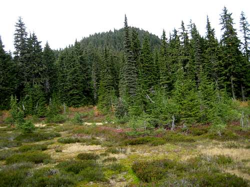 Mt Brooks lower South Ridge | 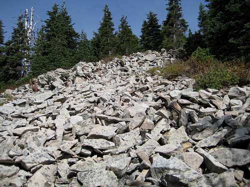 Mt Brooks Upper South Ridge | 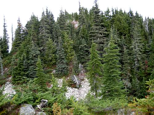 Approaching Mt Brooks Summit | 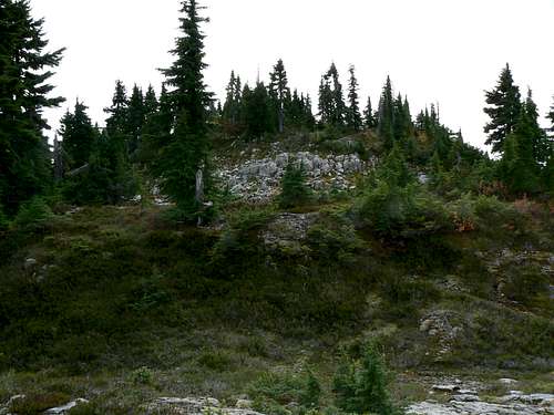 Mt Brooks summit from the north |
1.At about N49 42.718 W125 20.105 look for a wet rocky gully above and to your right. It may have a creek running down it. Leave the main Plateau trail here and make your way southwest up steep but open slopes aiming to intersect Brooks’ south ridge in open meadows on the south ridge at about N49 42.522 W125 20.418. There is no marking or trail on this route.
2.If this doesn’t appeal carry on up and over the Brooks/Elma pass to N49 42.456 W125 20.047. Again there is nothing to mark the spot but there should be a wet meadow to the right of the trail in your direction of travel. Leave the main trail here, cross the meadow west and continue west into the well spaced trees. Head up-slope – always west - and to the right of a bump in the ridge ahead. As you contour around the bump you should encounter a faint boot path for the first time. Follow this, or if you can’t find it, head north into the open meadows and aim for the waypoint noted in 1 above.
Once on the south ridge via either option it’s just a question of heading north to the top. There are some flags and the boot path re-appears occasionally but, mostly, it’s just a question of common sense.
As you approach the summit, the route crosses two gullies that split the ridge east/west. Above the second gully is the unexpected limestone boulder field that precedes the final few metres to the summit. The summit is about an hours travel from either of the points at which you leave the main Plateau trail.
The summit cairn has been built a little below the true high point in order to take advantage of the views to the west described above. It has a nice new (2005) wooden plaque provided by the Comox and District Mountaineering Club but no register that I could find.
 Mts Albert Edward & Regan Mts Albert Edward & Regan |  Mt Washington Mt Washington |  Mt McBride, Alexandra Pk, Mt Adrian Mt McBride, Alexandra Pk, Mt Adrian |  Mt Brooks "alpine island" Mt Brooks "alpine island" |
Reverse either of the options above to return to the main Plateau trail.
A combined hike taking in Brooks and neighbouring Mt Elma makes a good day trip. As noted above the route down the south ridge of Brooks joins the main trail at N49 42.456 W125 20.047 just 50 metres from the point where you leave it at N49 42.466 W125 20.005 to head up Elma.
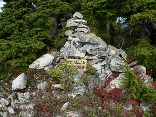
Mt Brooks summit
As always a MapSource/Garmin tracklog is available for the asking for the approach and summit routes. Just send me an email or PM.
Red tape/Safety etc
If, for some reason, you decide to camp on this trip there is a $5/person/day fee for any of the sites in the so-called core-areas of Strathcona Park. There is a self-registration box and payment slot at every core designated trailhead. Payment can be by cash or cheque. Fill in the payment form before you leave and take the receipt slip with you.With Mt Washington just 3 kms away, there is cellular coverage just about anywhere on Mt Brooks from which you can see the ski runs.
Camping
In core-areas of Strathcona you must camp in designated areas only and the nearest approved campsite for Mt Brooks is at the east end of the north shore of Lake Helen McKenzie.Note that fires are strictly prohibited, so you must pack a stove. Bear and cougar frequent the mountains and forests of Vancouver Island, so proper back country methods – isolating food bags, cleaning up all cooking scraps, good toilet practice etc – are essential. All of Parks’ designated core area campsites are now equipped with metal box food caches. Giardia is well documented throughout Strathcona Park, so boil or treat all water.
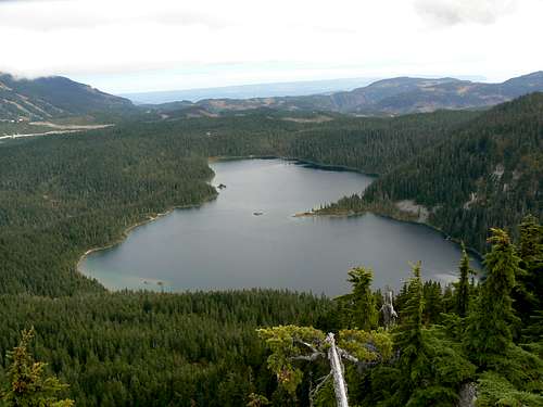
Lake Helen McKenzie from Mt Brooks. Designated camping at the head of the lake.
Useful Links
Strathcona Provincial ParkAdditional Information/Suggested Reading
Island Alpine – A Guide to The Mountains of Strathcona Park and Vancouver Island, Philip Stone, Wild Isle Publications, 2003, ISBN 0-9680766-5-3 and/or visit Island Alpine Climbing Guide
Weather
Nearest point forecastOR
Check the weather at altitude right from Mt Washington’s webcam