Overview
This hike up the extinct stratovolcano is much less in distance, time and effort than the hike from the Gooseberry trailhead on the south side off of Forest Road (FR) 193. It is a very pleasant incline hike of between two and four miles, round trip (depending on which route option), having a total elevation gain of only 709 ft. If you want a mountain top experience, but are budgeting your time, or avoiding the threat of a possible afternoon thunder storm, this is a great hike! Additionally, if you want to pleasantly introduce others to hiking, this hike will not burn out your novice friends and visitors and hopefully be a good memory leading to more hikes.
The mountain and surrounding area is a U.S. Forestry Service, Mt Taylor Ranger District managed area, of the Cibola National Forest. Visit the Mt Taylor Ranger District Webpage for alerts and information at URL: http://www.fs.usda.gov/detail/cibola/about-forest/districts/?cid=fsbdev3_065705. The mountain forecast page did not address the Mt Taylor weather, but looking at the Grants, NM weather may give you an indication of what to expect, although mountain weather can be significantly different from the weather in nearby communities. If the weather is bad in Grants it is most likely bad on the mountain. If the weather is good in Grants, that is no guarantee that it is good on the mountain.
Getting There
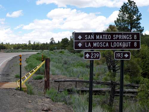
There is a scarcity of signs directing one to the northern Mt Taylor trailhead. Drive northeast from Grants, NM on State Road 547 just as you would to go the Gooseberry trailhead. This is a paved road most of the way. Just before the pavement ends at approximately 14-15 miles (sorry, not measured) you cross through a gate with a yellow cattle guard, having road signage on the right.
![Yellow Gate and Cattle Guard]() This gate is within view of the triple road Junction. Stay straight on FR 239 passing FR 193 on the right and the dirt road on the left. Note that the sign indicates that the fire lookout is 8 miles, which is right by the Mt Taylor northern trailhead.
This gate is within view of the triple road Junction. Stay straight on FR 239 passing FR 193 on the right and the dirt road on the left. Note that the sign indicates that the fire lookout is 8 miles, which is right by the Mt Taylor northern trailhead.You will come to a triple road junction within site of the gate at GPS coordinates 35.256372N 107.686236W. Continue straight and north on FR 239 passing FR 193 (to the Gooseberry Trailhead) on the right. Do not veer left onto the unimproved dirt road here. FR 239 is a dusty, gravel washboard road and it is difficult to find the best speed to reduce vibrations. After about 3.2 miles (from the triple intersection) turn right onto FR 453. There is a maze of roads in this area, but many are much less improved than FR 453. At about the 3 mile mark ignore the fairly developed road on your extreme left and continue going uphill to the right.
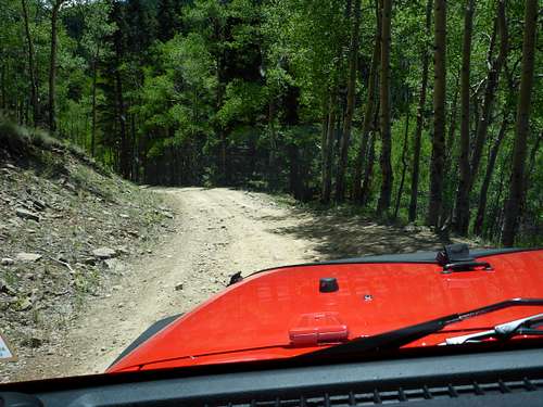
Most of FR 453 is rough and rutted, with many dips, curves and humps. I drove a Jeep Wrangler. I think, however that a relatively high clearance vehicle such as a Subaru Outback, a truck or Forrester could have comfortably made it, at least in dry conditions. Certainly no road for a Prius.
![FR 453]() FR 453 can get rough on some stretches, but is navigable with even moderately high clearance vehicle (although I drove a Jeep Wrangler)
FR 453 can get rough on some stretches, but is navigable with even moderately high clearance vehicle (although I drove a Jeep Wrangler)
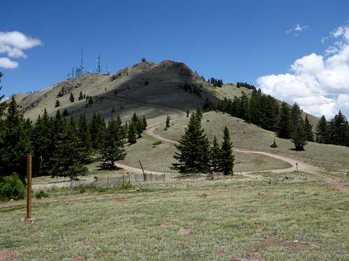
Finally there is an open stretch on an incline and you can see the crazy steep south slope of the La Mosca peak on the left with its antenna farm and fire watch tower about 500 ft. above the road.
![The Fire Watch Tower and Antenna Farm on Mosca Peak]() This is looking opposite of the trail heads
This is looking opposite of the trail heads Continue uphill and you will come to an open meadow on the right, opposite the fire tower. At this point there is a hairpin turn to the left and the road goes up an extremely steep and intimidating incline to the fire tower. This is about 4 ½ miles from the turn off from FR 239. Pull into the meadow and trailhead on the right, which has a sign, “Gooseberry-Water Canyon Trailhead”.
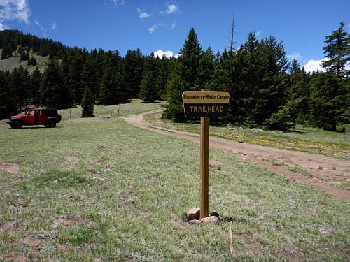
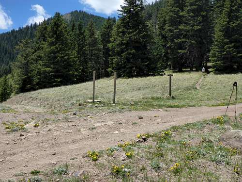
![The Trail Head(s)]() From the front of the broad meadow and trail head you cannot see the middle short trail, but the longer trail is easily identified on the right looking like a continuation of the road.
From the front of the broad meadow and trail head you cannot see the middle short trail, but the longer trail is easily identified on the right looking like a continuation of the road.The GPS coordinates are: 35.246506 N 107.600594 W at 10,592 ft. There was no sign mentioning Mt Taylor summit or trail, etc., although there were remnants of old signs which once could have indicated this.
Hike from the trailhead-two route options
1.Longer, gentler route: At the trailhead the main road/trail continues up to the right and up a grade, hugging the tree line and then into the woods. This is the longer, less steep, and shady route (from the north side) to the Mt Taylor summit. This longer trail is wide and is actually a dirt road up to the short-long route intersection at the saddle/meadow (later described). Signs are absent.
2.Shorter, steeper route: The shorter route starts at the middle trail immediately going uphill, which is not easily perceptible from the front of the large open trailhead (can be backlit and obscured by trees).
![The three trails]() My walking poles mark the longer route on the right. My wife is on the middle shorter route. The Gooseberry trail going downhill is on the left.
My walking poles mark the longer route on the right. My wife is on the middle shorter route. The Gooseberry trail going downhill is on the left.There is an obvious trail to the left falling down the slope from the broad clearing and into the forest to Gooseberry Springs. Don’t take this trail if you intend to summit Mt Taylor. You will be able to identify the shorter, middle trail if you move forward (northwest) across the open meadow from the front of the meadow near the hairpin turn (about 200 yards). It is a very narrow (12-18 inches), well defined, with fine gravel trail. Looking upward, you can easily appreciate the open and exposed steep, curving side of the mountain you will traverse, although the actual trail was not visible to me from this angle. Signs are absent.
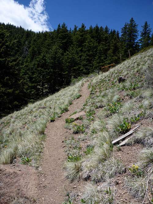
![Short Steeper Trail]() You are exposed, but this is a very short segment of trail.
You are exposed, but this is a very short segment of trail.![Your Destination Awaits!]() The slope of the short trail (trail not visible), and the north slope of Mt Taylor (to the left and at a further distance) from the broad open meadow at the trailhead.
The slope of the short trail (trail not visible), and the north slope of Mt Taylor (to the left and at a further distance) from the broad open meadow at the trailhead.
Both the short and long routes intersect at a saddle/small meadow at GPS coordinates 35.241861N 107.607472W at 11038 ft., which is at 1.7-2 miles on the long trail and at about ½ mile on the short trail. The summit is about ½ mile further south from this trail junction. If hiking up the longer trail be prepared for the incline to become steep. If hiking up the shorter trail you won't see much difference.
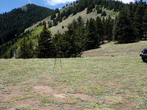
![Small meadow at trail junction]() The edge of this small meadow is the trail junction of the longer and shorter trails. The north side of the saddle is sparsely vegetated (next pic) and the south side is heavily wooded. My wife (she is tiny) is at the point where you turn to the right and uphill on the final 1/2 mile to the summit.
The edge of this small meadow is the trail junction of the longer and shorter trails. The north side of the saddle is sparsely vegetated (next pic) and the south side is heavily wooded. My wife (she is tiny) is at the point where you turn to the right and uphill on the final 1/2 mile to the summit.
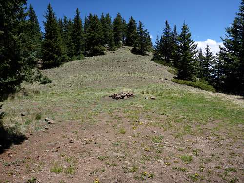
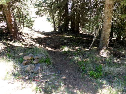
![North slope of saddle]() Note the fire ring in the meadow at the base of the north slope of the saddle.
Note the fire ring in the meadow at the base of the north slope of the saddle.
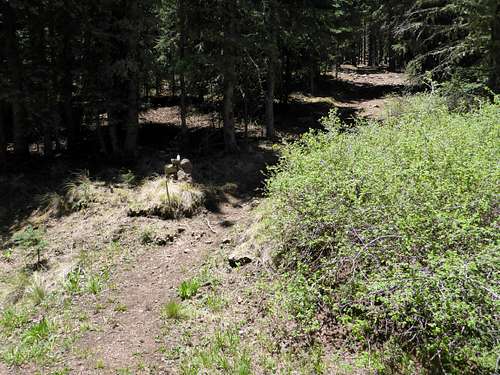
Caution: when approaching on the longer trail it is very easy to blow right past the trail to the summit on the right. The summit trail is not obvious, and very dark due to the forest shade. The trail will take a 90 degree right turn up into the dark, shady and steep slope. If coming up on the short trail you continue across the tip of the meadow and onto the summit trail. Watch for the small cairn marking the mouth of the summit trail at the far edge of the tiny meadow in this saddle, on the right or south. If you end up hiking beside an old wire fence on your left, and stepping over fallen trees then turn around and go back to the saddle/meadow and look for the trail going up the slope and to the south.
![Summit Trail]() Go uphill and south at the far edge of the small meadow to reach the summit. Note the cairn on the middle left.
Go uphill and south at the far edge of the small meadow to reach the summit. Note the cairn on the middle left.
None of this is very arduous, but this approximately ½ mile section remaining from the short-long trail junction/meadow to the summit is as steep as the short trail segment. It was shaded, and cool, but no vistas on this segment.
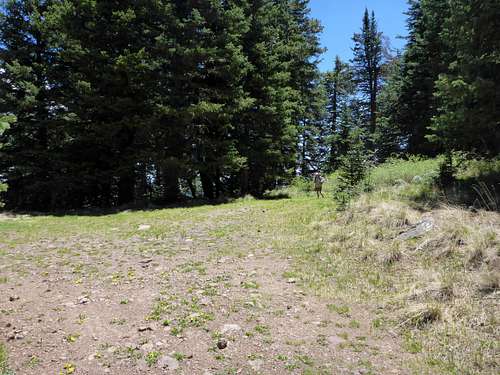
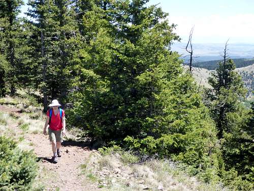
Near the summit you will traverse a wooded trail very near the edge of the slope on the left. The foliage becomes sparse and then you break out into the summit area.
![Almost there!]() The woods thin out towards the summit.
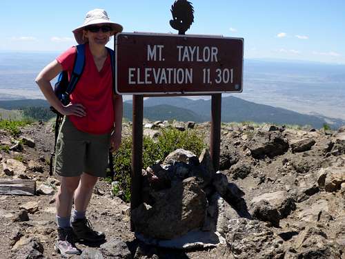
The woods thin out towards the summit.The “Mt Taylor Elevation 11,301 ft” sign with a cartoon-like caricature of a gopher head on top has a drop panel in the back concealing (at this time) a few small notebooks used for summit entries.
![Wife atop Mt Taylor]() The summit sign has a cartoon-like caricature of a gopher head on top has a drop panel in the back for summit entries.
The summit sign has a cartoon-like caricature of a gopher head on top has a drop panel in the back for summit entries.Epilogue
The wind was surprisingly calm and the temperature was about 60 degrees. After eating lunch and taking in the vistas we descended via the shorter trail. Wow! We were back at the Jeep in an easy ½ hour. The downhill assist was very handy on the drive down the rough road. On this weekday we didn't see another vehicle the entire drive up, and only three coming down once on NM SR 547.
![The short trail down to the trailhead]() Coming back we conitnued nearly straight across the edge of the meadow at the edge of the long-short trail junction, and onto the short steep trail to the trailhead.
Coming back we conitnued nearly straight across the edge of the meadow at the edge of the long-short trail junction, and onto the short steep trail to the trailhead. We were happy to choose the path less traveled on this beautiful late spring day. Segura viaja mis amigos (Safe travels my friends).


Comments
Post a Comment