Saddling Up - May 10th, 2013
I had some time to waste after landing in Portland, so I drove across the border and had a few drinks in Vancouver, Washington, celebrating by myself the fact that with one fell swoop I had officially knocked down the last two states in the lower 48 that I had yet to step foot in. As it got dark I got the text I had been waiting for and headed back to the airport to pick up Kamy, Ashley, and Mariel, who had a slightly longer flight in from Boston. We had three days to check out the city and the area, and though most of that would be spent checking out bars, restaurants, and brunches, we had some time to explore some nearby places as well.
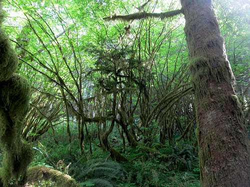
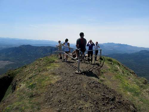
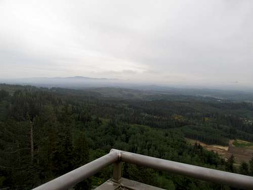
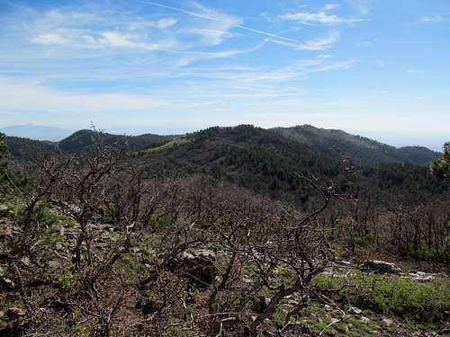
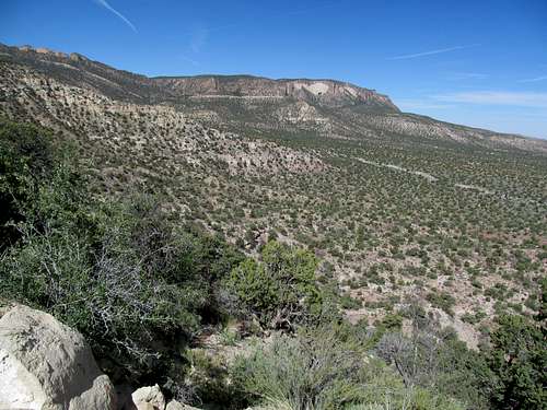
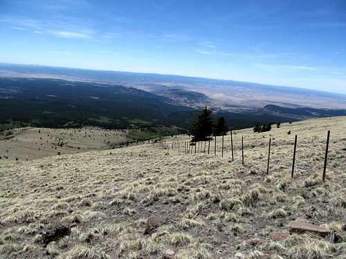
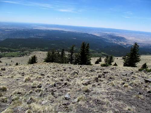
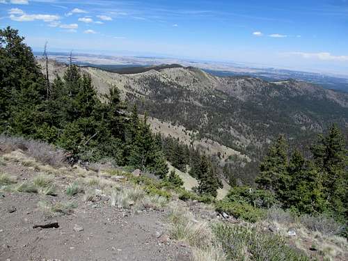
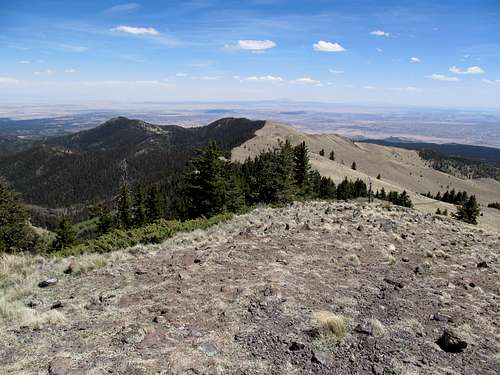
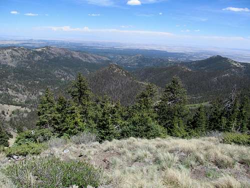
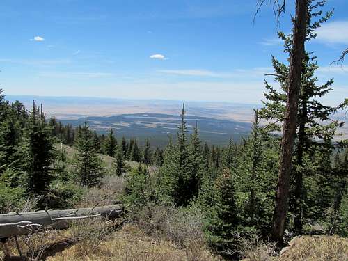
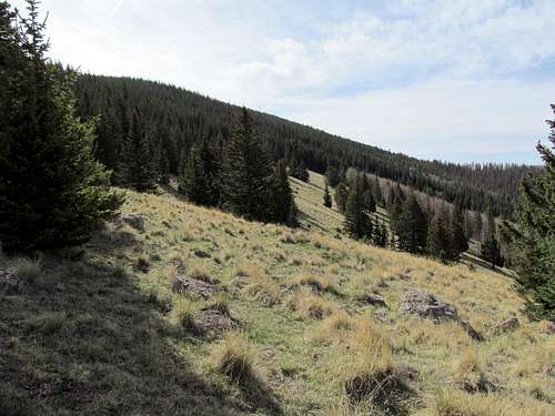
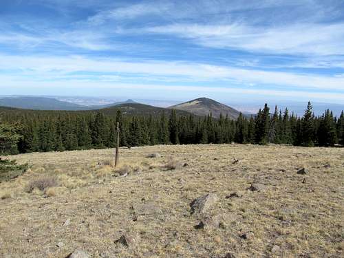
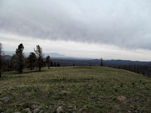
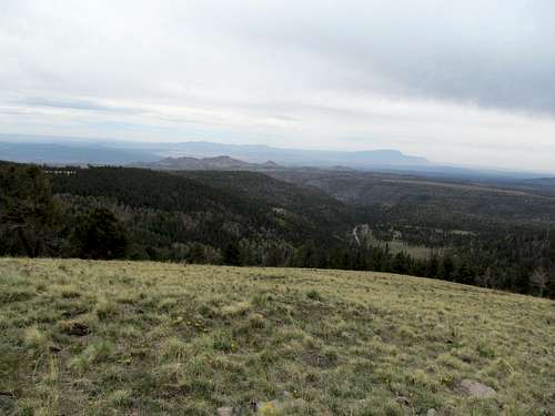
After checking in late to the hotel and grabbing a few drinks at a hipster dive down the street, where we found ourselves politely turning down invitations from strangers to go smoke with them at 4 AM, we got off to an early start in my rental Prius and headed west (after getting some delicious bfast at a food truck, of course!). I wanted to take my friends on a moderate hike, get a good peak and experience something they wouldn’t normally see back east, and Saddle Mountain in the coast range seemed to fit that criteria exactly. Plus it was close to Portland, and we arrived after some pit stops and false starts, and despite the Prius somehow bottoming out a few times along the paved road leading to the trailhead parking lot. All of us beheld how startlingly green it was along the drive, lush trees and rivers everywhere. It was a welcome change for me coming from the desert, and even for my friends, since much of this greenery was quite different from what you would find back in the Northeast.
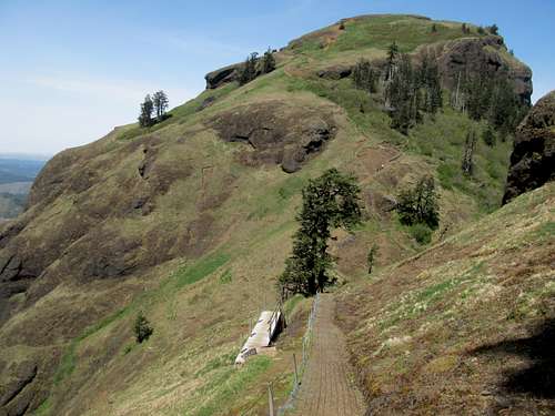
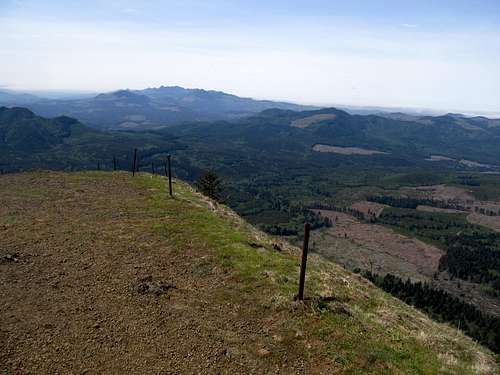
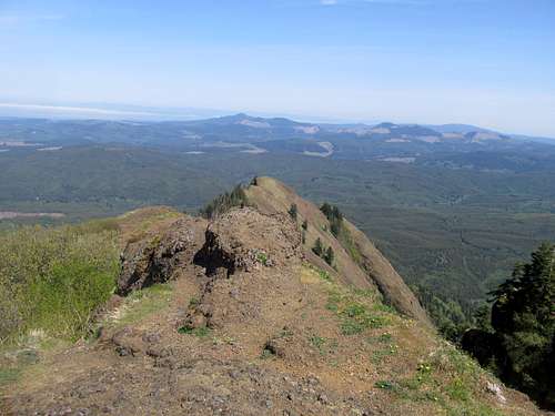
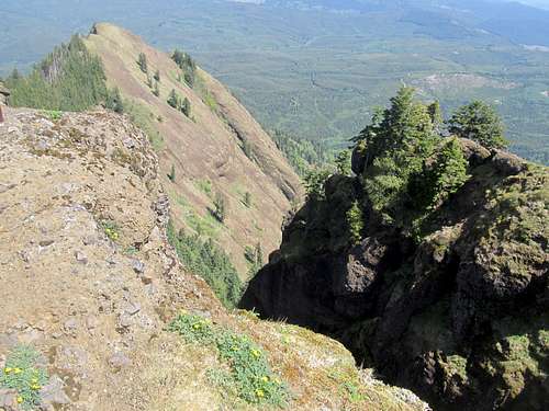
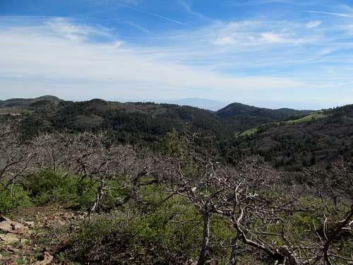
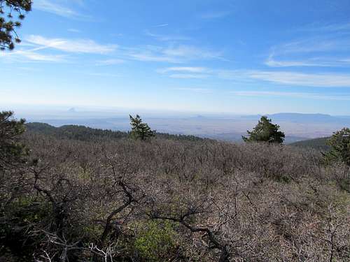
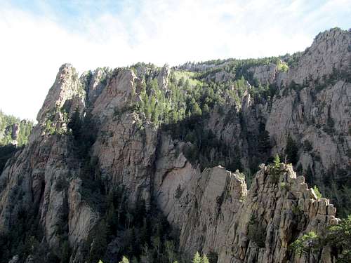
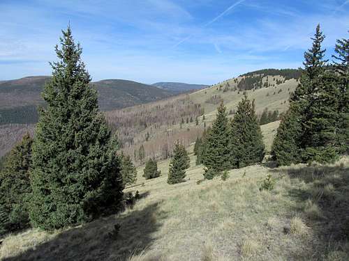
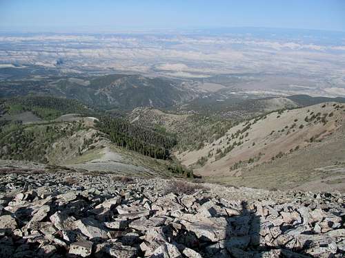
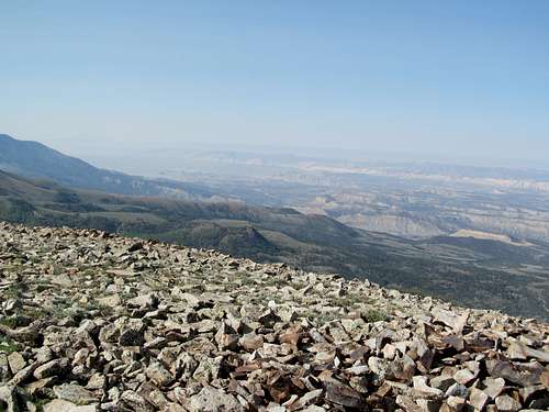
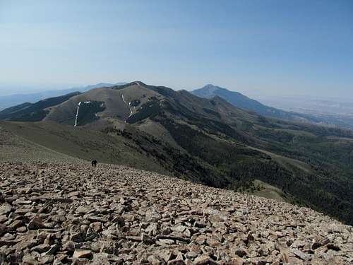
The hike itself was great. The trail is wide, easy, and great for the casual tourist or hiker, yet the rocky scene near the top with its volcanic rocks and precipitous ledges was breathtaking and unique. Even below treeline the vegetation is fascinating to look at and wade in, and missing the greenery of New England I felt right at home in the Coast Range’s lush environs.
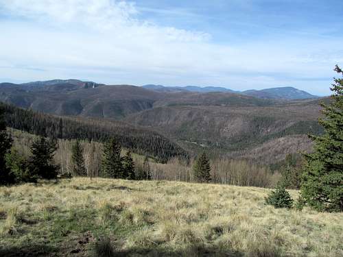
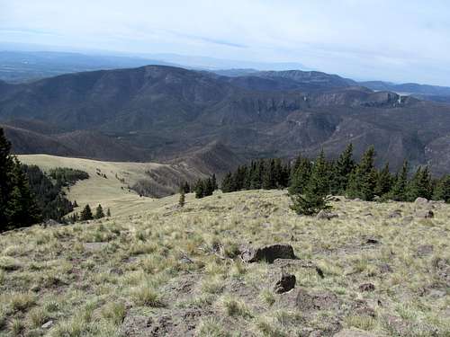
It was a little humid and we all broke a sweat heading up, but the tradeoff with the clear sunny day made up for it. We chatted with folks at the summit, many of whom were fellow tourists, and enjoyed the views, though I was dismayed that this early spring haze blocked the view to the nearby volcanoes; St. Helens was the most obviously visible, and you could barely glimpse Adams behind it, but it took awhile for us to be able to find Mt. Hood barely perceptible along the horizon.
We descended and headed to the beach.
I had always been fascinated by the Oregon Coast, a place that I had never been to but had always held within my imagination a sort of longing mystique ever since I learned from Elementary School many moons ago the stories of Lewis and Clark.
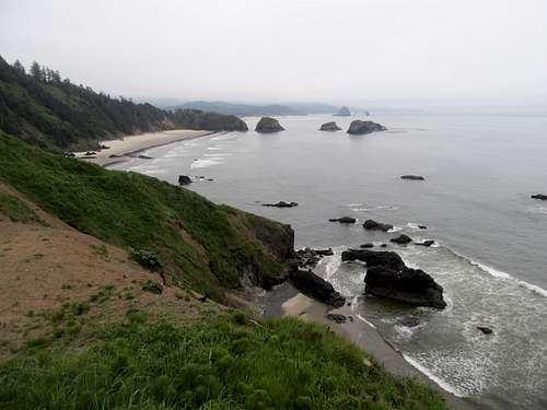
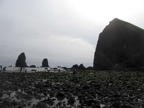
We ended up at Ecola State Park where, as promised by others who knew the area, a warm day 20 miles away turned to cold and fog once we rounded the ridge into the beachfront area. We enjoyed a late lunch at a cool brewery in Cannon Beach, then had a pleasant walk down to the fameis Haystack Rock.
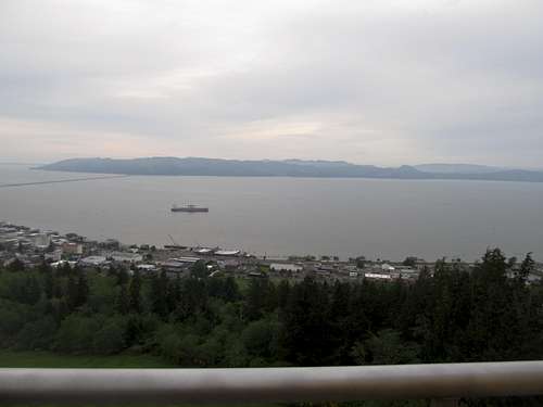
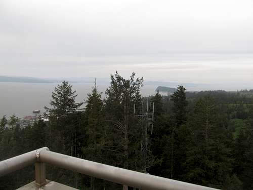
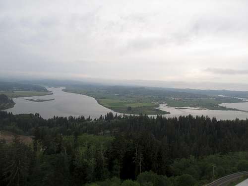
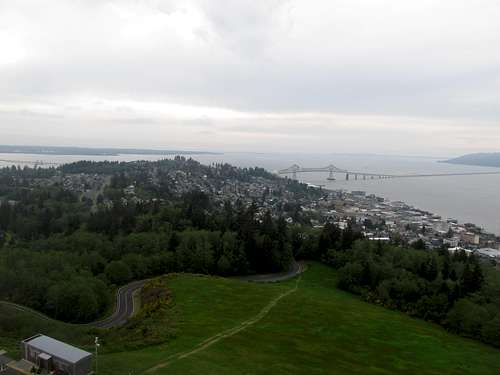
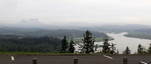
I drove us in the Prius to Astoria to continue satiating my hunger to relive my elementary school history lessons, driving to the Astoria column atop Coxcomb hill and beholding the views into Washington, the Columbia River, and back south to Saddle Mountain, where my friends felt the satisfaction of viewing a peak that they had already climbed.
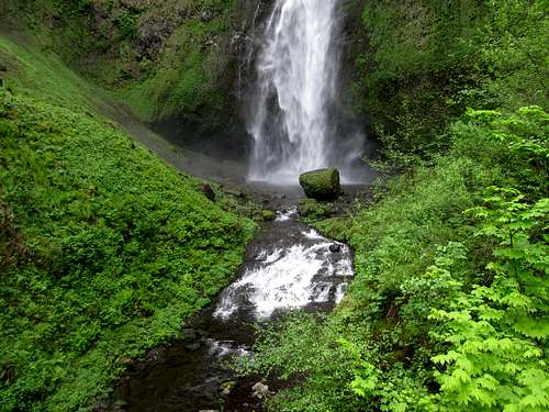
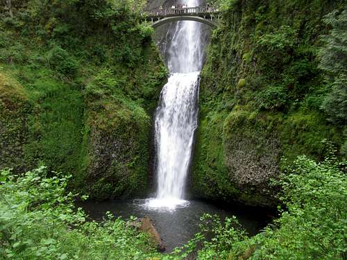
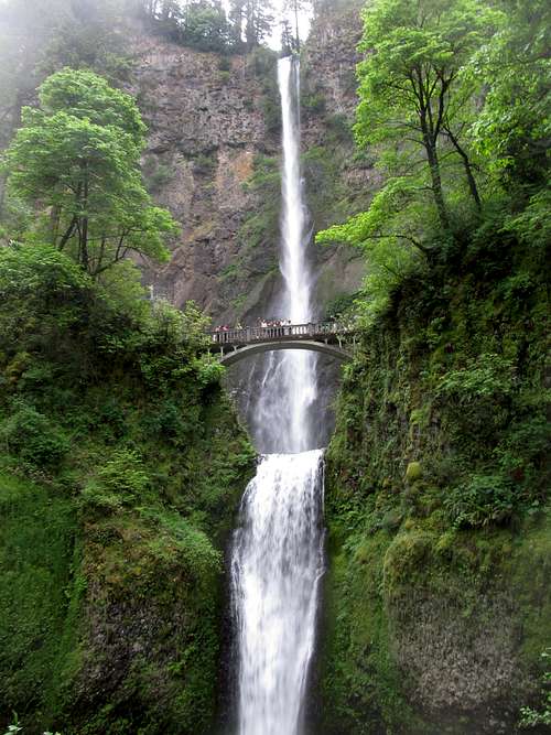
The rest of the weekend we enjoyed in the city, but after brunch on our last day there we had some time to kill before everyone flew back home, so I took the Prius 30-40 miles away to take everyone to see another famous tourist destination, Multnomah Falls. We had enjoyed a very rare stretch of more than two straight days of sunshine, a relative heat wave or so we heard, for Portland in early May, but the page had turned back to the usual rain and gloom on Sunday, but I think it was appropriate for us to enjoy the falls surrounded by its usual quota of fog and mist. The falls stood out despite the very crowded visitor center, restaurant, and gift shops, and made for a fitting finale to our trip.
3 Peaks 3 States 1 Day(s) - May 24-25th, 2013
The Portland trip left me exhausted, which is partly why I spent only one day the following weekend going after Mt. Elliott. Another reason I took it easy that weekend was because I had planned no rest for the weary; with Memorial Day weekend coming up I wanted take advantage of the three day weekend to visit New Mexico, another state in which I had yet to summit a summit. Greg had planted the seed in my head, as he had left the week before Memorial Day for a week long sojourn down into central NM. I toyed with the idea of joining him later on in my three day week, but it seemed too far to travel for such a short long weekend; besides, I had plenty of places to keep me occupied in the northwestern portion of the state, so we ended up in the same state but going after different peaks.
Cedar Mountain
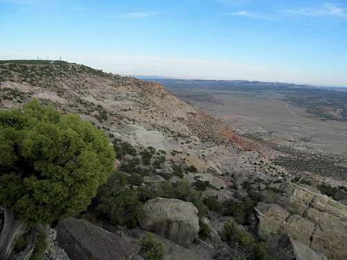
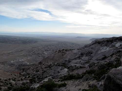
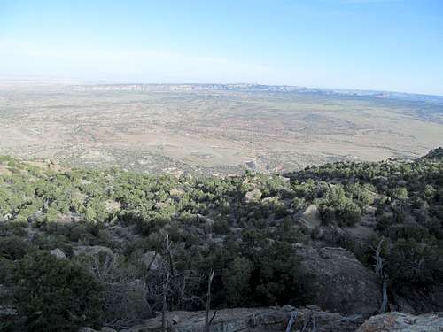
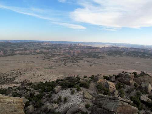
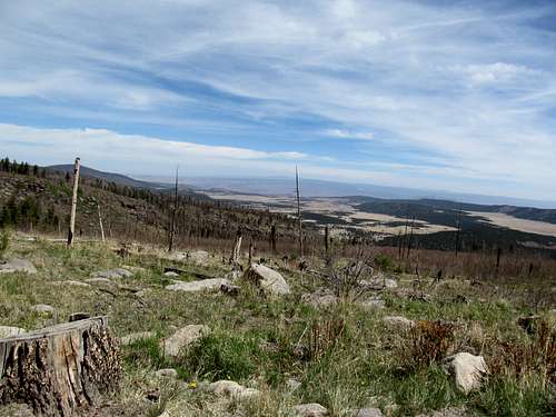
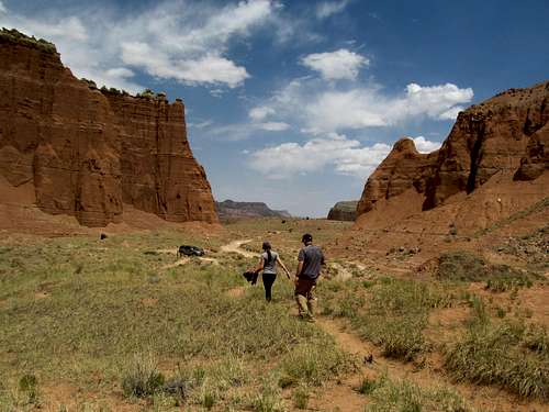
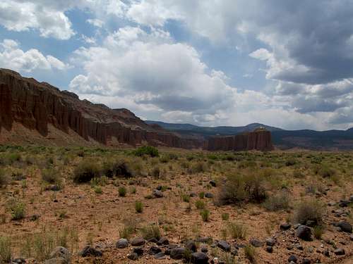
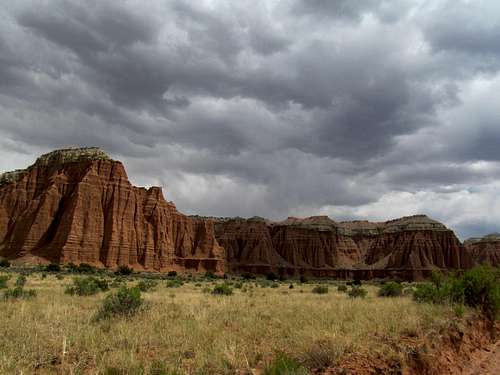
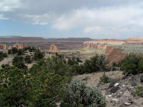
I bode farewell to my office a few hours early on Friday, hoping to sneak in Cedar Mountain and North Horn, two P1K’s in the Utah Top 100 Prominence list near Price between work and nightfall. Traffic jams from SLC through Provo slowed me down however, so I decided to just go after Cedar, a pleasant gravel road drive-up with great views of several remote canyons in the San Rafael Swell from the summit, and great peripheral views of the Book Cliffs and the Wasatch Plateau throughout.
After getting lost a little on the circuitous dirt roads leading back to US-6, I sped down past I-70 and Moab to Monticello, where I found a side road to park and spent the night in the back of the 4Runner. Five sparse hours of sleep later I woke and continued my drive at sunrise, as I needed all the hours I could get in for the day.
Pastora Peak
Monticello and all places further south was new territory for me, and I enjoyed the roadside views past the Abajos and down into the Four Corners desert. The Carrizo Range beckoned from across the border in Arizona. To me, they signified a sense of unfinished business, with a failed attempt at a long snowshoe up Pastora Peak many years ago had kicked my ass long before I could even sniff the summit.
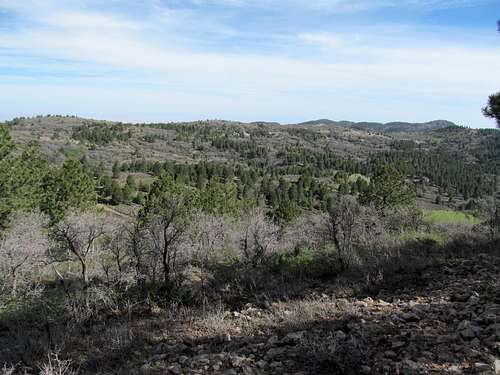
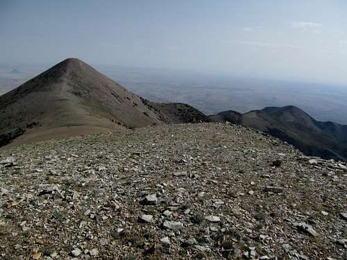
This time the ascent proved to be less the problematic. As expected the crux of the trip was the drive up; after finally locating the right road after a couple of wrong turns (ironic since I found the right road on the first try four years prior), the 4Runner had to brave some horribly steep and rocky roads, the section past the shelf road abutting the lower canyon, and up to the high plateau of the Carrizos. Once ascended, the road smoothed out, although several section were still badly rutted. The landscape here was gentle, relaxing, pastoral, even. Several ranches surprising sat here in the heart of the range range, their domestic horses grazing casually in the high pastures thousands of feet above the desert below. I wondered whether these isolated ranches operated during the winter; probably not.
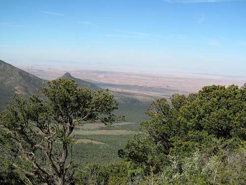
Following the directions on SP I was able to make my way pretty close to the summit, a small hump rising from the large, uneven plateau. The last miles up to this point had been rough as well, and I parked maybe a quarter-mile or so before the road reached the base of Pastora. It was a quick walk there, then a short but steep ascent to the summit. There were brushy areas on the ascent, at the summit, and on the descent, as well as some talus, but no major difficulties. The summit area is large with several spots contending for the high point and adorned with cairns, so I paid a visit to all of them. The views southeast into the Chuskas, Beautiful Mountain, and Roof Butte were great, as was Shiprock below, though it looked tiny and insignificant juxtaposed against much larger mountains. To the west ran the colorful hills of the Carrizo plateau, and in the opposite direction Sleeping Ute Mountain in Colorado, and glimpses of the still snow smothered San Juans further back. The best views north towards Monument Valley back towards Utah and the Abajos are reserved for the ascent road.
A rocky drive brought me back to the highway, and many many miles of monotonous driving through the Navajo Reservation until I reached the freeway at Gallup.
Mt. Taylor
Despite the noontime traffic Gallup seemed like a delightful place based on a quick foray through the downtown area; with its many small cafes and adobes, from a superficial glance the town seems to capitalize on its location along the historic route 66. Grants, my next stop down the road however, was a shithole and a half…prime breeding grounds for meth and such I’m sure. But nevertheless it serves as the gateway to Mt. Taylor, my next destination for the day. I had foregone a snowshoe there years before due to iffy weather…the same day that later saw my ass kicked by Pastora. Backtracking through that last trip was a trippy experience indeed.
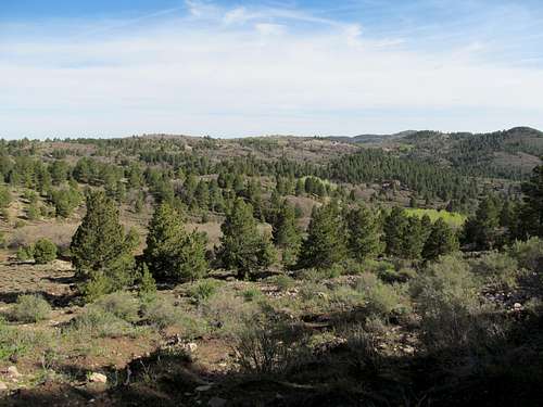
Taylor I found absolutely delightful, if none too exciting. After all the shit road driving in Arizona it was delightful to breeze down a highway and then a smooth dirt road all the way to an established trailhead and a well signed trail. I feared that the late afternoon sun would prove to be overbearing, but the vast ponderosa forest the trail travels through for the first few miles kept you shaded and cool; I’m pleasantly predisposed to ponderosas anyway after a brief but memorable residency in Flagstaff Arizona during my late elementary school years, and anytime I get to travel through a high ponderosa forest rekindles fond memories.
The trail becomes something of a former dirt road as it climbs out of the trees and up a naked slope. Then it turns and you face an awesome drainage, lined with deep dikes formed maybe by volcanic activity from Taylor’s past, maybe from erosion, or maybe a combination of both. No matter what the cause, it’s not something you see everyday, and makes for a nice sideshow next to the very pleasant trail.
The trail then loops around again past some cliffs and towards a deceptively large slope, its final switchbacks flirting with tediousness. I reached the top well before the 24 hours had passed since I had stood on Cedar Mountain in Utah, giving me three (albeit very easy) peaks in three states in less than a one day time window. A large group with a bunch of kids and teenagers were squatting about the entire summit area and seemed neither inclined to chat nor share. No matter…with the tree cover to the north the summit surprisingly didn’t have open 360 views, so I waded through the trees and the brush around the summit to try and get some views to the north and west.
The descent was quick, though the late afternoon sun as well as tired legs did make the last mile drag a little.
I made a pit stop at the Acoma Casino further down I-40 to watch the end of the Bruins Rangers playoff game. I prayed for a B’s win and clinch not only for the sake of the B’s themselves, but also to avoid the prospect of having to find and make time to watch a game 6 on Memorial Day Monday, a day that would involve the long drive back to Utah. Fortunately the B’s bailed my travel plans out, and I continued down to Albuquerque. I drove through the city past areas with various degrees of sketchiness, through downtown, and eventually towards the campus of UNM. Past that the neighborhoods got better, and I found myself in a delightful section of town surrounded by restaurants, breweries, and pubs. It was Nob Hill, apparently, the nice, hip, and gentrified part of the city, so I paid a little extra to stay in a motel here, had dinner and a few drinks in an “Irish” pub across the street (if you’re from Boston, there ain’t no true Irish Pubs in the US west of 128 ). People were friendly, girls were cute, and I only wished that I had a later curfew.
La Luzin' It (& Pajarito) - May 26th, 2013
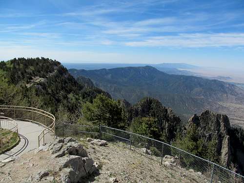
Sandia Crest
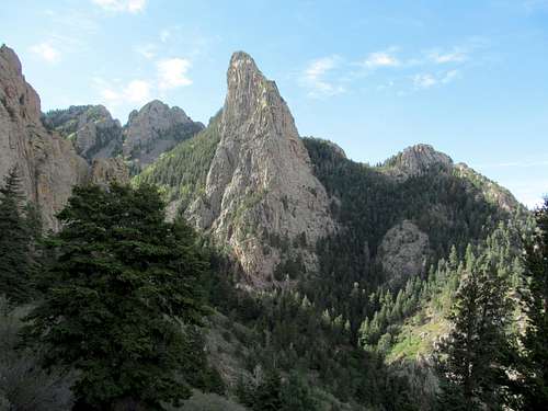
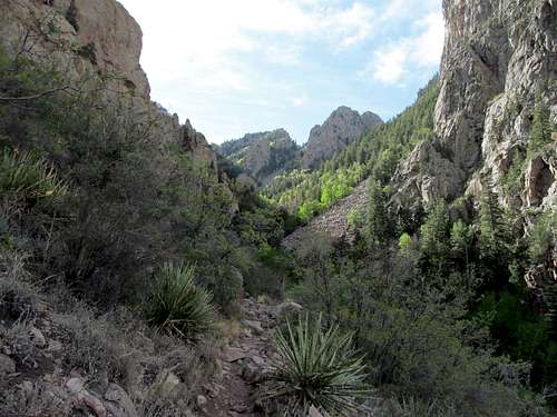
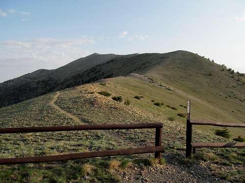
I got less than my preferred eight hours of beauty rest before I was up and early the next morning, delighted to find a Dunkin Donuts between my way and the highway. Adequately fueled by donuts and iced coffee, I drove north and fumbled around asking for directions before eventually finding the parking lot for the La Luz Trail for Sandia Peak, one which was quickly filling up.
Though the peak has a road all the way to the top, I decided to truly immerse myself in the Sandia experience I had to hike its flagship trail, and a few miles in I realized I made the right decision.
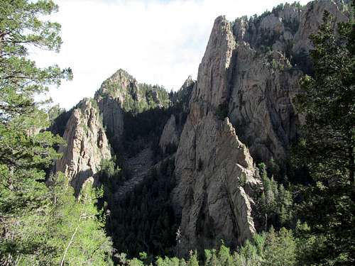
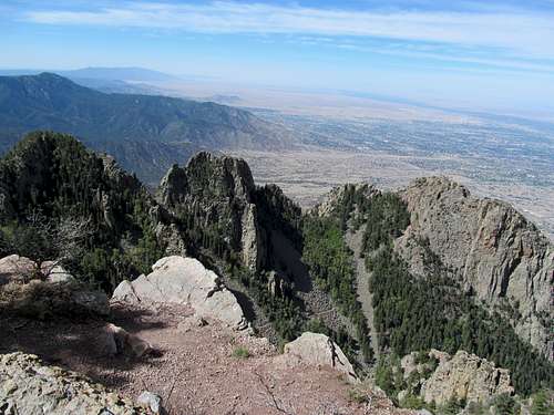
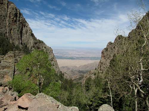
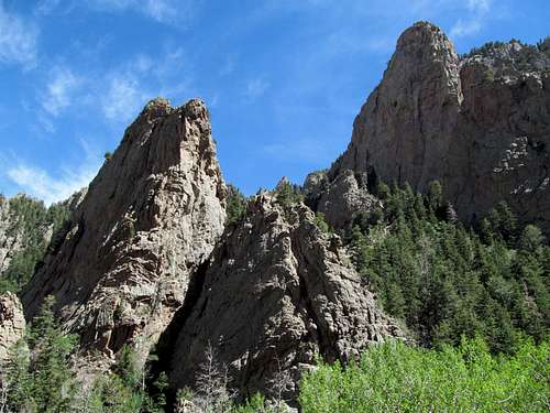
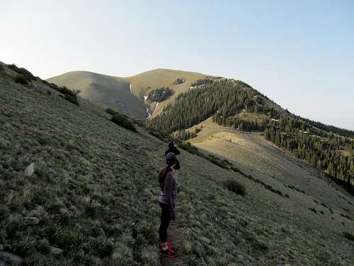
It was nice to do the first few miles in the early morning, shaded from the sun to the east by the massif of the Sandia Range itself. The views really opened up before the halfway point, as endless rock fins, pinnacles, and buttresses surrounded the still pleasant and wide foot highway to the summit.
Further up loomed the summit towards, several cliff bands, and even rows of yellowish trees which I guessed were maybe early season aspens. It was nice and crowded, lots of trail runners and casual hikers, all friendly and happy to be out on such a glorious day (contrast that from SLC, where apart from the few easy trails to one or two popular lakes most paths, despite even closer proximity to the city, are practically deserted by Colorado, and apparently Albuquerquean standards).
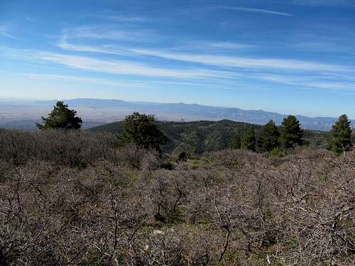
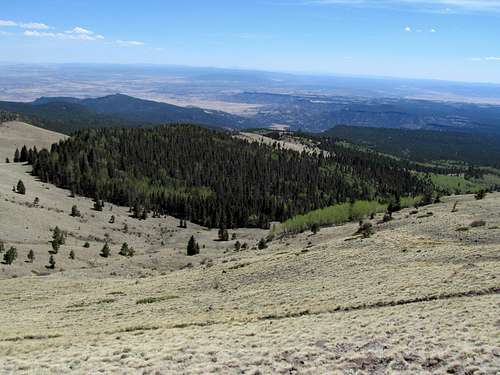
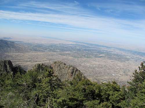
I made it to the anticlimactic summit in two and a half hours. The views south and west were decent, but I walked up and down the road and the nearby hills searching in vain for passable viewpoints to the north and northeast. Alas they were nonexistent, though I wonder if driving the actual summit road would offer up decent views of the Jemez.
I could explore the summit ridge trail further north, but I still had a packed schedule for the day, so after tallying around the summit for longer than I had planned, I made my way down, half running, and half fast walking.
It was interesting to see how the logistics of the mountain's visitors worked. I had the summit (with its visitor's facilities still closed) mostly to myself as the trail runners had long passed my fast-walk pace and, I assume, had trucked down in stowed cars or preplanned rides. On my way down I kept seeing and greeting the more casual dayhikers making their way up the mountain, with friends, families, and puppies. It was pleasant and once more, the friendly vibe of everyone in the Albuquerque area was interesting to note. The descent took less than two hours, though I came away bloodied by slipping and sliding my palm through the rough sandpaper terrain of the lower trail after slipping while trying to run the last few miles back through the now scorching heat. I got bandaids and Neosporin at a nearby gas station, then waded through the strip mall traffic in nearby Bernalillo, stopping to stock up on iced coffees and Starbucks, before saying farewell once more to the civilized world of the city and heading north towards the Jemez.
Jemez to Bandelier
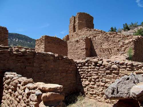
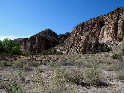
Though the rest of the my visit was to be devoted to the Jemez area, it seemed way too brief as mile after mile I passed by bars, cafes, hot springs, and other attractions that I vowed to come back and check out. I did stop by Jemez State Monument, which featured some old but intact Pueblo ruins and surrounded by the scenic canyon walls lining both sides of the main highway heading into the mountains. After making my contribution to the NM State Park rainy day fund I headed on, past the fascinating Valle Caldera, likely at its lushest time of the year, and through the high passes down to Bandelier National Monument.
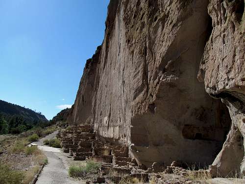
I had hoped to explore this place more, but it was running late in the day (the roads, though scenic, have a very low speed limit, which seems a common theme in the state, and regardless it’s very tough to speed through a very crowded three day weekend), and I only had time to walk the main loop trail from the visitor center. It was still a fascinating experience, bringing you up close and personal to the cliff wall dwellings of the ancient natives.
Pajarito Peak
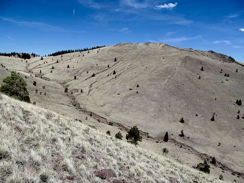
I backtracked and drove through the semi-top secret government roads (nevertheless open to the public) into the town of Los Alamos. I decided on here rather than nearby Espanola for Sunday night as the latter seemed to have somewhat of a reputation for crime and meth. Knowing of its attraction as a historical site dating back to the Manhattan project…I was disappointed to find it a very quiet and subdued, if overpriced, town, with none of the downtown hubbub that I had been hoping for… not quite an Aspen, or even an Albuquerque. First, before town, was one last peak for the day. I drove up the access road to Pajarito Mountain, a ski resort in the winter, and a steep ascent up a wide ski run during the summer. I was as close to sheer exhaustion as I had ever been, what with all the driving, and the peaks the day before, and a long hike/run of Sandia dating from earlier in the day as well. This last thousand feet of Pajarito took every ounce of willpower I had, though the views of Chicoma Mountain to the north made things a little better.
I was dismayed upon reaching the top of the ski run to find that the true summit was still a small downclimb and maybe four hundred feet or ascent away…I grumbled grudgingly these last few hundred feet of torture, but the views near the summit down towards the Valles Caldera, now basking and glowing amid a golden sunset, made it all worthwhile.
(The true summit, as far as I could ascertain sans GPS, as a nondescript spot in the nearby woods).
I finally found a motel in Los Alamos, exhausted as I had ever been, and passed out with no thoughts of flirting with my self imposed curfew.
Chicoma & Cerro Grande - May 27th, 2013
Chicoma Mountain
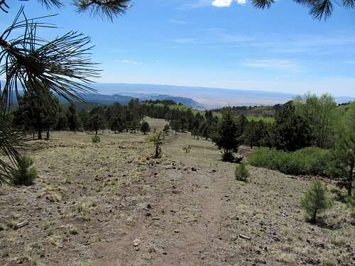
I felt a little more rested the next morning, coffee’d up, and drove north into Espanola, where I was able to find the road leading to Chicoma Mountain without much trouble. The mountain, though light in ascent stats, presented some problems, as I had read several accounts of hikers getting lost in the wooded terrain between the summit and the nearby forest road. I tried my best to commit every bit of imagery from Google Earth of the road respective to the peak to memory, and had even bought a compass the week before to insure against getting lost. With such a wooded mountain, I tried to map my ascent to maximize open areas as well so that I could get as many views in different directions as I could. As a result, I drove past the summit to approach it from the northwest, making my way through open woods and a small cattle pond. I crossed the dirt road that some have followed on their ascents, heading in a generally southeastern direction. There was a low saddle above me, and I figured I’d either reach it first and enjoy the views south, or keep contouring southeast until I crest the southern half of Chicoma’s summit ridge, from which point I could follow the ridge crest up until there was no more up to follow.
It was one of the crispest mornings I had ever experience, the temperature sitting just in that perfect middle ground between chilly and warm, and a clean and fresh feel to the air augmented by the smell of conifers. From my parking spot I ascended a small open drainage past the cattle pond that I remembered from my scouting. I did cross the 4WD road, which doesn’t lead to the summit, and continued past it to reach the edge of the ridge, at an open spot.
Despite the length of the day ahead of me I took a rare breath to take in the moment…to the south were the hills separating me from the obvious bulk of Redondo Volcano, though the Valles was not in view. I passed through open, expansive meadows, then through woods perfectly dense enough to allow a sense of enclosure but sparse enough for me to enjoy the ascent without having to any bushwhacking or log hopping. I did get a little impatient further up in the trees; a flatter stretch after a steep huff gave me the false impression that I was nearing the summit area, but after a few more minutes of gentle walking followed by more uphill I was quickly disabused of the notion. Finally the trees opened up again, and I took my time snapping pictures, and wandering from meadow to meadow until I found my way eventually to a false then the true summit cairn.
From certain angles I spotted Polvadera to the northwest, but in general the views were limited to the southern half of the sky. The Sangres and Rockies further to the northeast were blocked by the trees, but you already get good glimpses of them, from Santa Fe Baldy past the Truchas’s and Wheeler, along the approach road.
I had generally followed my spidey senses on my way up, while occasionally bringing out the compass to make sure my senses weren’t too off. I followed the same methodology on the way down, and actually managed to pop out of the woods right at my car.
Cerro Grande
Then finally, the last peak of the day…a drive back through Los Alamos to Bandelier, where I actually had a pretty tough time trying to find parking spot for Cerro Grande. The trailhead to the highest peak in the Monument is marked, but not obvious as you are driving by. The trail itself was pleasant, through similar woods, and up alongside a drainage before you reach a saddle below the summit. Overall the peak is a joke compared to some of the tougher efforts that awaited me later in the summer, but the weight of the long trip and summits weighed down my legs, and the last few hundred feet, as always, felt like forever.
I bumped into a few other hikers along the well maintained NPS trail, but considering that it was Memorial Day Monday the trail was far from crowded, and the few people I did bump into were none too chatty…perhaps I had overstayed my New Mexico welcome, or maybe the good vibes from the first best three day weekend of the year had worn off.
The day had turned cloudy, with light storm clouds towards the southeast. The views into the Valles were good but somewhat hindered by the trees (still recovering from a massive fire here a couple decades ago I think), and I hopped back down to the car in preparation for the long drive back.
I should have taken the major highways leaving the Jemez, but tried to go cheap in terms of distance, and found to my dismay that the road leading from Valles to the town of Cuba was excruciatingly slow (with an unexpected turn to gravel), though pretty. I measured my pace with Greg’s progress on the way back. He was a few hours ahead of me, as I drove the badlands towards Farmington, near Price by the time I passed Monticello, and so forth. I got home at a reasonable time, before midnight, after an enchanting first visit to the peaks of the Land of Enchantment. Though the relaxing and pleasant yellow pastures and craters were a change of pace from what I was used to, the non-climbing parts of the trip had been pretty hectic and stressful, I was still far from recovered mentally for what lay ahead: another weekend plus of playing tour guide and somewhat being responsible for the enjoyment of my friends as they came to visit me out west.
Ellen & Southern Utah - June 4-5th, 2013
The following weekend I tortured myself with ascents of Black Crook and Box Elder Peaks, which is a story for another day. The reason it bears mention is because part of the reason I stuck around SLC was because another long trip was fast approaching. John and Sara, the former who had climbed Mt. Whitney with me, were flying in from NYC. And moreover, landing Monday night at midnight, so I had to get my shit together before the weekend ended. Box Elder took a lot longer than I had anticipated on Sunday, and I hurried to get all the groceries done in the afternoon so I could get an early bedtime. Then I figured I could get into work early on Monday, leave early, then maybe even get a full eight hours of sleep before getting up at midnight to pick up my friends.
Already running late, I ended up getting a few hours of sleep Monday wrapped around watching the Bruins notch up another win against Pittsburgh in the Conference Finals. I got to the airport on time though, and we went for another late night shopping run at Wal-Mart before departing for places unknown, and very much so for Sara. John I had hiked back east with before, and we had gone on our
Whitney excursion for his bachelor party; Sara had done peaks back east too, Marcy and Mansfield, and they had visited Kings Canyon and Sequoia in the past too, doing some short hikes and camping in the NPS campgrounds. My goal for them was to take them up somewhere very unique, a major mountain, and yet an easy hike. Remote, spectacular, yet gentle, Mt. Ellen in the Henry’s fit my criteria completely, but it would involve us travelling through some of the most remote places in the country, a fact I tried to impart to Sara as we shopped. Our time was limited, which explained our midnight departure. We basically had Tuesday for Ellen, then the rest of the day and maybe half of Wednesday for the National Parks, before we needed to be in Las Vegas for Wednesday night. The overt purpose of the weekend was a bachelor party for a friend, and while we raged Sara planned to fly to Denver on Thursday to visit a friend of hers, but she wanted a night in Vegas to enjoy before the shitshow started.
Mt. Ellen
We drove down through Provo and down Price Canyon in the dark, hitting I-70 and then the roads down towards Hanksville as the sun came up. Though I had warned her, I don’t think Sara quite adequately grasped the concept of the middle of nowhere until dawn hit and she found herself very uneasy in a featureless (and peopleless) desert. The run down shantytown of Hanksville provided no comfort, nor did the bumpy drive towards Bull Creek Pass. I had called the BLM several times to ascertain whether the pass was melted out or not. They weren’t sure, but thought it likely. And while they said either the Notum or Lonesome Beaver approaches were both reasonable, they recommended another alternative: continue down UT-95 past the Henry’s, then approach the peak through the Little Egypt area up to Wickiup Pass, which follows the Lonesome Beaver approach the rest of the way to the pass. Their rationale was quicker progress down the highway and more miles travelled on pavement, and overall their advice was solid. With company in the car I tried to drive slower than I normally did, but the bumps and bruises were inevitable. I knew Sara wasn’t too comfortable with heights (one of the reason I picked the gentle slopes of Ellen), and she was a little nervous along the steeper parts, as well as when the snowbank narrowed the road and made the 4Runner drive that much closer to the precipitous dropoff on the other side in the last few miles before reaching the pass, but we arrived at Bull Creek safely and got on our merry way.
The hike itself was simple and delightful. The trail was great for most of the way up, and the breathtaking views of the Waterpocket Fold to the west were unrelentingly attention grabbing.
Sara, who had worn running shoes after not being able to track down her hiking boots before flying out, found her progress hindered in the last few hundred feet of mild talus before the false summit. Not knowing at the time it was a false summit despite the presence of a larger than life cairn, I nevertheless saw the bumps further to the north and wondered if the true highpoint was further ahead. I decided to check it out, and Sara, who was happy with her progress and didn’t like the prospect of another quarter mile or so of trailess terrain, gave permission for John to join me.
As we made our way up I gave John a sly look:
“Do you think she’s noticed all the spiders on the summit?” There were plenty of small, slight spiders you often find in the nooks and crannies of high elevation talus, and both of us knew that Sara was emphatically not a fan of spiders.
“Nope,” John said, then grinned. “Not yet at least.”
“We’ll hear her when she does see them,” he added further on.
“Victor, Sara’s screaming,” John said as we browsed through the summit register on the true summit. “You run back, make sure she’s alright, and I’ll catch up.”
So I did, sprinting the best I could back to the false summit. John admitted the full story on our way down.
“You should’ve just told me from the beginning there were spiders,” Sara said. I grinned as John cringed.
One final footnote to the hike was that while views west into Capitol Reef, Boulder Mountain, and the Tushars were spectacular, you could barely see more than a few miles east, and my much anticipated views of Canyonlands, the Green and Colorado Rivers, and the Maze were non-existent, blocked by the haze. It made sense; I had read about some pretty bad wildfires that had broken out in New Mexico literally a day or so after I had left there, and now that smoke must have travelled northwest to Utah, where the long line of the Henry’s prevented them from travelling (for now) further west.
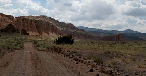
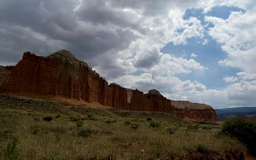
Cathedral Valley
We descended back down to Hanksville, where our options were to check out the touristy area of Capitol Reef, or to first take the 70 mile or so drive into Cathedral Valley. We opted for the latter, but as otherworldly as this side-trip was, the bumpy and rocky roads continued to torture my unfortunate visitors. The sustained nature of the rough roads for pretty much the entire drive was grating severely even on my nerves, much less Sara and John's. Later on at the visitor center we saw a sign about Cathedral Valley and laughed; it recommended visitors take at least a half day or more for the loop drive; we had done it in a couple of hours.
We were all too exhausted to see the rest of Capitol Reef save for the petroglyphs (I had been here before, so I was missing out on less), so we headed into the Best Western in Torrey, where we enjoyed some mediocre Mexican Food, much better ice cream, and a long night’s rest.
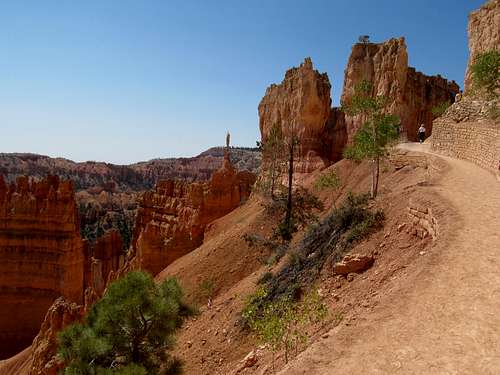
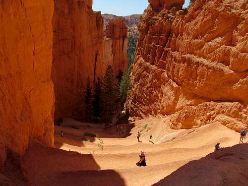
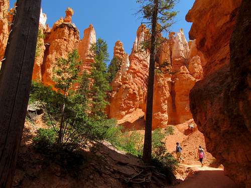
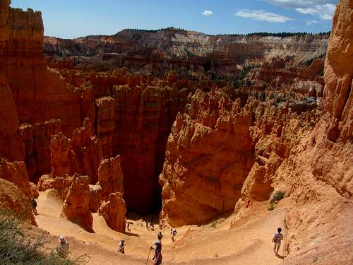
Bryce Canyon Navajo Loop
We stopped at delightful little coffeeshop in town at the junction with UT-12, then took the magical highway that had so entranced me years before towards Bryce Canyon in the early morning, driving past Boulder Mountain, through the gangplank canyons west of Boulder, stopping at the delightful Kiva Coffee House between Boulder and Escalante, and glimpsing in awe at Powell Point before we finally pulled into Bryce. We had time for a quick drive down the park road and back, then a quick hike of the Navajo Loop Trail. It was all new to John and Sara, but exciting for me as well, as after several visits in the past this was my first time journeying down into the “canyon” and walking alongside the famous hoodoos.
The homestretch took us through Zion, though we didn’t stop, partly because of the hassles of having to take the shuttle back into the park from Springdale, and partly because we were in a hurry to make it to Vegas. The Utah interior is beautiful like no other place on Earth, but all of us felt the dearth of civilization singeing our souls as we sped towards check in at the Cosmo for Wednesday night (Sara the most, me next, and probably John the least only because it was all so new to him). The Bruins won again, this time in two overtimes, and the next day Sara flew to Denver. We switched our lodgings to the Venetian/Palazzo for yet another bachelor party of epic proportions. (Our table at the club was right next to Emeril Lagasse and Sammy Hagar’s, the latter liking our group so much he bought us a bottle of his Cabo Wabo rum; no big deal, but know big deal). Just as importantly, the Bruins clinched the Eastern Conference while I was passed out in a daze, recovering the day drinking from the pool so that I’d be ready for the night’s soon-to-be blackout drunk adventures.


Comments
Post a Comment