
-
 5014 Hits
-
 0% Score
-
 2 Votes
|
|
Route |
|---|---|
|
|
39.03280°N / 107.1892°W |
|
|
Hiking, Mountaineering, Skiing |
|
|
Spring, Summer, Fall, Winter |
|
|
Half a day |
|
|
II |
|
|
Approach
Drive Highway 133 from Paonia or Carbondale, Colorado. Turn east onto a well-signed road leading to Marble, Colorado on the north side of McClure Pass. Drive 6 miles to a stop sign in Marble, Colorado. Turn right onto Quarry Road. Drive 2.6 miles and park at the base of Mud Gulch.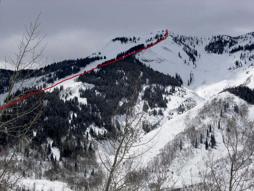
Marble Peak's Northeast Ridge Route
Route Description
Start climbing up Mud Gulch's south side and eventually gain Marble Peak's Northeast Ridge. Staying on Marble Peak's Northeast Ridge is the safest winter route. Marble Peak's East Bowl is a huge avalanche path and thus should be avoided during times of high avalanche danger.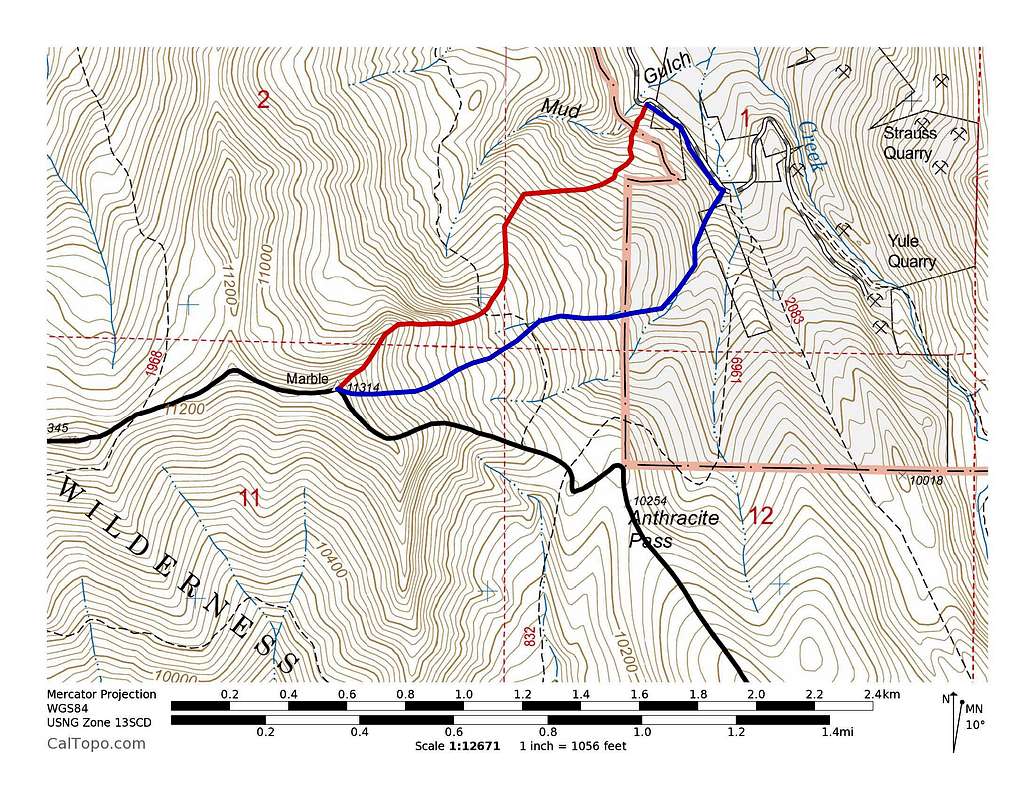
Marble Peak's Routes: Red = Northeast Ridge, Blue = East Bowl. Click to enlarge.
Elevation Gain: ~2,400'
Avalanche Gear/Knowledge (Marble Peak's East Bowl is a huge avalanche path)
Essential Gear
Skis/Snowboard + Skins or Snowshoes (Skis or Snowboard Highly Recommended!)Avalanche Gear/Knowledge (Marble Peak's East Bowl is a huge avalanche path)