


-
 3424 Hits
-
 79.78% Score
-
 11 Votes
|
|
Area/Range |
|---|---|
|
|
45.68370°N / 7.30937°E |
|
|
Hiking, Mountaineering, Trad Climbing |
|
|
Spring, Summer, Fall, Winter |
|
|
5906 ft / 1800 m |
|
|
Note
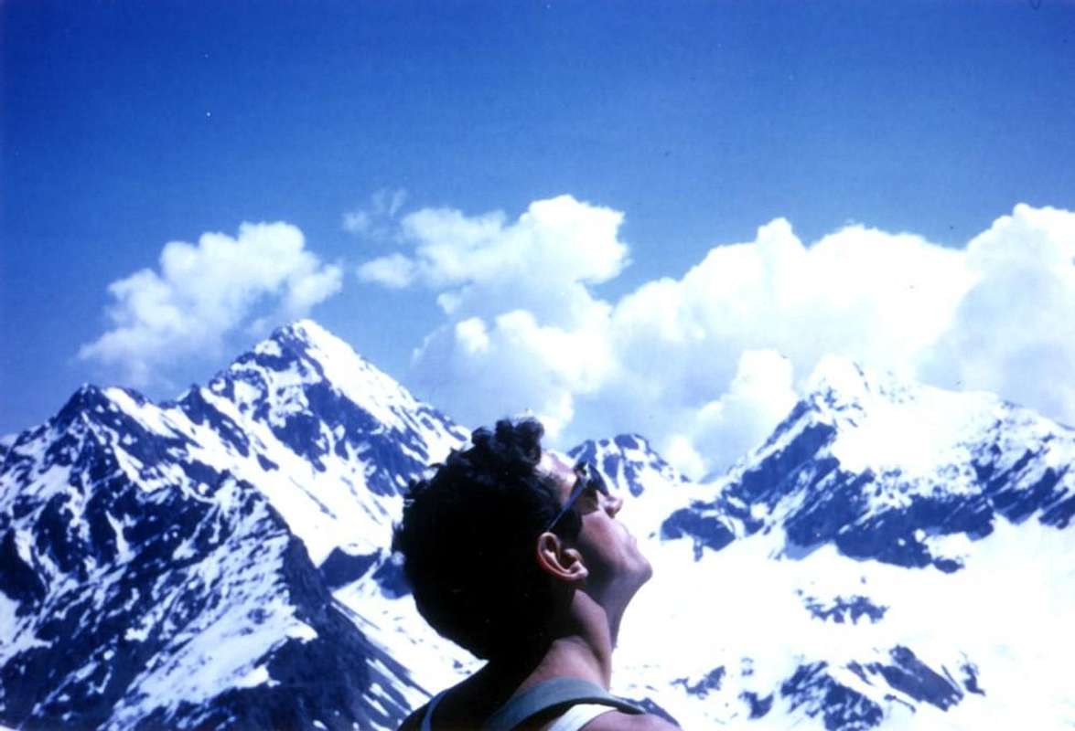
La montagna chiama i suoi figli, ed essi rispondono fedelmente al suo appello… Osvaldo Cardellina, Diario alpinistico, 1964-65 Page texts: @ OsvaldoCardellina "Osva", passed away on May 2, 2022. Page owners: Christian Cardellina e Osvaldo Cardellina. Any updates from September 12, 2022: Antonio Giani, page administrator, friend and climbing companion. Testi della pagina: @ OsvaldoCardellina "Osva", scomparso il 2 maggio 2022. Proprietari pagina: Christian Cardellina e Osvaldo Cardellina. Eventuali aggiornamenti dal 12 settembre 2022: Antonio Giani, amministratore della pagina, amico e compagno di salite. |
Overview
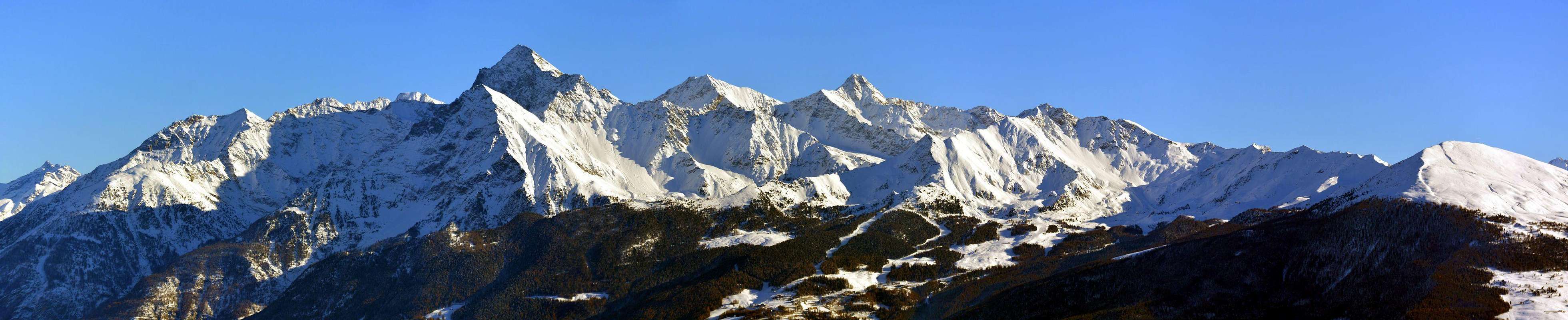
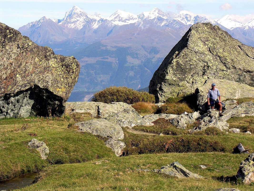
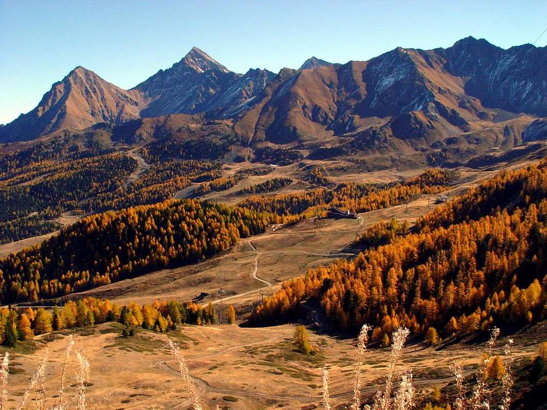
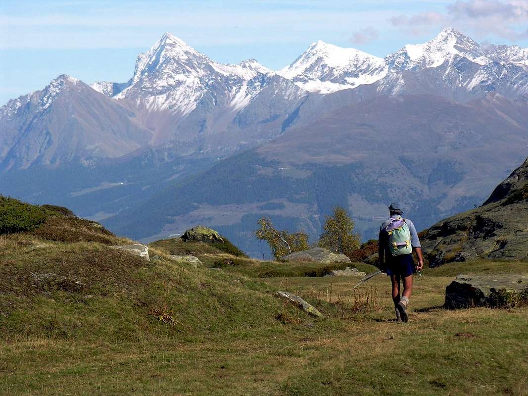
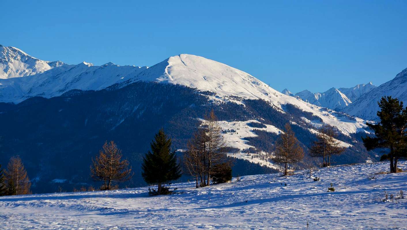
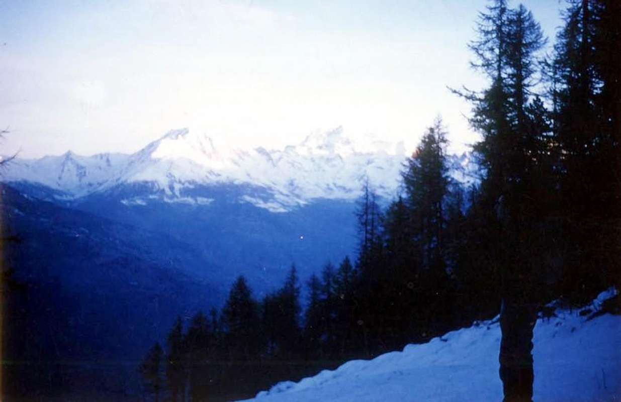
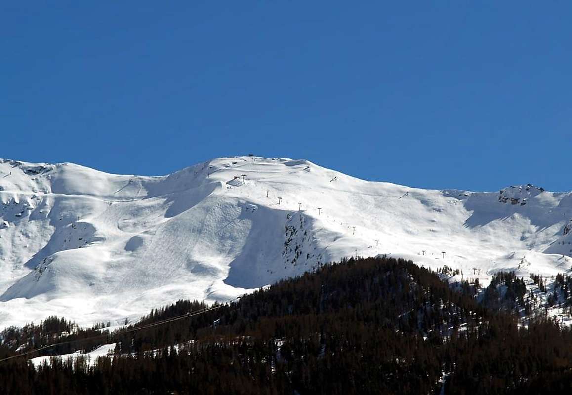
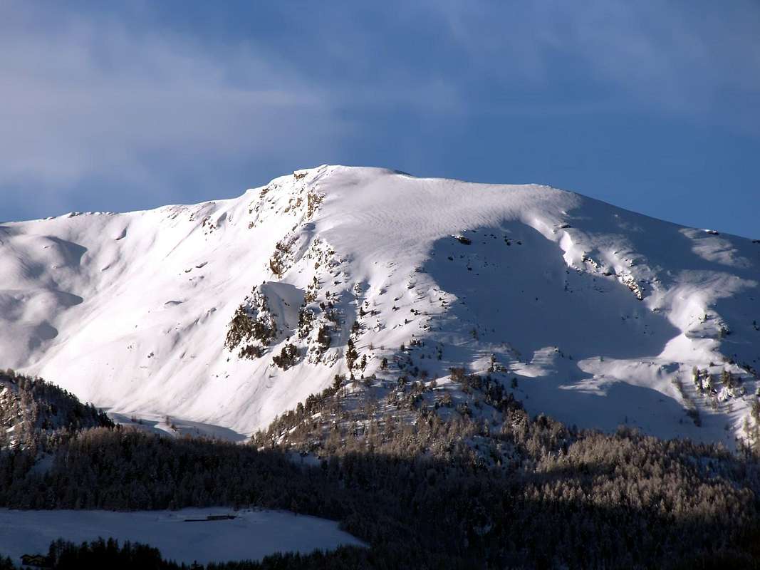
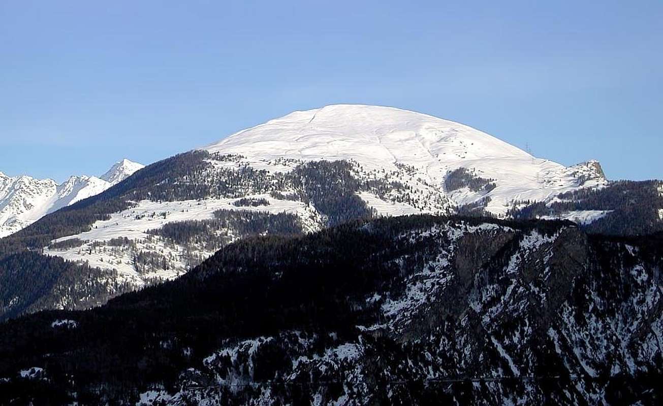
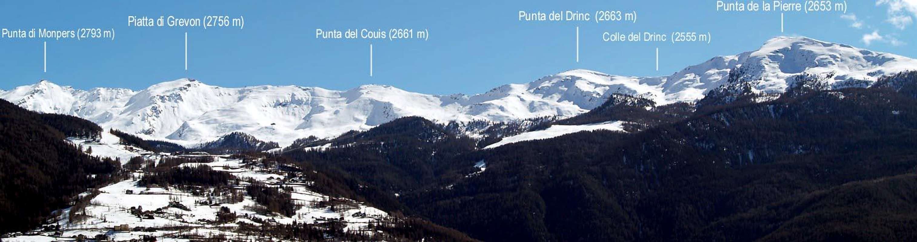
Pila-Resort. This wide basin dominates the City of Aosta and falls in four Municipalities: Charvensod Gressan, Jovençan and Aymavilles. On top of that is made up of the Tip of the Valletta (3.090m), from which depart from the two watersheds that contain it. To the North ridge down to the Mont Bellefaçe, Testa Nera (Black Head), Hill and Costa Chamolé, two Hills and Tip Replan, Signal Sismonda, Glues Plan Fenetre, Tips Ponteilles, Valletta and Dard (2.033m). The second is addressed to the Northwest towards the Col de Tsa Setze, important lines of communication with the Cogne Valley, continuing "wave" with a series of Summit 2.600/50 meters on average: TsaA Setze and Monpers Summits, Piatta (Flat) di Grevon, Couiss, Drink and de la Pierre (2.653 meters). Further than this, and to the West, "expands" another similar area over the Municipalities of Jovençan and Aymavilles, already over the watershed with the next Cogne Valley, reaching the Villages of Ozein and Tourlin Dessus and Dessous; the same, difficult to reach and sparsely visited this valley, it can be logically incorporated in the Basin of Pila, though, topographically speaking, belongs to the same. Vast forests form a large belt Alp Bren to those of Romperein, Champchenille and Borbolet reaching with extensive grassy plains that of La Pierre (2.119m) below the peak of the same name, and just before the Tip Vadaille or Vedaille (2.338m). This small and insignificant Summit, when viewed from the North, instead of projecting on the opposite side and on the Torrent Grand'Eyvia 1.000 meters high wall that looms above the Regional Road to Cogne. Here ends pratically the area that "gravity" Pila Basin and Resort, because farther down those cliffs and walloons wild incumbent on Fractions Epinel Crétaz, now belonging to Cogne Municipality (1.534m), into the valley with the same name. A private dirt road, which in winter becomes a beautiful cross-country ski trails, connecting the Pila Basin with this second area. Leaving the resort Posse-Tennis (1.766m) with path, before flat, then a slight downhill, gradually reaches the Pastures of Alpetta, Fernier, Bren du Milieu (1.642m; up to now no entry for cars. Great on the lookout Emilius) to finish in Grand Pailler, just after the plains of La Prému and in the vicinity of the holiday village of Tourlin Dessus (1.536m; park with a fountain, beautiful views of Mont Blanc and Grand combin). A paved road goes Northwest to the other fraction of Aymavilles or Ozein (1.349/69m), through Dailleux Village. But this is not discipline the particular features of this basin: Pila offers wonderful slopes for downhill skiing that reach up to 2.770 meters at the Piatta of Grevon near the Arno Bivouac (2.660m, dedicated to Simon Faccarello said "Arno" always open and with amazing views of the nearby Grivola), at the Top of the Couìss. This is the White Pila, Green gets me in the summer, as his extensive fields, ranging from the Sanctuary of Saint Grat East (Commune of Charvensod) to those of the Plan de l'Eyvie, Leissé, Grand Grimod, Grimondet and Liautaysaz and the forests from Combatissière, Jardin Public, Plan Bois towards those of Liautaysaz, Champchenille and Cote-Noire always from East to West.
 |
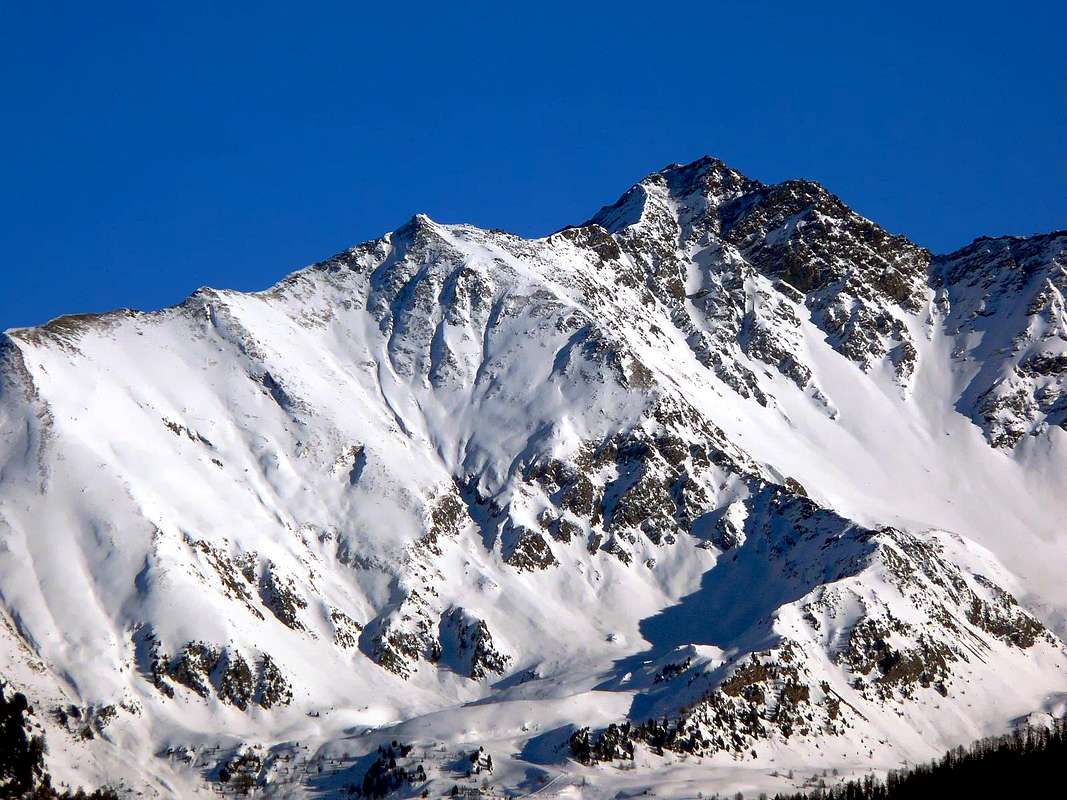
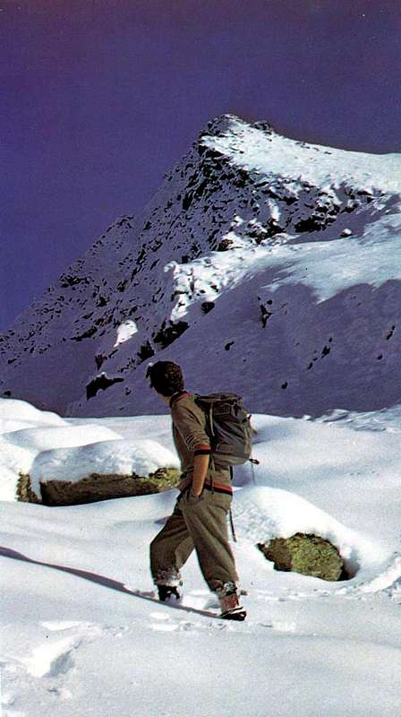
Beautiful walks and wonderful tours, all well marked, are offered to visitors, and there is little room for Mountaineering, except a few small climb on the North face of Testa Nera, above Lake Chamolé (2.325m), at the beginning of the path, bypassing the eponymous Hill (2.641m) leads to the Walloon of Arbolle with his Hut (2.516m). Two "Via Ferrata" are the middle ground between Hiking and Mountaineering and in practice, as the one after the other, are connected to each other: the first called "Panoramic Via", starting from Punta de la Pierre reaches the Tsa Sètze Hill (2.815m). The second, starting from this salt as "Via Ferrata" through the Ridge Southwest of Punta della Valletta, the highest point of this whole area. To play instead the practice of climbing to the Becca di Nona (3.142m) and Monte Emilius (3.559m) need to "migrate" in the adjacent Walloons of Comboé Arbolle: Pila becomes the "key step" to achieve these two hilltop. In addition to Pila a dozen years held international competitions (including the World Cup Downhill) descent with Mountain Bikes. Finally do not forget the trips by Snowshoes, which offer a diverse range of proposals, ranging from simple Walks to the medium and long term Excursions with different ratios of difficulty. More visits Historical-Cultural-Religious, to be made to the Hermitage San Grato and the many small votive chapels exist in the area.
Pila-Resort. Quest'ampia conca domina la Città di Aosta ed incombe su quattro Comuni: Charvensod, Gressan, Jovençan ed Aymavilles. Il vertice della medesima é costituito dalla Punta della Valletta (3.090 m), dalla quale si dipartono i due spartiacque contenenti la medesima. Verso Nord una cresta scende al Mont Bellefaçe, alla Testa Nera, Colle e Costa di Chamolé, Colli e Punta di Replan, Signal Sismonda, Colle Plan Fenetre, Punte di Ponteilles, Valletta e del Dard (2.033 m). La seconda s'indirizza a Nordovest verso il Colle di Tsa Setze, importante vie di comunicazione con la Valle di Cogne, per poi proseguire "ondulata" con una serie di Sommità mediamente sui 2.600/50 metri: Punta di Tsa Setze, Punta di Monpers, Piatta di Grevon, Punte del Couiss, del Drink e de la Pierre (2.653 m). Più in là di questa, e verso Occidente, s'"espande" un altra area similare sopra i Comuni di Jovençan ed Aymavilles, ormai già oltre lo spartiacque con la successiva Valle di Cogne, che raggiunge le Frazioni di Ozein e Tourlin Dessous e Dessus. La stessa, difficilmente raggiungibile e scarsamente frequentata da questa valle, può essere logicamente conglobata nella Conca di Pila, anche se, topograficamente parlando, non appiartiene alla medesima. Vaste foreste formano una grande cintura dall'Alpe di Bren verso quelle di Romperein, Champchenille e Borbolet raggiungendo con estesi pianori prativi quella di La Pierre (2.119 m) al di sotto dell'omonima punta ed appena prima della Punta Vadaille o Vedaille (2.338 m). Questa piccola ed insignificante Sommità, se vista da Settentrione, proietta invece sul lato opposto e sopra il Torrent Grand'Eyvia un'alta parete di 1.000 m incombente sopra della Strada Regionale per Cogne. Qui in pratica termina il comprensorio che "gravita" sull'Area di Pila, poiché più in là scendono quei dirupi e valloni selvaggi che incobono sulle Frazioni d'Epinel e Crétaz, ormai appartenenti a Cogne. Una strada poderale, che in inverno diventa una bella pista per lo sci di fondo, connette il Bacino di Pila con questa seconda area. Partendo dalla località Posse-Tennis (1.766 m) con percorso, dappima in piano e poi il lieve discesa, raggiunge progressivamente gli Alpeggi di Alpetta, Fernier, Bren du Milieu (1.642 m; fino a qui divieto di transito per le auto. Splendido belvedere sullo Emilius) per terminare a Grand Pailler, subito dopo le praterie di La Prému e nelle vicinanze de Villaggio turistico di Tourlin Dessus (1.536 m; parcheggio con fontana; belle vedute su Monte Bianco e Gran combin). Una strada asfaltata scende a Nordovest verso l'altra Frazione di Aymavilles o Ozein (1.349/69 m), passando per Dailleux. Ma non é questa disciplina la peculiarietà di questo bacino: Pila offre splendide piste per lo sci di discesa che raggiungono anche i 2.770 metri presso la Piatta di Grevon con il vicino Bivacco Arno (2.660 m, dedicato a Simone Faccarello detto "Arno"; sempre aperto e con incredibili viste sulla vicina Grivola), presso la Punta del Couìss. Questa é la Pila Bianca, me in estate diventa Verde, come i suoi estesi prati, che vanno dal Santuario di San Grato ad Est (Comune di Charvensod) fino a quelli del Plan de l'Eyvie, Leissé, Grand Grimod, Grimondet e Liautaysaz, e le foreste da quella di Combatissière, Jardin Public, Plan Bois a quelle di Liautaysaz, Champchenille e Cote-Noire, sempre da Est ad Ovest.
 |
Belle passeggiate e splendide e varie escursioni, tutte ben segnalate, si offrono ai visitatori, mentre per l'Alpinismo esiste poco spazio, se non qualche piccola salita sulla Parete Nord della Testa Nera, sopra il Lago di Chamolé (2.325 m), allo inizio del sentiero che, scavalcando l'omonimo colle (2.641 m) conduce nel Vallone di Arbolle con il suo Rifugio (2.516 m). Due "Vie Ferrate" costituiscono la via di mezzo tra lo Escursionismo e lo Alpinismo ed in pratica, essendo l'una successiva all'altra, sono collegate tra di loro: la prima detta "Via Panoramica", partendo dalla Punta de la Pierre raggiunge il Col Tsa Sètze (2.815 m). La seconda, partendo da questo, sale come "Via Ferrata" lungo la Cresta Sudovest della Punta della Valletta, massima elevazione di tutta questa zona. Per svolgere invece la pratica dello alpinismo verso la Becca di Nona (3.142 m) ed il Monte Emilius (3.559 m) bisogna "emigrare" negli attigui Valloni di Comboé ed Arbolle: Pila diventa il "passaggio chiave" per raggiungere queste due Sommità. Inoltre a Pila da una decina di anni si svolgono gare internazionali di discesa con le Mountain Bikes Infine da non dimenticare le escursioni tramite Racchette da neve, tali da offrir una serie variegata di proposte, andanti dalla semplice Passeggiata all'Escursione di medio e lungo termine con diversi quozienti di difficoltà. Più le visite Storico-Culturali-Religiose.
WALKS 1) - Hermitage of San Grato (1.787m) Walk 0h'45/1h'00; Tourist.
SKI-MOUNTAINEERING 1) - Pila-Perchu Dessus/Chamolé Alp/Plan Fenetre Hill/Comboé Alpages/Plan Valé/Grand Scez/Federigo Bivouac at Carrel Hill/Becca di Nona by S Slope and E-SE Crest (1.865m, 2.152m, 2.114m, 2.379m, 2.526m, 2.907m, 3.142m) Ascent of 4h'00/4h'30; OSA.
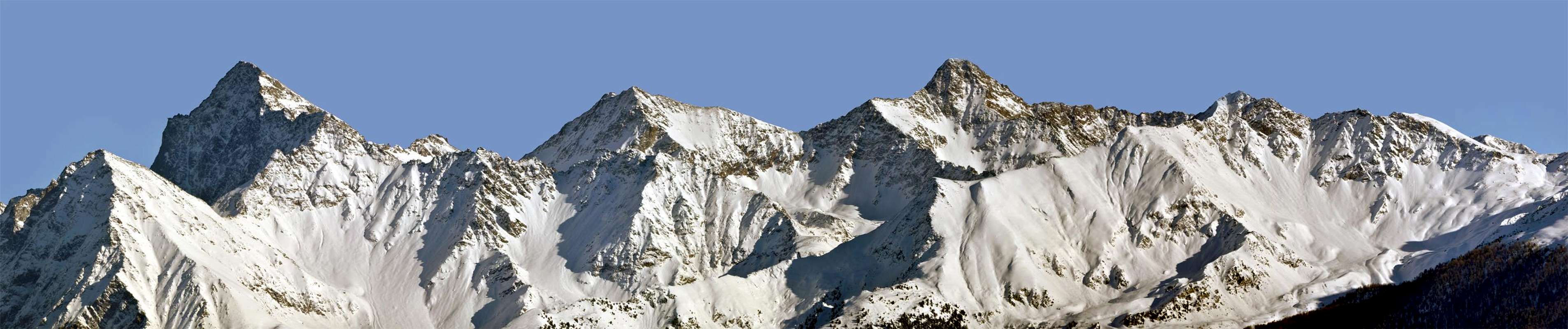
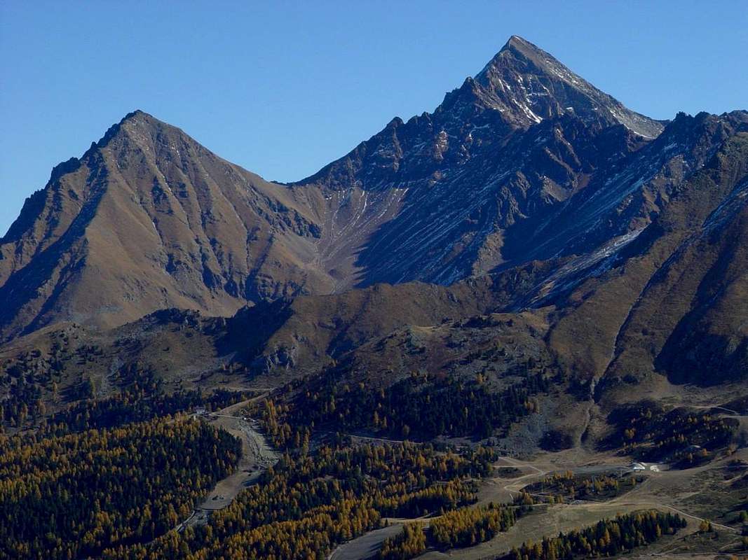
SUMMITS Succession from Punta della Valletta to Punta del Dard on Northern Watershed PUNTA della VALLETTA (3.090m) - Mont Bellefaçe (2.970m) - Testa Nera (2.820m) - Costa di Chamolé (2.580m) - Punta di Replan (2.457m) - Signal Sismonda (2.356m) - Punta di Ponteilles (2.263m) - Punta Valletta (2.146m) - Punta del Dard (2.033m).
PUNTA della VALLETTA (3.090m) - Great Shoulder (3.002m) - Punta di Tsa Sètze (2.824m) - Punta di Monpers (2.793m) - Piatta di Grevon (2.752m) - Punta del Couìss (2.661m) - Punta del Drinc or Drink (2.663m) - Punta de la Pierre (2.653m).
PASSEGGIATE 1) - Santuario di San Grato (1.787 m) Passeggiata di 0h'45/1h'00; Turistico.
1) - Comboé/Plan Valé/Grand Scez/Becca di Nona per il Versante S-SO (2.114 m, 2.379 m, 2.526 m, 3.142 m) Ascensione di 3h'45/4h'15; E/F.
SCI-ALPINISMO 1) - Pila-Perchu Dessus/Alpe di Chamolé/Colle Plan Fenetre/Comboé Alpages/Plan Valé/Grand Scez/Bivacco Federigo al Colle Carrel/Becca di Nona tramite Versante S e Cresta E-SE (1.865 m, 2.152 m, 2.114 m, 2.379 m, 2.526 m, 2.907 m, 3.142 m) Salita di 5h'00/5h'30; OSA.
Getting There
BY CAR:
- From TORINO, MILANO, etc: Motorway A5. Exit at IVREA or Quincinetto (PIEDMONT)
- From IVREA Town: Charvensod, Gressan, Jovençan, Aymavilles Municipalities.
- From Charvensod to Dard-Comboé-Arbolle Walloons towards Ponteilles (1.697m) Alp & Waterfall, through dirt road, Comboé Alp & Saint Ours private Shelter (2.114m), through dirt road, and Arbolle Refuge (2.516m), nearby Lakes (2.495m, 2.497m), by Chair Lift to Chamolé Station (2.309m), Lake (2.325m) and muletrack. From Charvensod (main road from Pont Suaz 567m) or Gressan (603m; alternative road) to Tivet, Les Fleurs Hamlets (1.292m, 1.414m) Pila Basin and Resort (low parking nearby Cableway 1.800m; upper parking 1.850m). Arno Shelter (2.660m), always open but unguarded, nearby Couiss Summit on watershed Pila/Cogne Valley. From Jovençan (631m) to Western Pila Conca, exclusively through path-muletrack to Tourlin Dessous (1.466m) and by dirt road to Pila-Posse Tennis (1.776m). From Aymavilles (646m) to Western Pila Conca, through Main Road to Cogne Valley, alternative road to Ozein/Turlin Dessus Hamlets and dirt road to Pila-Posse.
- From FRANCE: through the Mont Blanc Tunnel to Entrèves-crossroads to Vény/Ferret Valleys - Mountain Guides of Courmayeur - La Saxe Rock Gym - Courmayeur. By Little Saint Bernard Pass, closed since November until half May to La Thuile Valley - Pré Saint Didier - Courmayeur. It is not necessary to take Motorway A5: you can drive on SS.26, in the direction of AOSTA - IVREA - TURIN.
BY PLANE:
- Aeroporto "Corrado Gex" Saint Christophe (Aosta).
The Mountains and other things from the foundation of Rome
The mountains can be divided into two distinct groups: those located on the orographic right side or on the Northern Watershed with the Walloons of Arbolle-Comboé-Dard and those on the opposite or Northwest, for separating the Basin Pila from the Valley of Cogne in its initial part by the Municipality of Aymavilles reach the Hamlet/Fraction of Vieyes (1.132m). In both cases, present their point of origin located on the Top of Valletta (3.090m), the last important elevation in the long part that comes from the Monte Emilius and Pic Garin (3.451m). It is "small mountains" that do not have any claim but can offer a number of fun rides, beautiful Hiking, Ski-Mountaineering (more limited in number) or with Snowshoeing. Or maybe, to its Western end, an interesting and brief visit to the Roman Aqueduct Pondel (873m), with bridge 50 meters long and suspended on Grand'Eyvia Torrent; the same was built in 750 "Ab Urbe Condita" (from Rome foundation), which in the III° Century BC by the Roman Patricians Aimus and Avilius (hence it seems that the name derives Aymavilles). The bridge that allows crossing the Dora Baltea, heading to the Basin Pila is located just South of the Town of Aosta, near the Fraction Charvensod of Pont Suaz (567m). The same is certainly built before the foundation by the Romans, who called the Bourg as Augusta Praetoria Salassorum in the year 25 BC (two beautiful bronze statues dedicated to Julius Caesar and Gaius Octavian Caesar Augustus remember him entrance of the gate of the Southern Walls that surround the City). Surely, however, already existed beforehand because it was the only chance for the Salassians People to go from "Adret" to "Envers", ie from the North or the Village of "Cordelia" the hill to the South towards the Communes of Polleno (Pollein) Calvetianus (Charvensod), Gratianus (Gressan) and Joventianus (Jovençan) and the overlying pastures of Pila. in fact, until the seventies this was the only bridge in existence between Quart (Quartum Milium ad Urbem) and Aymavilles, that is more than 14 Kilometres. The current stone bridge was built in 1860 thanks to the involvement by the Canon of Saint Ours, Scientist Naturalist and even Mountaineer Georges Carrel (* 21 November 1800 Châtillon + Aosta 23 May 1870). Renovated and expanded in 1982, had resisted all the Centuries floods that frequently (every 50 years) had hard-hit the Aosta Valley (the last in 1957 and 2000, but we also remember that of 1908, which had swept away all the bridges of the Valley to the Ivrea, for collapse Lake Rutor La Thuile). But the most important is their prerogative that all are quite and offer panoramic views at 240/250° in the Aosta Valley, and also, last but not indifferent, presents ideas without particular difficulties or dangers are within everyone's reach. Or almost ... To that end we want to provide a small list of walking, hiking, climbing, trips Ski-Mountaineering or Snowshoeing recommended always from East to West:
 |
 |
 |
2) - Plan Fenetre Hill/Comboé Alp (2.229m, 2.114m) Walk 1h'30/1h'45; T.
3) - Chair lift Station/Col de Chamolè/Arbolle Shelter (2.311 m, 2.641m, 2.516m) Walk of 1h'30/1h'45; T.
4) - Fork Bois (Wood) de Lap/Lac de Leissé (2.076m, 2.114m) Walk 1h'45/2h'15; T.
5) - Gorraz parking/Grivel Alp/Liautaysaz Alp/Grimondet Pasture (1.850 m, 1.910 m, 2.077 m, 2.105 m) Walk of 2h'15/2h'30; T.
6) - Hamlet Turlin Dessus-Grand Pailler/Alp Bren du Milieu (1.530 m, 1.642 m) Walk of 0h'45/1h'00; T.
1) - Alp Chamolè/Col Plan Fenetre/Replan North Pass/Lake Chamolé (2.152m, 2.229m, 2.356m, 2.366m, 2.325m) Excursion-crossing on watershed of 2h'15/2h'30; Hiking.
EXCURSIONS
2) - Chanté old Alpage/Chamolé Pasture/Lake Chamolè (2.114m, 2.152m, 2.325m) Excursion 1h'20/1h'30; H.
3) - Chair lift Station/Col de Chamolè/Arbolle Shelter/Lake Gelato (2.311m, 2.641m, 2.516m, 2.957m,) Excursion of 3h'00/3h'30; H.
4) - Plan de l'Alpe Eyvie/Col Tsa Setze (2.253m, 2.815m) Excursion 3h'00/3h'30; H.
5) - Punta del Drinc (2.555m, 2.663m) Excursion of 2h'45/3h'15; H.
6) - Punta de la Pierre/Tsa Setze Hill (2.653m, 2.815m) Excursion with traverse of 4h'30/5h'30; EE (Expert Hikers).
1) - Comboé/Plan Valé/Grand Scez/Becca di Nona through S-SW Slope (2.114m, 2.379m, 2.526m, 3.142m) Ascent of 3h'45/4h'15; E/F.
ASCENTS
2) - Plan Valé/Grand Scez/Federigo Bivouac at Carrel Hill/Becca di Nona by E-SE Crest (2.379m, 2.526m, 2.907m, 3.142m) Ascent of 4h'00/4h'30; E/F.
3) - Pila/Comboé Alpages/Bivouac Federigo Zullo/Mont Ròss de Comboè/Little Emilius/Monte Emilius through W-NW ridge or "Via Ferrata"(1.800m, 2.114m, 2.907m, 3.301m, 3.342m, 3.559m) Ascent of 8h'00/9h'00 from Pila; 3h'45/4h'15 from bivouac; EE/A/ from PD- to PD+, with sports.
4) - Upper Chair lift Station/Chamolè Hill/Arbolle Refuge/Lac Gelè/Trois Capucins Pass/Monte Emilius through S-SE Crest or Normal Route (2.311m, 2.641m, 2.516m, 2.957m, 3.242m, 3.559m) Ascent of 5h'30/6h'00; EE/F+.
5) - Upper Station/Chamolé Hill/Arbolle Refuge/Lake Gelato/Arbolle Pass/Punta Rossa dell'Emilius through NE Crest with crossing on three Summits (2.311m, 2.641m, 2.516m, 2.957m, 3.154m, 3.400m-about 3.395 meters-3.401m) Climbing of 270/80 meters in 5h'00/5h'30; A/PD/PD-.
6) - Chair lift Upper Station/Chamolé Hill/Arbolle Refuge/Garin Hill and Lake/Mont Valaisan/Pic Garin through NW ridge and N Edge (2.311m, 2.641m, 2.516m, 2.815m, , 2.854m, 3.307m, 3.451m) Climbing of 450/70 meters in 5h'00/5h'30; A/F+/PD-/PD.
7) - Upper Chair lift Station/Chamolè Hill/Testa Nera/Mont Bellefaçe/Punta della Valletta/Punta di Pian Bessey through NE Crest and traverse (2.311m, 2.641m, 2.820m, 2.970m, 3.090m, 3.085m) Ascent of 2h'30/3h'00; EE/F.
8) - Chair lift Station/Testa Nera (2.820m) through North Face (various routes) or Northwest Crest Climbing of 250/300 meters in 1h'30/2h'00; A/PD+.
 |
 |
 |
2) - Upper Station/Testa Nera/Mont Bellefaçe/Punta della Valletta through the "Via degli Alpini" (2.311m, 2.820m, 2.970m, 3.090m) Ascent of 3h'30/4h'30; OSA.
3) - Pila-Gorraz parking/Plan Perdu/Restaurant La Chateleine/Alp La Pera/ Alp La Nouva/Plan de l'Eyvie Upper Pastures/Col Tsa Setze (1.850m, 2.000m, 2.102m, 2.149m, 2.170m, 2.253m, 2.815m) Ascent of 4h'15/4h'45; BSA.
4) - Pila-Gorraz parking/Chaléchemoz Pasture/Champ Vert Pasture/Lake and Alp Leissé/Leissé Damon or Upper Alpage/Superior Station Cableway Gorraz/Platta-de-Grevon (1.850m, 2.031m, 2.171m, 2.114m, 2.126m , 2.163m, 2.357m, 2.701m) Ascent 3h'45/4h'15; BSA.
5) - Ozein-Dailleux mini parking/Titeun Pasture/Rompérein Pasture/Champchenille Higher Alp/Punta de la Pierre or "La Pera" through Northwestern Slope (1.476m, 1.760m, 1.867m, 2.212m, 2.653m) Salita di 3h'45/4h'15; BSA.
1) - Pila lower parking/San Grato Hermitage/Saint Grat Pasture/Chamolé Pasture/ruined old Alp of Chanté/Perchu Dessus Pasture/Pila-Resort "Round Tour" (1.800m, 1.787m, 1.825m, 2.152m, 2.114m, 1.865m, 1.800m) Walk-Excursion of 0h'45/1h'00; F (easy).
SNOWSHOES
2) - Pila-Gorraz Upper parking/Unnamed Alp of Gorraz Damon/Bois de Chanté/Chamolé Lake (1.850m, about 1.890 meters, 2.325m) Excursion of 1h'45/2h'00; F+.
3) - Gorraz Upper parking/Chalechèmoz Pasture/Lap Pasture/fork 2.112 meters into Bois de Lap/Grand Grimod Dessous/Col de la Pierre/Punta de la Pierre through Northeast Slope and South-southeast Crest (1.850m, 2.031m, 2.076m, 2.112m, 2.158m, 2.584m, 2.653m) Excursion of 3h'45/4h'15; PD+.
4) - Turlin Dessus-Grand Pailler/Bren du Milieu Pasture/Alpettaz Pasture/ Fernier Alp/Pila-Posse (1.530m, 1.642m, 1.713m, 1.773m, 1.776m) Walk of 1h'45/2h'15; T.
5) - Ozein-Belley Hamlet/alternative Torrent Pépin/La Ruì Pasture/fork Torrent Borbolet/Borbolet Viou Pasture/Alpages of la Pierre/Saddle 2303 metres/Punta Vadaille (1.369m, 1.706m, 1.923m, 1.956m, 2.072m, 2.077-2.119m, 2.303m, 2.338m) Excursion of 4h'15/5h'00; PD-.
 |
SUMMITS Succession from Punta della Valletta to Punta de la Pierre on Northwestern Watershed
 |
 |
 |
Le montagne si possono dividere in due distinti gruppi: quelle posizionate sul lato orografico destro o Settentrionale sullo spartiacque con i Valloni di Arbolle-Comboé-Dard e quelle sull'opposto o Nordovest, atto a separare la Conca di Pila dalla Valle di Cogne nella sua parte iniziale che dal Comune di Aymavilles raggiunge la Frazione di Vieyes (1.132 m). In entrambi i casi il punto di origine é situato sulla Punta della Valletta (3.090 m), ultima elevazione importante nel lungo divisorio proveniente dal Monte Emilius e dal Pic Garin (3.451 m). Si tratta di "piccole montagne" che non han pretesa alcuna ma che possono offrire tutta una serie di divertenti passeggiate, belle escursioni, gite di Sci-Alpinismo (più limitate nel numero) o con le Racchette da neve. Oppure magari, alla sua estremità Occidentale, una interessante e breve visita all'Acquedotto Romano di Pondel (873 m), con ponte lungo 50 metri e sospeso sulla Grand'Eyvia; lo stesso é stato costruito nel 750 "ab Urbe Condita", ovvero nel III° Secolo avanti Cristo ad opera dei Patrizi Romani Aimus ed Avilius (donde sembra che ne derivi il toponimo di Aymavilles). Il ponte che permette, oltrepassando la Dora Baltea, di dirigersi verso la Conca di Pila é situato appena a Sud della Città di Aosta, presso la Frazione di Charvensod del Pont Suaz (567 m). Lo stesso é sicuramente anteriore alla fondazione della stessa da parte dei Romani che la battezzarono Augusta Praetoria Salassorum nell'anno 25 Avanti Cristo (due belle statue in bronzo dedicate a Giulio Cesare ed a Caio Ottaviano Cesare Augusto lo ricordano all'ingresso della porta Meridionale delle Mura cingenti la Cittànonché un Arco di Trionfo all'ingresso Orientale). Sicuramente però esisteva già in antecedenza poiché costituiva l'unica possibilità per il Popolo dei Salassi di recarsi dall'"Adret" all'"Envers", cioé da Nord dal Borgo di "Cordelia" alla collina a Sud verso le località di Polleno (Pollein), Calvetianus (Charvensod), Gratianus (Gressan) e Joventianus (Jovençan) ed i soprastanti pascoli di Pila. Infatti questo fino agli anni settanta era l'unico ponte in esistenza tra Quart (Quartum Milium ad Urbem) ed Aymavilles, cioè per oltre 14 Kilometri. Il ponte in pietra attuale é stato costruito nel 1860 anche grazie all'interessamento promozionale da parte del Canonico di Sant'orso, Scienziato Naturalista nonchè Alpinista Georges Carrel (* 21 novembre 1800 Châtillon + Aosta 23 Maggio 1870). Ristrutturato ed allargato nel 1982, aveva resistito a tutte le Alluvioni che nei Secoli frequentemente (ogni circa 50 anni) avevan sì duramente colpito la Val d'Aosta (le ultime nel 1957 e nel 2000, ma ricordiamo anche quella del 1908, che aveva spazzato via tutti i ponti della Valle fino alla Città d'Ivrea per il cedimento del Lago del Rutor a La Thuile). Ma la loro prerogativa più importante consiste nel fatto che tutte sono alquanto panoramiche ed offrono viste a 240/250° sulla Valle di Aosta ed inoltre, fattore non indifferente, presentano itinerari senza particolari difficoltà o pericoli sono alla portata di tutti. O quasi ... All'uopo vogliam fornire un elenco di passeggiate, escursioni, ascensioni, gite di Sci-Alpinismo o con Racchette da neve consigliate sempre da Est ad Ovest:
|
|
 |
 |
2) - Colle Plan Fenetre/Alpeggio del Comboè (2.229 m, 2.114 m) Passeggiata di 1h'30/1h'45; T.
3) - Stazione Superiore della Seggiovia/Col de Chamolè/Rifugio di Arbolle (2.311 m, 2.641 m, 2.516 m) Psseggiata di 1h'30/1h'45; T.
4) - Bivio Bois de Lap/Lac de Leissé (2.076 m, 2.114 m) Passeggiata di 1h'45/2h'15; T.
5) - Pila-Gorraz parcheggio/Alpe Grivel/Alpe di Liautaysaz/Alpeggio del Grimondet (1.850 m, 1.910 m, 2.077 m, 2.105 m) Passeggiata di 2h'15/2h'30; T.
6) - Villaggio di Turlin Dessus-Grand Pailler/Alpe Bren du Milieu (1.530 m, 1.642 m) Passeggiata di 0h'45/1h'00; T.
1) - Alpe di Chamolè/Colle Plan Fenetre/Signal Sismonda/Colle di Replan Nord/Lago di Chamolé (2.152 m, 2.229 m, 2.356 m, 2.366 m, 2.325 m) Escursione di 2h'15/2h'30; Escursionistico.
ESCURSIONI
2) - Alpe di Chanté/Alpe di Chamolé/Lago di Chamolè (2.114 m, 2.152 m, 2.325 m) Escursione di 1h'20/1h'30; E.
3) - Stazione Superiore della Seggiovia/Col de Chamolè/Rifugio di Arbolle/Lago Gelato (2.311 m, 2.641 m, 2.516m, 2.957 m,) Escursione di 3h'00/3h'30; E.
4) - Alpe Plan de l'Eyvie/Col Tsa Setze (2.253 m, 2.815 m) Escursione di 3h'00/3h'30; E.
5) - Punta del Drinc (2.555 m, 2.663 m) Escursione di 2h'45/3h'15; E.
6) - Punta de la Pierre/Tsa Setze (2.653 m, 2.815 m) Escursione con traversata di 4h'30/5h'30; EE (Escursionisti Esperti).
ASCENSIONI
2) - Plan Valé/Grand Scez/Bivacco Federigo al Colle Carrel/Becca di Nona per la Cresta E-SE (2.379 m, 2.526 m, 2.907 m, 3.142 m) Ascensione di 4h'00/4h'30; E/F.
3) - Pila-Comboè/Bivacco Federigo/Mont Ròss de Comboè/Piccolo Emilius/Monte Emilius per la Cresta O-NO o "Via Ferrata"(1.800 m, 2.114 m, 2.907 m, 3.301 m, 3.342 m, 3.559 m) Ascensione di 8h'00/9h'00 da Pila; 3h'45/4h'15 dal bivacco; EE/A/ da PD- a PD+, con attrezzatura.
4) - Stazione della Seggiovia/Colle di Chamolè/Rifugio di Arbolle/Lago Gelato/Passo dei Tre Cappuccini Pass/Monte Emilius tramite la Cresta S-SE o Via Normale (2.311 m, 2.641 m, 2.516 m, 2.957 m, 3.242 m, 3.559 m) Ascensione di 5h'30/6h'00; EE/F+.
5) - Stazione Superiore/Colle di Chamolé/Rifugio di Arbolle/Lago Gelato/Colle di Arbolle/Punta Rossa dell'Emilius tramite la Cresta NE (2.311 m, 2.641 m, 2.516, 2.957 m, 3.154 m, 3.400 m, 3.395 metri circa-3.401 m) Arrampicata di 270/80 metri con traversata delle tre Sommità in 5h'00/5h'30; A/PD/PD-.
6) - Stazione Superiore/Colle di Chamolé/Rifugio di Arbolle/Col Garin e Lago/Mont Valaisan/Pic Garin tramite Cresta NW e Spigolo N (2.311 m, 2.641 m, 2.516 m, 2.815-2.854 m, 3.307 m, 3.451 m) Arrampicata di 450/70 metri in 5h'00/5h'30; A/F+/PD-/PD.
7) - Stazione della Seggiovia/Colle di Chamolè/Testa Nera/Mont Bellefaçe/Punta della Valletta/Punta di Pian Bessey tramite la Cresta NE e traversata (2.311 m, 2.641 m, 2.820 m, 2.970 m, 3.090 m, 3.085 m) Ascensione di 2h'30/3h'00; EE/F.
8) - Stazione Superiore/Testa Nera (2.820 m) tramite la Parete Nord (varie vie) o per la Cresta Nordovest Arrampicata di 250/300 metri in 1h'30/2h'00; A/PD+.
 |
 |
 |
2) - Stazione Superiore della Seggiovia/Testa Nera/Mont Bellefaçe/Punta della Valletta tramite la "Via degli Alpini" (2.311 m, 2.820 m, 2.970 m, 3.090 m) Salita di 3h'30/4h'30; OSA.
3) - Pila-Gorraz parcheggio/Plan Perdu/Ristorante La Chateleine/Alpe La Pera/ Alpe La Nouva/Alpeggio Superiore di Plan de l'Eyvie/Col Tsa Setze (1.850 m, 2.000 m, 2.102 m, 2.149 m, 2.170 m, 2.253 m, 2.815 m) Salita di 4h'15/4h'45; BSA.
4) - Pila-Gorraz parcheggio/Alpe di Chaléchemoz/Alpe di Champ Vert/Lago ed Alpe Leissé/Alpe Leissé Damon/Stazione Superiore Funivia di Gorraz/Platta-de-Grevon (1.850 m, 2.031 m, 2.171 m, 2.114 m, 2.126 m, 2.163 m, 2.357 m, 2.701 m) Salita di 3h'45/4h'15; BSA.
5) - Ozein-Dailleux piccolo parcheggio/Alpe di Titeun/Alpe di Rompérein/Alpe Champchenille/Punta de la Pierre o "La Pera" tramite il Versante Nordoccidentale (1.476 m, 1.760 m, 1.867 m, 2.212 m, 2.653 m) Salita di 3h'45/4h'15; BSA.
1)- Pila parcheggio Basso/Santuario di San Grato/Alpe di San Grato/Alpe di Chamolé/Alpe diroccata di Chanté/Alpe Perchu Dessus/Pila "Girotondo" (1.800 m, 1.787 m, 1.825 m, 2.152 m, 2.114 m, 1.865 m, 1.800 m) Passeggiata-Escursione di 0h'45/1h'00; F (facile).
RACCHETTE da NEVE
2) - Gorraz parcheggio Alto/Alpe Innominata di Gorraz Damon/Bois de Chanté/Lago di Chamolé (1.850 m, 1.890 m, 2.325 m) Escursione di 1h'45/2h'00; F+.
3) - Pila-Gorraz parcheggio Alto/Chalechèmoz/Alpeggio di Lap/bivio 2.112 metri nel Bois de Lap/Grand Grimod Dessous/Col de la Pierre/Punta de la Pierre tramite il Versante Nordest e la Cresta Sud-sudest (1.850 m, 2.031 m, 2.076 m, 2.112 m, 2.158 m, 2.584 m, 2.653 m) Escursione di 3h'45/4h'15; PD+.
4) - Villaggio di Turlin Dessus-Grand Pailler/Alpe Bren du Milieu/Alpeggio di Alpettaz/Alpe di Fernier/Pila-Posse (1.530 m, 1.642 m, 1.713 m, 1.773 m, 1.776 m) Passeggiata di 1h'45/2h'15; T.
5) - Villaggio di Ozein-Belley/bivio Torrent Pépin/Alpe La Ruì/bivio Torrent Borbolet/Alpeggio di Borbolet Viou/Alpi de la Pierre/Sella 2.303 metri/Punta Vadaille (1.369 m, 1.706 m, 1.923 m, 1.956 m, 2.072 m, 2.077-2.119 m, 2.303 m, 2.338 m) Escursione di 4h'15/5h'00; PD-.
 |
Important Information
- REGIONE AUTONOMA VALLE D'AOSTA the official site.
- FONDAZIONE MONTAGNA SICURA Villa Cameron, località Villard de la Palud n° 1 Courmayeur (AO) Tel: 39 0165 897602 - Fax: 39 0165 897647.
- A.I.NE.VA. (Associazione Interregionale Neve e Valanghe).
Useful numbers
- Protezione Civile Valdostana località Aeroporto n° 7/A Saint Christophe (Ao) Tel. 0165-238222.
- Bollettino Valanghe Tel. 0165-776300.
- Bollettino Meteo Tel. 0165-44113.
- Unità Operativa di Soccorso Sanitario Tel. 118.