Sunday 5.15 - Death Valley Interlude
I drove sullenly into Death Valley under a low sheet of grey clouds. Coming in from Beatty and driving past and down the Grapevine Range the morning was cold, windy, and gloom (not unlike the one other occasion I had visited this place, as a child many moons ago). Gloomy could describe my mood right now, and my frustration at an inexplicable knee injury that stood to potentially ruin the climbing part of my Nevada vacation. Having somehow strained it on an easy hike of
Hualapai two days ago, it was stiff and sore beyond the point of reasonability after the preceding day’s hike on
Hayford. The knee never really was too painful, and if I wanted to I could force it like I did the previous day. If it was just soreness or something muscular related I would’ve just pushed it all week, but the possibility of potentially doing further damage to ligaments or tendons convinced me, along with the stiffness and the clicking at its worst, to facilitate a rest day so that I could preserve it for the coming week.
And were I to rest it would be complete. No activity, no easy hikes, minimal walking; I would give it as much rest as possible before another peak the next day. It cleared up as I drove (dove) into the lowest elevations of Death Valley, but the wind persisted, up to 50-60 mph, with frequent dust storms. Perhaps it was just as well that I was not hitting up Grapevine Peak; I might’ve been blown off the ridge entirely.
![Approaching Badwater]() Badwater Badwater |
![Badwater]() Badwater Badwater |
I stopped by the visitor center to inquire about conditions on Telescope Peak, which I was considering for later in the week. Apparently it was barebootable but the rangers were expecting an upcoming storm to dump considerable snow on the peak. One ranger recommended Red Wall Canyon, an obscure and yet spectacular hike along the Valley to the north. I put it in a mental pocket for further consideration, but I stuck to my maxim of no hikes for the day. (Unfortunately I would never get around to it this trip.)
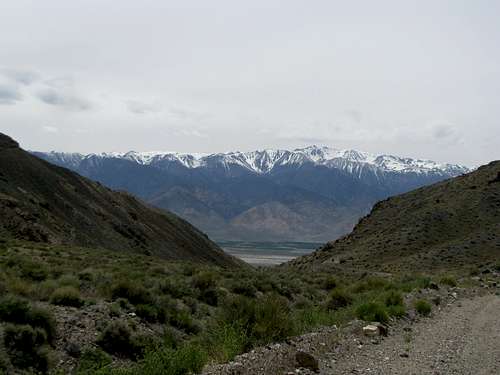
The usual tourist thing, down to Badwater, helped me pass the time but I was getting bored. I had planned to go back to Beatty after some casual National Parking, but a road sign indicating that Lone Pine was less than two hours away whetted my appetite. If I couldn’t climb a mountain, I might as well see some mountains, and perhaps nothing but the Sierras would do.
![Clouds...Sierras]() Sierras Sierras |
![Mt. Whitney]() Whitney Whitney |
I had been to Lone Pine before in my youth. Driving through town I had stared at Whitney, fascinated by the thought this peak, the highest in the lower 48, was standing more than 10,000 ft above the town and the Owen Valley. To a child that was a mind-bending yet at the same time a very tangible concept, and those memories still resonated more than a decade later.
Whitney and the Sierras were still striking this time around, especially with a thick gloss of late spring snow, but what caught my attention was the town itself. Apart from Aspen (which I love but kills my wallet) it fit the prototype of my favorite kind of western mountain town: urbane, lively, touristy but not hokey, geared primarily towards younger, active outdoorsy types rather than staid families, bikers, RV’ers, etc.
![Waucoba & Squaw Peaks]() Saline Valley; Waucoba Mtn Saline Valley; Waucoba Mtn |
I still planned on rounding back to Beatty and trying Grapevine on Monday, but driving north and going with the flow of things I ended up in Big Pine, CA. Glimpses of the western slope of the Inyo Range, over 11,000’ yet snowless, intrigued me. I drove down the Saline Valley Road to a point where I could accurately glimpse the eastside of Waucoba Mtn; it was still snow covered, but I had hopes for the western approach from Squaw Flats. The landscape around me was fascinating, filled with rangy hills and small, obscure chocolate drop buttes that begged for attention. Resisting the call to exploration I stuck stubbornly to my regimen of complete leg rest for the day, and returned to Big Pine for the night.
Monday 5.16 - Piper Peak
The next morning found me driving down the 4WD tracks into the Inyo’s towards Squaw Flats. I had only a narrow weather window for Waucoba, but alas even the trailhead was not to be when I occasioned upon an unexpectedly steep and rocky portion of the road. My rental Grand Cherokee had only an automated/sensor 4WD, it wasn’t switching on, and I could barely back the car down the narrow canyon, much less keep going up. Waucoba will have to wait for another day.
Fortunately I had a backup plan. Further into Nevada was Piper Peak, which had been on my wish list for this trip. I had scouted it out the prior day as well, and had found to my satisfaction that it was completely snow free. I made a beeline again across the border into the lush yet empty Fish Lake Valley and found the well-graded dirt road leading into McAfee Canyon south of Piper.
![Entering McAfee Canyon]() McAfee Canyon McAfee Canyon |
![Rd Into McAfee Canyon]() McAfee Canyon McAfee Canyon |
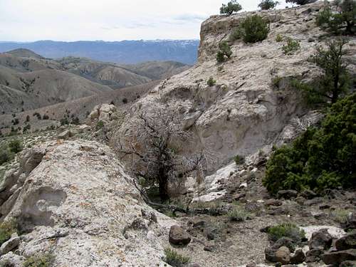
There are many different ways to ascend Piper from the south. I had considered several options but my bearing on the details were fuzzy since I had spent the past night primarily researching Waucoba. Seeing the limestone notch and benches that matched directly with the SP route photos and descriptions I parked and was on my feet a little after 9 AM.
The winds yesterday had brought along with them a cold front from what I would assume to be the Pacific Ocean. Temperatures ranged in the 40’s all day, but it wasn’t too bad as long as the sun was out. I had brought gloves from home but having only packed two long-sleeve shirts I was now wearing a brand new bright blue Sierra Nevada Brewing Company hoodie. Two new LEKI retractable trekking poles I spent a minour fortune on the day before in Lone Pine proved quickly to be a bust and annoying to handle, but I hoped that they would take at least some pressure off my knee(s). I followed a faint 4WD track at first, then split from it to aim at the break in the cliffs. Some steep climbing through a rocky and sparsely brushed ravine found me wandering a gently rising sagebrush slope to the top of the first bench, as described on SP.
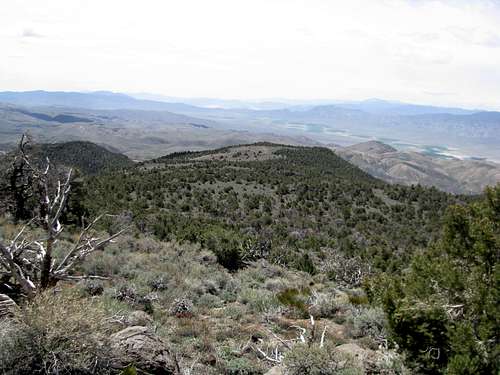
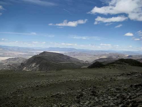
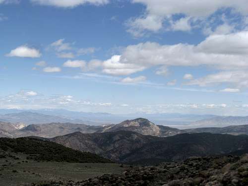
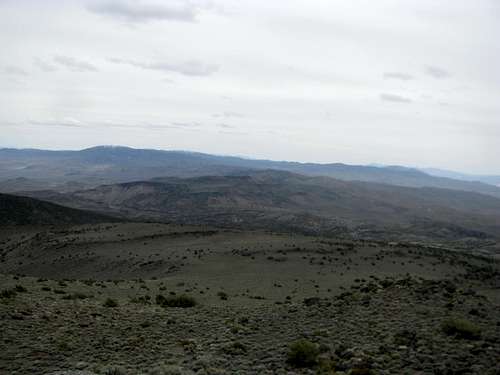
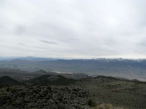
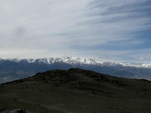
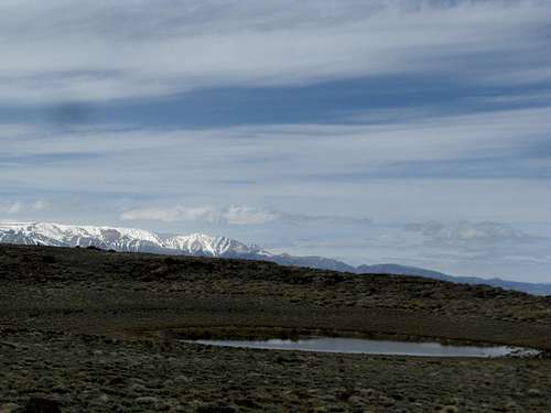
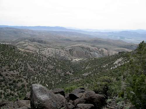
Much of the terrain ahead towards Piper was still mostly hidden by the second bench ahead of me. This obstacle rose at a steeper angle and required some scrambling among dark, crusty, volcanic looking rocks. Atop that I glimpsed Piper and its neighboring summit to the west, still miles away. The peak is trailless, and the terrain gradual. A wooded ravine revealed itself to my right, and beyond that the south ridge joined my current ridge at the head of the ravine below the summit of Piper. The (still very) White Mountains, cresting 14,000’ and reaching into Boundary Peak in Nevada, dominated the views behind and beside me.
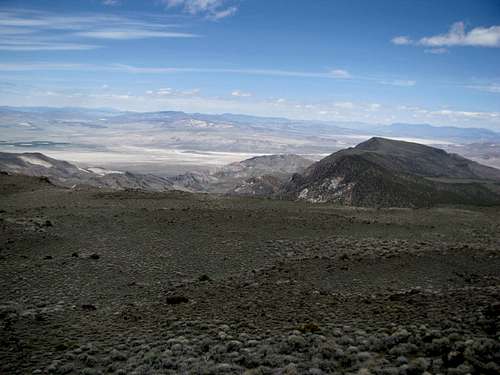
I angled northeast through sagebrush and a gentle incline. Along the way were small scattered bands of rock and areas of thick deadfall. I decided to contour towards Pt. 9,444’, ascending past one final rocky section above the juniper treeline. Thick, thick sagebrush dominated the terrain now as I ascended a small U-shaped valley below Pt. 9,444’ and towards Piper. It was a slog, but I eventually arrived at the oddly coloured boulders that comprise the summit of Piper Peak.
I downed a few granola bars and marveled at the views.
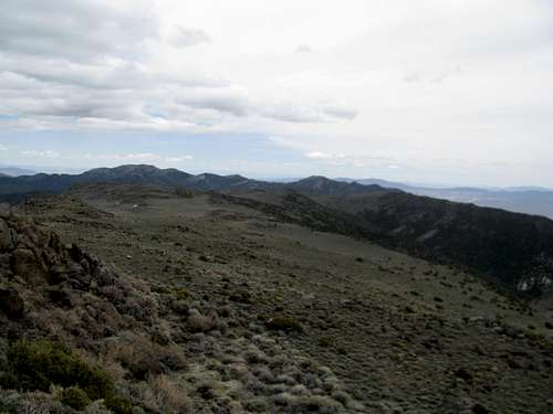
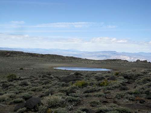
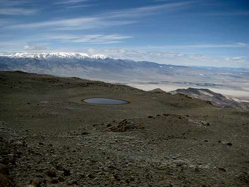
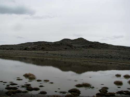
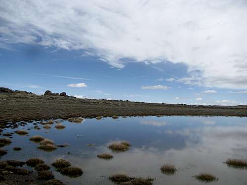
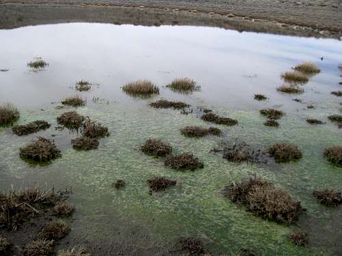
The sky had tinted from blue over to grey since I left the car, and standing still atop my windy perch I lingered on despite increasingly cold fingers. I found myself drawn towards a crystal blue pond about a hundred feet below, lying nakedly in the sagebrush tundra between Piper and 9,444’. This rare little alpine lake sitting atop a lower desert peak was completely unexpected, and I considered myself lucky to have seen it before its unavoidable evaporation only weeks away.
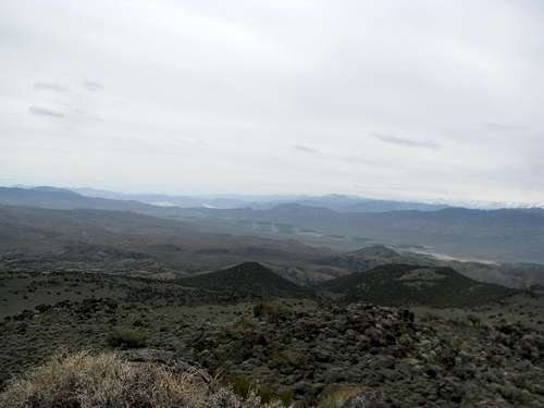
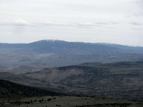
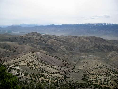
I saw the Sierras above Big Pine, peeking through above the saddle between the White and Inyo ranges, and once again getting bombarded with snow storms. A low grey cloud hung above Waucoba to the south, and I wondered if I would’ve been stormed on had I decided to pursue that peak today. The clouds were rolling by, seemingly and rapidly overtaking the sunny Great Basin country to the north and east. Sitting in the cloudy shadow of White Mountain Peak, the summit of Piper was a serene experience, and I did not want to leave.
Slowly the chill drove me down towards warmer grounds. I descended direct from the saddle below Piper southwards and contoured along the edge of the ridge on the ravine side for most of the way back, but not before circling around the little seasonal pond first.
I felt the continuing soreness in my knee; it had felt good in the morning, was sore now, but not as bad as Saturday, and though I hoped it would hold I felt the wear on it as I completed the descent back to my rental.
Despite ominous forecasts for the days ahead it was sunny again in the Fish Lake Valley, an inexplicably odd tableau of lush farmed fields and empty roads. I headed south, rounding Lida summit and driving past Magruder mountain before angling north through the almost proudly run down city of Goldfield before arriving in a cloudy Tonopah, apparently an oasis of civilization in these here parts. I spun the dice at the motel for a free room (no such luck) and settled in to ice my knee and inquire about local eats.
![Piper Peak]() Piper Peak Piper Peak |
![Piper Peak]() Piper Peak Piper Peak |
![Goldfield NV]() Goldfield, NV Goldfield, NV |
![Try your luck]() No such luck No such luck |


Comments
Post a Comment