|
|
Route |
|---|---|
|
|
53.16658°N / 117.96061°W |
|
|
Trad Climbing |
|
|
Spring |
|
|
Half a day |
|
|
5.10 (YDS) |
|
|
3 |
|
|
II |
|
|
Overview
This climb is located on Syncline Ridge in the Canadian Rockies near Jasper Alberta. The second pitch of the climb is the reason to climb this route. It is a beautiful pitch of solid limestone ascending a stellar left facing corner with strenuous stemming and fun gear placements.
Getting There
The parking for all climbs on Syncline Ridge is a large pullout area on the south east side of Highway 16. When travelling from Hinton (Alberta) the parking area is found in the middle of the second 60km/hr zone after you pass the east gate to Jasper National Park – this approximately 40 kilometers from Hinton. From Jasper, the parking lot is located approximately 38 kilometers east of Jasper, and about 4 kilometers east of where the Highway 16 crosses the Rocky River. There is an outhouse located at the west end of the parking area.
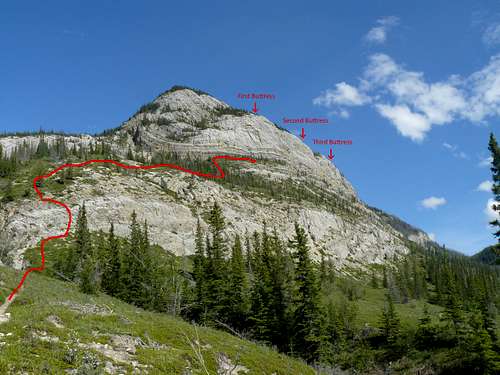
Once parked, the Syncline Ridge climbing area can easily be seen from the parking lot (see photo). The area is characterized by three large buttresses that are separated from one another by two large gullies. Follow the obvious hiking trail (located at the east end of the parking area) up over the first steep section, where it levels off somewhat and starts to gently climb up toward Hidden Valley (another climbing area). Walk another 200 meters and you can see where the main trails heads up through a broken cliff band – turn right here and walk down and up through the large obvious gully. From there you scramble through the lower cliff band and then just pick your way up (no trail) steeply until the first cliff face is reached. The approach takes approximately one hour.
Route Description
Locating the start of the climb
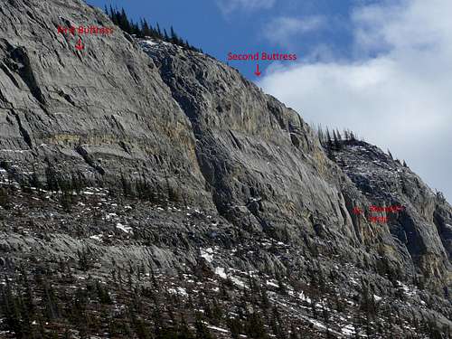
This climb is relatively straightforward to find. It’s located approximately ¾ of the way along the second buttress (see photo). The first and second buttresses are split by a large obvious gully – you need to walk down and through it to access the second buttress. The route ascends a very prominent left facing corner. Walk along the bottom of the second buttress (named “Raven’s Call” by Reynolds, and some people still call the climb by that name) until you are, more or less, directly underneath the large corner. Drop your pack here and get geared up. Two 60 meters ropes are recommended to rap the route.
The Route
Pitch one (5.6) – The first pitch is climbed on fairly poor rock and is short. You are just aiming to climb to the obvious tree near the start (and left) of the corner. Usually, it’s climbed on the right side of a small roof until that is surmounted and your can wander your way more easily up to the tree. There is a fixed anchor to belay from on the treed ledge.
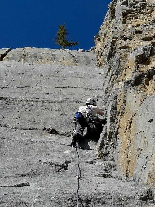
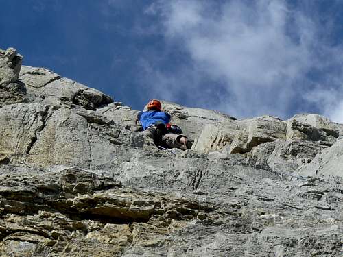
Pitch two (5.10-) – This pitch is the reason you came here. It’s a beautiful left facing corner on good limestone. The crack can be a little dirty in places, but most of the good protection areas have been excavated of dirt. While the route is protected by some fixed pieces (mainly bolts), it still requires numerous pieces of gear, most notably at the crux (which is near the top). Once past the crux, you clip a bolt and climb up and to the left to another obvious ledge with a tree. The route is more sustained than it first appears, and is a solid 5.10 lead. It’s also 40 meters long. There are belay anchors, but no chains (bring sling/cord to back up existing cord, if required).
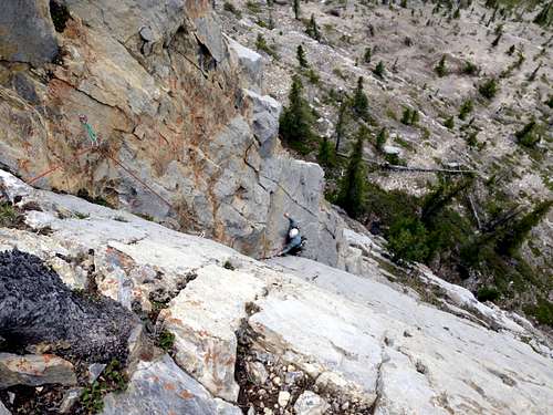
Pitch three (5.8) – From the belay, go up and slightly right following a couple of bolts. Once past the bolts, you go straight up following the obvious weaknesses in the steeper sections. Gear is fairly good – bring some big pieces. The climb ends at another bolted station.
Getting down
Rappel the route. The route can be rappelled with two 60 meter ropes.


