
Comments
No comments posted yet.
|
|
Trip Report |
|---|---|
|
|
34.35842°N / 117.76461°W |
|
|
Oct 5, 2013 |
|
|
Hiking |
Mark and I had not been hiking together since our Rim to Rim to Rim hike in the Grand Canyon in late May. Somehow we lost our local hiking groove, for many reasons, but it was time to resume it and neither one of was in very good shape. We made our decision to hike on Saturday the day before, not knowing where we would go, but deciding to do something. I was determined to try something different that we had not done before.
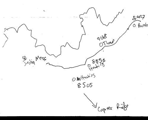
A number of things were working against us. The government shutdown might close a gate on a road leading to the trailhead of my first choice. I could not find my local trail book with a trail I wanted to consider for a second choice. Once I researched the second choice, it looked good, but I could not get a map because my National Geographic disk was in a computer my IT guy took from my office for repair. I printed some trail descriptions, but could not find them at 6 am when Mark arrived. So I showed him my proposed route on my laptop computer on my kitchen table, I traced out a crude map, shown below, and we were off. The plan was to drop one car at mile marker 66.37 of Angeles Crest Highway (SR2) and then drive the other car to the large parking lot at Vincent Gap where we take the trailhead to Mount Baden-Powell, then follow the Pacific Crest Trail to our car below Windy Gap, picking up the summits of Mount Burnham, Throop Peak, Mount Hawkins and Middle Hawkins along the way, and also grabbing the summit of Mount Islip.
The weather forecast was for 92°F in Los Angeles for Saturday, October 5, 2013, so I foolishly took my jacket and extra shirt out of my day pack and left them on my kitchen table where Mark and I had reviewed the proposed plan. This was a mistake. When we arrived at the parking lot at mile marker 66.37 the wind was gusting, the car said the outside temperature was 38°F and when I got out of my car it was cold. We spotted the little use trail up from the lot, and were intrigued by it, but it was simply too cold to proceed with only a windbreaker and, as fate would have it, Mark had meant to bring a warmer jacket, but forgot it on his kitchen table, so we were both in the same boat. Something to understand here is that we had now just traveled some 39.5 miles on a windy Angeles Crest Highway through the mountains, in two cars no less, and neither one of us was happy about throwing in the towel. But that was our decision, and we drove to the Vincent Gap parking lot together to make new plans and use its restroom facilities.
Upon arrival at the Vincent Gap parking lot, we noted that it was far less windy and slightly warmer, say 42°F. After due consideration, we decided to hike up to Mount Baden-Powell, and we started off. A little way into the hike we saw a signpost with mileage markers, and the distance back to where we had wanted to start was really not very far, I believe less than 10 miles, while the round trip to Mount Baden-Powell was 8 miles. This got me thinking again about the original plan, now that we had a positive confirmation of my original mileage estimate. About 5 to 10 minutes into the hike we decided to go back to our cars and leave one at mile marker 66.37 just in case we wanted to do the traverse when we got on top of Mount Baden-Powell. This was a very good decision.
By the time we made the shuttle with the cars and resumed, it was about 9:15, and we made the peak of Mount Baden-Powell in two hours. The weather was such that some of the time I had my windbreaker off, some on, and by the time we got to the top, it was on again due to wind, and the summit was very windy. But the views were great.
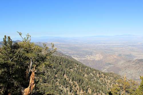
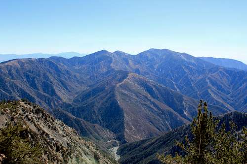
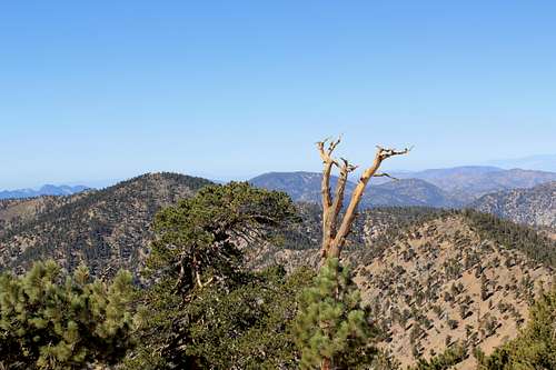
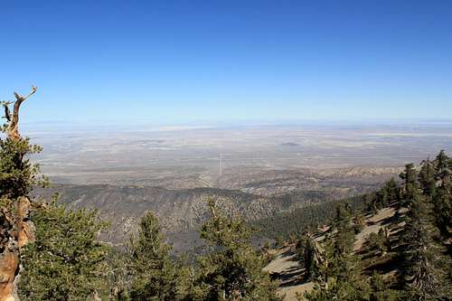
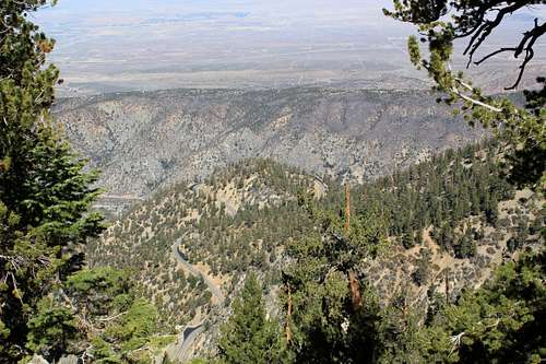
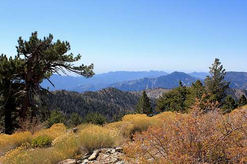
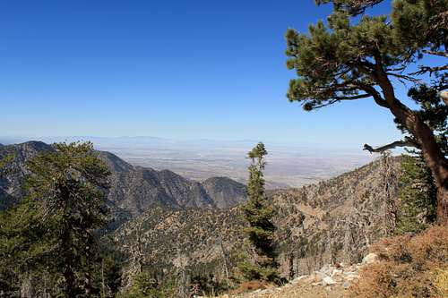
After a short look around the summit, we agreed to go forward with the ridge traverse to Windy Gap. We were hoping the wind would die down on the Pacific Coast Trail, but it was windy and cold for a couple of miles. Walking along the Pacific Coast Trail on this ridgeline was really something. On our left, to the south, we had views that looked down over the San Gabriel mountains and out into Los Angeles and beyond to the Pacific Ocean. On our right, to the north, we had views that looked out toward Lancaster and Palmdale to the northwest and to Victorville to the northeast and to the mountains beyond both. The persistence of such views is why I gave this report the title I did.
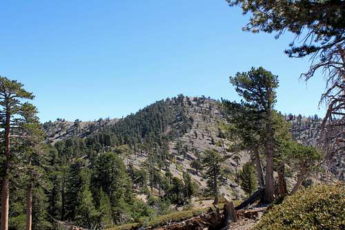
Getting to the summit of Mount Burnham was more happenstance than design. We were not sure if we were there earlier, and when we got there we knew it, but not until we were on top. It is not much of a mountain, more of a bump on the way.
Throop Peak was different. We stopped at a wooden sign junction that indicated we could go up to Windy Gap, with somebody having also carved in a note that the PCT was up, or take the lower trail to Dawson Ridge. As we had no good map, and I did not know where Dawson Ridge was, we had a decision. We chose going up, and later as we were going along the trail I confirmed it was correct by reference to the following map which I had quickly traced in the morning.
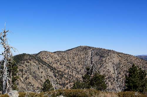
So the map showed Throop Peak was to the right of the trail, which was correct. We did not find a side trail up Throop Peak, but along one point I just left the trail and head up, and found it. The view from Throop Peak was nice.
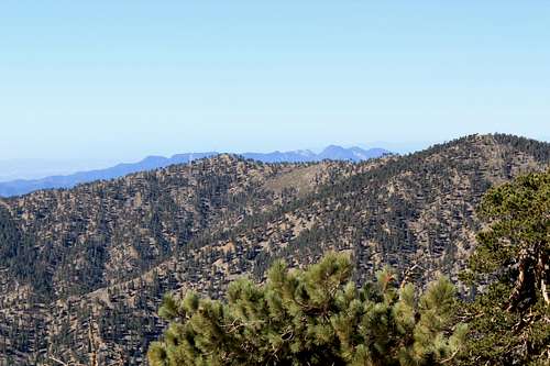
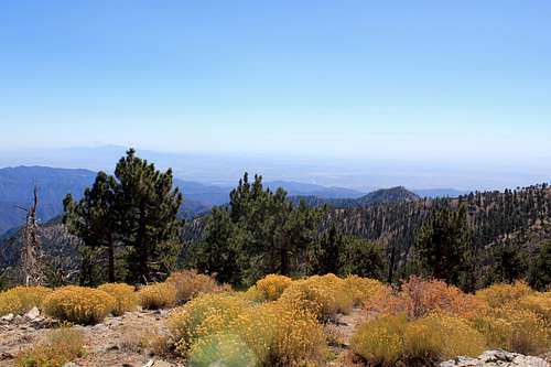
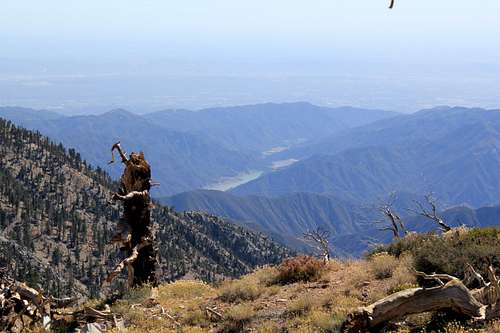
The trail to Mount Hawkins was easy to find and was only a minor diversion. The summit was not much to speak of, but, again, the views were nice.
After Mount Hawkins we walked along the trail and again had great views both to our left and to our right. We chose not to go to Middle Hawkins and proceeded to Windy Gap which is gained after taking switchbacks down a hill. Windy Gap cannot be missed because it has a clearly visible trail marker, bench, and trail going down to Crystal Lake. We chose to end our day early at Windy Gap, rather than going the extra 0.8 mile up to Mount Islip, so we took a readily visible use trail that led us back to our car waiting at mile marker 66.37 of Angeles Crest Highway.
When we ended our hike the temperature was 54°F. As we drove back to Glendale, the temperature started gaining after we left the mountains, and it was 92°F when we got back to my home shortly before 5 pm. It was hard to believe the difference in temperature and the events of the day. Certainly not one would expect if you were simply sweltering in the city.
Finally, I have to say, this was an absolutely wonderful little hike. Except for the requirement of a shuttle, it has a lot to say for it. There are many peaks to be had, views to see, variety to experience and you get to look out at two different views, plus survey a good portion of the San Gabriel mountains, and it can all be done quickly and easily in a day, and it is very easy to add additional peaks to the trip. This is definitely a hike that is worth doing again, especially with a little more planning and preparation, and something worth recommending. Which I now do.