Intro/Stats
South Guardian Angel, UT (7140')
Zion National Park
November 12, 2010
14.1 miles RT, 4200' gain
From Wildcat TH (7000')
Participants: Courtney Purcell (approach only), Sarah, & Kevin
Slideshow
The forecast is looking crummy for CO this weekend, so a last minute trip is planned to Zion! I'm pumped because I didn't think I would make it to Zion this year. Unemployment is sure a pain, but it does have some benefits! We're not sure what we're going to climb other than possibly a challenging climb of Mountain of Mystery on Sat with guidebook author Courtney (CP) Purcell involving a wetsuit descent.
He suggests South Guardian Angel as a "warmup" on Fri as he wants to hit a couple unnamed peaks in the area. South Guardian is a reclusive, seldom climbed gem deep in the heart of Zion that is on the wish list of many desert peak baggers. It is a long day any time of the year, complicated by possible swims in the Subway. It has turned back many with the intricate routefinding involved. CP advises us of a route that will avoid the Subway and we bite. He'll get us through the approach and show us the way!
Into the Heart of Zion
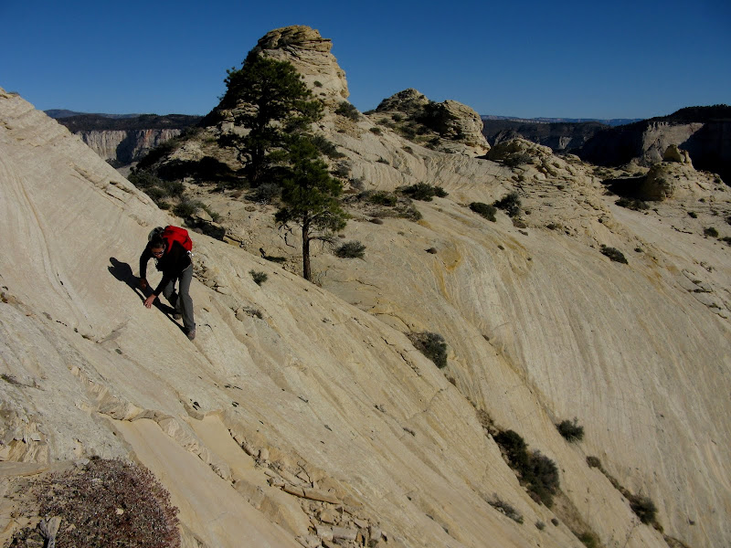
We set out at 5:42am from the Wildcat trailhead just off the Kolob Reservoir Road. One thing you find out in a hurry with CP is you better be ready to cruise! I started out behind having forgotten my sunglasses in the car. The trail is almost flat for the first bit and it's smooth sailing in the dark on the Wildcat Canyon trail. We left the established NP trail and descended a cairned route down a mellow slickrock bowl into Russell Gulch. This is not the standard route from this trailhead. We descended southeast down to about 6000 feet and traversed out of Russell Gulch on steep slabs. My recollection of this portion of the hike isn't good because I was struggling to keep up with CP and Sarah!
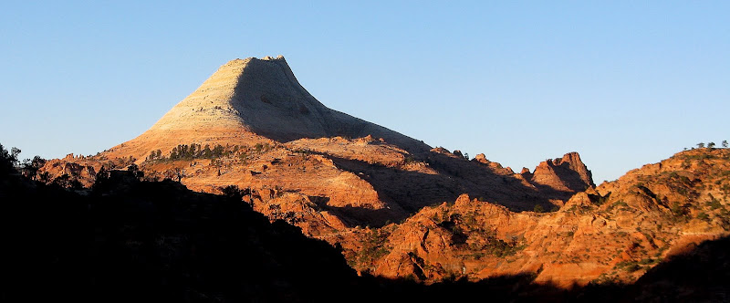
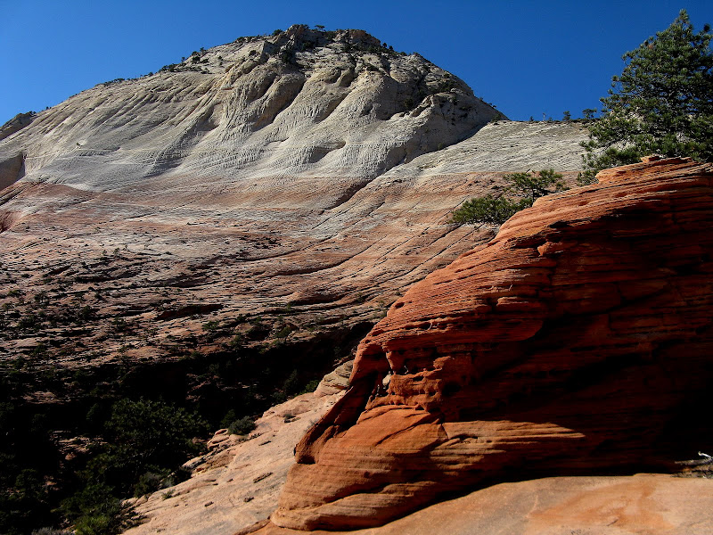
South Guardian Angel on the approach, ascent ridge in foreground:
At one point they got out of sight and I couldn't see where they went, so a summit yell or two was in order to get back on track. Once back together, CP showed us the rest of the way from a nice vantage point and headed for his peaks. After a bit of trial and error, Sarah and I made our way south and west, zig zagging through a lot of nasty brush. One thing I've learned in my 3 visits to Zion is that nothing comes easy there. Lots of steep, loose sandstone, bushes that bite, confusing terrain, and optical illusions all over the place! Luckily the pollen bushes behaved this time. Maps don't do much good with micro-routefinding as most maps are equipped with only 80' contours. We eventually connect with the standard route that comes up out of the Subway and make our way to a colorful amphitheater below the imposing n.e. ridge of SGA.
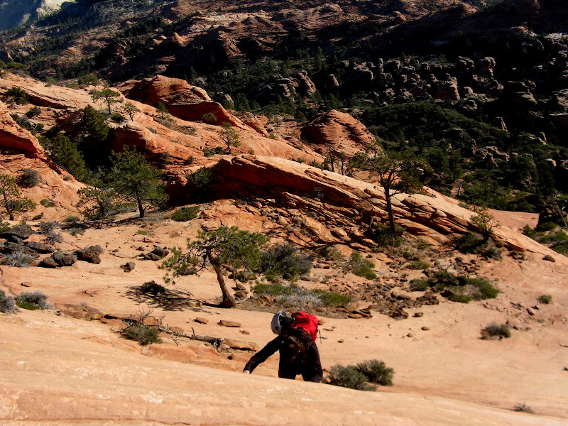
Slickrock playground:
We generally find the path of least resistance but I somehow lead us up a short, steep slab that quickly runs out of holds! Must have been those optical illusions again. We follow cairns here and there, but the routefinding above all the bushwacking nonsense isn't bad for Zion standards.
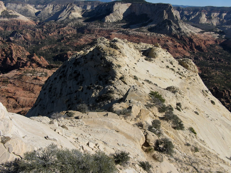
The north face of SGA comes into view and it is impressive to say the least. Yes, there is a 3rd class route up that ridge.
All of our toils of slow going bushwacking has now paid off and we efficiently make our way up the slickrock. We top out at a flat area below a false summit that we traverse below. This is where the crux of the route lies.
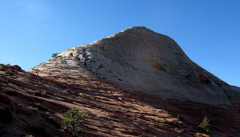
True summit in view:
The crux is a 3rd class traverse on exposed ledges. There is one spot that we really pay attention on, moving up from one ledge to another. It's a bit of a reach.
From there, it's smooth sailing to the summit, which we reached a bit after 11am. It was a gorgeous day, and we took a long break enjoying the accomplishment and even got a chance to log our peaks with Sarah's Droid! We must have been the first people to log our summit on SGA.
Looking down the n.e. ridge from summit:
With many miles before we eat, we headed down. The crux move seemed a little spookier to me on the way down. I sure wouldn't want to be up here when the slickrock is wet! We retrace our steps down the fun ridge and follow cairns when we can, avoiding the steep areas. A cool little "saddle" of layered sandstone really caught my eye.
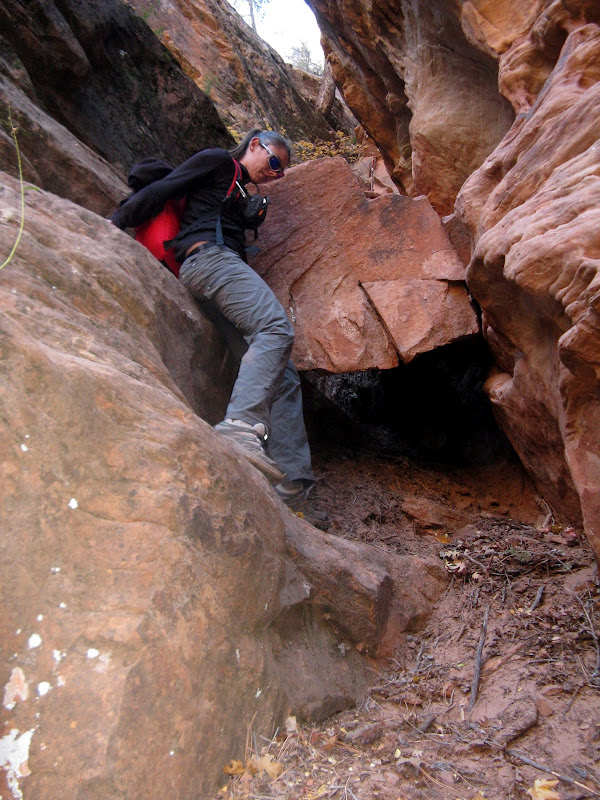
We find a nice, sandy wash that avoids a lot of the nastiness that we toiled through on the way up. It takes us pretty close to where we need to be. The next goal is to locate the climber's path that will safely take us down to the Subway. There's only one way down, so we climb up to a ridge and think we're a bit too far west. We descend to a saddle and find it! The trail zigs steeply down into a deep gully where there's a bit of downclimbing around a chockstone to a rappel anchor.
It turns out there's a 3rd class line somewhere that avoids this rappel. Just as Sarah is rapping, a group passes by in the Subway! We yell down but they continue on oblivious to us.
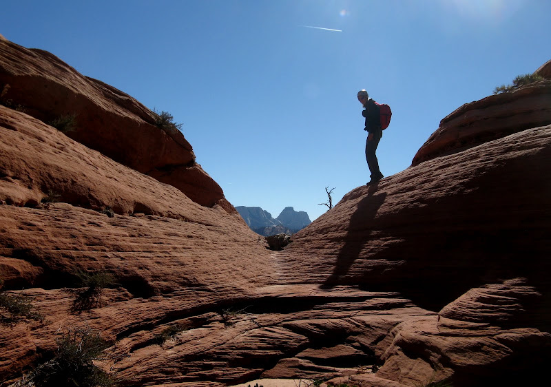
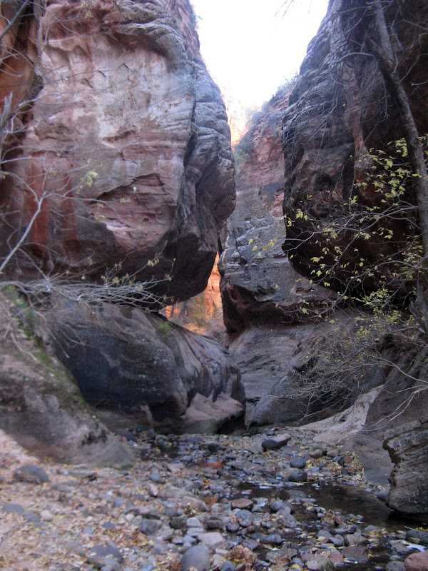
The Subway:
We do the direct exit out of the Subway, which is a STEEP haul with lots of tree belaying and one step forward, two steps back going on. The route is surprisingly well cairned though and we don't have any trouble following it. You must be on your toes in Zion though. A bush knocks me off balance and I plant the palm of my hand in one of those little mini-cactus plants. Now that's gonna leave a mark! Now out of the canyon, the cairns lead us n.w. across beautiful slickrock towards N. Guardian Angel.
N. Guardian Angel urges us to the finish line:
Our only routefinding error was going over the top of a bump east of NGA that cliffs out on the other side. We should have traverse below on the east side. The cairns eventually end, and we eventually bash our way back up to the civilized Northgate trail. I pass at hitting one of the Northgate peaks because I know I will be paying some serious dues tomorrow! We make it back to the trailhead at 3:42. Not bad for a days work in Zion!


Comments
Post a Comment