Stuck
Looking down, I'm guessing that it can't be more than thirty meters to the bottom of the steep couloir I'm descending. If only I could get there, I would be off the mountain and in hiking territory all the way back to civilization. But how? That's a whole different ball game. Sure, my route description offers two possibilities, but after considering both of them, I don't feel comfortable to commit to either one. I have to face it, I'm stuck. How do I get off this mountain?
I first got to this point an hour earlier. Up until then my descent had been swift and easy. Sure, a few times the route was less than obvious, but whenever I didn't see traces where others had gone before, I just scrambled down wherever it looked feasible, and it never took long before I picked up the route again. And the place where I was right now matched the route description - so why wasn't there a relative easy way down anymore? Was it there, but did I not see it? Or had something changed since the route description was written?
I have another look. The text describes it as an ascent route; I'm descending. From the bottom of the couloir, it reads:
"From here, there are two variants. One may continue straight up into a distinct, but steep gully. There is a chain here and the climbing is not too difficult. Alternatively, one can turn left and follow a snowfield (at least early in the season), ascend this snow and head right in order to gain a broad path/ledge that will connect with the previously described route."
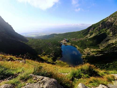
Satellite view of where I'm stuck, give or take a few meters.
I've descended the couloir on the right, recognizable by the light color. Hiking territory is down below on the left. The big shadow between me and the valley floor indicates the steepness of the wall.
According to the route description I have, my main option is directly west, the alternative is about 40 m north and then west.
With that in mind, I climb down a bit, looking for that chain. I descend a few meters to where I can stand on a low angled, very smooth rock slab. Obviously it's polished by running water. It's dry now, but when it's raining the water has to come down the mountain somewhere. In different circumstances, this will be a small stream. But the smoothness doesn't instill confidence, and I see no holds. I guess that the route probably goes right over the edge, and the chain might be immediately over the edge for all I know. But I don't like to go there to have a look, for without holds I'm not confident I won't fall right off the mountain. And as for that chain? According to the route description, there should have been more climbing supports along my original ascent route than what I encountered, so perhaps more things have changed and this chain isn't there anymore either.
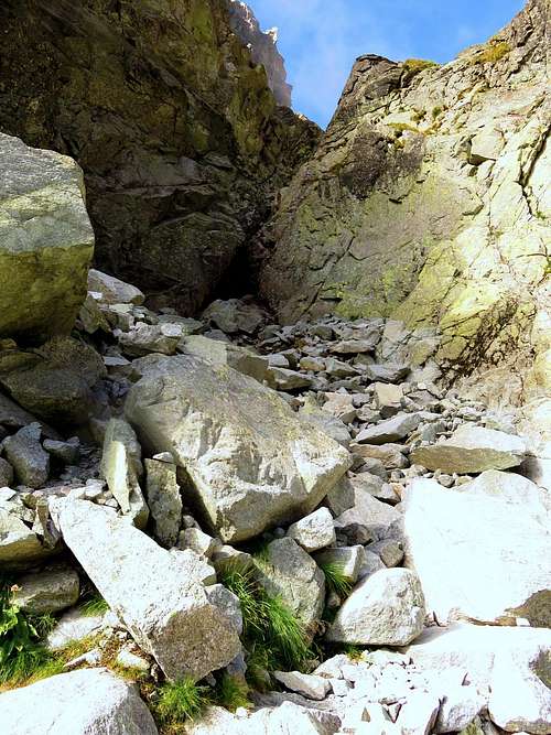
I turn to the alternative. Climb down a bit again. I see some old snow at the bottom, which matches the description, but it isn't nearly enough to be helpful in any way. The gully at the top is filled with very loose scree. Lower down it gets steeper, but I can't see far enough to judge how steep exactly. It might as well be vertical, and it looks much too high to safely jump down to the snow, even if it would have been soft. I think about descending a bit further, but once more I don't like going to the edge, this time because I don't trust the scree. The rocks are small, and though I can't see it clearly, I'm worried that there might be a solid layer below them and then it's like descending on ball bearings. I might not be able to stop in time.
Having checked out both options, I sit down for a break, and to think. After a while, I return to the smooth slab. Climb down a little further than before... but still don't like it any better. Back to the scree, do the same, and still don't want to try that either. Back up again. Sit down. Think. I realize I do not want to risk descending either of the two options. I'm not going to rationalize it and argue with myself that I should be able to do it. I don't care if I should; I trust my gut. If it doesn't feel good, I won't go there. But what else can I do?
Around that time I hear distant voices. At first I think they come from climbers that are descending a different route, not far away. It takes a while before I actually see anyone, and then it's far above me. They are on another route alright, but they are climbing, not descending! A bit surprised that that they have started so late, I still think that that will be the answer. Eventually they will come down again, and the most likely route for that is the one I'm on. And if I can use their rope, I will have no trouble getting down.
I realize that it might take a few hours before I will know if they will come my way, so I try to get their attention, to communicate somehow. I shout, but they don't hear me. I blow my whistle, but even that isn't loud enough to elicit a response. Shall I simply wait? I don't like that idea; I want to do something. Besides, if they will descend somewhere else I can wait forever. And so I decide to go back up again - perhaps I will meet them higher up, but if not, I'll descend by the route that I have originally used to climb the mountain. Based on what I had read, my ascent route was supposed to be a bit more difficult than the descent route that I have just discarded, but at least I know the difficulties of the route, and that makes a whole lot of difference.
Going back up will be tiring, but I feel strong enough, and I figure there is enough daylight for my plan. If I would wait and the climbers don't come down my way, by the time I find out it will be too late. My choices would then be limited to an unplanned night on the mountain or call the rescue service.
A Few Days Earlier
It was dark when the train pulled into the Poprad train station. My first view of the High Tatras, which were the main reason for my visit, would have to wait. Outside I saw a taxi, so I asked the driver to bring me to a hotel. He wanted to know which one. Since I didn't know the city I said any decent hotel would be fine, but his English was poor and he didn't understand: He wanted a name. I asked around a bit and learned that there was a Poprad Hotel. Sounded good to me, so I went to the taxi again and made the driver happy. Me too, for a while - until the hotel turned out to be full. Fortunately the receptionist was helpful and gave me directions to another place nearby. Before long I had a room.
It could use a bit of paint, but it was clean and not very expensive and the staff was friendly. And, most useful, the lobby hosted a couple of computers for guests that didn't have their own. The weather forecast for the mountains was poor, so I stayed two nights. I went into town to buy a good map, look for a climbing guidebook and pop into the local tourist info center to ask about climbing in the Tatras. I knew that it was heavily regulated, but I didn't know all the details.
 Decent hiking map
The info center was closed - perhaps they think tourists don't need information on a Sunday? At least the main shopping center was open, and in a book store I found a decent hiking map for the Tatras, scale 1:40 000. No useful guidebook though, only for hikers.
Back at the hotel I went online and started searching for details about climbing in the High Tatras. Of course I checked the SummitPost pages for the area as well as for
Gerlachovský štit: since it was the highest peak of the Tatras, of Slovakia and of all of the Carpathians, I wanted to climb it, if I could.
I must admit that, after reading everything I could find, on Summitpost and elsewhere, I was still in the dark about the easiest routes or what grades to expect. I got the impression that the easiest route was merely hiking, but that the rules meant I could only use it for the descent. And I couldn't find which routes I was allowed to climb. All in all, it was rather fragmented information. What I did find was a lot of red tape. Some sites (and trip reports) simply said that it was forbidden to go off trail, unless with a guide. Other sites said that members of climbing associations were allowed to go unguided, subject to a lot of restrictions. However, as I tried to understand the details, they appeared to be inconsistent. The best thing I found was a fairly decent looking route description, which apparently was the normal route that the local guides take with their clients. I made a copy with my camera, so I would always have it with me. After that, I resolved to ask for further information later.
Strbske Pleso
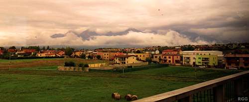
![As the train pulls out of Poprad, the cloud covered High Tatras come into view.]() As the train pulls out of Poprad, the cloud covered High Tatras come into view
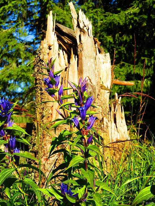
As the train pulls out of Poprad, the cloud covered High Tatras come into view![Willow gentian (Gentiana asclepiadea)]() Willow gentian flowers and the remains of a forest
Willow gentian flowers and the remains of a forestMonday morning I hopped on the train for Strbske pleso, the highest village in the High Tatras. It was still drizzling as I got off the train, so I abandoned the idea of an afternoon hike. The info center was open. I asked what the rules where for climbing in the Tatras, but the answer was surprising: I could hike on the marked trails, but would have to hire a guide for anything else.
I knew that the rules were not
that strict, so I said that I was an alpine club member, and as such I was allowed to climb unguided. I just wanted to learn the details of what the rules said I could and could not do. However, the woman behind the desk was adamant and countered that the High Tatras were not the Alps, so that my alpine club membership was not relevant! Dumbfounded by such ignorance, I gave up. I figured, I would try again later, in another village.
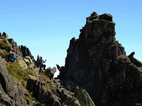
The next two days I explored the mountains near Strbske pleso, more precisely
Kriváň and
Rysy. A few hundred other people seemed to have the same idea; I guess that's what you get when you have a small mountain range with a limited number of marked trails. I must say that only well above the tree line would it be easy to go off trail; lower down, dense shrubs often made that quite cumbersome. And so I found it easy to obey the rules, as far as I understood them.
Stary Smokovec
Lower than Strbske Pleso, Stary Smokovec is the main village in the High Tatras. Once more I walked into a local tourist info center. As I asked about the rules again, they referred me to the office next door, which turned out to host the mountain rescue service.
I walked in and asked my question. More specifically, this time I added that I wanted to climb Gerlachovský, unguided, and wanted to know if I was allowed to do that - and to avoid misunderstandings I showed my alpine club membership card. A serious looking fellow looked at it and replied that, yes, I could climb Gerlachovský. I asked if they had detailed information about possible routes (I wanted to have more than the one description I had so far). He rattled off a bunch of route names that I could climb, but for descriptions he referred me back to the tourist info office.
 Excellent Tatraplan map
At this point I should mention that I was still in doubt whether I should actually try climbing Gerlachovský or not. On reading the route description and looking at my map, I couldn't clearly see where I should go. It might turn out to be good enough, but I wasn't sure. Fortunately, back at the info office, I saw a much better map. It was an excellent topographic map, 1:25 000, with detailed contours, and many more features were named, including various gullies! Suddenly the route description started to make a lot more sense. I could see that the ascent would start with the Velický žl'ab, and the descent would follow the Batizovský žl'ab. There was even an (unmarked) trail that looked like it lead to the base of the Velický žl'ab. The reservations I had before buying this map evaporated like snow in the strong afternoon sun. I got real enthusiastic. Not even the fact that they had just sold the last guidebook could dampen my spirits.
Next order of business was to find a place to sleep. To climb Gerlachovský, the best place to start was Sliezky dom. Formerly a mountain refuge, a few years ago it had been rebuilt as an upscale hotel, with limited shared accommodation for mountaineers. A guy at the info center called the hotel for me, but the shared accommodation was booked solid for the next few weeks. Did I want to have a hotel room instead? I asked the price - then politely declined. Instead, the info center found me a bed and breakfast place in nearby Nový Smokovec, appropriate
ly named
Villa Gerlach. It was a good sign.
When I arrived, I was pleasantly surprised. The owner was friendly, the room was small but nice, and there was a shared kitchen I could use. I asked if I could stay longer than the one night that the info center had booked for me.
In the mean time, my grey cells had been working on a plan. Hoping to stay at Sliezky dom, I had been thinking about hiking up
Východná Vysoká tomorrow, as a warm up, and climb Gerlachovský the day after. But starting at Nový Smokovec complicated matters: Either I would have to walk a couple of hours extra (and ascend an additional 670 meters), or I would have to take a taxi to Sliezky dom. I would prefer to walk, but that would make for a long day. Therefore I skipped Východná Vysoká from the program. My last incentive was the weather forecast: ZERO chance of rain! I wouldn't wait any longer, but climb Gerlachovský tomorrow!
Slippery When Wet
It had to be an early start. I didn't want to hike in the dark, but shortly after sunrise I was on my way. At first I kept a normal pace, but soon enough my leg muscles were warmed up and I switched into higher gear. Though I considered it unlikely, in the back of my mind I thought I might catch up to a slow climbing party, which could be useful if I would have any route finding problems.
![Velické pleso and Sliezky dom]() From a distance, well above Velické pleso, Sliezky dom doesn't look out of place anymore
From a distance, well above Velické pleso, Sliezky dom doesn't look out of place anymoreThe trail from Nový Smokovec to Sliezky dom was mostly in the woods. By the looks of it, this part had not suffered quite as much from the big storm of 2004 that had flattened great swaths of the forested lower slopes of the Tatras. To my surprise I passed some other hikers, not far below the hotel. Apparently I wasn't the only one that had started real early.
The hotel looked a bit out of place. It was too big, didn't blend in the mountain environment. I didn't stop, but kept walking. Around the little lake, and up the trail alongside the waterfall. Once above it, the terrain leveled out again and I got my first decent look of the upper Velický valley, and of the Gerlachovský massif that lined it. I sat down to eat something and to check my route description and the map. I didn't see the unmarked trail, nor the Velický žl'ab, but looking at the shape of the mountains I could see where it had to be, so that's where I headed. Within minutes I came to a clear trail, unmarked, but, as expected, it went straight to the base of the couloir.
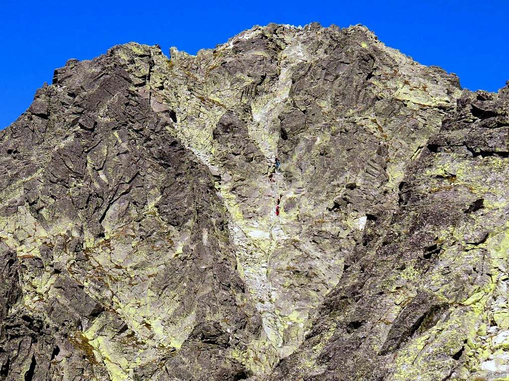
![The base of the Velický žl'ab is the crux of the route]() The base of the Velický žl'ab is the crux of the route
The base of the Velický žl'ab is the crux of the routeAccording to the description, the start was the hardest part.
I looked at it. Water trickled down the center of the couloir, making it wet. The dark rocks on the left looked hard to climb. On the right I saw some cracks and other irregularities on the rocks. However, I couldn't see a clear line higher up. I deliberated with myself. I knew it would be all to easy to start climbing on the right and then reach a point where I couldn't continue. And even if I would only be ten meters off the ground when that would happen, I might have a really hard time climbing down again. Not a good idea to try that when soloing, without rope. No, it would have to be the wet center, for I could see that it wasn't really high. Maybe five meters vertical, then it looked easier. I figured that I could safely try how good the wet holds were on the first couple of meters. If I didn't like it, I could abort.
Climbing
The holds, though wet, are surprisingly good. My feet don't slip off the small outcrops and tiny ledges, and there are enough handholds for balance. At the top of the vertical part are the remains of an old chain. It's a bit rusty, but I try it and it's still solidly connected to the wall. I'm up the wet vertical section, and happy about it. It's still steep, but the climbing is easier now. Falling still isn't an option, but I manage to avoid the wet parts and always find dry rocks to grab. This is fun!
![Velický žl'ab: the rib]() The saddle is clear to see
The saddle is clear to seeQuite soon the couloir widens, and a little to the right of it a trail appears. Much higher up I can now see the saddle on the ridge that marks the top of the couloir. Compared to the first part, this looks easy. Pleased with my progress, I sit down for a break, to enjoy the scenery - and eat something.
Just like it looked, the trail up to the saddle is easy indeed. Mostly it's walking, with some short interludes of scrambling. The exposure is rarely something to be concerned about. Soon I'm at the saddle on the jagged ridge.
For the first time I can see the west side of the mountain massif. High up it's less steep than the Velický žl'ab, and I can't help but wonder if there isn't an easy route up this face. However, as I can't see all the way down to the valley, I don't know. Looking forward, I can't see the true summit yet because the subsidiary peak of Kotlový štit (2601m) is blocking my view.
To traverse the western slopes, I have to cross a number of scree filled gullies, interspersed with rocky ribs. Judging by my map, the first gully - or is it several? I don't really know - is Gerlachovský kotol, meaning cirque or bowl. Sometimes I see a clear trail for a while, then it's gone again and I have to guess. But for a while I'm making all the right choices.
![Gerlachovský kotol]() Gerlachovský kotol from close to the saddle. I see traces of a trail
Gerlachovský kotol from close to the saddle. I see traces of a trail Off Route
![Guided party on the descent, on their way to Velický žl'ab]() Guided party on the descent, on their way to Velický žl'ab
Guided party on the descent, on their way to Velický žl'abI see a group of climbers coming my way. As they get closer, I learn that it's a guide with a couple of clients. We talk briefly, and the guide warns me that route finding is tricky. When he asks about it, I confirm that I'm a climber, and he responds that I'll be alright then for the rest of the ascent. They continue towards the Velický žl'ab, I continue my ascent.
![Climbers shortly below the summit]() Climbers shortly below the summit
Climbers shortly below the summitAfter crossing three scree slopes, I come to another rocky spur. I don't see traces of the route anymore, so I just scramble up a bit where it looks possible. On the crest of the spur I get a great view of the summit of Gerlachovský, just a few hundred meters north, and I clearly see the final part of the ascent, a rocky face leading straight to the summit. It looks steep, but I see people up there, and they don't seem to have any serious problems. That said, they have a rope, and I don't. But I remember that a frontal view of a face always looks steeper than it really is, and I presume this is no exception. However, I'm not there yet, and my immediate problem is that I see no easy way down from the crest of the spur to the scree that I must cross to get there. Am I in the wrong place?
I decide to keep ascending the spur. Perhaps it will prove to be easy to get to the main crest, and then I might even be able to follow that all the way to the summit instead of climbing the face. The description isn't quite clear about it.
A few minutes later I stop. It's not that I can't possibly continue anymore, but it's getting decidedly harder if I do, which can only mean that I'm definitely off route. I look around, to see if there is any way I can get off the spur and down on the scree to the north. It's not far down, but I don't see good enough holds to descend safely. Perhaps I can still do it, but why take that risk when there must be an easier way? I just have to find it.
I retrace my steps and climb down the spur, continuously looking for a way to reach the scree. I end up descending a bit further than where I first gained the crest, but then come to a spot where I see a clear way down. Some easy scrambling and I'm on the scree. The detour and the searching have taken some time, but as I started early and the weather will be fine, it doesn't matter. I still have plenty of daylight. I'm going to make it!
![Climbers on their way to descend the Batizovský žl'ab, seen from high on Gerlachovský štit]() Climbers on the descent, down the Batizovský žl'ab
Climbers on the descent, down the Batizovský žl'ab![Art on top of Gerlachovský štit]() Artfully illustrated metal box
Artfully illustrated metal boxI walk to the face, and, sure enough, it's not even close to vertical and there are lots of features I can use to climb it. A couple of climbers are coming down. They are roped up, and I wait a couple of minutes at the bottom of the face to give them room before starting up myself. The exposure means I must not fall, but it's easy indeed. A little higher I see a chain - but only after I've already passed it, a few meters to the left. It just shows that the face can be climbed just about everywhere.
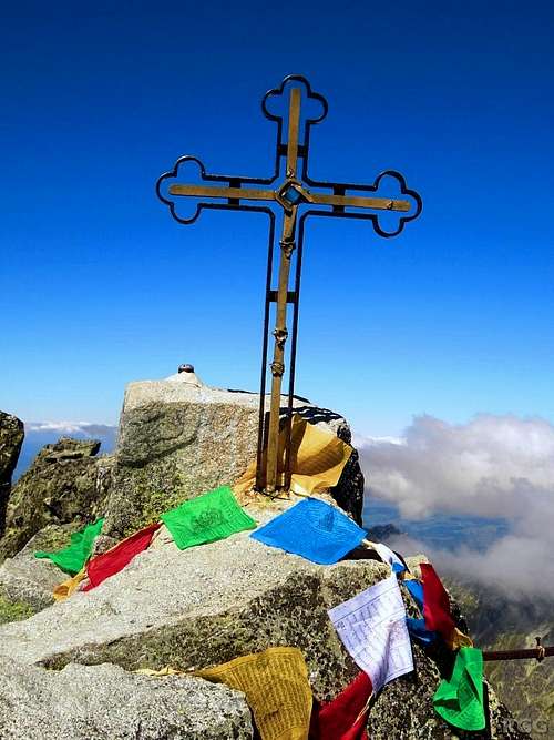
![Gerlachovský štit summit cross]() Summit cross
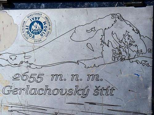
Summit crossWithout any problems I soon reach the top. There is a metal box - I presume with a summit book in it, but I don't check it - and a small summit cross. There can be no doubt: I'm on the summit. It's not even two o'clock, which means I've got plenty of time. I relax, enjoy the views, and have a bite to eat.
Eventually I must start my way down. I check the description and the map. They confirm what I already thought: the final face was in fact the top of the Batizovský žl'ab, which is the couloir I'm going to descend. As I reached the summit, I saw the climbers disappear from view further down that very couloir.
My descent is swift and easy. Sure, a few times the route is less than obvious, but whenever I don't see traces where others have gone before, I just scramble down wherever it looks feasible, and it never takes long before I pick up the route again. Until... I get stuck!
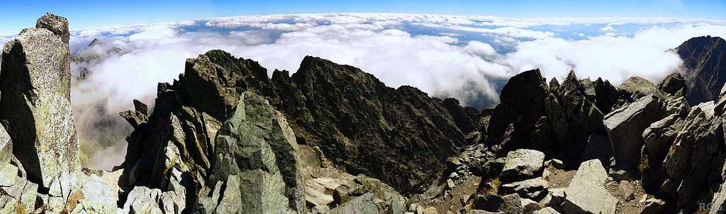
![180° summit panorama]() 180° summit panorama
180° summit panoramaBack Up
Ascending the Batizovský žl'ab again takes a bit longer than descending it, but I still make good time. As I approach the base of the final face again, I start looking for a good way to get up and over the spur where I got off route earlier. I hope to see a better route than the one I used before, but I don't even recognize where I had come down from it. Remembering that the last time I was too high, I stay what I think is a bit lower now, and have no trouble getting up it.
What happened next, I'm not sure. Perhaps the fact that I had run out of water quite a while ago meant I wasn't totally sharp anymore, even though I felt fine. Anyway, I thought I was traversing the face below the main ridge, on the western side, making my way to the saddle at the top of the Velický žl'ab. I kept a close eye on my altimeter, because I remembered the elevation that it gave for the saddle, even though I never thought I would cross it again. But now it was paramount that I find it. South of the saddle, the ridge was only a little bit higher, with just one more peak on it before dropping down altogether.
I knew that, during my original traverse of the slope, I had never gone up or down for very long. Being a little higher than the saddle, I mostly looked for traces of a trail below me. I didn't see any. I guessed I was still a bit too high, and so I kept traversing, and gradually losing altitude in the process. But as I got down to the elevation where the saddle should be, I didn't see it. Where is that saddle? Or where am I?
I pulled out the map. Looked at it. The main ridge below which I was traversing extended south from Gerlachovský. Some 400 m from the top, it rose to the summit of Kotlový štit. And only now did I really see something I should have realized long before: continuing past Kotlový, there isn't just one big ridge with a number of minor side ridges; there are two big ridges roughly extending south! The map is quite clear about it. One of the ridges continues south, and, coming from the north, appears to be the logical continuation from the main ridge. But another ridge - just as big, judging by the map - extends roughly to the southeast - and
that's the ridge that towers over the Velicka valley where I came from, so the saddle must be there as well!
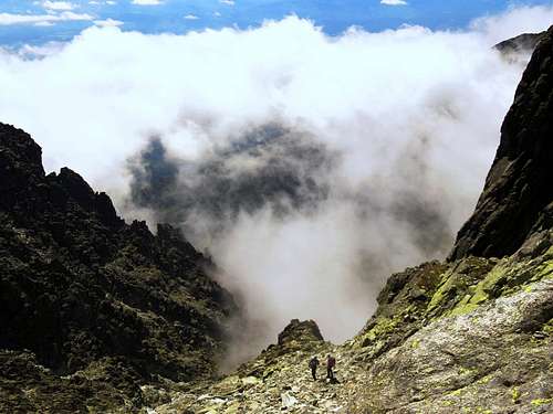
![Distant climbers]() Earlier in the day, shortly after starting my descent from the summit, I had seen distant climbers crossing what must be the long south ridge of Kotlový štit
Earlier in the day, shortly after starting my descent from the summit, I had seen distant climbers crossing what must be the long south ridge of Kotlový štit
So, below which of these two ridges was I traversing? Fortunately I'm old school. I don't use my compass often, but I do carry one, and this time I needed it. And what I had been suspecting after studying the map, proved to be true: I was heading south, so I had not crossed the Kotlový south ridge but was still on the wrong side, traversing the face below it.
No harm done, now I know where I am, and it's not too far off the route. I scramble straight up to the crest. There is no way down the other side, so I follow the crest upwards for a while, until I can descend without too much trouble. This time I have no doubts, I'm now on the slopes below the right crest, and if I just keep an eye on my altimeter while I traverse, I should reach the saddle without further problems.
And so it goes. Occasionally I see traces of a trail again, but less often than I recall from the first time I was here. Probably it's because the sun is lower now and the light is different.
All these ridges and gullies look alike to me now. I realize I must keep moving, or I'll have to descend the wet patch in darkness, and I really want to avoid that. Eventually I see a notch in the ridge, with just one peak further south of it. It looks familiar, and once more I see something of a trail. As I get there, I recognize it. And, more importantly, I recognize the Velický žl'ab on the other side.
It's about 300 m down, and I know what difficulties to expect. I reckon I should be able to get to the crux in less than half an hour. The sun is dropping fast, but there should still be light. As fast as I can without risking to fall, I go down the couloir.
![Not far above the base of the Velický žl'ab the terrain gets easy again]() Much earlier, this is shortly above the crux. When descending, knowing what lies below is reassuring. Without it, a gaping dark hole like this might be intimidating.
Much earlier, this is shortly above the crux. When descending, knowing what lies below is reassuring. Without it, a gaping dark hole like this might be intimidating.It's just as I remember it. Nothing difficult until I'm at the top of the wet, vertical rocks. But this time I know that, although wet, the holds are surprisingly good. Very careful I go over the edge. Climb down a little, then grab the old remains of the chains. Using that, I can descend a little further. If there were no big boulders below but something like soft grass, I could even jump the last part now. But landing on those big rocks would probably result in breaking something, so I take it one step at a time.
No rest for the wicked, it's getting late. I'm safe now, but I still want to get back to civilization. The unmarked trail is easy to follow on the way down. By nightfall I reach the marked trail and the top of the waterfall. The lake looks pretty, and the lights of the hotel are beckoning. By the time I get there, it's almost dark.
In theory I could walk back to Nový Smokovec. In darkness I wouldn't risk the forest path, but I could use the access road for the hotel. It's much longer, but safe enough. However, I had read something about a taxi service...
Still all sweaty from the fast descent I walk straight into the hotel, up to the reception and ask. It's 20 euros, which, considering my tiredness in general and my burning feet in particular, I find an excellent price. I have to wait just long enough to drink some tea and grab a bite to eat before the taxi is ready. It's not a regular taxi though, it's a landrover, and a bunch of other passengers get in the back. I'm lucky and get the passenger seat. As I talk to the driver, it turns out he is the hotel manager - the regular driver does it all day, but he's eating right now. Normal taxis are not allowed on the road. For regular hotel guests, there is a car park lower down, from where the landrover picks them up. However, none of the passengers has a car there, and we're dropped off at the train station in Tatranská Polianka, 4 km from Nový Smokovec.
The owner greets me as I enter Villa Gerlach, and she is clearly surprised that I already climbed Gerlachovský. I had told her I was going to, but somehow she didn't realize it would be right away. At the time I didn't give it another thought - only much later I realized I should have made sure that she knew, so that if I hadn't come back that night, she could have alerted the rescue services.
Next day I rested on the nice outside terrace of Villa Gerlach, and ate and drank a lot. And I walked all of two kilometers, to buy more food. That mountain air sure makes one hungry!
Epilogue
At the time that I climbed, I thought I was allowed to. Much later, when I decided I should write a route page, I started to wonder about it. To get some answers, I wrote to TANAP, the government body in charge of the national parks. In short, my climb was illegal.
I apologize for breaking the rules and I thank TANAP for not fining me for it. For more details about the rules, see the
Velický žl'ab route page. If you do want to follow this route, either go with a guide, or go in winter - for members of climbing organizations it's legal then.
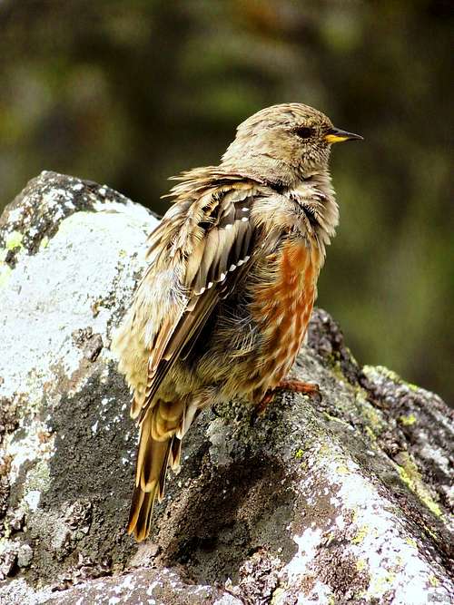
![Alpine accentor (Prunella collaris) on Rysy]() Alpine accentor on Rysy
Alpine accentor on Rysy


Comments
Post a Comment