
|
|
Route |
|---|---|
|
|
49.16170°N / 20.14830°E |
|
|
Mountaineering |
|
|
Spring, Summer, Fall, Winter |
|
|
Most of a day |
|
|
UIAA grade II/III |
|
|
Overview
The two easiest routes to climb Gerlachovský štit ascend two steep couloirs, the Velický žl'ab and Batizovský žl'ab respectively. The latter is a little shorter (in time, not in distance) and is often used for the descent. The scenic Velický route offers less hiking and more scrambling.According to the Slovak authorities, the official grade for both these routes is UIAA grade I-II (meaning that there are some sections of grade II). This is not just relevant as an indication for the difficulties, but also because the rules for the Tatras only allow unguided climbing below grade III during the winter season; in summer, lower grade routes may only be used to descend (see the Red Tape chapter for more information). This means that if you want to climb Gerlach in summer, you must either hire a guide or take a more difficult route - in which case you can descend by the Velický žl'ab.
For the record, my own estimate for the Velický žl'ab route is grade III. I mention this because it is relevant for the difficulties you can expect, but when it comes to the rules it does not carry any weight.
Bradavica from the base of the Velický žl'ab
Getting There
Map centered on Tatranská Polianka Click here to view a larger map
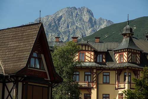
Gerlachovský štit from Smokovec
Starý Smokovec
Tatranská Polianka is the nearest village to the mountain. However, it's very small and has very little infrastructure. On the plus side, it has a railway station, serviced by cog rail trains.Four kilometers to the east of Tatranská Polianka lies Starý Smokovec, the largest village in the area. Not that it is big, but it is completely oriented on tourism. There are shops, including a couple of supermarkets. There are lots of accommodation options and restaurants. There is an info center, a museum and the office of the mountain rescue service. And, last but not least, there is a railway station. It's less than half an hour by train from the city of Poprad, which is well connected by road and train and even has a small international airport.
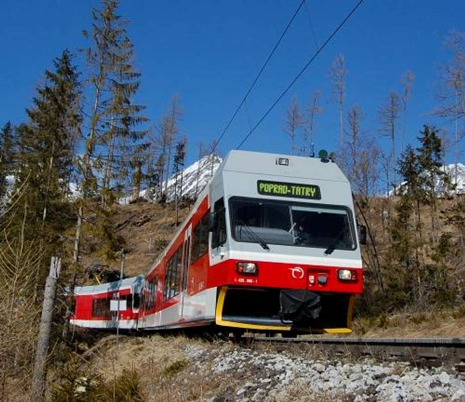
Cog rail train in the Tatras
Sliezsky dom
Sliezky dom, located just south of Velické pleso (or lake) has a long history as mountain refuge and hotel, dating back to 1871. The latest development, finished in 2011, turned it into an upscale hotel, but, in keeping with the mountain refuge history, there is still a bunk room for up to 9 guests.During the latest construction activities, a (private) 7 km long winding access road was constructed from Tatranská Polianka. The hotel runs a shuttle service for its guests, which is also available to hikers and climbers. Hotel guests are allowed to drive to the hotel after asking permission ahead of time, but parking is limited (and not free). For more information, click here.
If you decide to hike to Sliezky dom, the two shortest routes are the marked green trail from Tatranská Polianka and the marked blue trail from Tatranské Zruby, which later continues on a yellow trail and joins the green trail just before Sliezky dom. Both these routes are 5 km long. Alternatively you can take the 6.5 km yellow trail from Starý Smokovec.
Route Description
Open Source map with both the Velický and Batizovský routes, centered on the base of the Velický žl'ab. You have to zoom in a couple of steps before the name Gerlachovský štit appears.
Sliezsky dom lies at the southern tip of Velické pleso, the lake in the lower right.
Sliezsky dom lies at the southern tip of Velické pleso, the lake in the lower right.
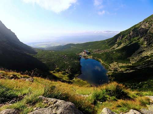
Looking down on Velické pleso and Sliezky dom
The Approach
Starting at Sliezsky dom (1670m), follow the marked green trail north, along the east side of the lake. After a few hundred meters, the big trail climbs steeply and passes a scenic waterfall. Above that, the terrain flattens out again and the valley widens.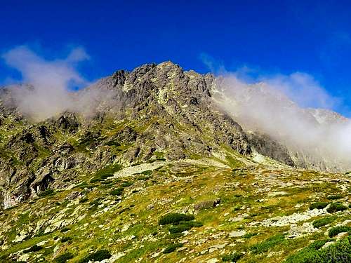
Kvetnicová veža
The Climb
The route can be broken down in three distinct parts: climbing the couloir, traversing high on the southwest face and the final summit push.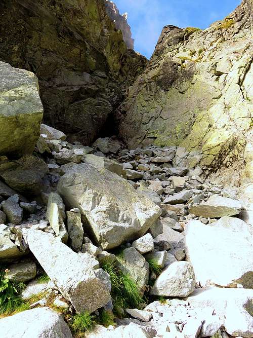
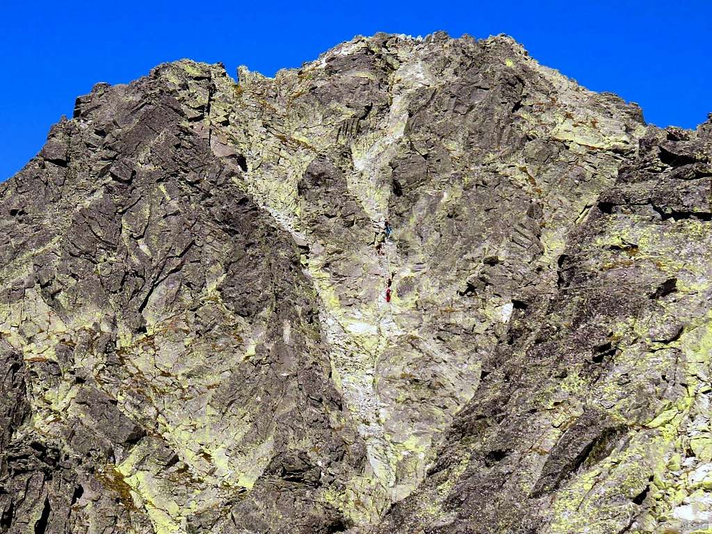
The base of the Velický žl'ab is the crux of the route
Climbing the Couloir
The steepest part of the couloir, or gully, is right at the bottom. It's about 5 m vertical rock. Normally there will be some water coming down the couloir, and consequently the rocks are wet, adding to the difficulties. In past times there was a chain here to aid the climbing. By August 2016 there was a small, rusty remnant of it right below the top of the rock step that was still good as a handhold.The official Slovak position is that the Velický žl'ab route is UIAA grade II. My own estimate for the start, and therefore the whole route, is grade III. Perhaps the official Slovak grades where set with the chain in place, and haven't been revised yet after it was removed?
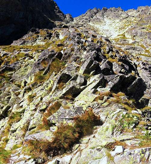
Above the rock step, the terrain isn't quite as steep anymore and it's easy scrambling for a bit, grade I and II. Soon after, the couloir widens, and the route exits the couloir on the right side, onto mixed rocky and grassy terrain. This is a fine spot for a break.
The slopes just right of the couloir, with the obvious saddle at the top. Though it looks deceptively close, it's still 300 m higher!
Traversing the Southwest Face
Gerlach isn't visible yet from the saddle, and won't be for quite a while, because Kotlový štit (2601m), a big subsidiary summit, is blocking the view. The main ridge from the saddle to Kotlov, and beyond to Gerlach, is much harder to climb than traversing the slopes below, on the southwest side.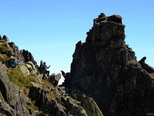
Guided party on the descent, traversing the SW face, on their way to the saddle
The main problem on the traverse is route finding. If you look carefully, you can occasionally see traces of a trail, but if you don't, you'll have to find your own way. This will certainly be the case in poor weather or with fresh snow cover.
There are a number of scree slopes running down the slopes, separated by rocky side ridges coming down from the main ridge, with the southwest ridge from Kotlov being the biggest. As a result, the traverse alternates between crossing the scree (or often the more solid rocks right above it) and crossing these side ridges. If you don't see signs of a trail, keep in mind that it's a traverse: you never want to loose a lot of height, but you don't need to gain all that much either. The saddle is just a bit more than 200 m lower than the summit, and the final push covers more than half of that.
After crossing the last side ridge, the route descends a bit to get to the base of the final steep south side. How far to descend, depends very much on where you cross the ridge, for which there are several options.
Shortly before I got on the last side ridge, I had often seen traces of where people had gone before, either close by or a bit further away, but now I did not see anything anymore. Descending on the other side looked difficult, so I had to make a choice. At first I scrambled up, following the side ridge, looking for a place where I could get down the other side. With a short rope there would indeed have been lots of possibilities - but I didn't bring one. I must have gotten fairly close to the main ridge when it got more difficult to continue further, so I turned around and scrambled down the side ridge instead, until I found an easy way down a little lower than where I had first gained the ridge. I estimate that I descended another 30 to 40 m to get to the base of the final face. And that was more than on any other side ridge.
Climbers on the south side, shortly below the summit
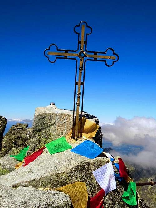
Gerlachovský štit summit cross
The Final Summit Push
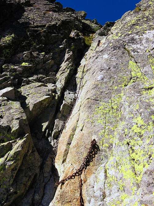
Unnecessary chain shortly below the summit
As is often the case with full frontal views, in the photo above the face looks steeper than it really is. I estimate that it's mostly grade I, with the occasional II. Falling is not an option, but there are plenty of good holds everywhere. High up I also came across what was perhaps the only chain on the route that had not been removed (yet). I didn't need it though, having scrambled up a few meters left of it, and in fact I only saw it when I was already alongside.
Instead of scrambling straight op this face, it's also possible to scramble up to the ridge a bit left of the summit, and then follow the ridge.
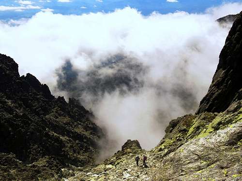
Looking down on climbers on their way to descend the Batizovský žl'ab
The Descent
Normally, those that climb this route descend by the Batizovsky žl'ab. Alternatively you can descend the route itself. When doing this, there are two key points to keep in mind.Firstly, at the end of the traverse, make sure that you are at the right saddle before descending on the east side, down the Velický žl'ab. If you've climbed the route, you'll recognize it when you're on the saddle, but if not, it's easy to miss. And surely you don't want to descend a different couloir, with unknown difficulties. For me, keeping a close eye on my altimeter was crucial. It wasn't calibrated, but I had memorized the elevation it gave earlier in the day. Furthermore it may help to know that when following the SE ridge beyond the saddle only nearby Kvetnicová veža (2433m) is higher, and not by much.
Secondly, as stated above, the crux of the route is at the very base of the couloir. A short rope can be useful here. I didn't have one, and I would have been scared to get down if I hadn't climbed it before and knew I could trust the (wet) holds.
Red Tape
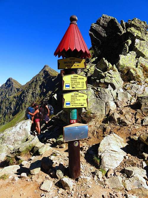
A typical signpost in the Tatras, a common sight along the marked trails.
First of all, climbing is only allowed when accompanied by a guide or for members of climbing organizations (bring your membership card).
Furthermore, leaving the marked trails is only allowed for the purpose of climbing, and you must follow the most suitable track to the start of the climbing route. Unless guided, the route must be at least UIAA grade III; the descent route may be easier. Only during the winter (more specifically, from 21 December to 20 March), routes of grade I or II may be used in both directions. Guided parties may use easier routes the whole year.
UIAA grades explained
Here is a short description of the first four grades on the UIAA scale.
| Grade I | The simplest form of rock climbing - no longer hiking terrain! Hands are required for balance. |
| Grade II | Climbing with the three-point technique. |
| Grade III | Protection at exposed places recommended. Vertical or overhanging sections with good handholds already require physical strength. |
| Grade IV | Considerable climbing experience necessary. Longer sections require multiple protection placements. |
These descriptions can be used to judge the difficulty of a route. In practice I find that this has its limits, and usually I just compare a route with others I have climbed. However, in the context of the red tape, the only relevant question for a route is whether the official grade is at least III or not. According to TANAP (the Tatra National Park organization, which, among other things, is in charge of the red tape) the Velický žl'ab route is officially UIAA grade II. That means it's not allowed to climb this route unguided except during the winter. Any other season it can only be used for the descent, or by guided parties.
Apology
Before climbing Gerlach I did my best to find out about what the rules meant for me, and I tried to find out the official grades for various routes. I misunderstood some of the rules from the documentation available, and I couldn't find the official grade for the Velický žl'ab route anywhere, but I thought I was allowed to climb it (I'll explain why in the trip report that I plan to post soon).Only later did I start to wonder, and to get the facts straight for this Red Tape chapter, I wrote to TANAP to find out. That's how I learned that I had broken the rules. I apologize for that, and I thank TANAP for not fining me.
With the answers now directly from TANAP, looking back at the rules on their site I still don't find them easy to understand. And to complicate matters further, someone with a better understanding of Slovak explained to me that the English and Slovak versions are slightly different (see here). I've concluded that the English version is not quite accurate.
When to Climb
The best time is the summer season. In theory, Gerlach can be climbed at any time of the year, though when using this route on the ascent you must go with a guide or go in the winter. However, winter conditions make the climb much more demanding, and with snow comes avalanche danger. On the plus side, a few meters of solid snow at the base of the couloir should make the start much easier (with crampons of course).Map
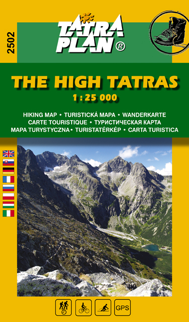
Excellent Tatraplan map
Note: Although I bought it in 2016, the small print says that it's the 13-th edition 2017.
Essential Gear
- Mountain boots
- Helmet
- Harness and a (short) rope can be useful
- With snow and ice, crampons and ice axe are necessary
External Links
Park Rules | Tatra National ParkA Czech post and a German trip report both state that the chains were removed early September 2004.
An old route description, dating back to 2010, was the best I managed to find before climbing the route. By now I know that there were some errors, and the chains, iron steps and bolts were not there anymore, but it still proved to be useful. Strangely enough, this implies that at least some of the chains were put back after 2004, only to be removed again later!
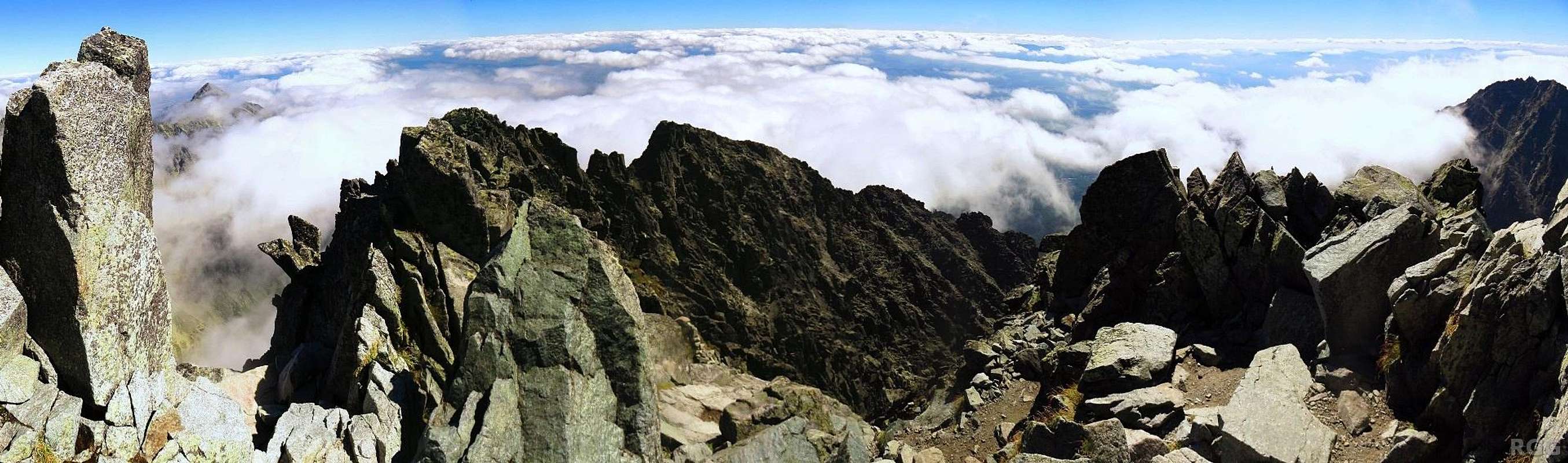
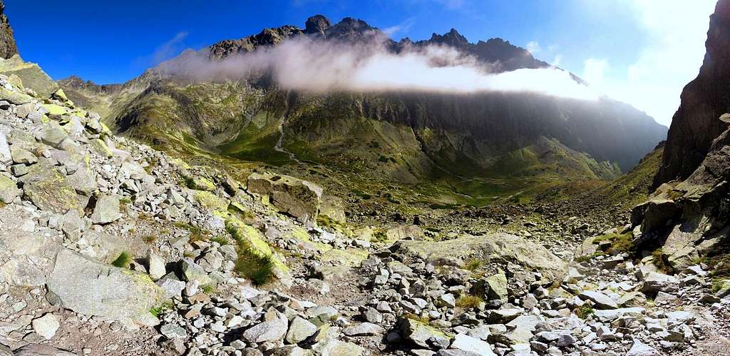
180° summit panorama towards Kotlový štit