
|
|
Mountain/Rock |
|---|---|
|
|
46.70630°N / 121.66312°W |
|
|
Hiking, Mountaineering, Scrambling |
|
|
Spring, Summer, Fall |
|
|
6310 ft / 1923 m |
|
|
Overview
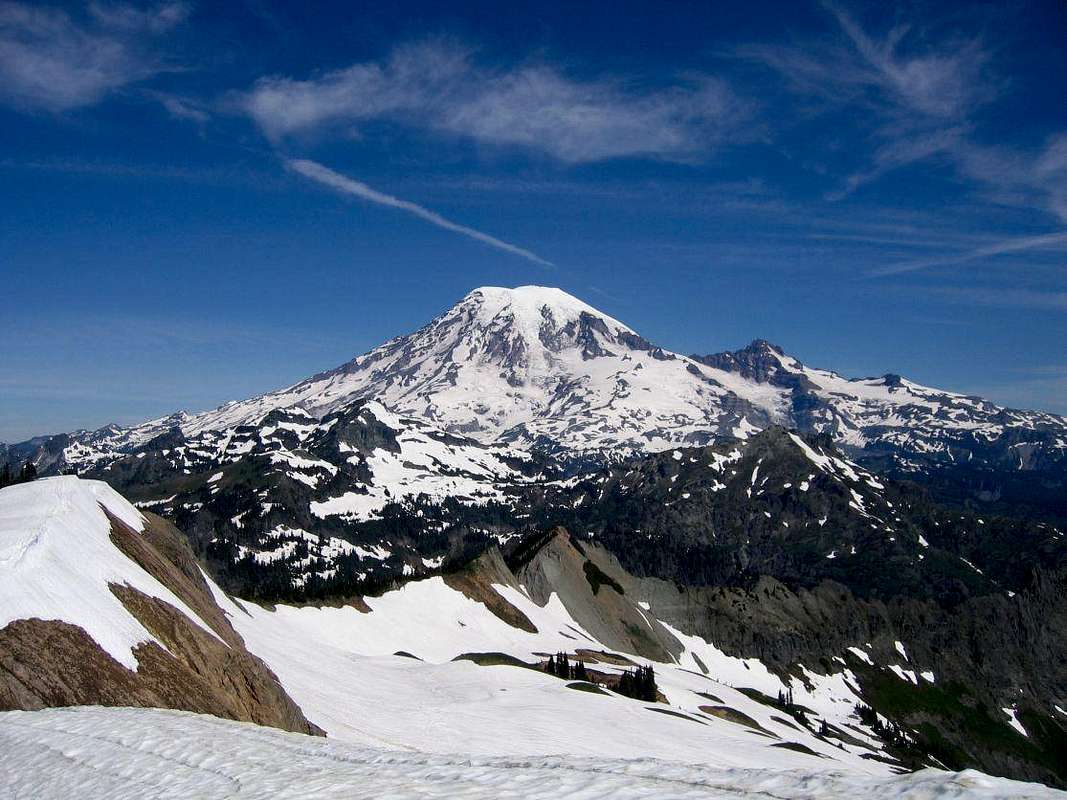
Tatoosh Peak is the southernmost peak in the Tatoosh Range and is located in the Tatoosh Wilderness - just south of Mt. Rainier National Park in Washington State. Despite its name and being of a height comparable to its siblings to the north, Tatoosh Peak is generally not regarded as being a part of the
Tatoosh Traverse as it lies outside the park. However, true Tatoosh complete-ists will need to visit this peak too to complete their collection and not be lulled by arbitrary man-made boundaries on a map. In any event, Tatoosh Peak is definitely worth a visit. The lookout site at the summit retains its sweeping panoramic views and it's a beautiful spot a clear day.
Tatoosh Peak has also garnered some renown as being the location where, in 1943, Martha Hardy wrote Tatoosh - a best-selling account about her experiences working here as a fire lookout throughout the summer. The Tatoosh Wilderness was created by Congress in 1984.
Tatoosh Peak likely sees more hikers than climbers throughout the summer and fall what with a well-established trails leading to the summit. Visitors earlier in the season (before mid-July), however, may find the snow travel on the approach more challenging. On approaching from the west, this peak can also be combined with a visit to the nearby Tatoosh Lakes.
Getting There
The easiest way to reach Tatoosh Peak is from Packwood, WA - located roughtly south of Mt. Rainier National Park. The Tatoosh Trail (#161) runs roughly north/south and can be hiked from either end to the summit at about the same distance (~10mi RT). Starting from north end is arguably the more scenic of the two.North Approach:
From Hwy 12 at the east end of town, turn off onto Skate Creek Rd (Rd 52). Cross the Cowlitz River in 0.5mi and continue for 3.5mi to turn off north/right on FR 5270 (gravel). Follow for 5.8mi to a junction and continue straight on 5270 for another 1.5mi to the trailhead.
Check with the local ranger station on conditions before driving here -- the road was very rough in July 2007 and may not be passable for standard 2WD vehicles.
South Approach:
As above although on crossing the Cowlitz River, turn right onto Cannon Rd. Continue upriver (the road becomes FR 5290 shortly) for 9mi. On arriving at an intersection, turn right and continue on 5290 for another 1.2mi to the trailhead near Hinkle Tinkle Creek. Butter Butte (5096') is another overlooked smaller peak accessible from this trailhead at the very south end of the range.
Red Tape
A free wilderness permit is required for all visitors to the Tatoosh Wilderness; this is available at the trailhead. A NW Forest Pass is not required to park at the northern trailhead.When to Climb
Tatoosh Peak likely can be climbed all year around -- although access to the trailheads may be an issue in winter. When snowbound locating the trail may also be an issue. Per a number of cliffs and steep slopes on the approach, caution should probably be taken in the winter as there is very likely avalanche danger on the approach.Tatoosh Peak is probably best done in the late spring to fall. Snow lingering on the western slopes of the peak may block the trail until about mid-July, so bringing an ice axe and/or crampons is probably a good idea until later in the summer. Alternate approaches may possibly be taken on Tatoosh Peak's north or west ridges. Bring your insect repellent just in case.
Camping
Camping is permitted in most areas throughout the Tatoosh Wilderness with the usual Leave No Trace ethics. Camping is not permitted, however, at the Tatoosh Lakes - and other sites will likely be lacking water later in the season. There did appear to be a small bivy site just north of the summit.External Links
Mt. Rainier Trail ConditionsThis site posts the current trail conditions for the Mt. Rainier area and can give you a good idea of what to expect in the Tatoosh Wilderness to the south.
Paradise WebCam
Mt. Rainier Paradise webcam. On a good day, Eagle Peak is visible left-center -- this can give a good approximation of conditions in the area.
Mt. Rainier Recreational Forecast
Weather conditions at Paradise will be very similar to those in the Tatoosh Wilderness.
Gifford Pinchot National Forest - Current Conditions
Good site to check on road and trail conditions reports although it is not updated regularly.