|
|
Mountain/Rock |
|---|---|
|
|
43.73510°N / 114.0816°W |
|
|
11305 ft / 3446 m |
|
|
Overview
The Box is located directly on the main crest of the Pioneer Mountains in central Idaho.

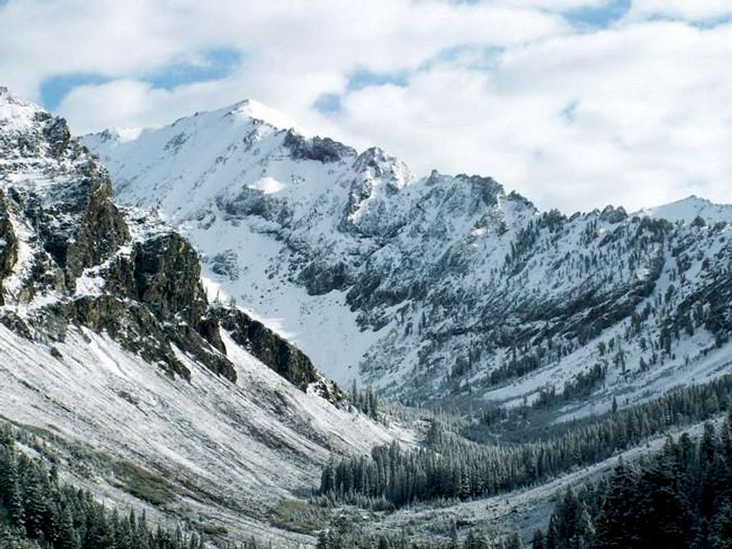
The Box is a beautiful peak that sits at the head of the Left Fork Wildhorse Creek, East Fork Big Wood River, and Box Creek. It is protected on all three faces by steep walls made up of loose and rotten rock.
The Box's unnclimbed north face is a sheer wall that drops 1,500' to an unnamed lake below. The southwest face is steep and made up of red and white rock shale that creates an unforgettable backdrop to the headwaters area of the East Fork Canyon. The southeast face that rises boldly above Upper Box Canyon Lake is primarily composed of bright white limestone reminiscent of a summit in the White Cloud Mountains further north.
The Box sees relatively little traffic most likely due to the fact of the very rough road to access the trailhead, peakbaggers and headed for nearby higher mountains, and its intimidating appearence from every direction. Most are suprised to learn that the easiest route to the summit, albeit quite strenuous, is an easy class 3 climb. The summit has some of the best views of the Pioneer Triumvite and Wildhorse Canyon to be found.
Getting There
To access The Box, a high clearence and four-wheel drive vehicle is an absolute must.
From Hailey, Idaho, drive north on Highway 75 for 7 miles until reaching stoplight that marks the turnoff for East Fork Road. From Ketchum, Idaho, it is 7 miles south on Highway 75 for this turnoff.
The first few miles of this road is on good pavement through various subdivisons. After passing through the old mining town of Triumph, the road turns to dirt and forks. The left fork heads up Hyndman Creek toward Hyndman Peak and the right fork continues heading up East Fork.
Take the right fork and drive on a very nice dirt road to Sawmill Campground. After here, the road slowly begins to deteriorate and especially so after pass Federal Gulch Campground. From the second CG, allow on 45-60 minutes for the last 4.5 miles on the road.
Some sections are very rough but it is generally just slow going. At one point, the road breaks into a field with stream running down the road and some parking to the side. This is the trailhead for PK Pass. Some may want to park here and walk the last .3 miles to the trailhead for Johnstone Pass, or the end of East Fork Road.
Southwest Face Route
This route requires the least amount of technical scrambling of any route other route that leads to the summit. The south ridge requires class 5 climbing and the east ridge is class 4.
Route Stats
Take the the unnmarked, but clearly cut, Johnstone Pass Trail from the end of East Fork Road. The trail quickly climbs up and over a small ridge and drops into a gorgeous mountain valley below Jacqueline Peak, McIntyre Peak, Peak 10,805, and The Box.
After about 1 mile on this relatively flat trail, it drops to the creek bottom and begins ascending the other side of the valley. At this point, "Little Matterhorn" or "The Witches Hat" comes into view. This small rock feature is absolutely gorgeous and resembles a small version of the Matterhorn in Europe. Unfortunately, its prominence is less than 50' from the backside and is not considered its own peak.

Once Johnstone Pass Trail begins to steeply ascend the slope the north, leave the trail and travel cross country across the high basin below some limestone cliffs and waterfalls. The best route to avoid some sketchy scrambling is to stay to the far east side of the canyon. This is a steep section that climbs 800' to about 9,800' or just east of "Little Matterhorn".
At this point, a small line of trees is visible above on the slopes of The Box. Continue heading toward the base of these trees until finding a small granite gully that leads up to the slopes above.
Take the gully through some easy class III terrain on solid white granite and loose volcanic shale. The gully will end roughly at 10,400' on the steep and loose southwest face of The Box.
From here, it is a 900' slog through loose rock to the summit. The best footing can be found along a small rib directly above the line of trees. At 200' below the summit it is possible to contour around to the south ridge above the towers that block it, and climb on the sturdy limestone rock to the summit.
Red Tape
East Fork Road is closed during the winter.
No red tape or permits required.
Many groups of Mountain Goats are found around here, please leave them alone.
Many abandoned mining digs are found on the approach up East Fork Road, for your own safety, stay away.
When To Climb
The Box is usually snow-free from late-July through late-September depending on the year.
A snow ascent would be extremely difficult because of the steep terrain surrounding The Box. Avalanche danger as well as access issues would both play major roles in a winter ascent.
Camping
The East Fork Valley above the Johnstone Pass Trailhead would make for a beautiful area to camp in.
Camping is also possible at the trailhead or Sawmill and Federal Gulch Campgrounds 4 and 6 miles from the trailhead.
Mountain Conditions
Although The Box is not located near any major weather reporting stations or observations the following links will are full of good info for conditions in the area.

NOAA Pinpoint Forecast-Has arguably the best 7 day forecast of any site around.


