Intro
Peak 15 (13700')-attempt
Peak 12 (13140')
Pigeon Pk (13972')
Turret Pk (13835')
Monitor Pk (13695')
Peak 13 (13705')
Animas Mtn (13786')
July 2-5, 2010
Participants: Dwight, Mike, Brian, Kevin P, Sarah, & Kevin B
Slideshow
I've only paid one visit to the Weminuche a few years ago to hit the Chicago Basin 14ers and Jupiter. It was high time to return. I have slowly whittled away at the centennial list and all that remains are mostly long backpacks in the San Juans. Pigeon and Turret require either a long pack in or a $100 train ride. Being unemployed, I decided to hike in from Purgatory. It adds about 18 miles round trip, but I got out of the pack out!
Peak 15 is regarded as arguably one of the most dangerous ranked 13ers in Colorado. Even though it is a bi-centennial, it sees few visitors. It involves some low 5th class climbing on questionable rock riddled with "kitty litter" gravel. Dwight was planning on being in the area and graciously agreed to lead it even though he did it solo a few years back. I get an email from Dwight the day before we leave lobbying for an approach via New York basin, which is what he took last time. He describes it as a "rough" approach. It shaves off about a mile and 500 feet versus the rugged Ruby Creek trail approach. Now when Dwight says something is "rough", you better not sign up for the abuse! I don't mind a bushwack and agree to go that way.
Day 1: From Purgatory to Hell
Day 1- From Purgatory to Hell
14.3 miles, 4200' gain (Purgatory/Animas River/Needle Creek trails/NY Basin to treeline)
Dwight and I car camp at the Purgatory trailhead at 8760' off of Hwy 550. We don't get there until about 1:30am. We get a few hours of sleep and set out at around 7:30. The first few miles go very quick as you descend some 1000 feet down to the Animas River on a good trail. We get rained on a bit, but it is brief. This was to be the worst weather day of the trip. The next segment of the hike is a gradual ascent up the Animas River to Needle Creek. We arrive in a little over four hours and stop for lunch, chatting with a few hikers heading up to Chicago Basin.
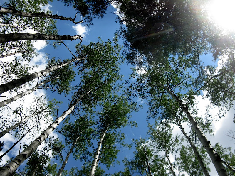
Tall aspens give us some nice shade along the Animas River trail:
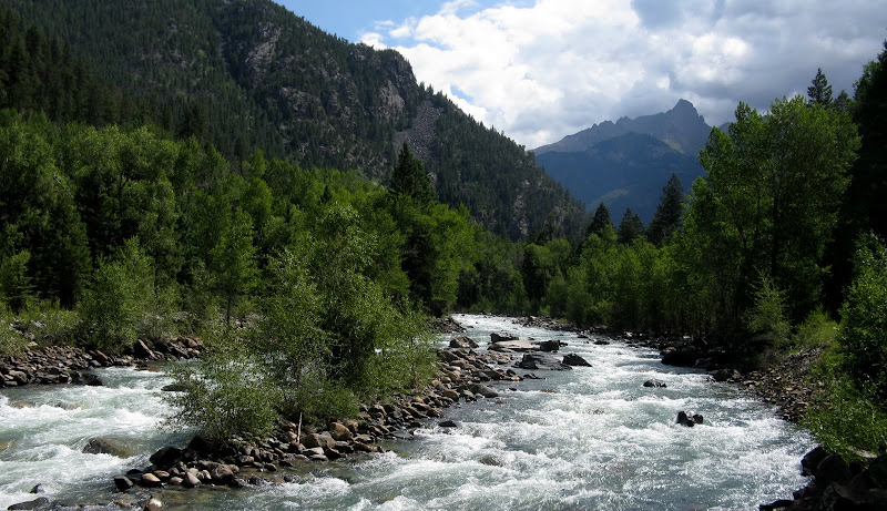
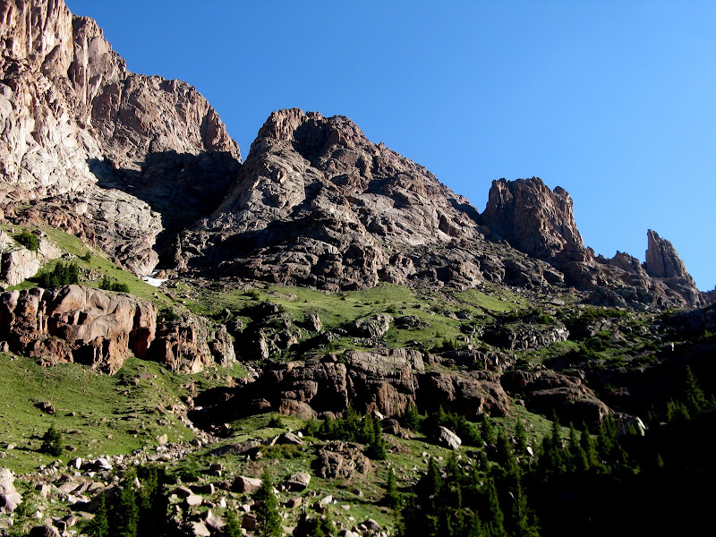
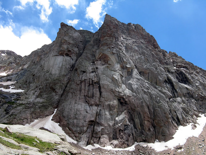
Pigeon towers above the Animas:
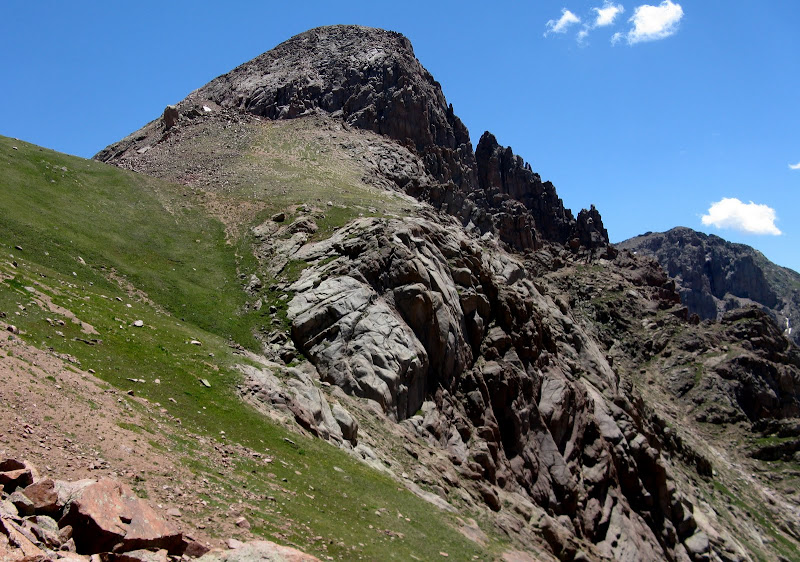
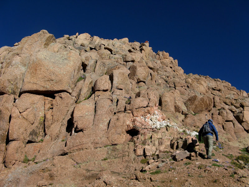
We press on up the Needle Creek trail and we enjoy the luxuries of a "civilized" trail for the last time in awhile. We hit New York creek at 9240' and are now faced with a ~1.25 mile/1800 foot bushwack to treeline. Doesn't sound too bad, right? Little did we know that this stretch would take us over 5 hours! We stay left of the creek initially and climb a ridge that is steep but goes well. The drainage starts to choke up and we are forced down into the creek where we weave around boulders and cross back and forth for awhile. Still not too bad. Higher up we see a couple waterfalls that are going to force us out of the creek for a long time. We decide to stick to the south side. Bad decision!
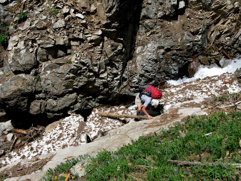
Dwight traverses an old snow bridge:
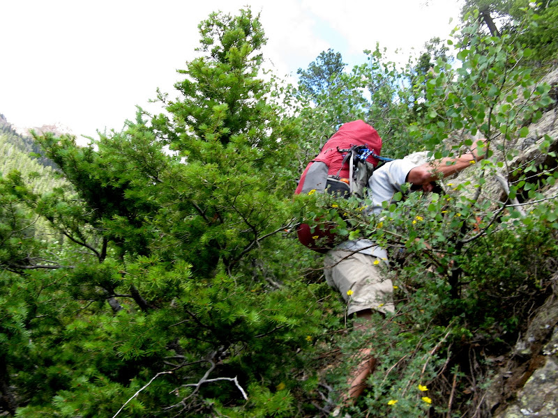
We are forced to sidehill steep slopes littered with loose rock, willows, bushs, and all sorts of encumbrances for hours. We are hard pressed to maintain a pace of any better than 1/4 mile per hour. This turns out to be the most intense bushwack I've ever done. Dwight hears the words "freaking tree" and "piece of crap" many times. It's a good thing I'm not a cussing man!
Advanced bushwacking at its worse:
A deep gorge in the slope carved out by a creek forces us to go agonizingly higher before traversing again. It doesn't take long for my 40 pound pack to gas me and we take a couple breaks to refuel. The terrain finally mellows out and we are able to traverse to the creek again.
Finally nearing treeline:
We set up camp at around 7pm just below treeline at ~11200' and hit the sack early.
Day 2: Peak 15 attempt & Peak 12
Day 2- Peak 15 attempt & Peak 12
3.6 miles, 3000' gain
The advantage to camping in NY basin is you have a much shorter approach on summit day, but then we have to haul your full pack over the Little Finger saddle to be in position for the rest of the trip. A pretty good size storm rolls through overnite and our morale takes a hit on getting Peak 15. We sleep in but decide to give it a shot as the skies start to lighten up. We set out at 7:30am and climb the steep, grassy slopes to the base of the couloir splitting Peak 15 & 16, weaving our way through some cliff bands.
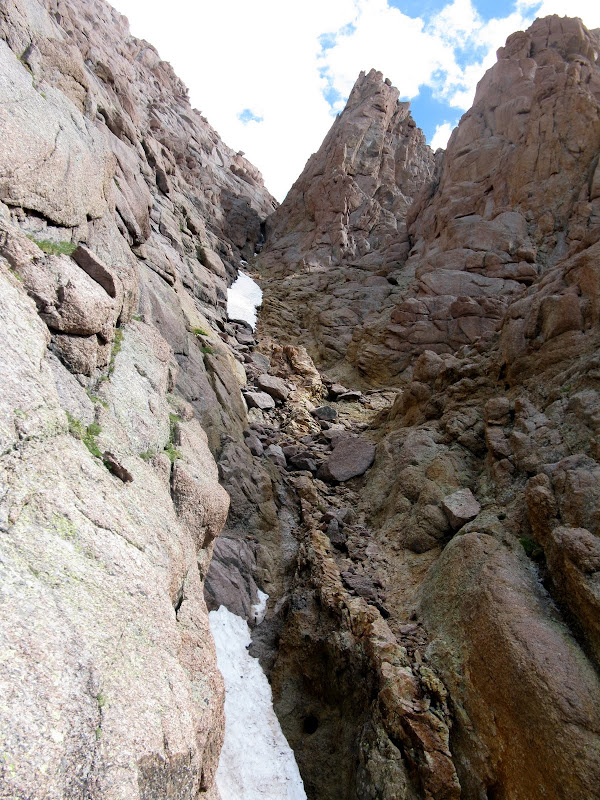
We cache our overnight gear and hang it off a big boulder a bit above the entrance to the couloir. The couloir holds some snow at the bottom that can't be avoided and at another section higher up, so we get on the face to the left of it. I should have brought crampons.
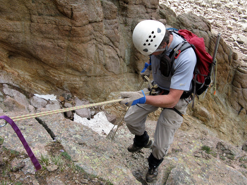
The face is exposed, class 3/4 scrambling on nasty kitty litter. I don't feel real confident with my footing. We get to about 12800' and are stymied by a cliff band that is too dangerous to climb unroped. We're going to have to rap into the couloir. By now dark clouds are building and there is a bite in the wind. I just don't feel right about pushing it any further and Dwight is on board to bail. It will be there another day for me.
Dwight raps down into the couloir:
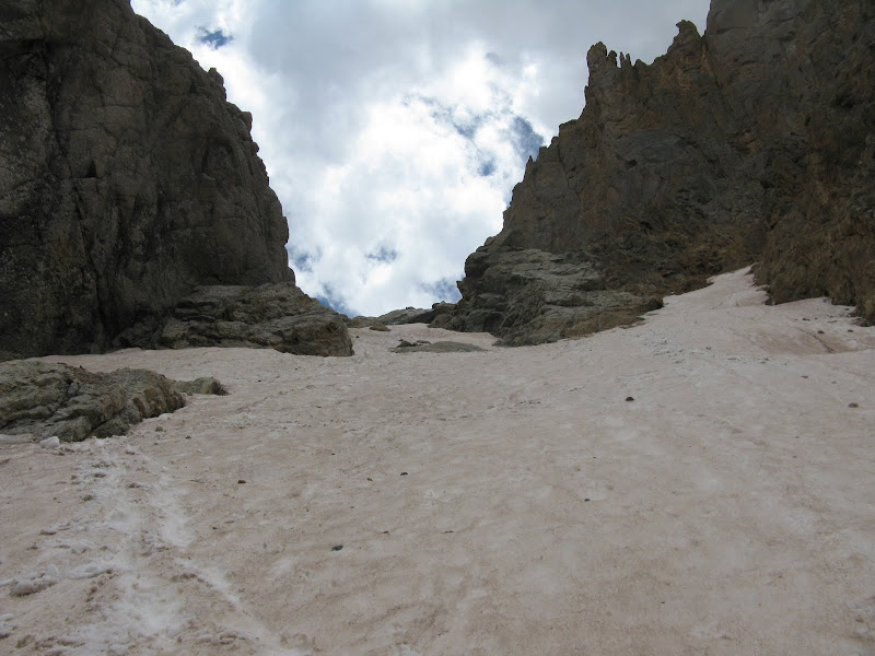
We repack our overnight gear and traverse across loose slopes and up to the Little Finger saddle. We then drop down into Ruby Creek basin where we will setup camp. The couloir down is dry for the first half, but there is snow to deal with for the second half. Dwight puts on some step-in crampons and kicks steps for me. It's about a 30-35 degree slope, which is tricky descending with trail runners and a full pack on. Both of us have to arrest near the bottom, but the snow is soft enough to stop quickly.
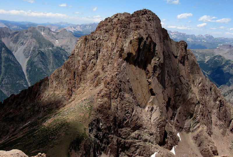
I decide to get Peak 12 out of the way, although the weather is looking iffy. It's the only walkup in the basin. I hang my overnite gear again over a cliff, which is a huge hassle. I find the trail that heads up to the saddle and Peak 12 goes quick with some minor scrambling near the summit. There are enough breaks in the clouds to lead me to believe that the electrical shows will hold off long enough.
The sheer n.w. face of N. Eolus:
Dwight finds a nice, grassy campsite near willows with easy access to Ruby Creek right at the base of the route heading up to Pigeon and Turret. Bob, Keith, Beth, Marlene, and Sharon arrive a bit after I do along with my partners for the next two days.
Day 3: Pigeon & Turret
Day 3- Pigeon & Turret
4.5 miles, 4500'
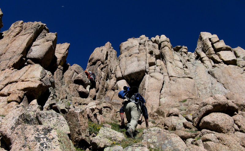
This day has the most vertical of any day, but it strangely feels like the easiest. I end up joining Mike Rodenak, Brian, Kevin Papillion, and his girlfriend Sarah for Pigeon and Turret while Bob's gang started a few minutes earlier. It works out well since it would not be good to have 10 people hiking together on these loose peaks! We set out at 5:45am on a rare July bluebird day in the San Juans. The route to the Pigeon/Turret saddle wastes no time testing your lungs and I have a hard time clearing the morning cobwebs. The views are superb though.
Bob's group and the east face of Pigeon:
We make good time up to the saddle as there is a decent climbers trail for a good part of the way. Now we are faced with a demoralizing 700 foot drop to circle around to the n.w. side of the mountain, the only way to scramble to the top. We drop to a 12780' saddle on the south side, then to 12400' underneath cliffs.
Pigeon looking mighty fine from the saddle:
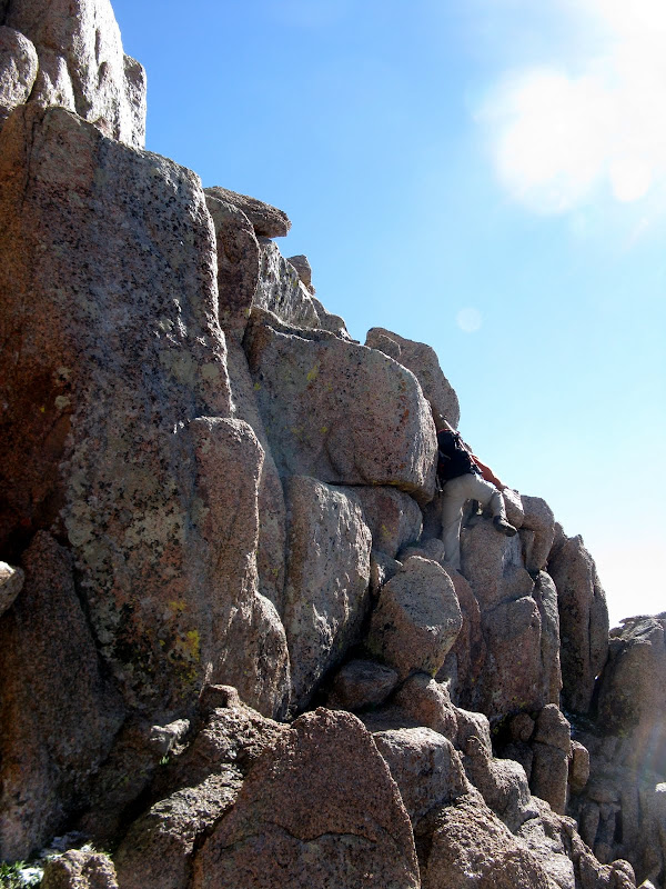
There's a faint trail for a good portion of this traverse. You are then faced with a steep, grassy, stairstepper workout up the northwest face to the broken ledges of the upper mountain. We then climb a nasty gully and hug the left side of it. We then traverse right out of it and weave our way up the ledges to the summit. We found that most of the scrambling was no harder than class 3, but it would be easy to get into tougher terrain. We top out at about 9:40am and enjoy a relaxed visit at the summit with Bob's group.
Typical terrain high on the mountain:
Mike on the exposed summit block:
We give Bob's group plenty of time to get out of the gully and begin our descent. As is always the case in the San Juans, you notice the loose rock a lot more going down! Trekking poles were very useful to reduce the slip-n-slides. We wrap around to the Pigeon/Turret saddle and there is barely a cloud in the sky, so we press on to Turret.
Turret looms:
Turret proves to be much easier via its west ridge with a few class 3 moves here and there. The routefinding is easy and there is a trail for the last 200 vertical or so. We top out at around 1:20 and the view over to Pigeon from here is impressive to say the least.
The descent back to camp is knee jarring, but goes pretty quick. The summit of Turret is only about 3/4 mile south (as the bird flies) of our camp site, but it's a 2300' descent!
Day 4: Monitor/12/Animas & Train Race
Day 4-Monitor/13/Animas & train race
7 miles, 2900' gain
The last day has the least amount of vertical, but offers by far the most challenge. The Animas group was quite a bit tougher than we thought and we pay the price for not doing our homework. Mike, Brian, and I set off at 4:10am with a stiff breeze and a temp of 30. I struggle to keep my hands warm with summer gloves on. And this is supposed to be summer? Luckily it's going to be another bluebird day. The goal is to climb the 3 peaks, pack out, and hit the train before it arrives at 3:45pm. I had my doubts.
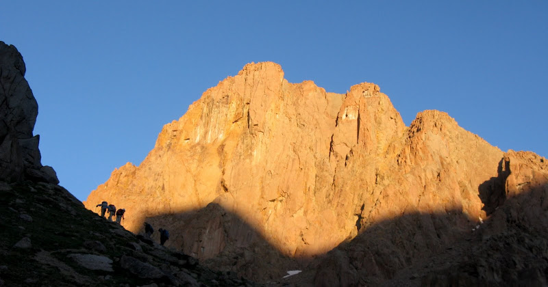
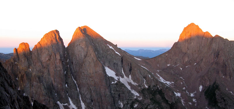
Once again, no rest for the weary as the steep grassy slopes kick my butt in the dark. We weave around slabs on grass and have to wait a bit for enough light to find the wide ledge underneath Peak 13 leading to the Monitor saddle. We make good time to the saddle and enjoy alpenglow on the Pigeon group.
Monitor is a serious class 4 climb made more difficult by loose kitty litter scree on top of hardpan in spots. We drop down to the right about 50 feet on rubble and then reclimb exposed 4th class blocks. There are a couple towers to navigate on the west side of the ridge.
We then climb a nasty gully to a notch in the north ridge and follow it to the summit. The ridge is much more enjoyable as the rock is more stable. The ridge is mostly 3rd class. We don't hang around on the summit long because it's cold and we're not sure how to get over/around Peak 13!
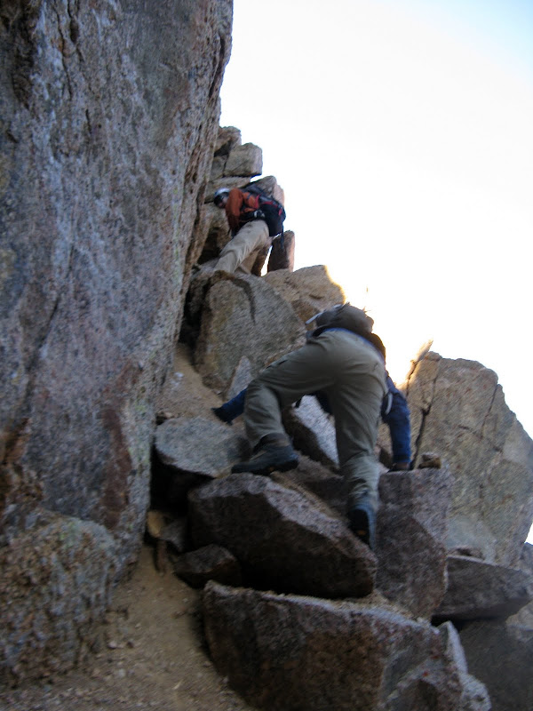
We carefully reverse our tracks to the saddle and take a ramp that heads over to the s.e. face. It looks like it dead ends at a corner, so it looks like we're going to have to find something on the s.e face because the traverse below the west face looks unreasonable. Mike climbs an exposed, 4th class chimney and Brian follows. I want Mike to make sure we can get to the summit from here before committing. A downclimb of this would be scary. Mike summits and partially descends the north ridge. It's a go. I wedge myself in and it's easier than it looked from below. Apparently if we would have followed that ledge further, we would have had an easier time. From the top of the chimney, it was mostly third class scrambling, finding the path of least resistance.
The upper s.e. face of 13:
The north ridge descent is exposed with sections of 4th class, but is not as loose as the other side. Animas proves to be my favorite of the 3 peaks, but we make the descent much harder than it should have been.
Scrambling playground on Animas:
We stayed a bit below the ridge, then traversed out onto the s.w. face, climbing a short low 5th class chimney that wasn't exposed. The quality of the rock was better and I enjoyed the scrambling, especially the exciting finish below the summit.
Brian pulls through a move near the summit:
Instead of retracing our route down to the Animas/13620 saddle as Garrett & Martin suggest, we descended a gully off the nw side of the mountain. We had to link up several gullies to find an exit to terra firma and it took awhile with a few backtracks. Brian got ahead and found an escape, while Mike and I found a gully that went further left that is ironically the standard gully for Animas. The traversing on the face was intense to say the least, so don't go our way!
We arrived at camp at 11:45 and packed out in 25 minutes, a new record for me! All that was left now was a descent of the heinous Ruby Creek trail, which is the roughest trail I've ever been on. Fallen trees, swallowing willows, loose rock, dead ends, and steep, steep, steep is the name of the game on this bad boy. Mike was nice enough to hang with me since I was a newbie to the trail until it crossed N. Pigeon Creek. Poor Brian got ahead of us and lost the trail. He ended up way below the trail and bushwacked from Ruby Creek to the Animas, contouring across several ridges! I arrived at the bridge at 3:20 and Brian made it with 10 minutes to spare. He was dehyrated pretty bad from the exhausting descent. What an adventure!
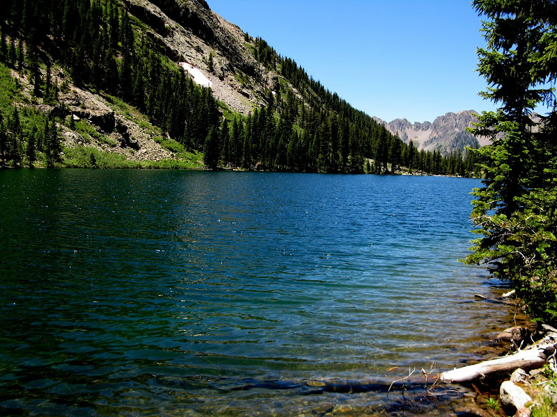
There's a high price of admittance for seeing Ruby Lake!


Comments
Post a Comment