
-
 4323 Hits
-
 75.81% Score
-
 6 Votes
|
|
Route |
|---|---|
|
|
46.35680°N / 13.86847°E |
|
|
Download GPX » View Route on Map |
|
|
Hiking |
|
|
Summer, Fall |
|
|
Most of a day |
|
|
Medium hard walk up |
|
|
Overview
Zgornji Tosc alpine meadow
Getting There

The chapel on Uskovnica
Uskovnica alpine meadow is one of the biggest and most beautiful ones in Julian Alps. It is sunny and panoramic. Nowadays shepherds huts are mostly converted into weekend huts and unfortunately, despite being on the border of Triglav national parc, forrest roads are uncontrolled penetrating higher and higher into the parc.
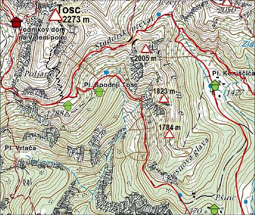
From Srednja vas in the upper Bohinj valley we can drive up (in summer) till Lom meadow, which is only some 10 minutes below Uskovnica. From Bled we can drive up almost through the entire year on Pokljuka plateau, till the winter sport center on Rudno polje. In summer we can continue from there towards the south-west almost to the creek of Ribnica. The road is closed for public traffic on some 1180 m, where we can park.
Route Description
From the crossroads where we park, we walk down by the road towards Uskovnica. Soon the road crosses the wild Ribnica creek (gorge) and in a few more minutes we reach the chapel on Uskovnica. There we keep right ahead, while the marked path goes left to the mountain hut on Uskovnica. By a cart road we cross the meadow and then start ascending across the slopes above Voje valley. By the last weekend huts the cart road ends (2012) and we continue by a good marked path, following inscriptions for Vodnikov dom on Velo polje meadow. The path goes now through nice woods.
Water source

Above Voje valley
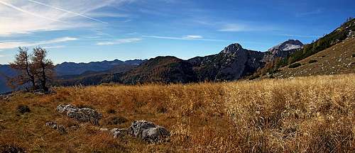
 Zgornji Tosc meadow |  Zgornji Tosc |  Voje valley from Zgornji Tosc |

Over the southern slopes of Tosc

Triglav

The summit plateau