
|
|
Mountain/Rock |
|---|---|
|
|
47.05935°N / 10.55737°E |
|
|
Hiking |
|
|
Spring, Summer, Fall |
|
|
8809 ft / 2685 m |
|
|
Overview
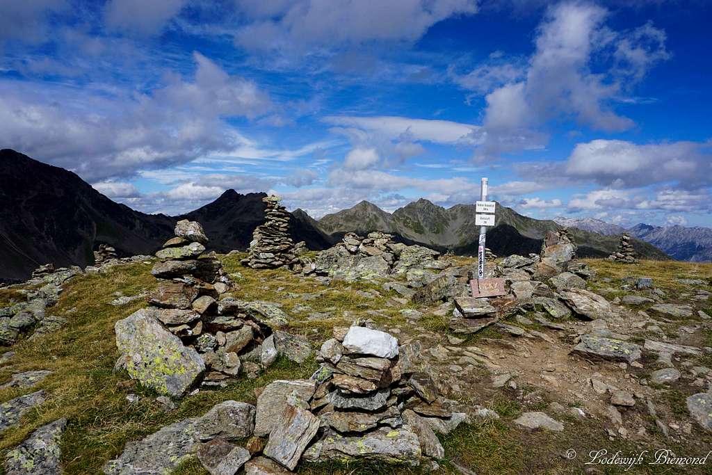
Stone towers on Vorderer Brunnenkopf
Vorderer Brunnenkopf is a mountain located high above the famous villages of Fiss and Serfaus. The mountain is a true hikers destination in summer and a ski-touring destination in winter. There are several well-marked trails up to its summit coming from West (Serfaus) and East (Fiss). The mountain is separated from its higher neighbor Planskopf by the Plansjoch saddle. To the east Vorderer Brunnenkof is bordered by Hinterer Sattelkopf (2670m).
Vorderer Brunnenkopf measures 2683 meters above sea level and is part of the long ridge connecting Zwolferkopf (2596m) in the NE with Planskopf(2805m) in the SW. In-between are Oberer- & Hinterer Sattelkopf (2670m) and Vorderer Brunnenkopf (2685m). The full ridge of mountains can be seen very well, especially from Serfaus (1427m). A famous hiking route in this part of the Samnaun group leads over the entire ridge of these mountains starting at Oberer Sattelkopf and ending at the highest peak of the ridge: Planskopf at 2805 meters. This hiking trail is not too difficult and very popular: T3+. Vorderer Brunnenkopf can be climbed best during the summer months plus in spring and fall, when there is no snow present on the mountain.
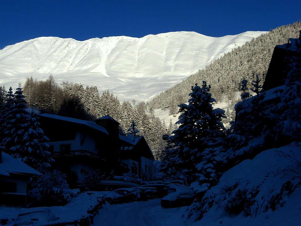 Brunnenkopf in Winter |  Brunnenkopf in Summer |
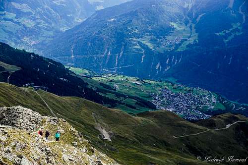
Vorderer Brunnenkopf is located in the (far) eastern part of the Samnaun Group. The only peaks more to the east are Oberer- & Hinterer Sattelkopf and Zwolferkopf. (2596m) The altitude of the ridge decreases further to the East-NE down to the village of Fliess, which marks the ending of the Samnaun Group mountains. Because of this position on the edge of the Samaun Group one can enjoy the perfect summit view, especially towards the north and east. Towards the north rises the Venet region with Glanderspitze, towards the east the Kaunergrat, towards the southeast the Glockturmkamm and towards the west the Samnaun Group.
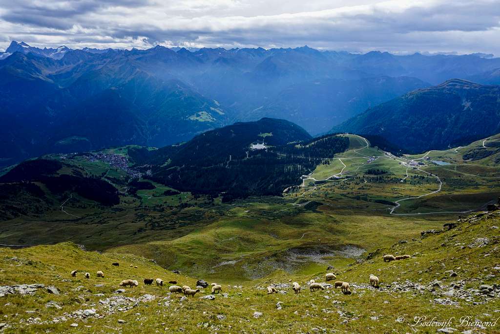
Sheep, Komperdell and Serfaus from the ridge
Summit Panorama
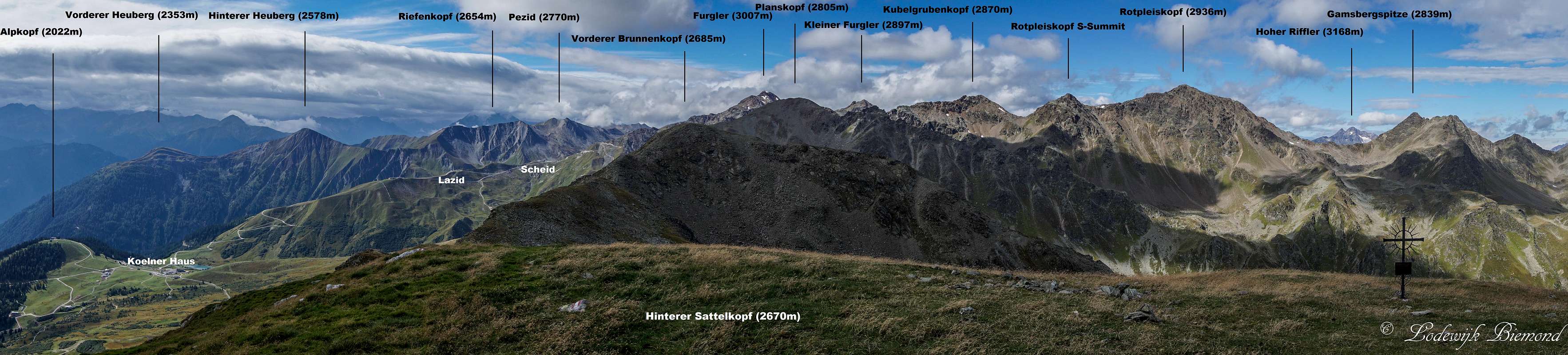  Brunnenkopf Panorama as seen from nearby Hinterer Sattelkopf (2670m) |
Route Overview

Vorderer Brunnenkopf MAP
Route: Fiss - Ridge- Serfaus
Vorderer Brunnenkopf and the Sattelkopfe
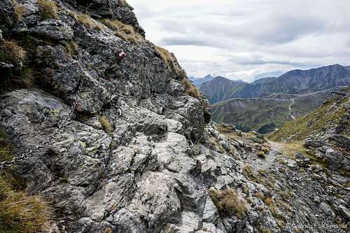
Secured part & Plansjoch
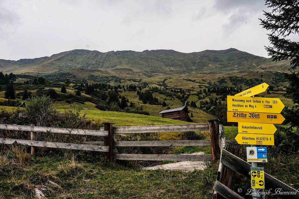
From the summit follow the marked trail towards the SW. You are now descending Brunnenkopf along the SW-flank. At this point the trail is secured by steel cables for a short section. This part of the trail is the hardest and graded T3 to T3+ at max. After descending this short section you will arrive on the Plansjoch, the saddlepoint connecting the mountain to Planskopf (2805m). At the junction on the Joch, follow the trail back down towards Komperdell/Serfaus. The trail goes down along the SE-flank of the mountain. You can already spot the cableway system beneath you. Follow the well-marked trail down and after 1 to 1,5 hours you will reach the Komperdell middle station. From here it is possible to take the cableway back down to Serfaus of hike further down to Serfaus (an additional 1,5 to 2 hours, T2). Of course it is also possible to hike this route the other way around and start from Serfaus instead of Fiss.
How to get there

How to get There Map
When to climb
On trail to Brunnenkopf
Maps & Books
Kummerleyand Frey – Ischgl & Serfaus - 1:35.000 - ISBN 9783259007136
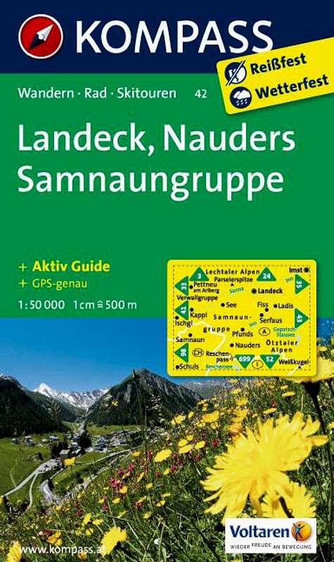
Kompass 42- Landeck Nauders Samnaun Group – 1:50.000 - ISBN 9783850265423
 |  |
External Links
Approaching the summit
Webcam Fiss & Brunnenkopf
Bergfex Weather Fiss and Serfaus
Accomodation in Fiss & Serfaus