
Comments
No comments posted yet.
Originally, I was going to solo Mt. Mansfield and heading into the climb, I felt generally optimistic, overconfident and borderline apathetic. Any one of many routes to the summit could be done in a day, so no base camp was needed. It was not a technical climb so no rope, helmet, harness, screws or technical tools. It was just going to be a nice little jaunt through the Green Mountains of Vermont.
The thing about an Alpine Tundra environment, however, is the fact that the weather can be brutal out of nowhere and for the unprepared, things can turn bad rather quickly. That New Year’s Day was some of the worst weather I’d ever been in, climbing or not.
It was roughly 700 miles from Ohio to Vermont. I was quite familiar with the first 8 hours of the trip. “The Green Mile” was a toll road running from Erie, PA, to Albany, NY. It was colored green on the Atlas. I’ve taken The Green Mile many times, heading to the Adirondacks, the White Mountains and to some East Coast climbing spots in-between.
Luckily, my cousin and climbing partner, Dusty, decided to join the adventure at the last minute, so I didn’t have to travel and hike alone. That would prove to be key as searching for the next Cairn in a whiteout is better served with two sets of eyes.
It took us just under 8 hours on New Year’s Eve to pass Erie, Buffalo, Rochester, Syracuse and Albany, before heading north. We took I-87 to Glen Falls and then turned east into Vermont. The drive up to Burlington was amazing. Lake Champlain creates the state line of eastern New York and western Vermont. So driving north, as you look left, you have the lake in the shadow of the Adirondack Mountains, and to your right, you have views of the Green Mountains. A driver couldn’t ask to be stuck in a more perfect middle.
Underhill State Park was about 40 minutes east of Burlington, Vermont, and after resting for the night, we arrived there at about 8 a.m. on New Year’s Day. There were cars parked in the lower lot on the mountain road, about a mile from USP, but none in the upper lot at the park’s entrance. We got out and started gearing-up.
Cross-over winter hiking boots, micro spikes, gaiters, long john tops and bottoms, hard shell pants, fleece layers, hard shell top, hiking poles and a backpack filled with: sunscreen, hard compass (in case the digital one on my wrist stopped working), water purification emergency tablets, ice axe, over-it-all down, topo and trail map, hat, gloves, neoprene face mask, balaclava, rope, water and food (cliff bars and PB&J).
After about five minutes of hiking up the forest road heading to the trailhead for Sunset Ridge, I was overheating. The weather forecast at the summit called for an inch of snow and negative 9F with the wind chill. Nothing too crazy. But that forecast had me over-layered at the start, which was 25 F at the car. Adjustments were made and we eventually found our way along the Sunset Ridge Trail. After a short distance, the Laura Cowles trail split off to the right. Both trails were about the same distance and came together again near the summit. Cowles’ ascent was through a forested ravine, so you would be protected from the elements and the path would be obvious. Sunset Ridge was exposed and could be difficult to navigate in bad weather. Even with the forecast calling for a little bit of snow, we wanted to go up Sunset for better views and a more challenging ascent. We got what we asked for.
The first mile was basically just winter hiking in the woods. Then we hit the sub-alpine zone on the ridge. There were small pines and shrubs, none higher than our thighs. The snow wasn’t deep enough to need snow shoes, which was good, but the problem was with visibility. You could only see about 20-30 feet in front of you, and everything was snow covered. Based on the topo, trail map and mileage, we had a pretty good idea of where we were. But it eventually just came down to finding a cairn and then searching for the next one.
We had to backtrack twice, but it was OK as our prints were still preserved in the powder. Eventually, we made it to where Sunset rejoined Laura Cowles near the summit. From here, you had to hike up to a little plateau and catch Long Trail, the final ¼ mile route to the top.
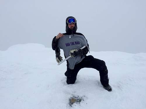
The ice-crusted wooden sign at Long Trail was very clear: you are about to enter a Tundra Alpine zone. Weather is insane. Climb at your own risk. Long Trail had rock on one side so there was some protection at first. Once you got above that, however, it was 35-40 MPH winds, barely any visibility and negative temperatures. After climbing for about five more minutes, we seemed to be at the top. Nowhere else to go, but extremely tough to conclude we’d summited. Dusty dropped to his knees and started scrapping away snow and ice from the rocks. Miraculously he found the survey marker, and we knew we had made it.
I took my glove off to snap some pics and my hand instantly froze. Why didn’t I have thin liners on? Shouldn’t be any skin exposure in those conditions. Nothing but the white fog of the sky as our view. We stayed four minutes before following our nearly-blown-away footprints back to the rock wall, then down to the Long Trail sign. Past the plateau and retreating down towards the junction of Sunset and Laura, when there was a moment of indecision. Left or right? Make the wrong choice and you could be wandering around in the Green Mountains for days. We picked correctly and found the junction. We decided to go down Laura Cowles instead of Cairn-hunting on Sunset Ridge. Although tiresome on the quads and knees, Laura was way easier to navigate and was a more direct path back down.
By the time we returned to our car, the upper lot was full, as it was Vermont’s “get out and hike day.” Many sleds, kids, parents, grandparents and pets were swarming the area.
Katahdin and Rainier are the next big two I have in my sights. Today though, is a day to rest.
Here's the video:
Mt. Mansfield Winter Summit from Adam Doc Fox on Vimeo.