Intentions
THOMAS BENNETT STUDENT ENRICHMENT MEMORIAL FUND IN CHEMICAL AND BIOLOGICAL ENGINEERING
Initially I was only going to write on SP about some lessons learned or insights gained from the tragedy as articles – recollections much more general and impersonal from the tragedy than a trip report. Personally I would have rather kept the story to myself and a select few loved ones, but the tragedy of Tom’s passing has become public enough now that for a variety of reasons I feel that I shouldn’t keep the full story to myself. Tom passed away due to sudden and unforeseen circumstances, and if it weren’t for his development of HACE, we would have both made it down in the wind without need for rescue.
I know that people are going to continue to publish reports of the tragedy whether I say something or not. They will second-guess Tom and me whether I say something or not; but it may make a difference to some people that I get the truth out. I feel that until I get a complete public report out, I will have neglected my duties to right the wrongs of the media, and also to put my anger about the aftermath to rest. At this point I have complete piece of mind over what happened and the decisions Tom and I made, so I’m not afraid of what others less involved or informed with these events think. Those that matter have already spoken, and the unanimous opinion is one of support.
For Tom and me climbing wasn't a trivial pursuit or a hobby, and we both have done it as carefully and thoughtfully as we could. We both took pains to educate ourselves, seek out mentorship, and practice the skills necessary to climb safely. We both even loved taking time to show others how to enjoy being out in the mountains safely. In the following account I’m intending to accurately portray what happened as well as the serious and thoughtful spirit in which Tom and I entered the mountains. There are some valuable lessons for other climbers to learn from the tragedy as well – the decisions I made that got me down the mountain alive. Tom's family has given me their blessing in speaking freely about Tom's last days in hopes that such positive messages make a difference for others.
Though I only knew Tom for a short while, we had quickly grown close. I feel as though I have lost an old friend, or a brother. It’s hard to put the feeling into words, but I found a similar reflection that I can relate to, written much more eloquently:
“Though I had only known Pete for the span of this expedition, we had become fast friends, seeing the same joke in this or that, moving at the same speed in the hills, and talking, always talking. Javid, our Pakistani liaison officer, between his sobs, said that according to his religion every move that we make, from beginning to end, is predestined by a higher force. But others would talk about the randomness of death, its fickle whims and unpredictable chaos. All that was sure to me at the time was a nagging uneasiness in the pit of my stomach and a certainty that it is just as poignant and terrible to lose a new friend as to lose an old one.”
- Greg Child, Mixed Emotions (41)
![Tom climbing in Squamish]() Tom climbing in Squamish Tom climbing in Squamish |
Top & Table of Contents
-
Intentions
-
Getting to Know Tom
-
Plans to ‘Climb Out’ Mt. Shasta
A Recount of the Mt. Shasta Tragedy
-
Thursday - Friday - Saturday - Sunday - Monday
Aftermath
-
Links
-
Images
Getting to Know Tom
I first met Tom at the Fall BBQ for the Cal Hiking and Outdoor Society (CHAOS) in September 2009. I had volunteered to help cook some burgers and it was while manning the grill that Tom and I got to talking. I had no idea at the time just how much he was into barbequing (he had entered numerous competitions in British Columbia), but he seemed to be a natural at it. We chatted along as the crowds bustled through and the sun set.
Once I learned that Tom was from Vancouver I immediately took a particular interest in chatting him up. I love the city, though I’ve only been there once, and I wanted to get a local’s take on the mountains there. Tom was an avid rock climber and cyclist, and he immediately took to me as I told him about my background and interests in alpinism and cycling. Tom had come down to California to continue a relationship he had with his girlfriend, who had just begun her PhD in Neuroscience at U.C. Berkeley, and although he wasn’t going to be down in the Bay Area full time until New Years, we made plans to make plans.
It was barely a week after the start of January 2010 that Tom and I got out in the mountains together for our first time. I had wanted to climb
Sargents Ridge on Mt. Shasta this winter, but with a strange twist that didn’t appeal to everyone – not only would the climb be done in the soft and shallow snows of mid-winter, but I also wanted to intentionally spend a night on the ridge at an exposed campsite. Although there were few takers, Tom was eager to join me for the route in the style that I wanted to climb it.
I knew I could climb the route car-to-car in a day, but I wanted to make things more interesting and gain more experience by camping in an exposed area where it would be necessary to carve out a snow ledge and maybe even tie into some snow anchors. I have ambitions to climb where such camping would eventually be necessary, and I often make an effort to practice these sorts of things ahead of time. For example, I’ve done a number of outings to the mountains with the sole purpose of building snow anchors or digging snow caves.
![Camp on Sargents Ridge]() Our intentionally exposed campsite on Sargents Ridge
Our intentionally exposed campsite on Sargents Ridge
Ultimately we only climbed to 12,000 ft since we had taken too casual of a pace and had been caught off guard by the difficulties from the low snow conditions and the complexity of route finding on the crux of the route. Still, the trip was a great bonding experience. We were a perfect match in fitness, attitude, and interests. We seemed to be thinking as one, and when the decision came to turn around, we both arrived at the decision independently, at the same time, and for the same reasons. I have never climbed with anyone else where the decisions in climbing had felt so fluid and in sync. The way we chose to descend was unusual, since usually there is some trepidation for suggesting such a thing, whether it is saving face or not wanting to appear to weak or uncommitted, but for us there were no reservations.
![Game Over!]() Tom and I choosing to abandon our attempt on Sargents Ridge
Tom and I choosing to abandon our attempt on Sargents Ridge
Though we didn’t succeed on Shasta, we made plans to return to the mountain with the same intention of climbing the peak in unusual styles as training for bigger climbs. I didn’t realize it at the time, but throughout the spring we were so in sync with our passions that we were quickly drawing up plans to climb the world together.
Subsequent weekends had bad weather for getting out safely for alpinism, but that didn’t stop me and Tom from milking every moment we could get in the mountains. We were up at Lake Tahoe together nearly every weekend over the next few months skiing at Kirkwood. Tom was an experienced backcountry split-boarder, I was looking to get into backcountry skiing to augment my mountaineering trips, and Tom was eager to get me into it. Soon we made a habit out of spending one day ice climbing near Lake Tahoe, and the next skiing at Kirkwood – the perfect ‘two-fer’ weekend. On one perfect weekend we even managed to get back to Berkeley early enough to catch a showing of the Banff Mountain Film Festival.
Tom and I quickly grew to be close friends. I had only known him a few months, but already I was beginning to feel as if I knew him my whole life – in some ways he was like the brother I never had. He was always eager to sign up for every crazy idea I had, he goaded me into trying new things, and he was always eager to share and teach. We each complimented each other with our strengths and weaknesses, and our friendship quickly extended to getting out on the town together beyond just climbing.
We even had similar attitudes of practice and preparation for safe and thoughtful climbing, and an eagerness to share alpinism and this attitude with others. We helped Scott Morrison to lead a beginner snow camping trip for CHAOS to the Mariposa Grove in Yosemite, where the Giant King Sequoias are. Tom had eagerly attended my meetings for a winter mountaineering clinic that I was teaching for my second year in a row, and he had even offered to assist in the field outings where I would be introducing CHAOS members to techniques of winter camping, climbing, and safe winter travel practices.
![Tom Bennett]() Tom helping to lead a beginner snowcamping trip in the Mariposa Grove
Tom helping to lead a beginner snowcamping trip in the Mariposa Grove
Top & Table of Contents
-
Intentions
-
Getting to Know Tom
-
Plans to ‘Climb Out’ Mt. Shasta
A Recount of the Mt. Shasta Tragedy
-
Thursday - Friday - Saturday - Sunday - Monday
Aftermath
-
Links
-
Images
Plans to ‘Climb Out’ Mt. Shasta
The spring of 2010 was to be a great one for me to develop my skills as an alpinist. I had an ambitious expedition planned to attempt a winter ascent of the rugged and remote Black Kaweah and as this trip came together I decided that this year I felt up to the challenge of attempting Liberty Ridge on Mt. Rainier in the spring. Due to various reasons the Kaweah trip fell apart at the last minute, leaving me with several free weekends and a desire to push my technical experience in preparation for Liberty Ridge, which I still intended to climb. This led to my idea of climbing out Mt. Shasta.
I have already climbed a number of routes on Mt. Shasta, and I realized that with sufficiently ambitious and carefully planned weekends, I could probably climb the rest of the remaining routes on Mt. Shasta over the spring and summer. Tom was eager to join me for everything that I was planning for Mt. Shasta. The routes that I was planning to do in the spring would be good opportunities to get in shape and get more technical experience for Liberty Ridge, and I talked with climbing ranger Eric White to determine early season access, optimal time to climb the various routes regardless of access, as well as other information. Trailheads on the north and east sides of the mountain aren’t kept open in the winter, and they tend to not melt out until June or July, so we were expecting at least an additional 5 miles and 2,000 ft of climbing each way for all routes.
The Bolam Glacier and the icefalls on the Whitney Glacier would be the first routes we planned to climb, as the best time to climb them this year looked to be March or April. Although the approach was long, Tom and I were strong, and we figured that with taking Friday off from work, we could make the approach, set up camp, and climb both routes in one weekend, effectively yo-yo’ing the peak. We would start the approach Thursday night, finish the approach and summit via the Bolam Glacier Friday, camp high on the mountain, and climb the icefall variation of the Whitney Glacier Saturday before heading out Sunday. I had drawn up similar plans for other routes later in the year as well.
As the planned weekend for our trip approached, I regularly checked the Mt. Shasta Avalanche Center advisory and NOAA point forecast to make sure that conditions would be reasonably safe for such a large outing to the mountain so early in the season.
The avalanche center weather discussions focus more on historical and forecasted weather details relevant to avalanche danger, but it also sometimes talks about the general weather forecast in terms of storms moving through. This can be helpful in determining whether the weather forecasted is likely to be localized weather (at which point I am more inclined to go to Shasta and climb based on what the weather appears to be doing on the mountain the day of the climb) or a system moving through (at which point I just plain stay away from the mountain until the weather has cleared through). I was also concerned about avalanche danger from some of the expected snowfall and wind loading. For the upcoming weekend the advisory looked great for an ascent of the north side of the mountain.
The NOAA forecast was a
point forecast for the summit area of Mt. Shasta, which is very location specific and based on computer models, although accuracy is certainly not guaranteed, but probably better than any other source. In the days leading up to our trip, the forecast called for some storm activity on Mt. Shasta, with a few inches of fresh snowfall, winds in the 30-40 mph range, and cold temperatures. However, the forecast showed the weather to be clearing Thursday and Friday, with Friday night through Sunday afternoon being completely clear. Sunday afternoon it appeared that clouds would begin moving back in, and for Monday and beyond the forecast called for a 10-20% chance of ‘negligible’ precipitation. No information was listed for winds, but the temperatures appeared to stay mild and as far as I could tell, the weather appeared to be localized weather and not part of a larger system moving through.
As of Thursday afternoon the overall forecast wasn’t the best, but it wasn’t bad either, and there were no indications of a storm system moving in. The forecast was pretty typical of Shasta for the winter, and the two times I had already been up in 2010 had had drastically different weather than was forecasted. Plus, we were looking at the forecast for as far away as Sunday and Monday, and weather forecasts are
not all that accurate in general beyond the current day, especially beyond 2-3 days out.
![Mt Shasta Re-Created Weather Report]() The last weather forecast that we saw before leaving for Mt. Shasta (Re-creation)
The last weather forecast that we saw before leaving for Mt. Shasta (Re-creation)
Mt. Shasta makes its own weather and is so unpredictable that it reduces this accuracy enough that my belief for the most appropriate way to use forecasts is to use them as a starting point for assessing and predicting the weather, and then to watch signs on the mountain in terms of clouds (e.g. lenticular clouds) and wind speed and direction and see how things match up with the forecast. If the development of weather on the mountain matches the forecast, I tend to emphasize the forecast more in my decision making. If the conditions deviate, then I put less weight on the forecast, watch the mountain even more closely, and weight my decisions more on signs on the mountain and the uncertainty of what the weather will do. This is how climbers are advised to climb notoriously serious and unpredictable peaks such as Denali, which I climbed 2 years prior.
Top & Table of Contents
-
Intentions
-
Getting to Know Tom
-
Plans to ‘Climb Out’ Mt. Shasta
A Recount of the Mt. Shasta Tragedy
-
Thursday - Friday - Saturday - Sunday - Monday
Aftermath
-
Links
-
Images
A Recount of the Mt. Shasta Tragedy
Thursday, March 25th
Originally Tom and I had planned to leave work early and arrive at Mt. Shasta by sunset on Thursday, as this would leave us enough time to do part of the approach that night and make it easier to cover more ground the next day. However, Tom had a meeting that ended up running late, which made us leave late.
The drive to Mt. Shasta was great. Light-hearted humor abounded (e.g. the jokes about syphilis on his stick abounded – and no, it’s not what you think it is). We realized a shared connection in our appreciation of viewing mathematics and physics in nature, such as why the edges of a broken avalanche slab or medial crevasses form crisp cuts at 45 degrees up slope. We talked about the turmoil currently brewing in his personal life, and on a positive note began making plans to find a place to room together later in the spring.
Tom and I drove to Mt. Shasta’s north side on Military Pass road. We made it about 0.9 miles off of Highway 97, but by 5,000 ft the road had too much snow cover to proceed any higher
(a). By this time it was nearly midnight. Realizing that making part of the approach that night was a lost cause, we decided to sleep at the car and head up in a few hours. We went to sleep around midnight with all of our gear packed.
Friday, March 26th
![Mt Shasta Tragedy - Day 1 (Far)]() Day 1 on Mt Shasta - Approach
Day 1 on Mt Shasta - Approach4:30 am – Approach
![Heading to Shasta]() Heading cross-country towards North Gate under full packs
Heading cross-country towards North Gate under full packsWe woke up at 4:30 a.m., ate breakfast and drank lots of water to fully hydrate for the big day ahead of us. We started walking up the snow-covered road in our snowshoes with our 50 lb packs at 5 a.m. In order to have an easy route to follow up and down the mountain in low visibility, we chose for the route to follow the prominent creek that starts crosses Military Pass road and wraps around North Gate. From there we would pass through a prominent notch and follow another drainage until it started to steepen. From there we could traverse further west below cliffs and above a pair of rock horns as we traversed through another notch over into the drainages for the Bolam Glacier. The creek be easy to follow, and it was bordered by a continuous and prominent ridge with little tree-cover, indicating easy cross-country travel with good visibility of the surrounding area. The remaining route was above tree line with well-defined features and would also be relatively straightforward to follow from our camp for descent.
By 5:45 a.m. we reached the turnoff from the road
(b) and we ascended the ridge until we reached North Gate at 6:45 a.m
(c),about 5 miles and 2,200 ft from where we had started. We then dropped into the creek and followed it directly up to a saddle at 7,920’. During the ascent the skies were sunny and clear, although Mt. Shasta had a lenticular cloud on the summit. Winds were non-existent until we reached the saddle. At the saddle the winds suddenly picked up, blowing a lot of snow down from the slopes above.
Winds continued to blow at around a steady 20-30 mph with lots of loose snow as we ascended into the next drainage west from North Gate, traversing around the mountain towards the Bolam Glacier. At 8:20 a.m. we had covered about 6.5 miles and 3,500 ft of gain in ever-softening snow in our snowshoes.
We took a small break near some rock outcroppings at 8,600 ft to eat some food and enjoy the blowing snow
(d). Tom posed in our wind-scoured lunch break spot as I snapped away with my camera. Winds continued to blow down directly from the mountain as we continued traversing west through an annoyingly breakable wind crust.
![Snow Dunes near the Bolam Glacier]() Snow ‘dunes’ above North Gate Snow ‘dunes’ above North Gate |
![Tom Bennett]() Tom at our luncbreak Tom at our luncbreak |
![Tom Bennett]() Tom in blowing snow from the ending storm Tom in blowing snow from the ending storm |
![Wind Scoured Snow Near the Bolam Glacier]() Wind scoured snow Wind scoured snow |
![Wind Scoured Snow Near the Bolam Glacier]() Wind scoured snow Wind scoured snow |
As we rounded the corner into the east fork of Bolam Creek (
(e)Far,
(e)Close), winds decreased somewhat. We climbed a 20-30 degree chute to our left, cutting out of it early by climbing steeper slopes directly to our right, topping out on a ridge. We followed the ridge up a short ways and dropped off to the right into a shallow drainage.
![Mt Shasta Tragedy - Day 1 (Close)]() Day 1 on Mt Shasta
Day 1 on Mt Shasta
By 11:30 am we had reached a nice view of Mt. Shasta and the Bolam Glacier. Earlier Tom and I had planned to climb up to the Pt. 10,748, where we would cache our camp gear before ascending the Bolam Glacier. We would then pick up the gear and traverse over to the Whitney Glacier to set up camp for the next day. Because our trip had gotten a late start with no approach the night before, we decided to abandon this idea. Instead, we would make camp at the base of the Bolam Glacier first. If we set it up fast enough, then we would climb a ways up the Bolam Glacier depending on our energy, time of day, and weather, and then descend to camp that night.
![Approaching the Bolam Camp]() Headwall climb Headwall climb |
![Approaching the Bolam Camp]() Making progress on the north side approach Making progress on the north side approach |
![Approaching the Bolam Camp]() I can see our camp from here! I can see our camp from here! |
![Bolam Glacier Camp]() Setting up camp below the Bolam Glacier Setting up camp below the Bolam Glacier |
At about 9,800 ft we found a nice protected spot for our campsite (
(f)Far,
(f)Close) The wind here was virtually gone, and there was a nice snow slope to dig the tent into. Walking up and left about 100 ft gave us a nice view of the mountain, while the camp itself was protected by the wind from all 4 sides.
As we set up camp we admired a strange site on the mountain that I had never seen. Vortices were forming off of the summit*, and these spiraled through the lenticular clouds like swirling bubbles. Sometimes they even formed on Shastina before bouncing off the main summit and down the east side. The vortices were roughly 1000 ft long and 300 ft high and they moved from the summit down the slope and out of view within about 30-45 seconds. I later looked at a map to see the distance they moved and clocked the vortices to be moving at about 80-120 mph.
![Mt Shasta Vortex Shedding Diagram]() ’Vortex Shedding’ on Mt. Shasta
’Vortex Shedding’ on Mt. Shasta
Lenticular clouds are a sign of moisture in the air and very high winds, so it did not look like a good time to summit. The weather forecast for the day had called for cloudy skies and moderate winds left over from a storm that had passed through earlier in the week, with winds decreasing and the sky clearing for the next day. As we set up camp the lenticular cloud dissipated, matching our expectations of this being the tail end of bad weather from earlier in the week, with weather improving for the next few days.
| |
|
|
| |
|
![Shastina Roughing it Up]() Turbulence from Shastina breaking up the edges of the lee-wave clouds Turbulence from Shastina breaking up the edges of the lee-wave clouds |
3:00 pm - Climbing the Bolam Glacier
![Shasta Lenticular]() Lenticular cloud on Mt Shasta from the departing storm
Lenticular cloud on Mt Shasta from the departing storm
Winds at our camp were light and we still had a good number of daylight hours left and a full moon to look forward to, so we decided to rope up and climb the Bolam Glacier as high as we felt was safe and worthwhile. We climbed above our camp and roped up at the toe of the glacier at about 10,400 ft. The ascent of the glacier went quickly. As we ascended the lenticular cloud disappeared and the winds remained light.
![Tom Bennett]() Tom beginning our tentative foray up the Bolam Glacier Tom beginning our tentative foray up the Bolam Glacier |
![Bolam Glacier]() The lenticular cloud fading away The lenticular cloud fading away |
As we ascended, there were no crevasses to be seen, although the patterns made by wind-scoured and deposited snow made it difficult to tell whether patterns on the snow were transverse crevasses or not, so we exercised caution. At one point when Tom was leading, he stepped into a small crevasse, but he only sank one leg low enough to realize there was no bottom to that foot step. Later, on the way down, I saw that the crevasse was probably the bergschrund. Still, the plunge was an indication that it was good to be roped up on the glacier.
We wound our way left and right on the glacier to bypass some small icefalls and avoid the areas most likely to be crevassed. Some of the icefalls were cone-shaped chunks of ice colored by an unreal hue of blue, jutting up through the winter snowpack like teeth. These seracs were a surprise, both because we didn’t expect to see any on the Bolam Glacier, and because they had a conical, Hersey Kiss shape to them.
![Tom Bennett]() Tom on the Bolam Glacier Tom on the Bolam Glacier |
![Tom Bennett]() Tom & ‘Hershey Kiss’ seracs on the Bolam Glacier Tom & ‘Hershey Kiss’ seracs on the Bolam Glacier |
![Seracs on the Bolam Glacier]() Hershey Kiss seracs on the Bolam Glacier Hershey Kiss seracs on the Bolam Glacier |
I was feeling very tired from such a long day out and was feeling the altitude, so Tom led out once more. As we ascended higher we climbed slower as the slope steepened and the snow softened. Tom’s ascent rate slowed and his cursing increased as the snow softened and became less consolidated. He wasn’t used to climbing in soft, deep snow, so the extra exertion and mental frustration were taking a toll. Since I was used to such snow after growing up climbing in the powdery Wasatch Range, I offered to lead on. The snow was soft enough to start that I lunged up the slope and swam against the powder. I crossed my tools across the snow in front of me to make a platform that I could mantle on as I flutter-kicked my feet in the slope, burrowing a path up the softer snow. Despite the snow being soft, I managed to pick up the pace and climbed the rest of the way to the top of the glacier, winding through some rock outcroppings over snow slopes of around 40-50 degrees.
![High on the Bolam Glacier]() High on the Bolam Glacier High on the Bolam Glacier |
![High on the Bolam Glacier]() Wind scoured snow Wind scoured snow |
![Tom Bennett]() Tom high on the Bolam Glacier Tom high on the Bolam Glacier |
We reached the top of the glacier on the Bolam-Whitney Ridge crest about at about 7:30 pm, just as the alpenglow of sunset lit the Bolam Glacier with a fiery orange glow. We were well above 13,000 ft (
(g)Far,
(g)Close) and had wonderfully clear views of the landscape below us. Winds were light. Because we were tired, the summit was still about 40 minutes to an hour away, we had a long day the next day, and it was getting late, we decided to descend.
![Tom Bennett]() Tom near the top of the Bolam Glacier Tom near the top of the Bolam Glacier |
![High on the Bolam Glacier]() climbing the last steep headwall of soft snow climbing the last steep headwall of soft snow |
![Sunset High on the Bolam Glacier]() Sunset on the Bolam Glacier Sunset on the Bolam Glacier |
To facilitate our descent, partway down the glacier we traversed towards the Hotlum-Bolam ridge and cut down a broad couloir, bypassing most of the Bolam Glacier. It had been a very long day. We had climbed almost 5,000 ft in snow with 50 lb packs in 6 hours and in total that day we had climbed about 8,500 ft and 13 miles in the snow to an elevation of just over 13,500 ft.
We made it down to camp without problem in the dark. The full moon lit up the slopes so brightly that we turned off our headlamps once we left the shadow of the couloirs. We descended the rest of the way with the moonlight and glowing white snow slopes lighting our way.
![Wind Scoured Snow on the Bolam Glacier]() Wind scoured snow on the Bolam Glacier
Wind scoured snow on the Bolam Glacier
We reached camp around 10 pm, after being on the move for close to 18 hours. I was exhausted enough from the day’s climbing that I fell asleep on the snow outside our tent while Tom got settled in the tent with the stove. I had grand ambitions to do some night photography of Mt. Shasta that night, but that would have to wait for the following night. Tom, meanwhile was still full of energy, and after hearing earlier of my idea to do night photography, he took the time to sit out and make some attempts to photograph Mt. Shasta under the full moon light.
Despite needing food and drink to rehydrate and nourish myself from the day’s climbing, I ended up feeling so tired that I accidentally fell asleep in the tent before dinner was ready. Tom ate and drank, but was unable to wake me, so he left me alone to play catch-up in recovery the next day.
![Mt Shasta s North Side at Night]() A full moon night at the 9,800 ft camp
A full moon night at the 9,800 ft camp
Top & Table of Contents
-
Intentions
-
Getting to Know Tom
-
Plans to ‘Climb Out’ Mt. Shasta
A Recount of the Mt. Shasta Tragedy
-
Thursday - Friday - Saturday - Sunday - Monday
Aftermath
-
Links
-
Images
Saturday, March 27th
![Mt Shasta Tragedy - Day 2 (Close)]() Day 2 on Mt Shasta
Day 2 on Mt Shasta9:00-11:00 am – Getting Going
Because we had had such a long day on Friday, and because we were no longer strictly following our earlier itinerary due to our delayed start, we chose to sleep in a little. Our ambitions to climb the Whitney Glacier had been tempered, and I wasn’t sure exactly what we still wanted to do with the day. We spent the morning melting water for the day, making butter-toasted bagels in the stove lid, and drinking tea and water. I made sure to drink until I could piss reasonably clear to ensure that I was starting off the day fully hydrated. Tom had already fully recovered from the night and was just enjoying the calm sunny day in the mountains as he took photographs and brewed tea.
![Bolam Glacier Camp]() Getting a lazy start from camp Getting a lazy start from camp |
![Mt Shasta s North Face]() Good weather over the Bolam Glacier Good weather over the Bolam Glacier |
The weather forecast appeared to be holding as expected. The entire sky was clear and blue, and there was little to no wind. By about 11am or noon we were ready to head out with our day’s worth of food and water. Tom brought 3 liters of water. I only brought 2.5 liters since I had lost the cap to one of my Platypus bottles during the confusion of getting settled in the tent the previous night. Little did I know how much I would miss that extra liter of water . . .
We were starting late in the day, so we decided that we were only going to try to climb a couple of the icefalls on the glacier. Since the entire route was only 3.8 miles and 4,600 ft of climbing to the summit, it was still possible to go for the summit this day if we descended in the night, but Tom and I agreed to see how fast we got through the lower glacier and what the weather was like before expecting to do anything more.
From camp we climbed over the protective ridge of our camp and traversed across a broad, flat bowl before beginning a gradual ascent that wrapped around the base of the Whitney-Bolam Ridge. Despite the long day the day before, once we started moving we both were feeling very strong. We moved quickly despite the soft snow and the increase in winds. As we wrapped around the tip of the Whitney-Bolam Ridge, the winds picked up. The winds weren’t a surprise considering where we were and the nature of wind on a glacier with the size and vertical drop of the Whitney Glacier. In a research call to the National Forest Service before our trip, climbing ranger Eric White had told me that this area of the mountain typically acts as a wind-funnel so we had expected it to be much windier here than over on the Bolam Glacier, where we’d been the day before.
“I think today we’re going to get pretty tired of the wind,” Tom commented. Although my anemometer only measured sustained winds at 15-20 mph with gusts to 30 mph, there was so much loose wind-blown snow that it felt as if it were blowing much faster as the cold wet snow crystals cut into our faces.
![Approaching the Whitney Glacier]() Rounding the corner to the Whitney Glacier Rounding the corner to the Whitney Glacier |
![Approaching the Whitney Glacier]() Breaking trail through soft winter snow Breaking trail through soft winter snow |
![Shastina from the Whitney Glacier]() Shastina Shastina |
1:00 pm – The Whitney Glacier
We took a brief break on the lateral moraine before roping up
(h) and cutting diagonally toward the center of the glacier. We traveled this way in an attempt to travel in between the marginal crevasses, which cut in from the edge of glaciers at 45 degrees against the direction of the flow of ice. I was thinking of making good time up the glacier and avoiding possible crevasses versus taking a more ‘interesting’ route up the glacier, so I led the way up a subtle trough where compression tends to hold crevasses shut, then at a mild angle up a ridge in the glacier to avoid crossing the longitudinal crevasses that tend to roll off the sides of such features. I followed this high point as it skirted to the left of the lowest icefall.
![Reaching the Whitney Glacier]() About to enter the Whitney Glacier About to enter the Whitney Glacier |
![Shastina and the 1st Icefall on the Whitney Glacier]() Loose snow blowing on Shastina Loose snow blowing on Shastina |
![Whitney Glacier]() The Whitney Glacier The Whitney Glacier |
At last we reached a bare and rocky rise at 10,600 ft, beside the lowest icefall
(i). We had a clear view of the rest of the glacier up to the saddle with Shastina and the upper icefall, where the glacier disappeared around a corner. Before us was a large flat area and two intermediate icefalls scattered along the right side of the glacier. We could have easily avoided these by staying to the left, but in Tom’s playful manner he said, “how about we head straight over to that next icefall, eh?”
![Ice on the Whitney Glacier]() Dirty ice on the left icefall Dirty ice on the left icefall |
![1st Icefall on the Whitney Glacier]() The 1st Icefall The 1st Icefall |
![1st Icefall on the Whitney Glacier]() Loose snow blowing over the 1st Icefall Loose snow blowing over the 1st Icefall |
Instantly my mind kicked over from focusing on speed and security to focusing on cautious fun and confidence as we honed our skills on difficult glacial travel. I picked out a good line through the center of the icefall that looked like it would go, and we cut across the glacier to our first foray inside the glacier.
Normally it isn’t a good idea to linger too long in icefalls as they are composed of seracs, which are free-standing towers of ice that tend to topple unpredictably. However, it is common practice to climb in them for ice climbing practice when they are deemed safe enough for that limited exposure, and the Whitney Glacier’s icefalls aren’t too active. By traveling here so early in the year, more of the abysses are filled or bridged with snow and the glacier is moving at its slowest, so the icefalls are in their most ideal condition to be climbed. Earlier in the season the weight of winter snowfall can accelerate a glacier and later in the season the melting snow can lubricate the bed surface and accelerate a glacier, and it is this same movement of ice that forms seracs and that also topples them as ice cascades in slow motion down the mountainside.
![2nd Icefall on the Whitney Glacier]() The 2nd Icefall The 2nd Icefall |
![Approaching the 2nd Icefall on the Whitney Glacier]() Approaching the 2nd Icefall Approaching the 2nd Icefall |
![And What Do We Have Here?!]() Entering the 2nd Icefall Entering the 2nd Icefall |
![Ice in the 2nd Icefall of the Whitney Glacier]() Glacial Ice Glacial Ice |
![Approaching the Ice Arch in the 2nd Icefall on the Whitney Glacier]() Ice Arch
Ice Arch
I cut across the flats and ascended one of the snow ramps that cut into the icefall parallel to the main direction of the crevasses
(j). Immediately an ice arch caught our attention – one serac had fallen like a domino onto another but had failed to break apart. We headed straight over to the arch and after considering the size of the fallen serac and the quality of contact it had with the next serac, decided that it was safe to approach. It was time to thread through it! I climbed through the arch, ascended partway inside it, and then belayed Tom up, after which he led out for the next section of our travels.
![The Ice Arch in the 2nd Icefall on the Whitney Glacier]() Ice Arch Ice Arch |
![The Ice Arch in the 2nd Icefall on the Whitney Glacier]() Ice arch cap Ice arch cap |
![Climbing the Ice Arch in the 2nd Icefall on the Whitney Glacier]() Threading the arch Threading the arch |
![Climbing the Ice Arch in the 2nd Icefall on the Whitney Glacier]() Ascending the arch Ascending the arch |
![Tom Bennett]() Tom threading the arch Tom threading the arch |
Now we were in the heart of the icefall. We had entered a surreal world of deep blue, clean ice interspersed with clean, white snow. The parallel fins of ice reminded me of a frozen version of the Fiery Furnace, a maze of sandstone fins in Arches National Park that I explored as a child. Although we could see wind blowing on Shastina, within the icefall we had found a still and quiet refuge.
![Inside the 2nd Icefall on the Whitney Glacier]() Entering the 2nd Icefall Entering the 2nd Icefall |
![Inside the 2nd Icefall on the Whitney Glacier]() Climbing through the 2nd Icefall Climbing through the 2nd Icefall |
|
![Inside the 2nd Icefall on the Whitney Glacier]() 2nd Icefall 2nd Icefall |
![Inside the 2nd Icefall on the Whitney Glacier]() 2nd Icefall 2nd Icefall |
![Exiting the 2nd Icefall on the Whitney Glacier]() 2nd Icefall 2nd Icefall |
![Ice in the 2nd Icefall on the Whitney Glacier]() Glacial ice Glacial ice |
![Ice in the 2nd Icefall on the Whitney Glacier]() Glacial ice Glacial ice |
![Serac in the 2nd Icefall on the Whitney Glacier]() Serac Serac |
Eyeing some of the clean hard ice that was colored a surreal blue, I said “You know, Tom, it’s too bad we don’t have enough time today to stop and climb on some of these ice blocks. We should come back another time and camp closer so that we can have a dedicated ice bouldering session.” Tom looked at me briefly, shrugged, and then started climbing one of the seracs. He climbed as high as he dared without placing screws, backed down, and then climbed a smaller serac that he could top out on. Although we were at 11,000 ft and wearing 30 lb daypacks, he moved fluidly up and down the ice, smiling and laughing like a child in a jungle gym. Once he got that urge out of his system, Tom led on deeper into the icefall.
![Tom Bennett]() This isn’t the route?
This isn’t the route?
“So much for waiting until next time,” I mused. Tom was truly a man who knew the meaning of ‘Carpe Diem’.
![Tom Bennett]() Tom having fun in the 2nd Icefall Tom having fun in the 2nd Icefall |
![Tom Bennett]() Ice Bouldering Ice Bouldering |
![Tom Bennett]() Tom’s response to me saying we should come back and climb here later Tom’s response to me saying we should come back and climb here later |
As Tom wandered through the maze of arch fins, he backed off of one passage with sagging snow, but in the next one he punched partway through the snow into a crevasse. Tom then chose to traverse higher to avoid the questionable snow beyond, climbing with his ice tools on a sloping ledge of ice on one of the ice fins in order to circumvent this suspected booby trap. He set up a braced body belay across the crest and belayed me over. From here we were done with our first icefall and before us lay a sea of partially filled crevasses. The crevasse edges were poking up out of the snow like waves lapping at the edge of our solid ice rest spot. I kept slack out of the rope as Tom led on, just in case he hit another buried crevasse.
![The 3rd Icefall of the Whitney Glacier]() Dirty left icefall Dirty left icefall |
![I See You!]() Lunchbreak beyond the 2nd Icefall Lunchbreak beyond the 2nd Icefall |
![Tom Bennett]() Through the other camera lense . . . Through the other camera lense . . . |
4:00 pm – The Upper Icefall and Glacier
Before we knew it we were through the crevasses and at the base of the crux icefall on the glacier at 11,400 ft
(k). Here the glacier spills over a very steep drop of about 40-50 degrees for 200 ft, leaving vertically oriented crevasses and steep, exposed ice. At this point the standard route veers right to the Shastina saddle before switch backing onto the upper glacier to bypass the icefall. We chose instead to ascend one of the ice fins, belaying each other and placing ice screws as we went.
In a quick and natural exchange, Tom made a fist in the palm of his other hand and started shaking it up and down, offering a “rock, paper, scissors” invitation for who would lead the first ice pitch. Tom won the roe-sham-bow before I was fully aware of what was happening, and he quickly led out and up the first pitch while I belayed. We were back in the wind again, and the wind-blown snow was concentrating at the drop in the icefall, spilling down on us like a continuous spindrift.
![Tom Bennett]() Tom at the base of the 3rd Icefall
Tom at the base of the 3rd Icefall![Tom Bennett]() Tom ready to lead on
Tom ready to lead on
The ice was low angled enough that Tom placed few screws and quickly gave me the sign to follow. I quickly reached Tom and then led out above the icefall as ice gave way to softer snow. At this point there was a lot of blowing snow, but my anemometer was only clocking the winds at 20-30 mph with no obvious gusts. Snow plumes were blowing off of Shastina and Pt. 13,384 above the West Face & Casaval Ridge, but it looked no worse than the wind blowing down the glacier in our faces.
The skies had few clouds that were dissipating and the rest of the climbing to the summit was expected to be straightforward – perhaps another 3 hours, putting us on the summit at sunset. If we went for the summit, the descent of the Whitney-Bolam Ridge would be at night, but not in the dark. It was a full moon that weekend, weather forecasts from Thursday called for clear skies Saturday night and so far that looked to be the case.
Under full moon, which we had experienced from the north side the night before, the mountain is so bright that you don't even need a headlamp to see well enough for climbing. This is one reason that we took descending at night lightly. In fact, most of my ascents of snow-covered peaks have been primarily at night due to better snow for climbing and often safer conditions, combined with this increased visibility. It also adds a surreal spiritual element to climbing in the ambiance of glowing snow, a sky full of stars, and few sounds except your own breath and the crunch of the crampons and ice axe biting into the snow and ice. So we were looking forward to the experience.
In light of this, and the fact that we were feeling better as we ascended higher, our ambivalence about summiting changed to eagerness, and I quickly post-holed out across the glacier
(l). It flattened as I rounded the corner, and looking to my right I saw some massive radial crevasses, perhaps 50 ft across.
Considering the large crevasses and the soft wind-deposited snow, I was worried about my ability to spot any snow bridges. Suddenly one of my footsteps seemed to keep compressing snow a little too far and with too little resistance. I withdrew my foot and looked down into darkness. I cautioned Tom to keep out slack in the rope and travel cautiously. I took out my trekking poles so that I could more easily probe for crevasses on the flatter ground as my ice tools were too short for the job. I could see that the glacier I punched into was narrow enough to step across, so I did so carefully and continued up the glacier, swinging extra wide of the radial crevasses and probing as I went.
![Tom Bennett]() Entering the upper Whitney Glacier Entering the upper Whitney Glacier |
![Blowing Snow on the 3rd Icefall of the Whitney Glacier]() Loose snow blowing on the upper Whitney Glacier Loose snow blowing on the upper Whitney Glacier |
![The Upper Whitney Glacier]() Looking up the upper Whitney Glacier towards Misery Hill Looking up the upper Whitney Glacier towards Misery Hill |
At 12,600 ft I end-ran the bergschrund without any problems and at last we had a full view of the remaining slopes ascending to the base of Misery Hill on our right and to the summit plateau on our left
(m). Misery Hill, by the way, is a common torture for most would-be Shasta climbers. Just as they think they’re near the summit from most of the common routes on the mountain, they crest the final rise only to see a football-field-sized plateau at 13,200 feet and another 600 foot hill waiting for them past that. One they crest the false summit of Misery Hill, there is a ridge traverse and long summit plateau to cross at 13,800 feet before they can begin the final ascent of the summit mound. We turned left to follow the glacier’s steep final headwall to the highpoint at the summit plateau.
![The Upper Whitney Glacier]() The conditions of the final headwall that led us to believe the weather was good enough to summit late
The conditions of the final headwall that led us to believe the weather was good enough to summit late6:30 pm – Topping Out on the Summit
The terrain of snow alternated between harder ice and softer snow as we climbed the final 800 foot headwall. We swapped leads whenever one of us slowed down to keep up our pace. Since turning the corner away from the base of Misery Hill, the winds disappeared. To our right was one last icefall that appeared to contain pitch after pitch of roped ice climbing to ascend the headwall. Alas we were short on time, but Tom and I both made a note to check it out on another trip.
The sun set as we neared the top of the headwall
(n). I noticed a cornice had formed on the right side of the headwall, so I angled left of a rock prow dividing the top towards a safer exit, reaching it just after sunset. By this time some light clouds had descended on the crest of the summit plateau and we couldn’t see more than about 50 ft through the mist. I took out my map and took a compass bearing to make sure we headed in the right direction to the low point of the saddle between the main summit and the sub-summit. Although eerie, travel in the clouds was straightforward and we came across climbers footprints just as we reached the saddle.
Tom was feeling the urge to start down since we had a long night ahead of us and the summit was perhaps another 20 minutes ahead of us. I wasn’t about to let Tom be denied the summit a third time for the sake of a few minutes while the weather was good, so I insisted we actually go up to the highpoint.
As we climbed the snow slope that winds around the backside of the rocky prow, the winds picked up noticeably. As I crested the ridge and crawled through the first set of rocks, which blocked the wind somewhat, I was almost knocked off my feet as I hit a wall of wind roaring across the summit ridge from the west. The wind was blowing so hard and continuously that it felt like I was walking submerged through a river. Still, I could stand up against the wind with concentration and I was on a running belay with the trailing rope going back through the rocks to Tom, so I half walked, half crawled to the metal summit register box.
The winds were too high to go the final 50 ft to the exposed perch of the true high point, so I clipped myself into the large handle of the summit register, which was cemented to a large boulder, and took in the slack as Tom climbed towards me. As the wind rumbled over the crest, the rope between us stretched out completely horizontally in an arc downwind. I could feel the rope pulling me that way from the drag of the wind – and keep in mind that this flexible rope was only a thin 7mm in diameter (as compared to the average 10 mm diameter climbing rope) and the length left out probably weighed several pounds.
Tom was as surprised by the suddenness and intensity of the wind as I was, but I insisted that I was solidly anchored and belayed him the final stretch to the summit register. He tagged it, called it good, and I belayed him back to the shelter of the rocks. Once he took out all of the slack our running belay was re-established so I unclipped from the register and followed Tom back down to the summit saddle.
Ca. 8:00-9:00 pm – Choosing to Bivy on the Sub-Summit
As soon as we passed through the rocks on the summit ridge, the winds quickly died down again. As we descended back to the saddle the winds decreased until we could barely feel it. On the summit plateau between the summits it was clear again, and it was quiet, with no sign of the tremendous winds blowing just 100 ft overhead.
We ascended the sub-summit, which leads to the Whitney-Bolam Ridge, eager to get down and to a hearty dinner at camp. Winds were light were we were, but just as on the main summit, when I stepped out from behind the rocks lining the ridge and onto the high point of the sub-summit the wind almost knocked me off my feet. I could barely hear over the roar of the wind ripping across my hood and I struggled to keep my torso upright against the wind to look ahead. The view down was mostly clear in the moonlight and I could see our planned descent route.
Through the streaks of wind-blasted snow I could see that the ridge dropped down steeply some 50 to 40 degrees, with snow interspersed with rocks and some cliffs on both sides. The ridge was quite a knife-edge at the top, but it appeared to broaden out somewhat after the first 200 feet. Still, the ridge appeared to remain steep at about 30-40 degrees for several thousand feet, with many rocks protruding through the snow. While this would have been a trivial down climb in the day, with the high winds it seemed likely that one of us would be blown or knocked off the ridge. Also, I knew that these high winds were scouring the snow down to a hard-packed icy surface. Even roped together this seemed dangerous to descend under the high winds. I turned around and struggled back to Tom through the winds.
![Mt Shasta Tragedy - Day 2 Winds]() Day 2 winds on Mt. Shasta
Day 2 winds on Mt. Shasta
Tom was surprised to see the rope go slack as I reappeared around the rocks on the highpoint. He still had no idea of the high winds just around the corner. I broke the bad news to him. He asked about descending the ridge anyways, but staying more on the leeward side for protection from the wind. I felt that that side looked steep and awkward to descend, and I was worried that the ridge wasn’t sheltering that side much from the high winds anyway. We sat down behind the calm shelter of the highest rock and discussed our options.
First I pointed out that it was very calm and quiet behind the rocks on the sub-summit ridge. There was enough flat snow piled around the base that we could dig a platform to sleep on and build up some light wind walls for protection. We still had some water and food, very warm clothing, and our backpacks were made to be used as bivy sacks, so we had insulation from the snow and protection from the weather.
I remembered our weather forecast from Thursday calling for Saturday night through Sunday morning to be clear, with deteriorating weather later Sunday as more clouds and moisture moved in through Wednesday. A small chance of negligible precipitation and winds no stronger than on Saturday had been forecasted for Sunday. My estimate was that at best the winds might be less intense or may be blowing at a different direction later on, allowing us to descend. At the worst, with the same conditions in daylight we could either more safely descend another route or just get fed up with waiting and force our way down the ridge, setting up anchors and belaying as we went.
I have plenty of experience down-climbing at night in difficult conditions, and know that in addition to conditions already being more hazardous with the winds, we were also tired from a long day of climbing; that it would take us all night to get back down to our camp under the difficult circumstances. If we just bivied until sunrise, we would be rested, have better visibility, and would make much better time down the ridge than at night. (Bivying is short for bivouacking, which is a minimalist or unplanned form of camping out in the open, which is common in more difficult mountaineering outings).
We decided staying on the summit was a viable option. While it was uncomfortable, and undesirable since we were eager to get out Sunday, I didn’t want to risk an accident by being rushed. Still, we discussed all of our options to make sure that bivying on the sub-summit was the best course of action, and that staying on the sub-summit wouldn’t be too dangerous.
We talked route-by-route for the viable descent options:
![Mt Shasta Tragedy - Descent Routes]() Considered Descent Routes
Considered Descent Routes - Our chosen descent line – the winds were just too strong, though, to down-climb quickly, safely, and without belays. We could have stayed more on the leeward side of the ridge for some protection from the wind and belayed each other from snow or ice anchors as protection from the wind causing a fall, but this would have taken all night and possibly beyond sunrise. This would add danger, and the slowness of the down climb in those conditions left us inclined to wait until morning and see how conditions were then.
Whitney Glacier - The icefalls would require rappels to descend through and would likely block moonlight for route finding. Rappelling is usually more dangerous than climbing and best avoided if possible. We could have attempted to
go around the icefalls via the standard route, but as we had not been up that way and didn't know how well covered the crevasses were on the bypasses, we decided it was safer to attempt that route in the daylight. Also, such descent options would probably leave us exposed outside to the weather all night and much more tired the next day than if we waited to descend in the day. The winds and moonlight that night would have allowed us to descend either route if we had needed to, though.
We decided that we could try to descend this route the next day.
Avalanche Gulch - I was familiar with this route and it had no difficulties that we were concerned about. Winds at the time were not preventing us from climbing that way. The only downside is that it would have deposited us completely on the opposite side of the mountain, and it probably would take us two long days to hitchhike around the mountain back to our car and to retrieve our camp, so this way only seemed like a good idea if there were a problem with waiting for daylight or better conditions to descend any of the other options on the north side of Mt. Shasta.
Wintun Ridge and Clear Creek - These routes would deposit us on the wrong side of the mountain, far from our camp, car, or any open trailhead.
Wintun-Holtum Ridge - This ridge would also take us far from our camp. We could possibly skirt around the edges of the Hotlum Glacier, but it seemed that we might be traveling against the strong winds. Also, we were unfamiliar with that area except for knowing that the terrain could be hard to assess in flat lighting. Similar to other routes, we were concerned about either getting caught out in the open, or having the descent take too long versus spending the night and descending in daylight.
Hotlum-Bolam Ridge - This is the next ridge over. Because of it being slightly
further around the mountain, it could possibly have been slightly more protected from the wind, but we weren't sure. I had looked at it Friday when we ascended the Bolam Glacier and saw that the top 1,000 ft had numerous cliffs and rock spires to navigate. Since we hadn't gone up this way before, I was wary of going down it at night if clouds moved in or winds were stronger than expected. If the route finding was difficult like on
Sargents Ridge, then descending it under these conditions would have been a bad idea. Basically, as with the other routes, I felt it better to wait in a known and sheltered location than to exhaust ourselves climbing through the night and risking becoming lost or trapped partway down the route in the middle of the night.
We decided that we could try to descend this route the next day.
Bolam Glacier - We were familiar with the route since we had climbed it the day before. However, even though it may have been protected by the wind, it was in a location where the winds were likely forming wind-slabs on the route, possibly making it a dangerous descent due to avalanche concern. We did not want to risk setting off a wind-slab avalanche on the Bolam Glacier.
Although we didn't consider this at the time, in retrospect staying on the summit may have been a safer option in other ways. If we had descended part way and then got lost or stuck at night for whatever reason, we would no longer have cell phone reception. Also, the winds shifted from west to south overnight, and by staying on the summit we could still descend whatever direction the wind was blowing towards, so this kept our descent options open until we were ready to commit to the descent. Altitude Mountain Sickness (AMS) seemed a negligible risk considering our individual histories at altitude and our ascent rate to the summit, so hypothermia was the only serious concern about remaining on the summit.
My Last Night with Tom
So after some time of deliberation, we decided to stay on the summit until daylight. If the weather appeared to deteriorate at all, or if either of us showed signs of hypothermia or moderate AMS, we would descend Avalanche Gulch as an emergency option. At first we had considered digging a snow cave, but a snow cave requires about an hour or so of digging, and you cannot avoid getting very wet when excavating one. You are crawling in snow that is melting against your clothes, and it is hard enough work that you cannot avoid sweating profusely into your clothes. Since the weather at our shelter was mild and we only expected to stick around another 8 hours or less, we decided instead to build a light wind shelter to conserve heat and energy.
We dug down into the snow at the base of the rock, but the drift wasn’t very deep before we began hitting rocks, so we made do with the depth we could level the platform to. The resulting wind shelter was slightly confined. I could lay flat if I curled into a mild fetal position. Periodically throughout the night my legs would get sore and I would sit upright so that I could stretch them out. My left knee especially needed to stretch since it has undergone two knee surgeries, and tends to act up from time to time. I am 5’9”, and Tom’s 6’4” height left him a bit more confined, but I left him more space across the platform so that he could lay slightly diagonally.
We didn’t have sleeping bags for the night out, but I didn’t consider this a problem. Sleeping bags only keep you warm when you aren’t moving, while warmer clothes allow you to move in cold weather, so you can climb in colder weather. The weight and bulk of either basically left us with choosing to bring more layers of warmer clothing, and we brought warmer clothes than we expected to need climbing. Both of us had climbing packs that were expressly designed to serve as emergency bivies, and they worked well that night. We could crawl into our packs to insulate our feet and legs, and draw up the extended top to covers up to our waists. My pack had a removable insert that acts as an insulating pad, so I extended it to act as a ground pad for my whole body. Tom’s bag did not have this, but the bag insulated his lower half, and we made an insulating mat out of the climbing rope for his upper half.
My only concern about staying on the summit was that although we were confident that we could stay warm enough, the summit was not a trivial place to spend the night out in the open, as hypothermia could easily sneak up on us as we sat around passively in the cold. I was expecting temperatures of around 10-15 degrees Fahrenheit if the winds remained calm where we were. As a Boy Scout I had worked as a lifeguard at the New Fork lakes in the Wind River Mountains of Wyoming where hypothermia is a severe risk, and I had experienced watching people for signs of hypothermia and fishing them out of the water as soon as they began to show symptoms. Also, I have experienced hypothermia from cold water so I knew personally how it feels to have it. Apart from uncontrolled shivering, the important signs to look for are mental symptoms. For example, your vision and mental clarity are affected by hypothermia. When I was hypothermic I felt as if I were drunk and could not tell the passage of time, and one victim I pulled from the New Fork lakes reported his vision rotating 90 degrees.
Out of concern of possible hypothermia we talked on and off throughout the night whenever one of us woke up to see how the other was feeling. We both seemed to wake up every half hour or so due to the discomfort and cold. Tom sounded clear and coherent the entire time, with completely normal mental awareness. Basically, Tom was Tom all night. Both of us shivered on and off slightly, although Tom seemed to be a bit colder than I, so near the end of the night we cuddled a bit so that I could keep him a bit warmer. We joked about how that night brought us literally closer together, and how we looked forward to experiencing more epics together.
It was cold out, with temperatures hovering around 10-15 degrees Fahrenheit, but it was still at our protected platform. Although the decision to stay out in these temperatures may sound extreme to some, it is a reasonable decision to make if you are adequately prepared with gear and experience for digging better shelters if needed. For example, in December I slept out in open-air snow trenches in the powder snow of the Wasatch when temperatures hovered around 5 degrees Fahrenheit and a mild wind kept blowing snow into the trench. Such nights were uncomfortable, but reasonable since I stayed dry and warm enough to climb the following day.
Throughout the night Tom never suffered a dramatic increase in being cold and neither of us felt cold enough to get up and move around for warmth or to attempt an earlier descent. I asked about headache, nausea and windedness as well, and Tom reported feeling completely fine.
The night was surreal. We had a moonlit view of the glowing white summit plateau, and the black rock of the summit block rising across the way, lined in white from snow. Occasionally clouds would billow up in the moonlight and obstruct our views of the sky, valley, or summit as slivers slithered by.
Top & Table of Contents
-
Intentions
-
Getting to Know Tom
-
Plans to ‘Climb Out’ Mt. Shasta
A Recount of the Mt. Shasta Tragedy
-
Thursday - Friday - Saturday - Sunday - Monday
Aftermath
-
Links
-
Images
Sunday, March 28th
![Mt Shasta Tragedy - Day 3 (Close)]() Day 3 on Mt Shasta
Day 3 on Mt ShastaSunrise
After a long and uncomfortable night, the skies finally began to lighten as morning broke. I think both Tom and I were debating internally between whether to get out our cameras to capture the beautiful clear sunrise or huddle a bit longer in our backpacks before breaking camp for the descent. What wind we could hear the past night seemed to have disappeared and it looked like our plan to spend the night on the summit had been a good one. Conditions for descent looked optimal and we were sure we could blaze our way down the Whitney-Bolam Ridge, Bolam-Hotlum Ridge, or the Whitney Glacier.
As we had only brought enough food and water for climbing and left our stove in camp, we had not had dinner or melted any additional water to replenish calories and rehydrate from Saturday’s effort. I’d say that both of us were mildly dehydrated by Sunday morning, but neither of us was feeling too bad. I was only able to bring 2.5 liters, and I tend to go through much more water much more quickly due to heavy sweating and asthma. The climbing intensity on Saturday, however, was mild enough that I had 0.5 liters of water left despite the added dehydrating effects of wind and altitude. I didn’t even have as much as a headache, but I know that both Tom and I had water on our minds.
At last the sun was fully above the horizon, the skies were mostly clear, and we decided to start heading down.
Ca. 8 am – First Signs of HACE
Tom was feeling better than I was when we were ready to leave. The cold had left me eager to get down and disinterested in food, but Tom was happily eating some of his granola and said he felt ready to pack up and climb down.
While I was putting gear back in my pack, Tom stood up to put on his crampons. I saw him suddenly fall to the side into our rock windbreak as if he had been hit by a bag of bricks. He stood upright and began to stumble. He said that he was having trouble with his balance and then he nearly fell over. I was concerned that he might fall off the sub-summit, so I hurried over and grabbed him to steady his stance and get him away from the edge of the snow platform. Then he said his vision was deteriorating and that maybe he thought he had snow blindness. I was shocked.
“Tom,” I said, “I don’t think you have snow blindness. I think you have some serious AMS. We need to get you down Avalanche Gulch NOW.”
By now Tom’s voice had begun to change and he began to stutter and as his speech wavered.
“I-I-I don’t think I can climb d-down like this. I can barely s-stand,” Tom replied.
“Tom, whatever is happening is serious. We HAVE to get you down. I’ll short-rope you down Avalanche Gulch. You can fall safely all you want and I can help lower you down,” I urged. Short-roping is a technique where two climbers tie in close to each other. When descending, the stronger climber stays higher on the slope and can catch the fall of the weaker climber through a braced stance or self-arresting with their ice axe if pulled out of their stance.
Tom sat down and attempted to put on his crampons while sitting, but he had some difficulty adjusting the straps. Ultimately I adjusted some of them for him. He was aware that he was suffering from some sort of severe altitude problem and that he needed to get down, so initially he was very proactive in getting gear together and attempting to get down the mountain.
By the time I attempted to get Tom to a lower altitude on short-rope, he showed signs of lassitude as he became less talkative. As he walked down the slope on short rope, he quickly gave up attempting to walk on the 20-30 degree slopes, sat on his butt, and attempted to slide down the hill to keep moving. The situation was grim, but Tom wasn’t ready to give up. He was fighting for every inch. By this point I was scared for Tom, and scared that we might not be able to get down. But in my panicked mind I knew that there was no choice – we had to descend or Tom would only get worse.
As we descended the sub-summit, the winds increased. This was unexpected since the winds were blowing orthogonal to the summit ridges last night, leaving the plateau protected. By the time I got down to the saddle, I was almost knocked over as I walked into a blast of wind that was screaming up Misery Hill and over the summit plateau. Apparently the winds that were blowing from the west last night had shifted and were now blowing from the south, directly up Avalanche Gulch and the long flat approach we needed to cross to get over to the south west slopes of Mt. Shasta.
![Mt Shasta Tragedy - Day 3 Winds]() Day 3 Winds on Mt. Shasta
Day 3 Winds on Mt. Shasta
I attempted to stand up in the wind and was knocked over again. My abdominals screamed as I tried to hold myself upright. I knew there was no way I could get Tom down any of the northern routes – they were too steep and rugged for him. If conditions were calm he would have had to slide and stumble across the flats to Avalanche Gulch, and I probably would have had to lower him down the route as he braced himself. Doing the same on the steeper and crevassed Bolam Glacier seemed out of the question. We would have to descend Avalanche Gulch regardless of what the wind was doing.
I knelt down on the snow and crawled on my crampons and ice tools into the wind in a futile attempt to head towards Avalanche Gulch. It is a long ways back to the route from the summit plateau and you need to do some carefully orienteering or see where you’re going to make sure you don’t accidentally descend onto the Whitney or Konwokiton Glaciers. The crevasses and icefalls of the Whitney Glacier can be hazardous if you’re not traveling in a self-sufficient rope team, and the rarely climbed Konwokiton Glacier is also very technical, as well as being the most hazardous on the mountain due to tremendous avalanche and rockfall danger.
Holding onto a map here was out of the question, so I attempted to look up in the direction of the route, which was also the direction of the wind. I regretted looking up because my face was instantly blasted by the wind and ice crystals. The wind knocked my glacier glasses up and plastered them with snow. The snow also briefly blinded and gagged me as snow was driven into my eyes, up my nose, and down my throat.
The driving force of the wind was unrelenting. I could barely crawl into the wind and I couldn’t even look in the direction we needed to go. Yet Tom could barely stand on the calm sub-summit. Grim reality finally set in as I realized that I could not get Tom down in those conditions. I decided that we had to go back to our shelter and call 911. It was obvious that Tom needed SAR to get down.
It was a struggle to get Tom back up to our wind break and on the steeper sections I had to place his feet in the snow steps and push him uphill as he attempted to stand up. Once we got back to the wind break, he sat down upright against the rock wall and dropped his head.
9:00 am – First SAR Call
I turned on my cell phone and first reached 911 at 9:04 am. I got to the point with the most pertinent information, thinking that even if the operator wasn’t ready to record the information that a voice recording could be referred to later if we lost reception.
(The following is my best recollection of what was generally said. I could be a little off on the exact details)
911 Operator: “911, what is your emergency?”
Me: “This is Mark Thomas requesting a Search-and-Rescue evacuation for Thomas Bennett. We are on the sub-summit of Mt. Shasta, next to the main summit. He is having severe cerebral problems from altitude and needs to be evacuated immediately.”
911 Operator: “I’m sorry Sir; I’m having difficulty hearing you. Please say that again.”
This went on several times before the static cleared, and then finally I got my message through.
911 Operator: “Let me transfer you to search-and -rescue.” (SAR)
Transferring . . . . . . .
SAR Operator: “What is your emergency?”
Me: “This is Mark Thomas requesting a Search-and-Rescue evacuation for Thomas Bennett. We are on the sub-summit of Mt. Shasta, next to the main summit. He is having severe cerebral problems from altitude and needs to be evacuated immediately.”
SAR Operator: “What is Tom’s condition?”
Me: “He’s suffering from severe ataxia and has lost his eyesight. I can’t get him down.”
Beeeep.
My phone disconnected as it flashed an empty battery symbol and powered down. The cold had drained my phone’s batteries in a matter of minutes. I stowed it in my jacket to rewarm the phone and tried to use Tom’s I-Phone. The process was a little slow since I didn’t know where he had it or how to use it.
At this time Tom was barely responding to me. He talked in short sentences, mostly in truncated phrases. After some difficult attempts to communicate with Tom, I managed to find his phone and call 911.
911 Operator: “911, what is your emergency?”
Mark: “This is Mark Thomas again calling about the search and rescue on Mt. Shasta. I lost my connection.”
911 Operator: “Let me transfer you.”
Transferring . . . . . . .
SAR Operator: “What is your emergency?”
Mark: “This is Mark Thomas again calling about the search and rescue on Mt. Shasta. I lost my connection.”
SAR Operator: “O.K. In case we get disconnected again, can you write down our number for a direct connection?”
I couldn’t really write in these conditions and everything we had was wet from the blowing snow the previous day.
SAR Operator: “O.K. What numbers can we call to reach you?”
I gave the operator my cell number but said that the cold was killing the battery. I had difficulty getting Tom to tell me what his phone number was.
SAR Operator: “What food and water do you have?”
Me: “I have about half a liter of water, a GU, a Cliff Bar, and a candy bar.”
I tried to ask Tom what he had left for food and water, but it was getting more difficult to get him to talk. All I could ascertain from Tom was ‘some granola’, so that would have to do for now, so I relayed that to the rescuer.
SAR Operator: “And what is your location?”
Me: “We are on the sub-summit of Mt. Shasta, next to the main summit. We are near 14,000 ft. We came in from the north side of Mt. Shasta and climbed the Whitney Glacier. We ran into high winds on our descent route last night and spent the night on the summit.” Apparently they were confused as to our location.
SAR Operator: “O.K. We need to forward this information on. Keep your phone on and we’ll call you back soon.”
I hung up the I-Phone and put it in my jacket to make sure I didn’t lose its battery power to the cold.
During the 911 call Tom still had enough presence of mind that he attempted to crawl back into his sleeping bag for bedding down again at the shelter. However, he did not have the presence of mind or coordination to get everything out of his pack or to get his feet all the way down to the bottom. I was frightened for Tom, but at this point there was nothing to do but wait for SAR to call back. I crawled back into my pack, shivering as I waited and the winds began to lightly blow snow into our shelter.
Ca. 10:30 am
I kept watching the phone for a call, but none came. Eventually I looked closer and saw that the I-Phone had lost reception. Several times I crawled out into the increasing wind to a clearer view of the valley, but the phone failed to get reception. I tried calling 911 again but with no luck. I tried my phone, which had regained some battery power, but it either couldn’t find a connection or it died as the phone started ringing.
Although Tom seemed to be getting drawn more and more into his own world, sometime around this point he spoke up, saying that he thought his eyesight was getting better. This was the first time he volunteered to talk since before 9:00 and this made me feel hopeful. I asked him some questions about some metrics to prove whether this was really the case. He said that he could see his feet and crampons pretty clearly, and that he could see me, but just as a blur even though I was sitting beside him. I never asked for metrics when his eyesight first went, so I had no basis of comparison, but if this was an improvement, it certainly wasn’t much of one.
I continued off and on to call 911 and check for reception without luck. I tried to warm up as the weather got colder and the sky began to cloud over. At that point I knew based on observed weather conditions that we were going to be there at least until the next day. I thought about digging a better shelter if I could find deeper snow, but that would require climbing back down to where the winds were blasting across the mountain. I’m not sure if I was indecisive about digging a snow cave then or just afraid to accept the hard reality that we were both cold, getting colder, and would be there at least until the next day. Certainly no helicopter was coming, and if any SAR climbers were attempting to reach us, they wouldn’t arrive until that night – if not until the next day. At least Tom’s condition didn’t appear to be getting worse, and his volunteered observation of his vision left me feeling a bit better about waiting it out at least until I could communicate again with SAR.
Ca. 11:30 am – First Snow Cave
By now our wind shelter was getting occasional drifts of snow blown into it and I was getting seriously cold. I had hugged and cuddled with Tom to keep him warm and he responded mildly to this. As the clouds moved and the wind picked up, it became apparent to me that even the rescuers might not make it to us today.
I couldn’t stand waiting around any longer not doing anything. I had given up on hearing back from SAR by this time. The weather had continued to deteriorate and although Tom’s condition appeared to be holding steady, he hadn’t responded much to me in a while. I left Tom to dig a snow cave for us to move to in order to ride out the weather. I knew that at least digging the cave would warm me up, leaving me better able to care for Tom, and it would help ease my fears of our dire situation by distracting me with a task.
I walked down the slope into the stronger winds looking around for signs of a snowdrift deep enough to dig a snow cave in. I checked along the rocks on the ridge but didn’t see anything promising. As I descended towards the saddle I saw a large snowdrift about 50 feet my left about halfway down the sub-summit. I walked over to check it out. There was a lip on the leeward side that indicated that the drift may be deep enough for a fully contained cave, so I started digging.
I dug down and straight in and made it about four feet in before I hit rock. This was not enough space to dig a regular cave, but if I extruded this hole parallel to the slope as a “T” configuration from the entrance, I figured I could dig slots long enough for us to lie in across the hillside in snow ‘tubes’. I expanded the hole to my left and made it about 4 more feet before I hit hard ice and rock. Holding out hope I dug to my right where the snowdrift was likely deeper – that being the leeward direction – and kept on digging. Following the rocks, I found that the hillside wrapped around in a way that I could expand the slot wide enough to fit me and Tom side-by-side.
Things seemed to be getting better. The winds outside the snow cave were probably blowing about 40 mph and kick a lot of cold snow in my face every time I stuck my head too close to the cave entrance, but inside my ever-enlarging cave it was warm, still and quiet. The cave was becoming a peaceful refuge against the terror developing outside.
I have practiced digging snow caves many times and this snow was the optimal hardness for easy digging and leaving a stable cave, so I made progress quickly. Usually digging caves is a 2-person job, but even solo I was able to excavate it quickly. I crawled inside to get out of the bad weather as soon as it was large enough to do so, and I managed to excavate most of it while staying inside, protected by the wind.
By the time I was done I was feeling pretty good. The cave was comfortable, plenty large for me and Tom, and although there might be problems with it being located below the entrance, I figured we could block the entrance with our packs and gear to keep the warm air inside and the wind-blown snow outside. I polished off the inside walls to keep water from dripping on us as the cave warmed from our body heat and then eagerly climbed outside to go get Tom into it.
Ca. 1:30 pm
When I reached Tom I was shocked at his state. He was going comatose and was no longer protecting himself from the increasing wind and snow.
“Tom! I just finished digging a snow cave. You can’t stay out in this weather. You’ll freeze to death. We need to get you into the cave. It’s very warm and comfortable. Come on!”
I couldn’t quite bring myself to accept the reality of the situation and continued talking to Tom as if he could hear me
Reflecting now on Tom’s behavior, I don’t think he had any awareness left at this time and I thought (and confirmed later) that everything I did at this point was in vain. With HACE, the only permanent treatment is descent, which was beyond my ability to do for Tom and I was fully aware of this. Secondary to that, injecting dexamethasone (a strictly regulated prescription drug), administering oxygen from a canister and mask or using a Gamow bag (both of which are serious pieces of equipment that only fully stocked expeditions carry to extremely high altitudes) were the only ways that I could have alleviated Tom’s symptoms. Even with those aids, Tom’s condition had progressed so fast that they may not have been enough to get him down – Tom was too far gone to be saved.
I may have started to go into some sort of shock at this time as I wasn’t really expressing much emotion at this point. My stomach was caving in, and my grave feelings of dread from earlier drifted towards a sense of panic that I kept trying to push back into the recesses of my consciousness. It seemed like I was saying the concerned words one should say in this situation, but they came out awkward and stilted. My face felt wooden – although I was screaming and crying inside, I was calm on the outside. Basically I was compartmentalizing my emotions to try to deal with the situation without freaking out. Tom was dying, help was not coming in time, and all I could do was fight for Tom. I stopped thinking about the deteriorating weather at this point and was completely engrossed in Tom’s condition.
Ultimately, because Tom was barely responding to me, I knew that I would have to drag him to the snow cave.
“Tom!” I shouted angrily at him. “You can’t stay out here!” He was mostly passive and mildly resisting to my efforts to move him. At first I was cautious in trying to move him, but eventually I realized that he needed to be moved, whether he wanted to or not, and I would have to start making some very hard decisions.
“Tom! If you don’t start moving soon, I’ll move you myself! I swear, if you don’t start working with me here, I’m going to drag you down to that snow cave!”
I was bluffing at first because I was afraid of hurting Tom and the idea of dragging him against his will was terrible. Then there was the practical problem that I weigh about 165 lb, and Tom probably weighed closer to 175 lb or more of solid muscle. I really had no idea if I could even make good on my threat to drag him across the snow slope in the wind if I tried. Thinking of how I could get Tom down, I took one of my quick-draw runners off of my harness and clipped it to his belay loop. This gave me a leash to pull him close to his center of gravity, so I could drag him without the problems of him spinning around and dragging into the snow.
After a lot of struggle dragging and lowering Tom down the slope, I then had to move him sideways over to the cave, which I did by hugging Tom tightly and rolling across the snow slope, taking care not to snag our crampons against each other. By the time we got over to the entrance of the cave, Tom’s head was just above the opening, but I found that I wasn’t strong enough to lift or push him into the cave. I only had to move him uphill about 6 feet, but I couldn’t even move him an inch. At this point I was getting exhausted, wet and cold, and Tom was in a far worse place then where I had dragged him from. The wind was blowing snow pretty hard over both of us and during the brief time we had stopped it had already begun to bury us.
I tried different positions without any luck and nearly gave up in despair, but I knew that Tom would die if I left him where he was, so I kept trying despite my muscles and lungs crying for a rest. I stopped to think some more and then I thought to try to use my body as a lever to move Tom uphill. I crawled into the entrance of the cave and extended the runner to its full double-length. I stood on the lip of the entrance of the cave and squatted so that I would fit through the entrance as I tilted back. I tilted into the mouth of the cave, moving Tom up a bit, then did a leg press into the cave until I smacked into the back wall, moving Tom up a bit more. This was exhausting, but at least it was moving him. I did this five or six times before I finally managed to get Tom into the snow cave.
The wind wasn't even blowing that hard in the area that I hauled Tom; it would have been impossible to get Tom 7,000 ft down to the Bunny Flat trailhead in the +70 mph winds that were blowing up Avalanche Gulch.
Ca. 2:30 pm
Once Tom was in the cave he had become still. Growing more terrified from a nightmare that wouldn’t end, I attempted to check Tom’s breathing and pulse. I was surprised how hard this turned out to be and it took some time as it was difficult to tell his breath over mine, and the heavy clothing he was wearing may have hidden signs of his breathing. It was hard to take a pulse from his neck with my cold fingers, but after trying both sides, doing a visual and audio inspection, and feeling for breath on my fingers and ear, I decided that he had indeed stopped breathing and had lost a pulse, so I began CPR.
I knew Tom was going to die one way or another, and I was terrified. I could not allow Tom to die alone, and I could not let myself give up on Tom, so I stayed, and I fought against the futility of it all.
Throughout my time giving CPR, Tom was completely unresponsive. After 30-45 minutes of CPR with no response, I gave up.
I felt pretty strongly that Tom had passed away. At this point I felt pretty detached, but I still had to think and act, so I considered my situation. I got out my headlamp and shone it into Tom’s eyes. There was absolutely no response in his pupils. This was the one sure sign of Tom’s passing that I could use to justify to myself in declaring him deceased. I don’t think I could have brought myself to accept his passing otherwise.
I knew in my heart that that Tom was dead. For some reason, perhaps due to shock, I knew I ‘should’ cry, yet I couldn’t. This disconnect was strangely upsetting, but I could only think about what to do next. Although I was slightly squeamish at the idea, and felt shameful at even feeling hesitant to do so, I prepared myself psychologically to stay with Tom’s body in the cave until I could guide SAR to us, whenever that might be. I began thinking through my head what steps I would take, such as bringing the gear down from our overnight shelter, organizing it in the 4 foot space that I dug to the left of the entrance, which would make a convenient cubby for it all, and sleeping beside Tom. I wasn’t sure if I could even sleep, but I was at least going to stay in the cave with him.
Ca. 3:30 pm – Second SAR Call and Leaving Tom
Throughout this time I must have had turned my phone on and had forgotten about it, because suddenly it started beeping out a tune that I had received voice mails. Surprised, I decided to check the first one, thinking it would be from SAR’s first return call and that the remaining four messages would be redundant ones from them.
(This is a recollection to the best of my memory as to what I heard, but now the voicemails are erased from my phone)
“This is Siskiyou County search and rescue. We’ve been trying to call you back but we’ve been unable to get a response. We’re trying to call you back regarding the rescue that you requested. We’re still not sure exactly where you are. Did you report that you’re stuck on Casaval Ridge? There is a large storm expected for Mt. Shasta tonight - . . . . “
My phone cut out again, but at least this time it was due to reception and not the battery, so I left the cave and climbed to the top of the sub-summit in hopes that I would get reception again. First on my mind was to report exactly where we were, since that critical information had failed to be communicated during the transfers between agencies on the phone and the poor reception. Next was to update SAR as to Tom’s condition. Last, I wanted to find out if the storm was short and mild enough that I could ride it out in the cave with Tom while communicating with SAR, or if I should leave Tom considering his condition and descend for my own safety. It sounded like the expected incoming weather was worse than had been forecasted last Thursday.
Apparently, because SAR believed that we had climbed out of Bunny Flats (the only trailhead where wilderness permits are collected in the winter), and because records there indicated that some other climbers from the East Bay had descended and left later that afternoon, rescuers were beginning to believe that we were those climbers.
Fortunately, I was able to make contact with 911 from the sub-summit.
(This is a recollection to the best of my memory as to what I heard)
Mark: “This is Mark Thomas again calling about the search and rescue on Mt. Shasta. Could you please transfer me to SAR.”
911 Operator: “Let me transfer you.”
Transferring . . . . . . .
SAR Operator: “What is your emergency?”
Mark: “This is Mark Thomas again calling about the search and rescue I called for on Mt. Shasta. My phone battery won’t last long, so let me tell you what I need to get across, and then ask me questions. I’m calling to report that Tom Bennett is deceased, but I am still with him. WE ARE ON THE SUB-SUMMIT OF MT. SHASTA, AT 14,000 FEET, JUST ACROSS FROM THE MAIN SUMMIT.”
SAR Operator: “O.K. Sir”
Mark:“I received your voicemails about an incoming storm to Mount Shasta. In light of Tom’s state and that we have a snow cave, how safe is it for me to stay up here with him?”
SAR Operator: “…………..”
I checked my phone and it was showing that it had lost reception and was nearly out of batteries again. I tried the I-Phone and it also showed no reception. At this point I knew that I might be in serious trouble, but I still was conflicted about leaving Tom. I considered the cold hard facts: Tom had passed, I might be in mortal danger and it would be a waste to die here as well. At the very least I would spare a lot of anguish to others and risk to SAR if I can mark Tom’s location and get down.
It was a painful decision, and it took me a while to be at peace with it, but in light of the uncertain information, I decided to leave Tom and descend the north side of Mount Shasta.
It was good that I made the decision that I did, as based on photos that I saw of the summit after the storm, I'm sure I would have perished if I had chosen to wait out the weather. The 100 ft tall summit rock was clear when I left the plateau, but after the storm the entire face was plastered with rime ice cantilevering out several feet thick. If I had tried to wait out the storm in the snow cave, I would have been buried.
4:30 pm – Getting Down
Before attempting to descend, I returned to our wind shelter and brought all of the gear down into the cave. I rummaged through my pack and threw out everything that I didn’t need to get down safely. I expected to become exhausted trying to climb through the wind, so I took out all unnecessary weight, such as the rope, ice screw rack, harness, etc.
Once I had my pack pared down I turned my attention back to Tom. Reverently, I closed his eyes and prepared his body as best as I could. I was concerned about how easily SAR would find him if the snow cave became buried in the incoming weather. I’ve often practiced recoveries of buried objects as training for avalanche safety in recovering buried victims, and I applied those concepts to this case.
First, the clearer I could keep the cave of snow, the less snow there would be to dig through and the easier it would be to locate the cave, so I planned to block the entrance with Tom’s pack to keep the cave clear. I figured this could also serve the dual purpose of leaving a shallow object buried at the mouth of the cave that the rescuers would hit first, as a guide to locating the cave.
Next I was concerned about how deeply the cave might be buried. In avalanches, a quick way to locate a victim is to sight some related object sticking out of the snow, such as an arm or ski pole. I looked around the cave for a marker and saw the avalanche probe that we brought for probing for crevasses on the Whitney Glacier. I extended it to the full length and plunged it halfway in the snow beside the mouth of the cave, leaving about 5 feet sticking above the snow. I hoped that this was the best compromise between keeping it visible and making sure it withstood the storm.
I put on a face mask to protect my face from the windblown snow and put on my warmest hand wear – some oversized synthetic down-filled mittens. I covered the mouth of the cave with Tom’s pack as I crawled out, and noticed that by then the entire height of the probe was already building up rime ice and bending under the increasing drag in the wind. I hoped that it would last as I set out to get down. Just in case, I made sure to take a close look at nearby reference points so that I could draw a diagram later as to where the cave was.
First I tried climbing towards Avalanche Gulch again but ended up knocked down and blinded by the windblown snow as I had the first time. My eye protections was covered in water from the melted snow and was worthless, so I could only protect my eyes by cinching my hood tight and looking at an angle into the wind, but for the most part I had to look almost straight down as I moved.
Once again I stopped to think. There was no way I could reach Avalanche Gulch while being being able to see and move against such strong wind. But I could look downwind and I could climb downwind. The wind was rocketing between the twin highpoints on the summit plateau and down the Bolam Glacier. I decided to go with the wind that way and then traverse out onto the leeward side of the Whitney-Bolam Ridge if the wind would allow me. It was frightening to say the least to start out in such strong winds, as I was aware how easily I could die from exposure once I left the safety of the snow cave. SAR didn’t know that I was descending and I knew that if I got lost or trapped on the descent, they would have no way to find me. I would just disappear. Still, leaving my last reported position seemed to be the best course of action.
I was timid about starting down, but it became easier to climb by this strategy with greater conviction once I attempted to backtrack against the wind as I found that I couldn’t climb back to the snow cave against the overwhelming force of the wind. The only way to go now was down. Sometimes the scariest decisions are the easiest ones to make because there aren’t any better alternatives.
I dropped below every sudden rise I could find to get a little windbreak as I wrapped around toward the ridge. The terrain steepened quickly and I transitioned from walking downhill leaning back against the wind to facing in and down climbing. I kick-stepped or front-pointed down the slope, depending on snow hardness. The snow was always too hard-packed to plunge the shaft of my ice tools into the snow for security, so I used a dagger technique, where you grip each tool at or just below the head and shove the pick into the slope.
So I down climbed facing in with 4 points of contact as the slope steepened to 40 degrees and occasionally rolled back to 50 degrees. I could barely see beyond my feet through the whiteness and some of the drops came as a surprise, so I had to test each foothold carefully to avoid a fall, and also to make sure I wasn’t down climbing off of a cliff. Occasionally visibility would get good enough that I could see a cluster of rocks 50 or so feet away and I climbed towards those as a reference point.
The slope just kept going down, and although I kept hoping the winds would die down and the slopes would ease up as I descended, neither seemed to happen. I could look for the next set of rocks to aim towards by looking between my legs as I down climbed, and when the blowing snow thickened to where I could barely see my feet; I took care to just keep climbing in the same direction. My arms were burning from all of the daggering, but I needed to keep moving. To give myself a goal to work towards, I aimed to make 50 to 60 dagger placements before I would allow myself to rest. Then I would lie against the slope and rest my arms while snow blew into my face and down my jacket. As soon as I felt rested enough or the snow cold and wet enough, I continued the process.
Although I could climb with the wind, the extremely high speeds still made it a constant battle to get down, and I constantly had to watch out and adapt to changing conditions. The wind sometimes blew in from the side and snatched my pack. If there was any slack in my waist belt, this would shock load me hard enough to swing me partway out of the slope. I would tighten the belt, but the buffeting from the wind inevitably worked it loose and at one point a strong crosswind gust swung me out with both feet blowing out and an ice tool lifting out of the slope. Only by channeling force from my remaining tool through my body and curling my feet back into the slope was I able to stop from twisting right off the slope. On several occasions a gust would land on top of me with enough force to blow both of my crampons out of the slope, but I managed to catch my fall by hanging on my tools.
The lack of visibility made it difficult to navigate when I had several options of descending through the rocks, and sometimes I became indecisive as to whether I should stay higher on the ridge crest or descend closer towards the Bolam Glacier. Taking a moment to listen through the roar of the wind was often all I needed to do to figure this out – I could hear an unearthly roar somewhere below, so I knew to avoid going that way if I could. A few times I was forced towards the roar and I sorely regretted climbing into it. The wind sounded like a freight train, or heavy machinery crunching and banging away.
As if all of these difficulties weren’t enough, I was also fighting a continuous battle against the buildup of rime ice on me and my tools. Despite constantly being on the move, rime formed over my jacket, soaking it as my body heat melted the ice. It covered my zippers so I had trouble operating them, and my tools even started collecting rime on the picks and between my mittens and where I was gripping the head and shaft, causing me to slip off my tools as I down climbed. I would stop every few minutes to bang and scrape the tools together to clear ice off so that I could continue to hold them.
Ca. ??? - Blown Off Course
Due to the steepness and the wind, I couldn't even face out from the mountain for descent until after down climbing the first 3,000 ft or so. As I got lower on the mountain and the slopes occasionally eased up, I periodically faced back out again to take a break from daggering. The ridge was less defined at this point so I needed to start navigating with my map, compass, and altimeter to make sure I started angling to the east to intersect the shelter of the 9,800 foot camp.
I attempted to check my altitude but found that my altimeter was covered in a half-inch block of ice. I really shouldn’t have left it attached to the shoulder strap of my pack, exposed to the elements. I chipped off the ice enough to see that the screen beneath was dead, so from here on out I would have to navigate with only a map and compass. By this time I couldn’t see my map as it had become dark – the sun had set at some point during my down climb but I hadn’t noticed.
Because my zippers were choked with rime ice, I had to take off my mittens to get out my headlamp, and each time I took out my map or compass. Luckily I was wearing liners beneath the mittens, which protected my hands, but the tip of the middle finger on my right hand had come open. I didn’t think much about this at the time as I was focused on other things.
As I moved downhill I took occasional compass bearings and matched them up with the map to get a sense of which direction I should go, but as the slopes flattened I began to have other problems. The wind had begun to shift across the fall line, and based on my compass readings, I was traveling west across the slopes rather than straight down them. Because it was dark and because I had to lean so hard into the stronger winds gusts, sometimes as much as 45 degrees, I couldn’t tell which way was down. I had to use my compass to guess where the fall line went. Even knowing this, the wind was forcing me west ever harder and I needed to go east into the wind to get to camp. I attempted to head back east over and over as I descended, but the winds actually became stronger from this direction as I got lower.
I learned later that sustained winds on the high mountain that night were forecasted to be between 80-100 mph. Considering the temperatures I was descending in, this put the wind chill temperatures at somewhere between -15 to -25 degrees Fahrenheit, which according to the NOAA wind chill chart estimates is within a frostbite exposure time of 30 minutes.
At this point I was cold, wet, and feeling exhausted. I would sit on the snow slopes to rest, but even when I faced away from the wind, the high wind speeds created enough suction in front of my face that spindrift would still circle around and blow a steady stream of ice crystals into my face and jacket. The stronger gusts were exhausting me and sometimes paralyzing my ability to move as I was overcome by gusts buffeting me one direction and then another. It happened with such regularity that it seemed as if the Whitney and Bolam Glaciers were acting as large chambers of restrained air, each one taking turns to fill and then release energy as the pressure of one side of the ridge overcame that of the other.
Eventually I clued into the fact that the gusts would only last about 30 seconds to a minute and then I would have a break of about 30 seconds to a minute where the winds were only blowing 60 mph or so. I decided that when the gusts hit me it was better to lie down on the slope and get blasted by the blowing snow than to attempt to stand against them. Eventually the gusts would pass and the winds would ease to a speed that I could climb with again. I would go through the motions of lying down in the winds to be blasted in the face for a while, then walking for a few seconds – over and over again.
Based on my headings, I was heading towards the moraine of the Whitney Glacier. Eventually I began to see bushes and small trees sticking up through the snow which indicated to me that I had descended below the camp by this point. I tried in vain to ascend back up slope and to the east, but was blinded, gagged, and knocked back by the wind as I had been so many times this day. Although the winds had begun to feel lighter lower on the mountains, it was still impossible to climb against them.
I was taking more and more rests, and they were getting more frequent and lasting longer, so I could tell that I was wearing down. It almost felt better to let snow begin to pile up over me than to continue walking down into blackness while fighting the wall of wind. Psychologically I was wearing down too as I lost any sense of where I was or how far I had to go until I had shelter.
I looked at my map to decide what to do next. Continuing to descend was becoming a bad idea. Continuing to head in the direction the wind was blowing me would spit me out into the nether regions of the northwest side of Mount Shasta, far from our car and from where SAR was likely to be coming in from, and in a flat cross-country area that had no good features to orient by. Basically, I would just have to wander down slope until I hit the I-5 or Highway 97.
I decided that I needed shelter, which meant snowdrifts, but the high winds had scoured all of the fresh snow away. I needed trees to block the wind and maybe collect windblown snow for a cave. The problem was that tree line on the Whitney Glacier moraine begins about 800 ft lower than by the Bolam Glacier where we had ascended, so I had further to descend. Also, I knew from earlier talks with climbing ranger Eric White that that area of the mountain did not have old growth pine forests, but instead was covered in Manzanita, which I knew would not make good shelter.
I had no choice but to keep moving with the wind north and west as the strong gusts of wind continued to buffet me. I kept an eye out for snowdrifts and eventually larger rocks and more trees began to appear. Occasionally I would find a pathetic wind break or patch of snow to try. I would pass it by to look at more promising rocks and bushes down the slope only to find that they were only worse. I expended significant time and energy attempting to walk the hundred feet or so up slope to second-guess my decision to bypass the earlier spots. Ultimately I decided that nothing was adequate to recover and that I should continue down.
At one point the ridge dropped off into a cliff to my right
(o). I could barely look that way as the wind was especially strong as it accelerated over the crest. I stayed close to the cliff and picked my way down a broad ramp. Eventually I saw some trees and a large snowdrift piled up against the cliffs on the ramp. The snowdrift was blown into a steep and narrow crest that broadened out into the tree-filled corner. I took out my shovel and started digging into the crest, which luckily faced downwind, making for an ideal entrance as the wind would not blow directly into the cave. To my relief every branch I hit was a small broken one and I could rip it out of the snow and keep digging.
Soon I could crawl inside the cave as I enlarged it, and finally I could lie down and rest free from the wind blasting my face and blowing snow into my jacket. I finished the cave, crawled sopping wet into my backpack bivy setup, and put my ice covered anemometer and saturated mittens inside my jacket to dry out overnight.
I felt that I should cry for Tom, but I was still in too much shock over the suddenness of everything and the trauma of the descent to fully absorb what had happened. I was exhausted but warming up, and I quickly fell asleep.
Top & Table of Contents
-
Intentions
-
Getting to Know Tom
-
Plans to ‘Climb Out’ Mt. Shasta
A Recount of the Mt. Shasta Tragedy
-
Thursday - Friday - Saturday - Sunday - Monday
Aftermath
-
Links
-
Images
Monday, March 29th
![Mt Shasta Tragedy - Day 4 (Close)]() Day 4 on Mt Shasta
Day 4 on Mt Shasta8:00 am – Where Am I?
I woke to daylight streaming into the cave (
(o)Close,
(o)Far).There was no sun out, but the clouds had cleared enough to leave the sky bright. I kicked off the snow that had blown into the cave and all over my legs and stuck my head out of the entrance. The quietness of the snow cave was deceiving and I was greeted with a blast of cold and snowy wind to my face, but today it didn’t feel nearly as strong. I was overjoyed to see that I could see much further, perhaps as far as a few hundred yards when the wind decreased, so I could navigate reasonably well by sight.
My anemometer had thawed and was working again. It said that it was about 8:00 am and that I was at an elevation of 8,700 ft. At last I could get a general fix on the topographic map as to where I was! Still, I considered trying again to reach the camp. I still only had a general idea where I was and I wanted to have a known starting point to navigate from as I headed cross country. I knew that I had a lot of post holing on flat ground to look forward to, so I wanted to get my snowshoes for the trek out as well. Since I was dehydrated and low on food and water, I could also replenish my reserves before attempting the long trek out.
As I prepared to leave the cave I checked both phones. My phone had regained charge but neither phone had reception. I looked over myself and noticed that the tip of the middle finger on my left hand was porcelain white that faded out into a deep gray about halfway to the first joint. Apparently it had become frost-bitten the night before from the open flap in my glove liner. I patched the flap with tape from my first-aid kit to avoid any more damage to the finger. I also realized that the previous day had been so intense that I hadn’t eaten or drunk since Saturday. I ate the rest of my food then and there to get some calories in my system, sipped a bit of my remaining half liter of water, then started back for the camp.
9:00 am – Attempting to Find Our Camp
Although it was still windy on the mountain, the winds were mild compared to the previous night. I could climb up and across the slopes towards the camp with no problem, and I could see well enough that I felt I had a chance of spotting my tent.
At this time I had no idea what was happening with SAR. At this point they had located Tom’s Subaru on Military Pass Road and the climbing rangers were attempting to reach us on skis. Still, the winds were strong enough that they kept getting blown over, and they didn’t make it higher than 8,000 ft in an attempt to climb the mountain. They told me later that with the forecasted weather for the upper mountain for the previous night and that day, they felt that both Tom and I had probably perished the night before.
Hurried, I had skipped putting on my crampons this morning, expecting soft snow, but soon I had to stop and put them on. The wind had blown so hard for so long that all that was left on the slopes were hard ice and rocks strewn about. I could barely recognize the terrain that had been covered in snow just the day before.
I made good time ascending and traversing the slopes. I was still so used to moving slowly under the winds the night before that I misjudged my speed. Soon I was at 10,100 ft and eventually my compass bearing placed me on slopes past the camp and somewhere near the Hotlum Glacier.
Crap.
Ca. 12:00 pm? – Continuing Down
I gave up attempting to reach the camp at this point. I still didn’t have cell phone reception, so I planned my next move with a general idea of where I was. I headed down slope aiming for the prominent rise called North Gate in an attempt to intersect our approach route. If I could do that then I would have a prominent and clear snow covered stream to follow all the way back to the road, making for a fast and simple exit.
![Mt Shasta Tragedy - Day 4 (Far)]() Day 4 on Mt Shasta - Deproach
Day 4 on Mt Shasta - Deproach
Navigating became difficult as I got lower on the mountain. I would place myself on the map with a compass bearing and elevation, but my surroundings that I could see in the clouds didn’t quite match up with my supposed location on the map. In an attempt to form a mental map of my location on the mountain, I would try to locate myself on the map when I came across distinct features, but these locations didn’t match my elevation and compass readings. Ultimately I decided this didn’t matter and that I should just focus on descending first and then figure out where I was heading.
Eventually I ended up following a drainage and every time I took a compass reading the direction read was constant and matched the orientation of Inconstance Creek. I was feeling confident that this was where I was. I saw from my map that there was a sudden drop just before a junction, and I figured that if I hit that I could be certain that I was in fact in that drainage. If that were the case, I planned to descend to about 6,600 ft where the ridge separating Inconstance Creek from North Gate Creek had flattened, and then cut across to North Gate Creek to get back on route. I could just follow a compass bearing due north (minus the declination) and I was guaranteed to intersect the approach route. Based on what I remembered from the approach, I figured that I should be able to get cell reception as I crossed over the ridge.
In hindsight, after looking at Google Earth, I believe that I did not descend Inconstance Creek. I descended further east via one of the smaller drainage grooves carved out by the Hotlum Glacier. Ultimately this was inconsequential apart from leaving me second-guessing my travel decisions and leaving me more distance to travel than I had assumed.
At this point I was sinking to my mid-calf with every step, but I had caught a second wind and never felt a need to stop or slow down. I was going to get down. I was feeling relieved about this but also hurried to get in contact with SAR and tell them where Tom was. Perhaps I held a secret wish that he was still alive, but for some strange reason I felt an urgency to relay where he lay. Or perhaps I felt that as a messenger of death that my first purpose was to notify Tom’s loved ones, and then worry about myself.
I shed layers as the temperature warmed and the sun occasionally shone through the clouds. Finally I hit my long-awaited reference point in the drainage and before long I was traversing north towards North Gate Creek.
Ca. 2:00 pm? – Third SAR Call
The ridge was much more prominent than I had expected and according to my altimeter and I was gaining much more elevation to cross over the ridge than the topographic map indicated I should. I decided that this mismatch was inconsequential as long as I kept my heading and pressed on.
At last I reached the ridge crest, where my altimeter showed me as being at roughly 7,000 ft
(p). My phone had regained full charge and at last I finally had reception. I called 911.
(The following is my best recollection of what was generally said. I could be a little off on the exact details)
911 Operator: “911, what is your emergency?”
Me: “This is Mark Thomas. I called in a search and rescue on Sunday.”
911 Operator: “Let me transfer you”
Transferring . . . . . . .
SAR Operator: “What is your emergency?”
Me: “This is Mark Thomas. You’re currently searching for me on Mount Shasta.”
SAR Operator: “Let me transfer you to the field commander.”
Transferring . . . . . . .
Field Commander: “Speaking.”
Me: “Hi, this is Mark Thomas calling.”
Field Commander: “Mark. Boy, are we glad to hear from you! We have been looking everywhere for you. Where are you?”
Me: “I’m at 7,000 ft near the Inconstance Trailhead. I’m heading down to the car and can descend under my own power. Tom has died and I left him on the summit, so I’m descending alone.”
Field Commander: “We have snowmobiles running along the road. Tell us where you can meet up with them.”
Me: “I think I’ll intersect Sergeant Pass Road where the North Gate Creek crosses the road. The crossing is obvious and there is a tree clearing there.”
Field Commander: “Don’t you mean Military Pass Road?”
Me: “Right. Sorry. I’m not in the clearest mindset right now.”
Field Commander: “O.K. Call us when you get there and we’ll send a snowmobile to pick you up. Do you have any idea how long it will take you?”
Me: “I’m really not sure. Conservatively maybe four hours?”
Field Commander: “O.K. Call us when you reach the road.”
Ca. 4:00-5:00 pm? – SAR Pickup
I descended the ridge and continued to posthole as I walked toward the road. The sun was shining now and at last I could see the road below. I stripped off more layers and drank the last of my water. In the milder weather lower on the mountain I had regained my sense of thirst and I began to occasionally suck on a ball of snow to satiate this craving.
As I descended I began to intersect snowmobile tracks and I would follow these compacted paths through the snow to make better time. It seemed to take forever, but finally I reached the road, albeit a little ways beyond the pickup point. I called in to report where I was, but my phone lost reception before I could reach the field commander.
I walked along the road for another 15 minutes to the meet location
(q). Meanwhile, the climbing rangers had crossed my tracks and were looping back to where I was. I had barely begun to tell the field commander where I was when suddenly Dan, one of the climbing rangers, came tearing down the road on his snowmobile. My descent from the mountain was over, but I wasn’t feeling much better. I began to shiver as the adrenaline wore off, but I wasn’t focused on myself – I was still focused on Tom.
While I felt some relief, I was anxious. I wanted to get down and tell SAR exactly where to find Tom. I knew he was dead, but I was still hoping that I was wrong.
Top & Table of Contents
-
Intentions
-
Getting to Know Tom
-
Plans to ‘Climb Out’ Mt. Shasta
A Recount of the Mt. Shasta Tragedy
-
Thursday - Friday - Saturday - Sunday - Monday
Aftermath
-
Links
-
Images
Aftermath
The Media
Even though I was down from the mountain, things were far from over for me. Little did I know that it would be two weeks before I could relive the experience in a calm enough environment to really cry about it. It would be a month before the stress would be low enough that I could come down emotionally and begin to reintegrate into normal life.
As I was recovering at the trailhead, the field commander told me that the media was already waiting for me just beyond the SAR field camp. They wanted to interview me.
Me: “Tell them I’m not going to say anything until I can contact Tom’s loved ones. I want them to hear about Tom from me, and I want to make sure that I don’t say things publicly that they want to have kept private. “
Field Commander: “O.K. They at least want to know if they can film you as you drive out.”
Me (not seeing a problem with that):”They can if they want to . . . they don’t have my full name, do they?”
Field Commander: “They know. We aren’t allowed to keep that from them, but that is all that we have told them.”
“Aww crap” I thought – or maybe I said it aloud. I knew that it was only a matter of time before the media would be contacting my parents and tracking down where I lived for interviews. I had no idea just how much the story had exploded, or to what lengths the media would go to make a story and invade my privacy, but I was about to find out.
Before I was even off the mountain, the media had called my workplace asking for interviews. They took photos from Facebook to use in the television news reports without asking and they contacted friends from there for interviews. As they pieced together more of my life, they contacted members of the Cal Hiking and Outdoor society for interviews. They contacted climbing friends from SummitPost for interviews. Several television channels sent T.V. crews to my apartment, and when they discovered that I wasn’t there, they attempted to interview my roommate and neighbors. No one talked to them, so ultimately the media supplemented their story with interviews from climbers at the local climbing gym. The craziest source I heard about was a survivalist in Florida criticizing us, despite knowing nothing about what happened to us or probably even mountains or snow in general.
With my cell phone out of batteries, I was limited in my ability to contact people, and I couldn’t see who was calling my motel room. Pretty soon the media started calling there, so I had to avoid answering the phone, which made it difficult to contact loved ones. Once my phone was charged I still couldn’t communicate much – there were so many text messages and voicemails requesting interviews that my mailbox was full and I couldn’t receive any more messages.
I didn’t realize this (and missed out on messages from friends and family) until my climbing friend Misha told me a week later.
I had no computer and didn’t turn on the television, so I had no idea what was going on with the media until Tom’s girlfriend had arrived and relayed to me some of what she was reading online. No one in the media had cared to quote the only statement I had to say at the trailhead. I guess it just wasn’t newsworthy enough. From what I was hearing, they chose instead to report that we had climbed the north side of Mt. Shasta without permits and despite the hazardous weather warning in the weather reports. They claimed that we climbed the mountain despite it being ‘closed’ due to the bad weather, and that we had become trapped by the weather on the summit. Luckily, family, friends, and others who knew Tom and I doubted all of these reports as this behavior didn’t fit us. Still, the Mt. Shasta tragedy was being shaped in the public image as a repeat of a common story of two ill-prepared adrenaline junkies creating a mess by climbing into the mountains in the face of bad weather. Things looked bad enough that my dad took it into his own hands to do an interview for the Sacramento Bee to provide a counter-story in defense of our character.
I felt ready to explode and I wanted to say something in our defense, but I held strong to my declaration to the media that I made earlier of remaining silent until I could speak as one with Tom’s loved ones. I only made one public comment, on SummitPost, in an attempt to at least say something briefly to the caring community there regarding the media reports, and the posting was immediately lifted and printed as a quote from me without any reporter asking for permission.
It wasn’t until Tom’s body was recovered* and the family released our public statement that I could begin to feel a decrease in pressure. Many of the false allegations were finally beginning to be corrected, and after the public statement was released, Tom’s family gave me permission to speak freely in our defense.
![Chinook Helicopter]() The Chinook Helicopter that brought Tom back to his family
The Chinook Helicopter that brought Tom back to his familyLoved Ones
Breaking the news to Tom’s girlfriend and family was the hardest thing I have ever done in my life. It was excruciating to deliver such devastating news to Kirstie. All that I knew about Tom’s family was that none of them were climbers I could only imagine how my news would be received. As hard as Tom’s death was on everyone, Tom’s family was extremely supportive of me. They were relieved that at least I was able to get out all right, and they appreciated everything that I did for Tom.
I felt that they saw me as a last link to Tom, or at least a connection to Tom’s final days, and I did everything I could to fulfill this role to Tom’s family and friends in Canada over the next month. Serving such a role was therapeutic to me and helped greatly to ease my own sense of guilt in Tom’s death. They have insisted that I am now a member of the family and I was made a full part of Tom’s life celebrations in Canada. We continue to keep in touch and we are all working together to put together some lasting memorials in Tom’s memory.
![Tom Bennett]() Tom Bennett - August 28, 1983 to March 28, 2010
Tom Bennett - August 28, 1983 to March 28, 2010Recoveries and Discoveries
From the moment I left Tom, one of the things I fixated on was making it easy for SAR to locate Tom’s body. I knew that a lot of risk and expense would be taken to recover him and that since I left him in a snow cave, he would be very hard to locate once I left. I felt a great sense of relieve when I heard that he was recovered safely despite the narrow weather window, and in a way I felt vindicated when I heard that the probe and pack that I left as markers made a real difference in rescuers finding the cave. If I hadn’t left those markers, the rescuers wouldn’t have found Tom on their first visit to the summit and it may have been some time before he was ever found.
![Mt Shasta Summit]() Mt Shasta Summit
Mt Shasta Summit
Two months later I was finally able to make a return trip to the north side of the mountain in hopes of finding the camp. I had hoped to recoup some climbing gear and items that might be meaningful to Tom’s family, clean up our camp to avoid leaving so much trash on the mountain, and I also hoped that it could be helpful in my own closure. Climbing ranger Eric White was extremely generous in assisting me in recovering the camp. He and I skinned up to the area of the camp together, and having him along to talk with made the experience much better for me. We talked about his expertise with SAR and avalanche forecasting on the mountain, as well as his thoughts and experience as a climbing ranger engaged in the MSAR for Tom.
After using photos of the camp with some landmarks to narrow the location of the tent down to a matter of feet, we eventually found the remnants, crushed flat into a block of ice, buried under 3-4 feet of snow. At some point the tent had collapsed with such force that it launched the poles, which were originally inside the tent fabric, outside and away from the tent. We only found one of them. Luckily the trip wasn’t in vain and I managed to bring back some meaningful mementos of Tom’s.
 |
| The remnants of the 9,800’ Bolam Glacier camp |
The final autopsy reports found nothing unusual in Tom, apart from cerebral edema. There was no indication of an embolism or aneurism, as had been speculated in later media reports. In light of these reports and my own research, I confirmed my suspicions regarding Tom’s fate: Tom perished from an extremely rare onset of HACE that was unusually fast and severe. Tom’s HACE had no pre-existing conditions that could have led one to predict that it could have been an outcome of us staying on the sub-summit of Mt. Shasta. If Tom had any pre-existing conditions or an initiating event, it was isolated in the brain or was too subtle to be determined in an autopsy.
In the end, the ‘how’ and ‘why’ as to Tom’s death will forever remain a mystery.
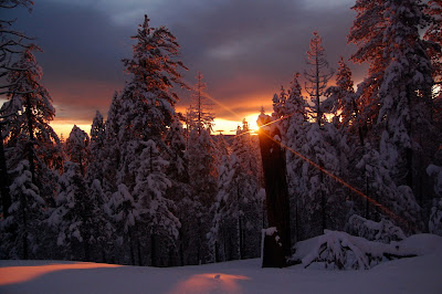 |
| A sunset Tom and I saw together in the Mariposa Grove |
Top & Table of Contents
-
Intentions
-
Getting to Know Tom
-
Plans to ‘Climb Out’ Mt. Shasta
A Recount of the Mt. Shasta Tragedy
-
Thursday - Friday - Saturday - Sunday - Monday
Aftermath
-
Links
-
Images
Links
-
-
-


Comments
Post a Comment