


Comments
No comments posted yet.
|
|
Trip Report |
|---|---|
|
|
42.65190°N / 115.6977°W |
|
|
Download GPX » View Route on Map |
|
|
Apr 28, 2021 |
|
|
Hiking |
|
|
Spring |
Bruneau Canyon
Bruneau Canyon is a giant chasm in the high desert plains of southwestern Idaho. A Google search reveals that the canyon is 40 miles long and up to 1200 ft. deep (the places that I visited were 600-700 feet deep). An 18 mile drive from the town of Bruneau, Idaho will take you to a view point on the eastern rim of the canyon. You will not find any trails there but you could easily follow the rim of the canyon north or south. One day I followed the rim north and another day south.
From the view point, if you go south, you will soon reach a side canyon that creates an obstacle to further progress along the rim. For that reason, from the view point, I drove a two-track south to bypass the side canyon.
Roberson Trail East
Three miles south of the viewpoint (on a straight line), you will find a trail that will take you down 600 vertical feet to the bottom of Bruneau Canyon. You could drive a number of dirt roads to reach the trailhead. From the starting point of my hike as above, I hiked the rim 4.45 miles south to Roberson Trail Head and then took the trail to the bottom of the canyon.
Link
This trip report is about a hike south of the viewpoint. For north of viewpoint see this page:
https://www.summitpost.org/bruneau-canyon-rim-north-of-viewpoint/1061204
Hike Length: 9.29 miles
Total Ascent: 1658 ft
Maximum Elevation: 3715 ft
Minimum Elevation: 3010 ft
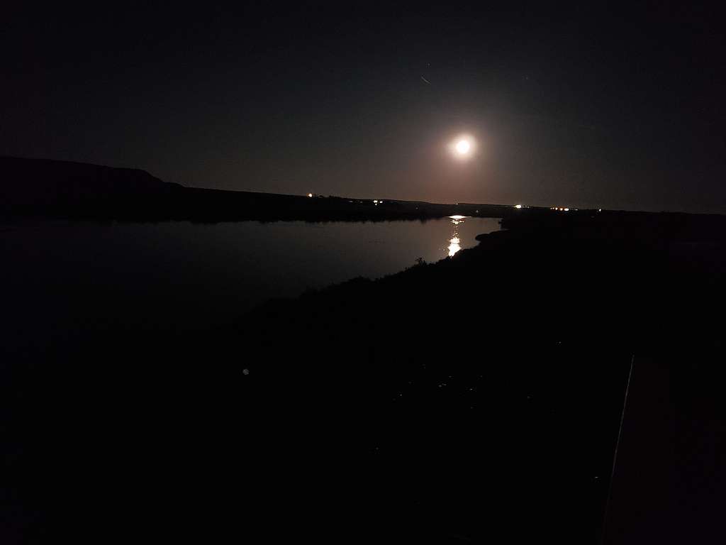
Had gone to bed early in the vacation rental house on the banks of Snake River a few miles east of Grand View, Idaho. Woke up around 10:30 p.m. to see the full moon reflecting on the river. Took a picture with my phone and went back to bed.
Left the house after 6 a.m. and drove 15 miles to the town of Bruneau then got on Hot Springs Road south. The road was paved for 11 miles, then became a dirt road passable by any car. 15 miles after Bruneau, at a sign, turned onto another good dirt road and went 3 miles to reach Bruneau Canyon View Point. I had been there 3 days prior to that when I had followed the rim of the canyon north. Today’s plan was to go south. Got onto a two track road and followed it south over the desert surface. The road soon became rocky and went downhill a short distance. I had a rental Jeep Wrangler so it did fine on the rough section. The road soon became easy to drive again and made a broad U-turn heading north toward the rim of Bruneau Canyon. I parked just before reaching the rim. It was 34 degrees F and elevation was 3570 ft.
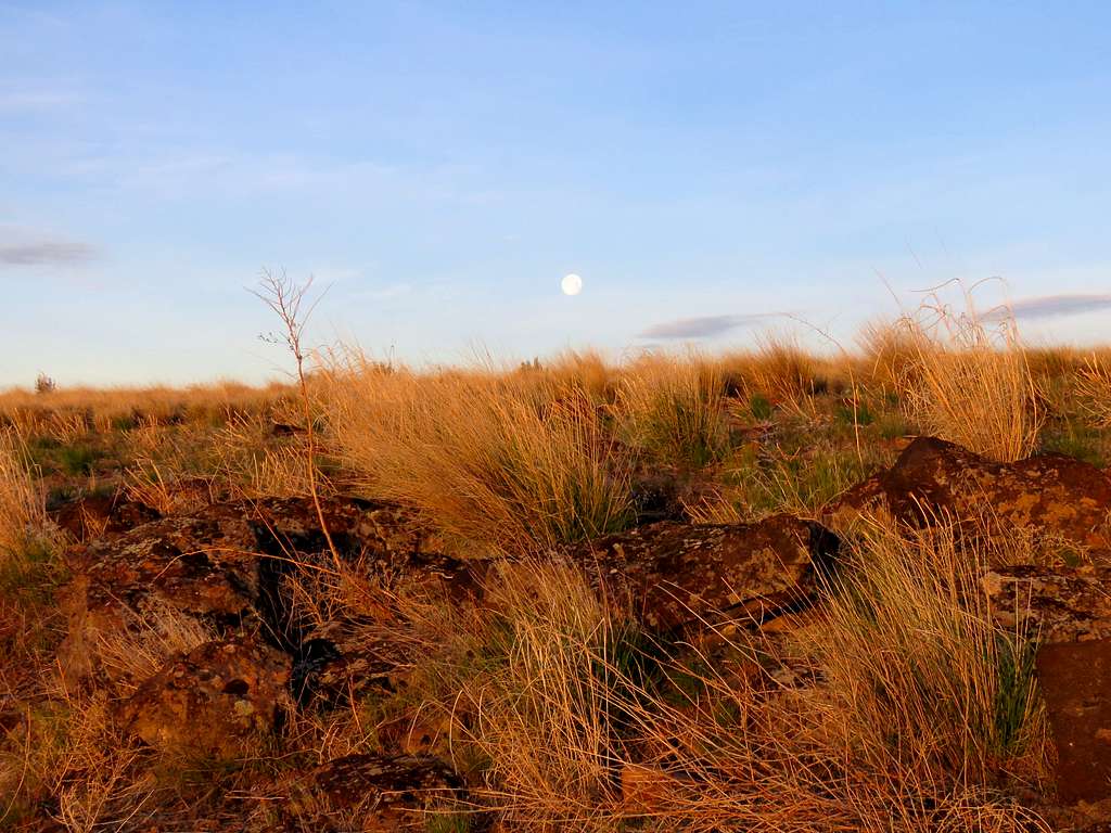
Started my hike at 7:05 a.m. (sunrise around 6:40 a.m.). The full moon was still visible.
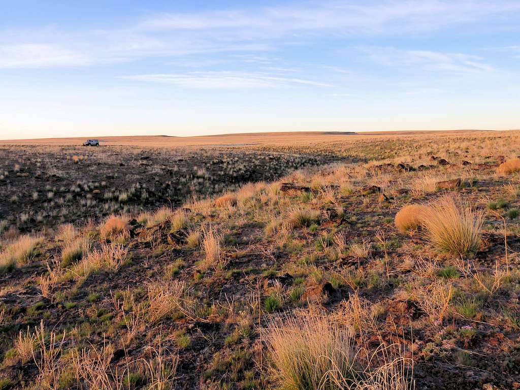
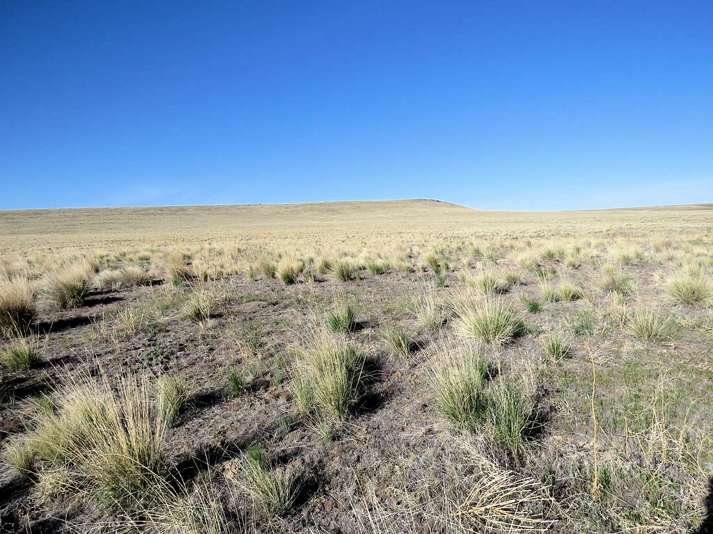
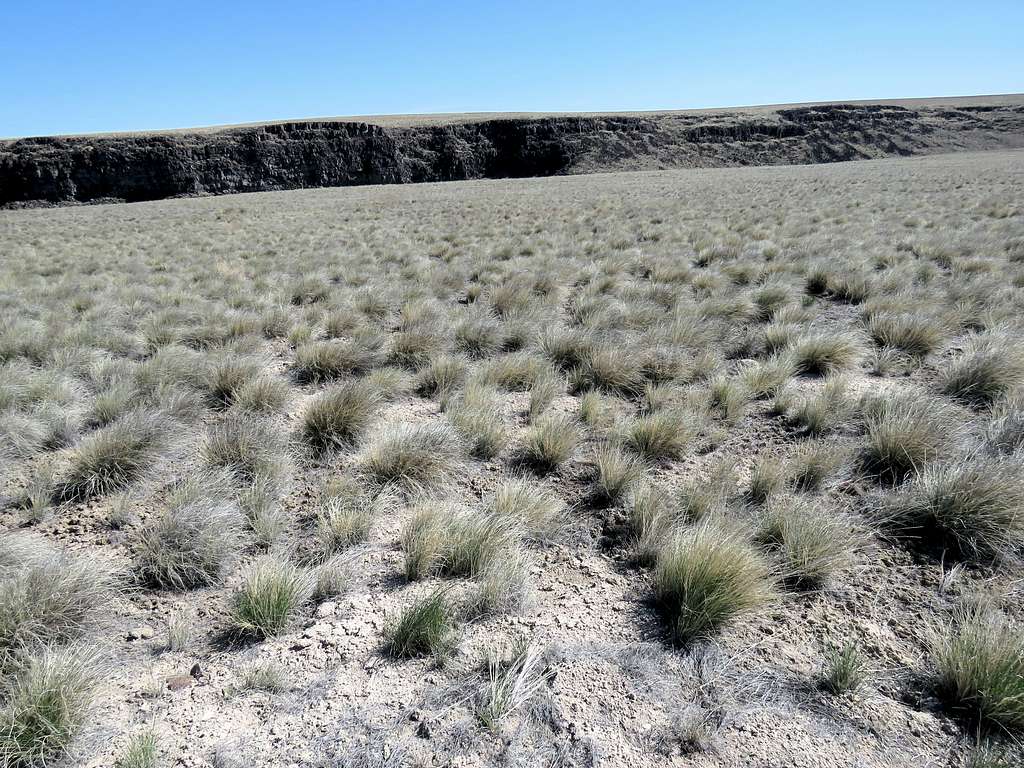
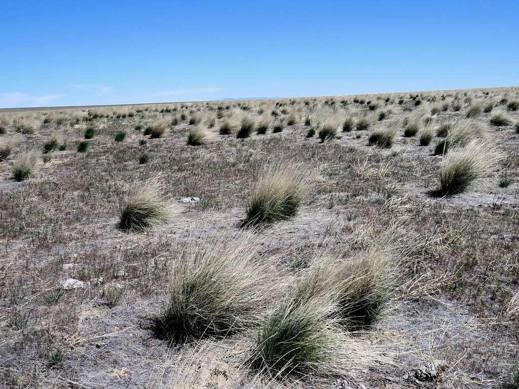
I was on a vast desert plain. Hard to believe there was a deep canyon nearby.
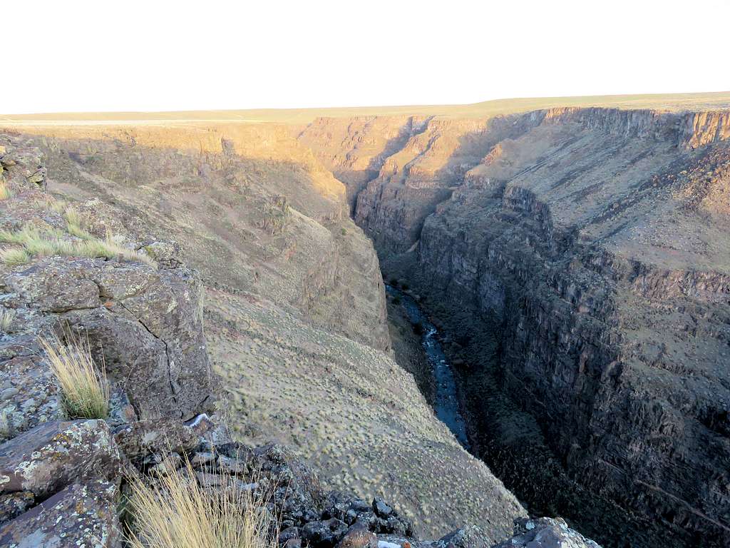
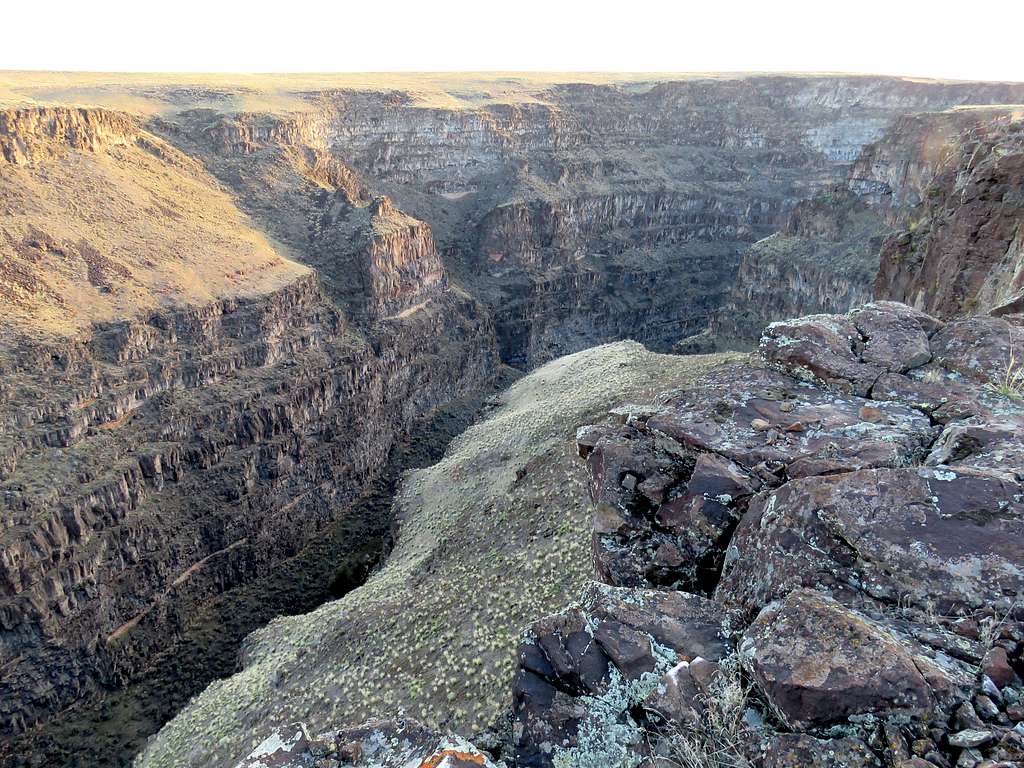
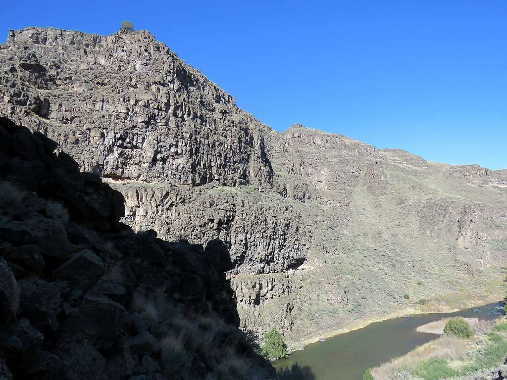
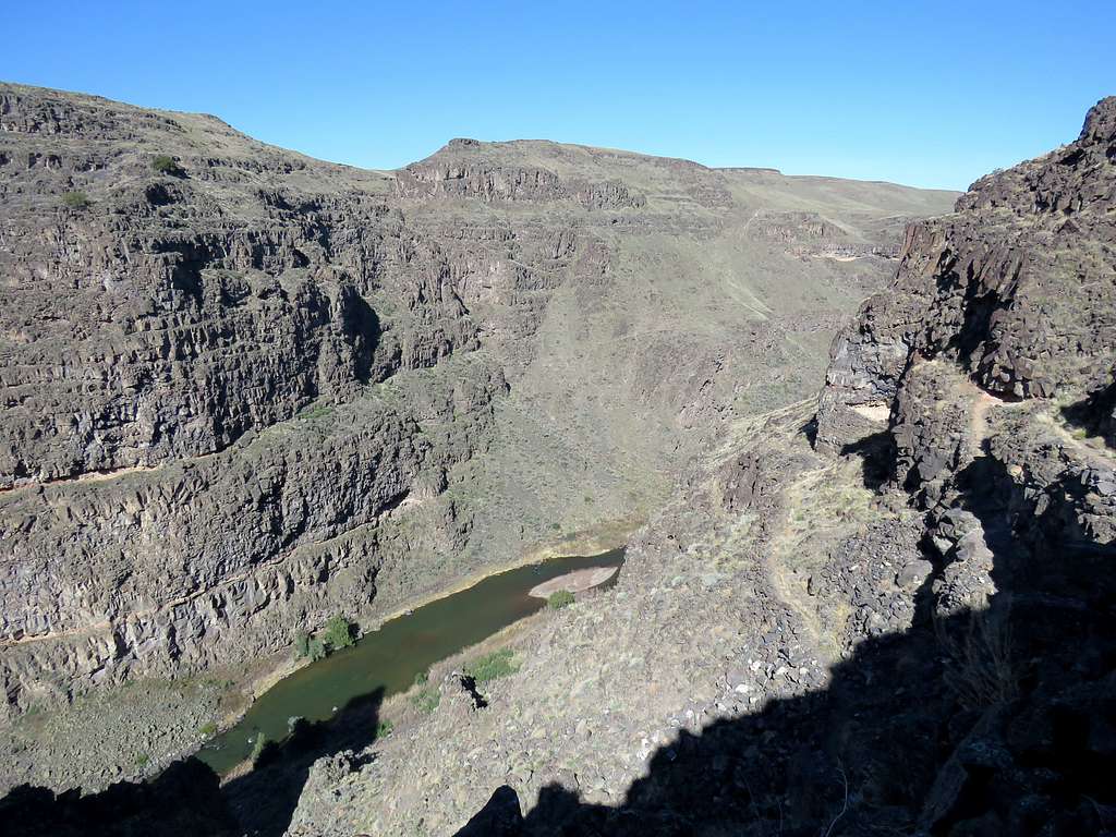
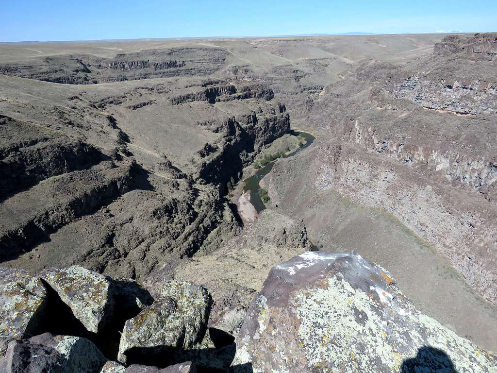
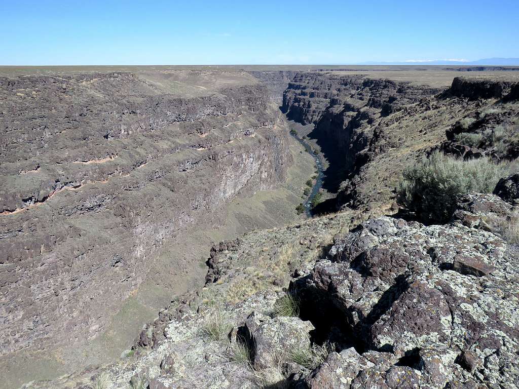
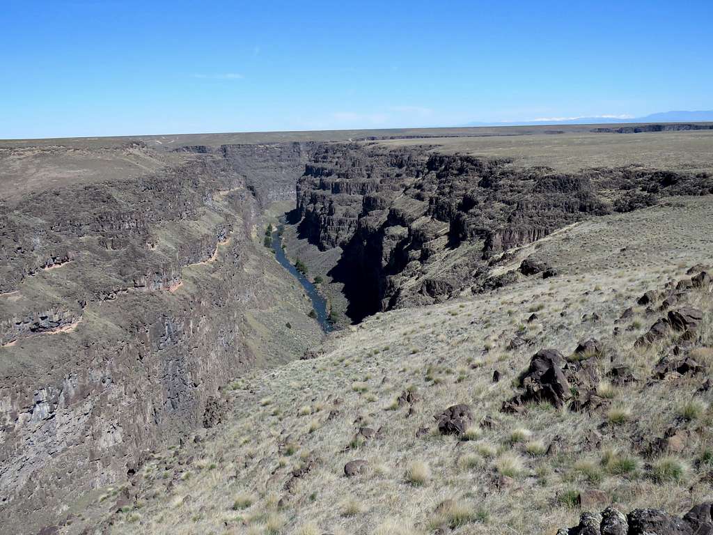
Hiked a short distance north until I reached the edge of the canyon (which at that point was 660 ft deep and ran east-west). The sun was shining on the rim of the canyon while the bottom was in the shade so it was hard to take good quality pictures. Began to follow the rim west until it made a sharp turn and for the rest of the hike headed south. Due to many obstacles, I often found myself on the surface of the plateau a few tens of feet away from the very edge of the canyon. I periodically walked to the very edge to get better views.
Farther south.
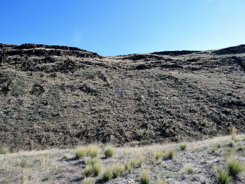
I then reached a wire fence that stretched across the desert plain going all the way to the edge of the canyon. There were no private property or any other signs on the fence. I assumed that it was there to keep the cattle out. It was easy to grab the last fence pole on the edge of the canyon and go to the south side without the need for any scary acrobatics. I then had to pull a little away from the rim to go around a couple of drainages and then went up a slope to reach the new surface of the plateau which was 100 feet taller. Looking north at the lower plateau.
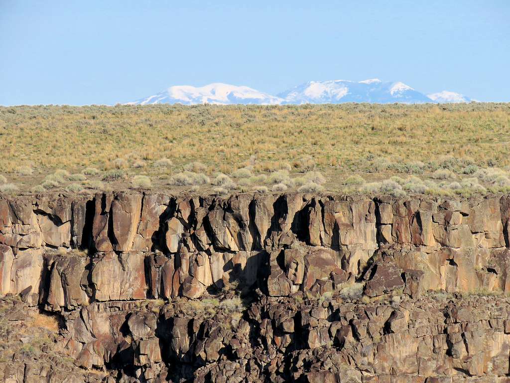
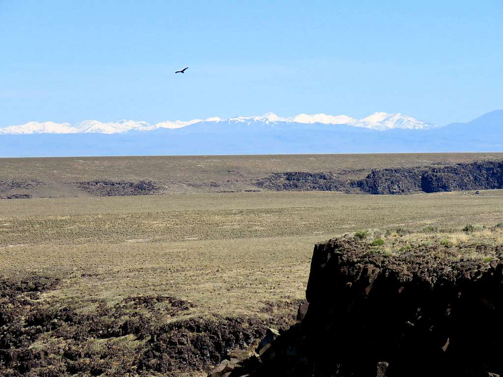
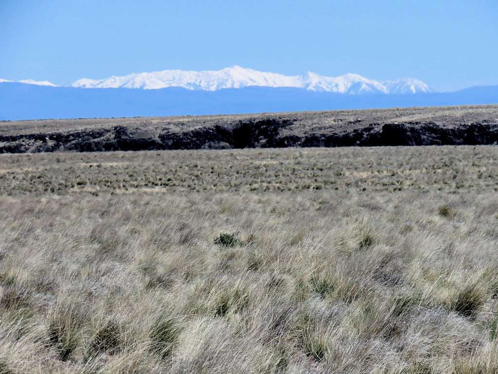
Zoomed view of Quick Silver and Heyden Peaks 52 miles away.
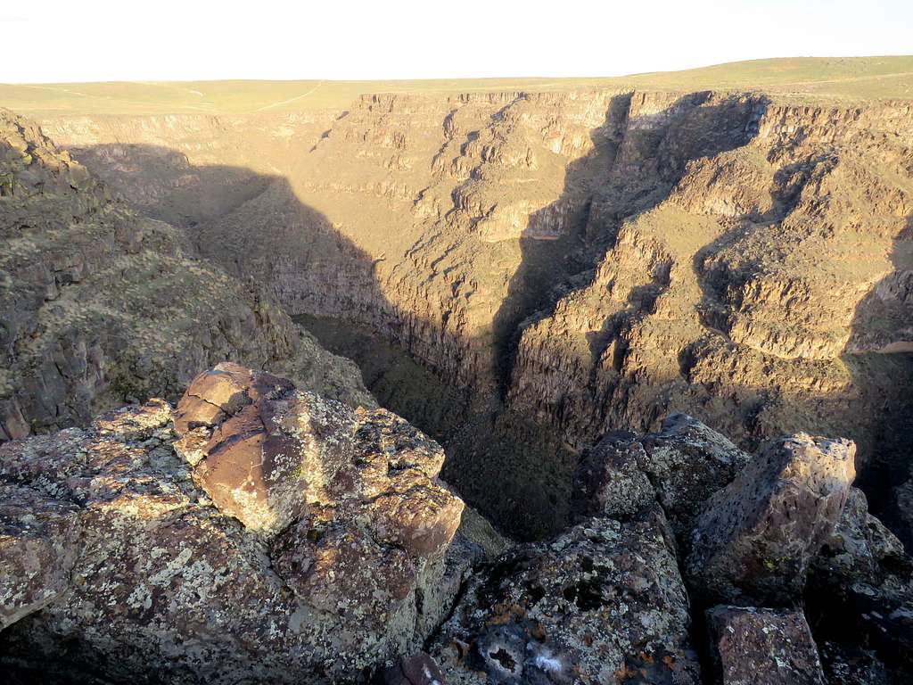
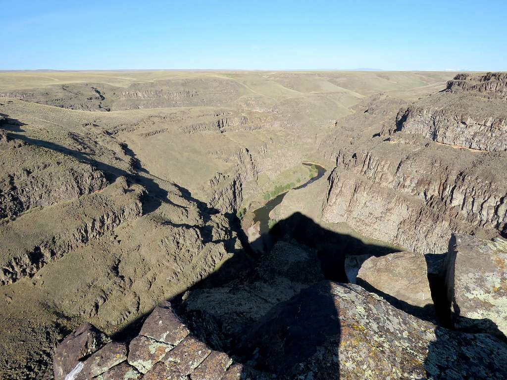
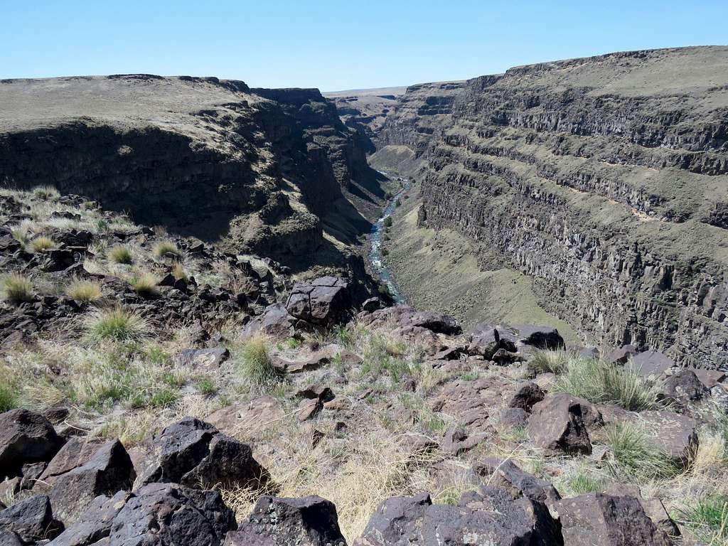
At 8:54 a.m. and 3.32 miles of hiking, I reached the edge of a side canyon which made an obstacle to hiking further south. Looking down into the canyon.
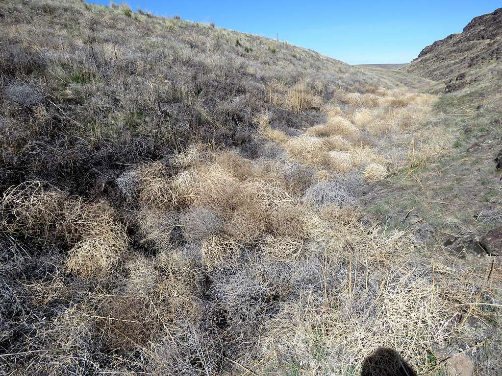
I had seen that side canyon months ago on Google Earth when I had been planning my path. Headed east following the rim of the side canyon. Walking into the sun made me feel hot. I had planned to go a whole mile to reach a place where Google Earth had shown the walls to wither away. Kept my eyes open for a quicker opening in the walls which actually came about after hiking only half a mile. Went down the slope 100 vertical feet to the bottom of a drainage which was filled with tumbleweed. Kept pushing my hiking poles into the weeds to see how deep the drainage was and to alert any potential critters. Did not want to step on a rattle snake. Fortunately was able to cross the drainage without any trouble and went up the other side to reach a gently slopes plateau. Looking back at the slope I descended.
Headed southwest on the plateau toward the Roberson Trailhead. I soon reached a two track dirt road and followed it to end of it at the trail head where I reached at 9:28 a.m., 4.43 miles and 3650 ft elevation. No one was there. I actually did not see anyone all day long.
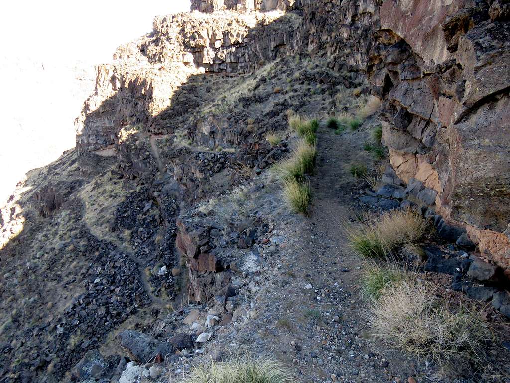
Got on the trail and began to go down into the canyon.
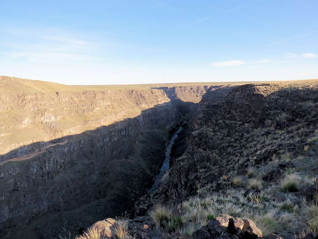
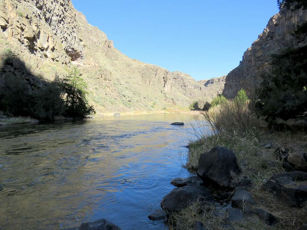
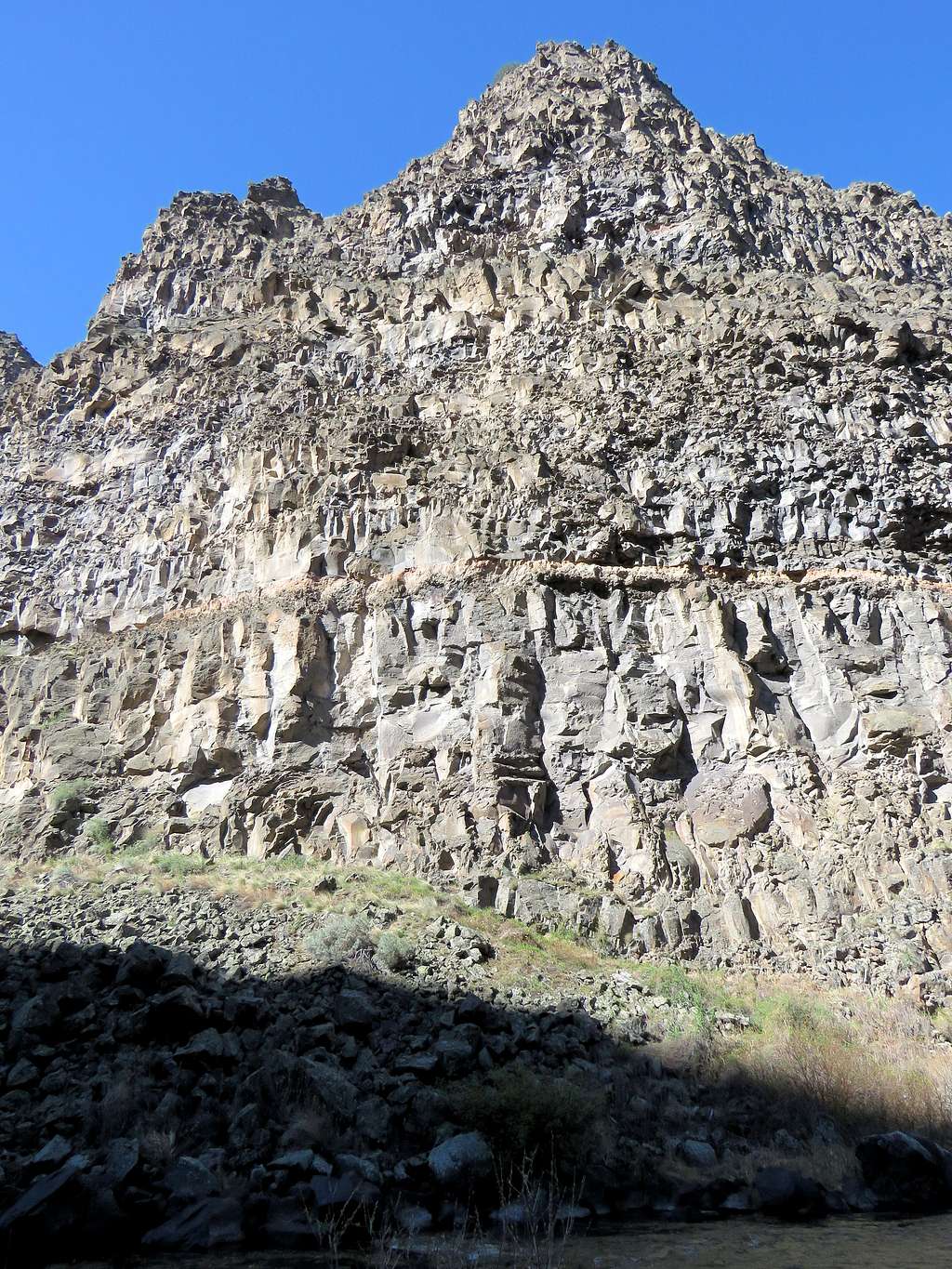
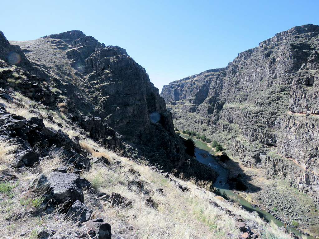
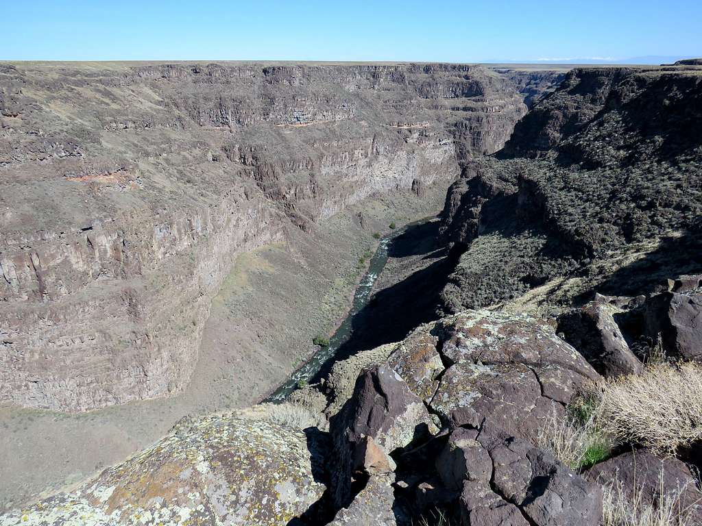
After many twists and turns I finally reached Bruneau River at the bottom of the canyon at 9:54 a.m., 5.15 miles and 3010 ft elevation. It was hard to believe that I had actually walked down those walls. The view south (upstream) was particularly spectacular.
Looking north.
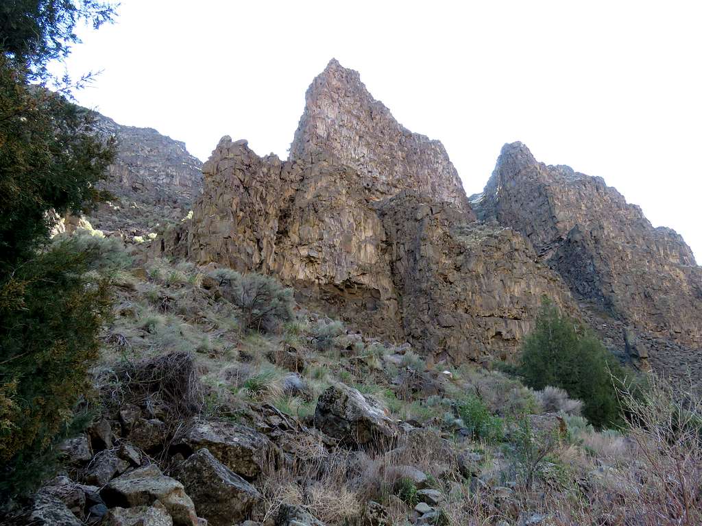
Looking up the walls.
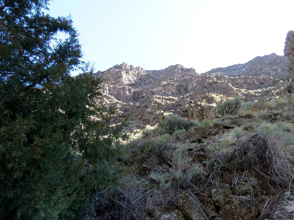
I was in the shade and it was feeling cool to cold. I had to wear my jacket. Had my lunch, enjoyed the views and then left at 10:17 a.m. going back up the trail. A cool breeze had begun to blow so I did not get hot walking up. Views from the trail.
Up to trailhead at 5.86 miles and 10:46 a.m. Was then walking on the plateau toward the walls of the side canyon where I had come down from.
Crossing the tumbleweed covered drainage proved more difficult this time. My hiking poles sank all the way down into the weeds. Had I stepped on the weeds, I would have fallen in holes waist deep. After searching for a good spot, I still sank more than knee deep, thorns got all over my pants and mud somehow got into one of my boots.
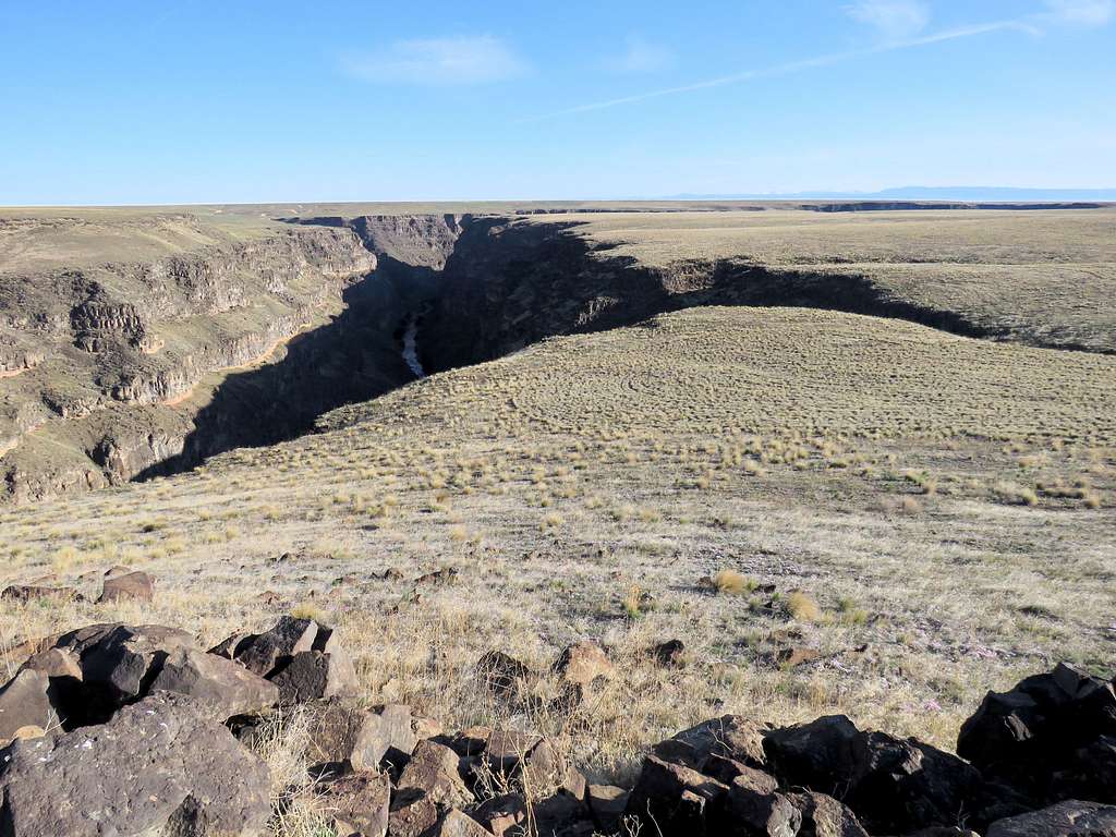
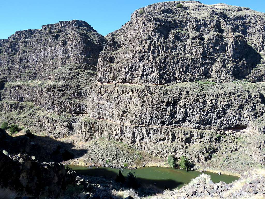
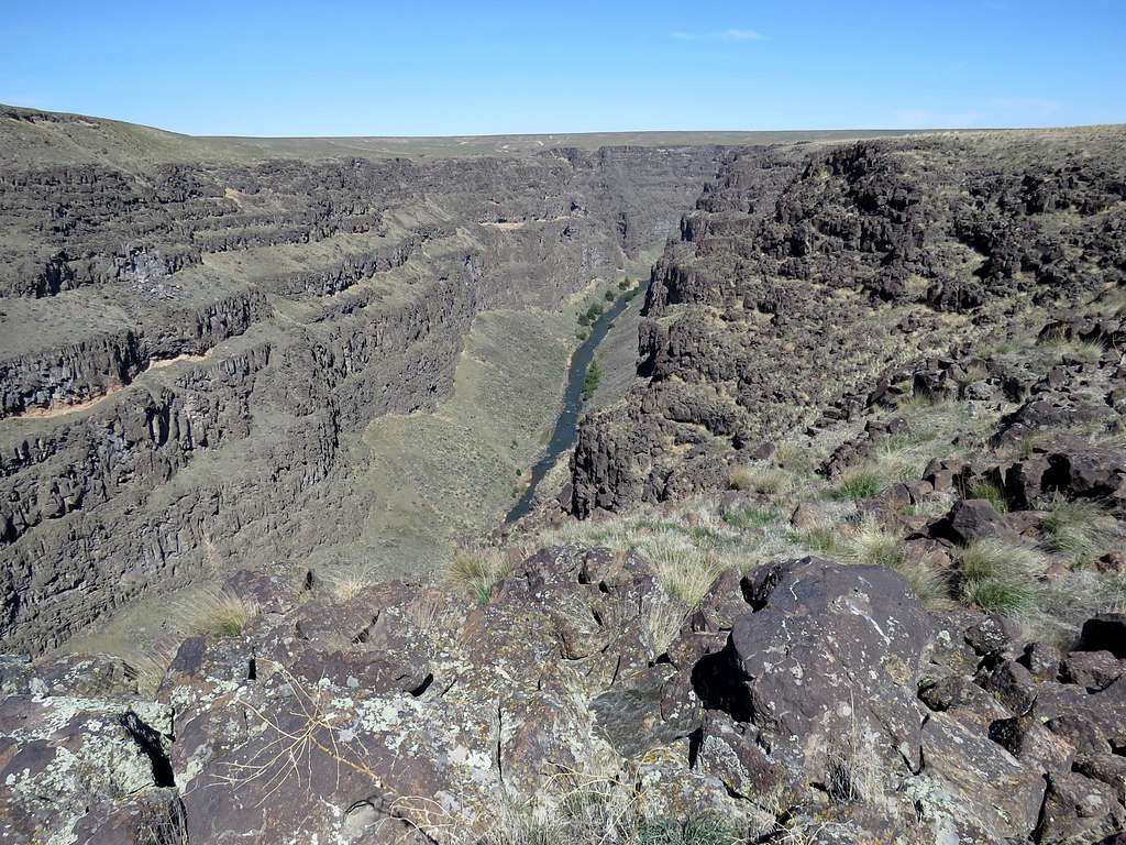
Went back up the slope and walked half a mile west to reach the edge of Bruneau Canyon. The sun was up and I had much better views of the canyon than I had had earlier in the morning. The weather was so pleasant and I was again having that “Great to be Alive” feeling that I sometimes get on my good hikes.
Had a hard time Identifying these peaks. Probably mountains around Trinity Peak 90 miles to the north. Zoomed view.
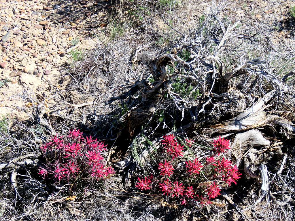
Pretty.
Went down the slope to the lower plateau. Still great views of the canyon.
Once I reached the fence, I said goodbye to the canyon. Headed northeast on the surface of the plateau aiming for where I had parked as my GPS showed. Reached my Jeep at 12:32 p.m. It was up to 65 degrees F.
Zoomed view of very distant mountains.
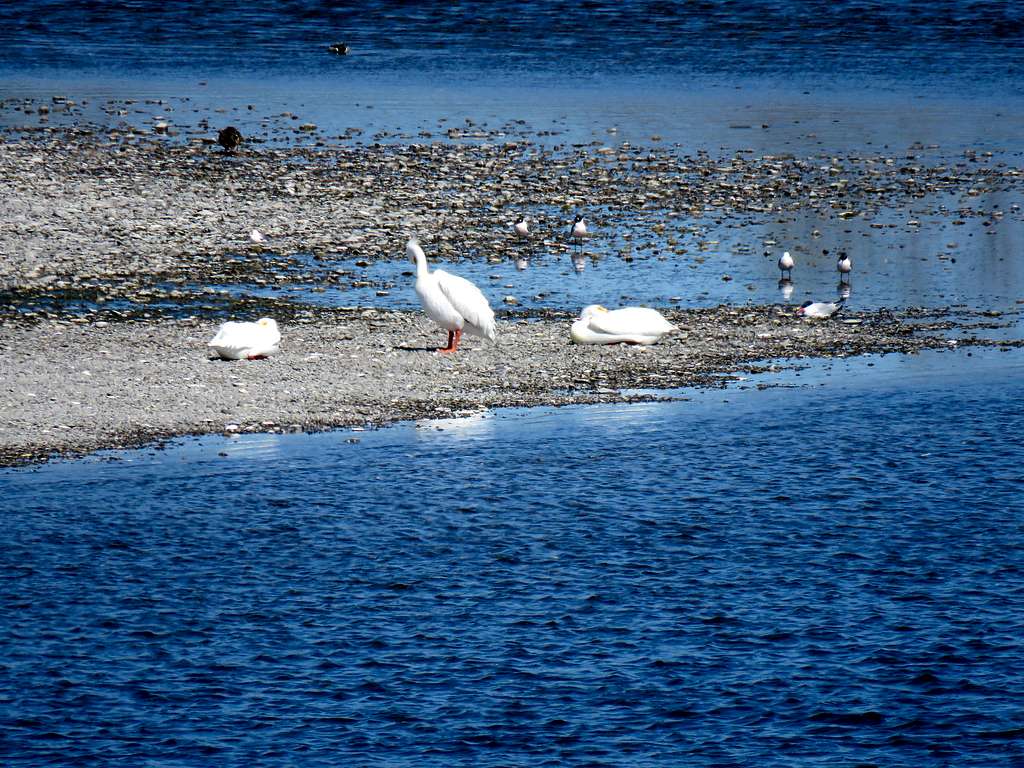
Reached home at 1:40 p.m. After showering, eating and doing office work, sat on the porch and enjoyed zooming on the birds in the island in Snake River in front of the house.