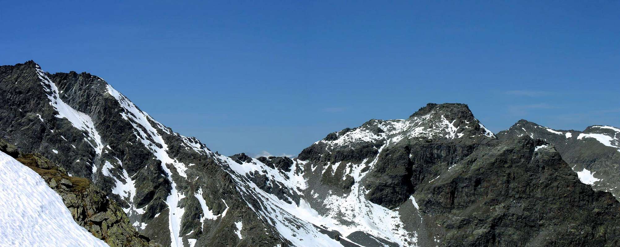
This tour that is path during the "Tor des Géants, running race now famous in the mountains in Aosta Valley, is a variant to the classic crossing from Valgrisenche to the valley of La Thuile through Planaval Pass (3.010m) that connects the valley of Fond with that of Ussellettes just to the East of Refuge Albert Deffeyes (2.494m). So "bind" so the areas of three municipalities (Valgrisenche, Derby, La Thuile) with a semi-circular tour around the beautiful pyramid of Mont Paramont (3.301m), which becomes complete if you fall from the refuge towards this last step before returning to Villages of Baulin or to La Clusaz or above Planaval (1.580m) at the entrance towards Valgrisenche. Here we describe the first version, as in the "Tor des Géants", with descent to La Thuile, but also the second, though much more rarely, is frequented though very long and just less more challenging. In any case both offer great views of the glaciers of Rutor that descending towards both the two main valleys, while into the Vallon d'En Haut to the North you can admire the beautiful North glacial wall of Mont Paramont. Anyway here is recommended as a simple and long hiking trip.
Questo tour che viene percorso anche durante la "Tor des Géants", gara di corsa in montagna ormai famosa in Valle d'Aosta, costituisce una variante alla classica traversata dalla Valgrisenche alla valle di La Thuile attraverso il Passo di Planaval (3.010 m) che collega il Vallone del Fond con quello di Ussellettes appena ad Oriente del Rifugio Albert Deffeyes (2.494 m). Si "legano" quindi le aree di tre Comuni (Valgrisenche, Derby, La Thuile) con un giro semicircolare intorno alla bella piramide del Mont Paramont (3.301 m), che diventa completo se si rientra dal rifugio verso questo ultimo passo per poi rientrare a Villaggi di Baulin o di La Clusaz sopra Planaval (1.580 m) all'ingresso della Valgrisenche. Qui descriviamo la prima versione, come nel "Tor des Géants", con discesa a La Thuile, ma anche la seconda, anche se molto più raramente, viene frequentata anche se molto lunga ed appena più impegnativa. In ogni caso per entrambe grandiose vedute sui ghiacciai del Rutor che scendono verso entrambe le due principali vallate, mentre dal Vallone d'En Haut a Settentrione si ammira la splendida Parete Nord glaciale del Mont Paramont (3.301 m). In ogni caso qui viene consigliato come semplice e lunga gita escursionistica.
Approaches and Route
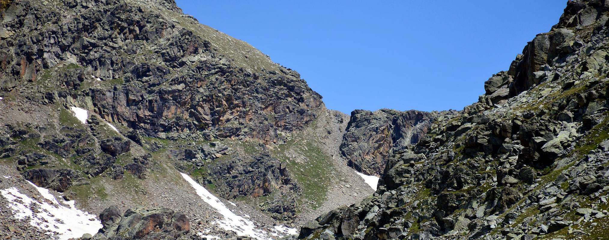
From the City of Aosta (583m) follow the SS.26 in the direction of Mont Blanc. Near the Village of Leverogne (780m) turn left on the Regional Road for the Valley of Valgrisenche. Go past the Villages of Rochefort, La Ravoire, and Chamencon; then turn right for the Village of Planaval (1.557m), about 10 km from Leverogne. You can park here and continue on foot along the paved road in the direction of the Village of La Clusaz (1.631m). Then once out of the village, turn left after two switchbacks. But, if you are lucky, you can also park your car just in front of the start of the trail, that is clearly visible and well-marked. The ascent begins here: gain the initial, steep 500m of elevation and go past a water outlet at 2.060m to reach the first plateau. Continue along the bank of the stream that flows from the Château Blanc Glacier. Past a small wooden bridge, the trail climbs steeply for another 100m before reaching the second plateau, where another small bridge is located. Cross the bridge and aim straight for the Baracche (Huts) of Fond (2.340m, 1h'40). Keep right along the trail that leads to Lago di Fond (2.438m, 2h'00). Cross the lake outlet and follow the trail, which is again very steep, until Colle de la Crosatie (2.838m). From here bypass the ridge for the last 20 meters, paying special attention in case of snow or wind (3h'30 from Planaval). The descent is to the North-northwest always through the Alta Via n° 2 until you reach the Alpe Promoud (2.021m; 1h'20) with a path of very tight hairpin bends, placed between Chanté Colmet (2.424m) and Mont Vallette (2.521m). From this up towards South-southwest with the trail n° 5 to reach the High Pass or Haut Pas (2.859m; 2h'00), located between the homonym valley and that of Ussellettes in the Valley of La Thuile. A short descent to the West-southwest through the trail Alta Via n° 2/15 leads, skirting Les Lacs d'Ussellettes to Refuge Albert Deffeyes (2.494m) and from this with the usual trail Alta Via n° 2/3, passing near the three famous waterfalls "Rutorine" (Rutor) to the La Joux (1.624m), Village in the South of La Thuile to which you come up with the very narrow road, alongside the eponymous Dora (EE/F/F+; 3h'00 from Passo Alto 1.635 meters in altitude; 9h'30/10h'30 total).
Dalla città di Aosta (583 m) seguire la SS.26 in direzione Monte Bianco. Vicino al villaggio di Leverogne (780 m) girare a sinistra sulla Strada Regionale per la Valle di Valgrisenche. Si superano i villaggi di Rochefort, La Ravoire, e Chamençon; poi girare a destra per il Villaggio di Planaval (1.557 m), a circa 10 km da Leverogne. Si può parcheggiare qui e proseguire a piedi lungo la strada asfaltata in direzione del villaggio di La Clusaz (1.631 m). Quindi una volta fuori dal paese, svoltare a sinistra dopo due tornanti. Ma, se si è fortunati, si può anche parcheggiare l'auto proprio di fronte l'inizio del percorso, che è chiaramente visibile e ben segnalato. La salita inizia qui: dislivello iniziale, ripida 500m di elevazione ed oltrepassare una presa d'acqua a 2.060 m per raggiungere il primo plateau. Proseguire lungo la riva del torrente che scorre dal Ghiacciaio del Château Blanc. Passato un ponticello in legno, il sentiero sale ripido per un altro 100 metri prima di raggiungere il secondo pianoro, dove si trova un altro piccolo ponte. Attraversare il ponte e puntare dritto per la Baracche (Capanne) di Fond (2.340 m, 1h'40). Tenere la destra lungo il sentiero che porta al Lago di Fond (2.438 m, 2h'00). Attraversare la presa di lago e seguire il sentiero, che è ancora molto ripido, fino a Colle de la Crosatie (2.838m). Da qui si oltrepassa la cresta per l'ultimo 20 metri, con particolare attenzione in caso di neve o vento (3h'30 da Planaval). La discesa avviene verso Nord-nordovest sempre tramite l' Alta Via n° 2 fino a raggiungere l'Alpe Promoud (2.021 m; 1h'20) con un sentiero di tornanti molto stretti, collocata tra Chanté Colmet (2.424 m) e Mont Vallette (2.521 m). Da questa risalire verso Sud-sudovest con il sentiero n° 5 fino a raggiungere il Passo Alto o Haut Pas (2.859 m; 2h'00), situato tra l'omonimo vallone e quello di Ussellettes nella Valle di La Thuile. Una breve discesa verso Ovest-sudovest tramite il sentiero Alta Via n° 2/15 porta, fiancheggiando Les Lacs d'Ussellettes al Rifugio Albert Deffeyes (2.494 m) e da questo con la solita mulattiera dell'Alta Via n° 2/3, passando vicino alle tre famose Cascate "Rutorine" (del Rutor) si raggiunge La Joux (1.624 m), Villaggio a Meridione di La Thuile alla quale si arriva con la stretta carrozzabile, affiancando l'omonima Dora (EE/F/F+; 3h'00 dal Passo Alto con 1.635 metri di dislivello; 9h'30/10h'30 complessivamente).
Difficulty
This route can be considered EEA/F+ for the Southwest Ridge.
L'itinerario è da classificare in A/F+ per la Cresta Sudovest .
Parents refers to a larger category under which an object falls. For example, theAconcagua mountain page has the 'Aconcagua Group' and the 'Seven Summits' asparents and is a parent itself to many routes, photos, and Trip Reports.

 2966 Hits
 81.84% Score
 14 Votes