Graham and I had had an excellent summer season in the Cascades and on Vancouver Island mountains. We wanted to finish on a high note with the long trip in to the Golden Hinde but the weather really didn’t offer anything like the week-long window one needs to make the Hinde anything other than an endurance test. Besides, I had really wanted to save Vancouver Island’s tallest peak for my 60th birthday present the following year. However, I was off to Nepal the following month and really felt that one more testing objective was required to keep fitness and psyche levels up to the necessary levels. Elkhorn Mountain fitted the bill nicely. It’s easily do-able in a three day window or less and, as a bonus, is one of the 9 so-called “Island Qualifiers” that all self-respecting alpinists on the Island aspire to climb.
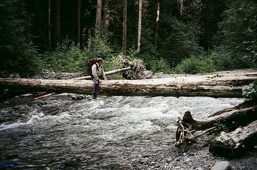
Having chosen the best looking window offered by the long range forecast, we left my place in Courtenay in the eminently predictable driving rainstorm but at the civilized hour at least of 11am. The weather improved somewhat by the time we arrived at the Elk River Trailhead at 12.30 but still looked threatening overhead. After a quick lunch over-dosing on fresh fruit etc we were off down the ERT at 1pm exactly. What a pleasant trail this is. Meandering gently along beside the river as it does it gives the first-time Elkhorn ascensionist slightly less than an hour to wonder if it’ll all be as easy as this before kicking him/her firmly in the teeth. The dental work started right after we spotted a few flags leaving the main trail and as we looked up the canyon of Elkhorn Creek from the wrong side of the Elk River. A little mild bush bashing got us to the river easily enough but then it looked like it was going to be off with the boots and on with the Tevas for a little deep water wading. Fortunately, a bit of exploring downstream revealed a convenient (deliberately felled?) log crossing and we bum shuffled over the Elk in good order.
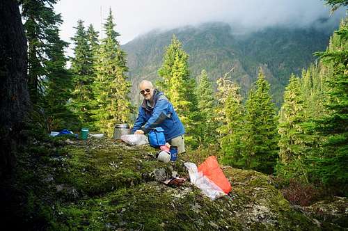
A pleasant evening then ensued. I found a lovely “split-level” rock just above our tent site that made a wonderful natural kitchen. A little above this was a rocky knoll to where we could take our books and/or food and which (when the clouds cleared) gave lovely views north east across to
Kings Peak, west to Puzzle and Volcano Mountains and east to tomorrow’s objective. Certainly one of the best back-country camps I’ve had the pleasure to experience. It had been an energetic afternoon, however, so we were in bed and unconscious by 9pm.
Day Two
After a peaceful night we were up with the lark at 5.15 and off and running by 6.40. The first half hour up from the forested col involved a bit more bushwhacking but of the kind more typical on the Island.
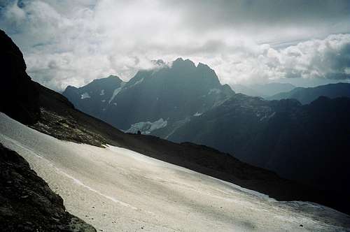
Steep B3 huckleberry but little in the way of deadfall. We finally emerged from the trees onto the open NW ridge 45 minutes above the col at an elevation of 1550m. Elkhorn’s imposing summit block was now in full view 2km or so away. There were a couple of bumps on the ridge to negotiate. As I remember it, the first and largest is bypassed on the right (south) side and you go right over the second down into a sharp notch and then back up to the open ridge. Compared to day one it was certainly very pleasant travelling and got us to the toe of the upper NW ridge at 9.45 and 1900m. Occasionally the heavy cloud opened up to give us spectacular views of
the Kings Peak/Elkhorn arête, Mt Colonel Foster with Landslide Lake below it, Rambler Peak and the upper Elk River valley.
The ridge directly above us was
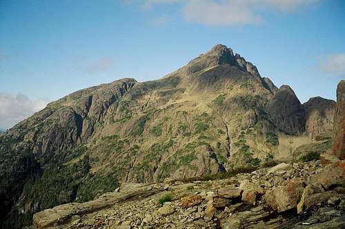
the first ascent route taken by the 1912 ACC party under the leadership of E.O. Wheeler. However, we had decided in advance on the West Gullies route and, therefore, dropped off the ridge and traversed south 300-400m across the top of the West Basin to the foot of the gullies. Helmets went on as we came under rock-fall threat from the summit block and harnesses at the foot of the gullies. By this time the clouds had really rolled in and we were peering up into the murk.
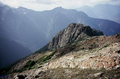
![West Gullies]() Graham looking up the Western Gullies
Graham looking up the Western Gullies
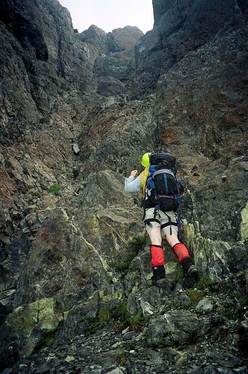
The Western Gullies can be a bit confusing in that they seem to offer all kinds of possibilities, only a few of which actually go. Right off the bat we made a false start up what looked like the obvious line in the centre of the gully system. Graham rapped off while I went down and looked further. I finally found a narrow ramp right under the right wall of the gully. This took us at easy 4th Class up to the well-known chockstone pitch which told us we were now on route. Chimneying up behind the chockstone is probably low 5th but the pitch is only 3-4 metres so we passed the packs up and didn’t bother getting the rope out. Thereafter we traversed up and left at 3rd Class and quickly ran into another dead end. Graham freed a 15m pitch involving a leftward off-balance traverse to go around the obstacle. Chicken that I am, I had him toss me a top-rope when it was my turn. It went at about 5.3. We then attempted to travel further left – since we knew the exit from the gullies went that way – until I spotted a cairn 20m or so to our (climber’s) right. An exposed 4th Class traverse got us over there from where we could see our way clear. Five more minutes of loose Class 4 and we were out of the gullies with the summit boulder field in view and a 10 further minutes saw us on top. Crossing the boulder field the sun came out briefly but the summit welcomed us at 12.35 with solid clag.
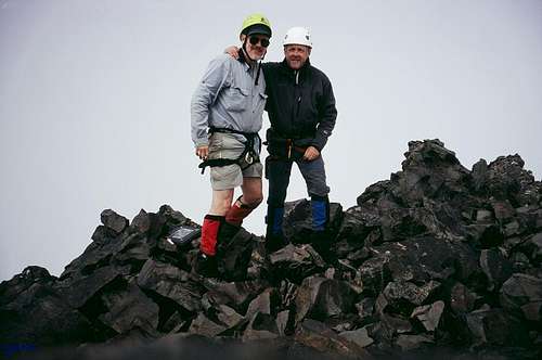
![Summit pose]() Martin and Graham on the misty summit of Elkhorn
Martin and Graham on the misty summit of Elkhorn
We had a leisurely lunch hoping this would give us a break in the clouds but nary a hole appeared in the solid cover. Visibility on top was no more than 20m. Graham, who was making his second trip up Elkhorn, described what I should be seeing and joked that, with my white helmet, the photos would make me appear that I only have half a head. Little does he know…………
According to the register, we were the first party to summit in several months on what is one of the Vancouver Island’s most sought after summits. Tells you what a climbers’ paradise the Island is!
We set off down at 1.15 and this time kept further to the left (climbers right) of our upward route. We made 4 raps to reach the bottom of the gullies, including the chockstone pitch, with downclimbing between each. This could have been done – and usually is - with less but we were only carrying a 30m rope.
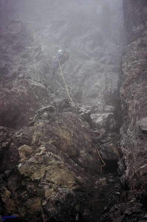
![Rapping the West Gullies]() Martin rapping down the W Gullies in the clag
Martin rapping down the W Gullies in the clag All this was done in the mist but at least with improving visibility as we got lower. At 3.25 we took off the harnesses, scrambled down and over to the West Basin and awaited the inevitable. Sure enough, the sun popped out, the cloud cleared away and, by the time we had arrived back on the NW ridge, the mountain was revealed in all its splendor. Oh well. At least we were treated to lovely views all the way back down to camp which we reached at 6.25 for just a tad less than a 12 hour day.
Although the misty conditions had been disappointing, any real precipitation had held off and we did get some great views, just not from the summit. But as always, nothing can beat sharing such an experience with a true and trusted friend nor can anything substantially diminish the joy of simply being in the mountains.
After a large and leisurely dinner we retired to our nylon palace at 8.30. Just before I turned my headlamp off about 9 I looked across at Graham. He was just lying there with a great big grin on his face. He didn’t have to say anything; the grin said it all.
Day Three
Our last day on the mountain began with an interesting observation and a lesson learned. Before relating the story, however, I have to get slightly distasteful.
Over many years of back-country travel and in conversation with others, I have discovered that there are three schools of thought applying to the means of disposal of our bodily wastes when in the woods and mountains.
1. Bury it
2. Spread it on a rock well away from a traveled area, let the sun bake it out and leach away.
3. Carry it out with you
Option 3 certainly has its place on crowded mountains like Shasta and Hood. You'd have to go a long way off-route on Avy Gulch to practise options 1 or 2 without offending others! The target/bull’s-eye piece of paper you’re given is also a standout conversation piece at parties and can also be used on the mountain in various after-dinner – or even better after-breakfast - games. However, I never seem to see as many blue baggies in the bins at the trailheads as I do people on the mountain. Plus, this cheats you of the right you’ve earned to carry out a lighter pack than you carried in. So I tend to restrict Option 3 to trips to the States.
Of the two remaining choices and after years of deliberation, I’ve finally come down on the side of Option 2. Not everyone will agree with this but there you are. Might make a good forum post even. Graham is also a committed #2 man.
So, now that you’ve got the background, here’s the story.
After getting up at 5.30 – still with big smiles of course – and having breakfasted, off we toddled to our separate ablution areas to answer nature’s call. When I got back Graham was already there and looking somewhat pensive. His offering of the previous morning had been buried! Now as we know, only one species buries fecal matter – felines. We had clearly been carefully watched over the past two days and heartily disapproved of with regard to our toilet practices. On a more serious note, we could have been attacked at any time we were in the “delivery position” so to speak. Crouched down, one offers a small profile of the type that cougars think represents a viable food source. Obviously we were trespassing in someone’s territory and that neither of us was attacked probably owes a lot to there having been two of us.
Suitably chastened we were packed up and off at 7.15. As we passed the shallow tarn that had been our water supply for 2 days we agreed that it was down to a volume of half of what it was when we arrived. Although a great place to camp, it's clearly not viable in a protracted spell of dry weather. Anyway, an uneventful but sweaty 3 hours later and we were bum shuffling across the log over the Elk once more. Back at the truck by 11.30 and phoning-in safe arrival from Campbell River at 1pm.


Comments
Post a Comment