
-
 3812 Hits
-
 78.27% Score
-
 9 Votes
|
|
Route |
|---|---|
|
|
43.33209°N / 103.46732°W |
|
|
Hiking |
|
|
Spring, Summer, Fall |
|
|
Overview
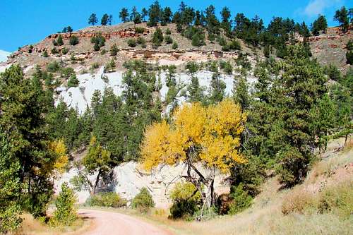
Sheps Canyon View
A century ago, almost all of the land in the Black Hills’ Seven Sisters Range was privately owned. For many years, people tried to scratch a living from homesteads, but the soil is rocky and the precipitation, unpredictable. Small cattle ranches and logging look to be the only viable commercial uses for the land. Historically, economic struggles have chiseled away private ownership leaving more and more of the Seven Sisters Range under public ownership. However, there has been virtually no development of trails and the “checkerboard” effect of intermingled private and public land plots has made the development of new roads into the area almost non-existent. No doubt, the fact that there are almost no residences inside the range outside of lower Brady Canyon is likely a significant factor in this.
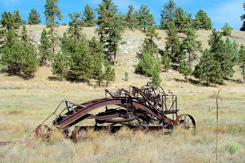
Ancient horse-drawn road grader near the trailhead
That said, public access into the Seven Sisters Range is pretty much limited to four points, namely the Seven Sisters Range North Route through the Allen Ranch, Brook Drive into lower Brady Canyon, the eastern route (short) up Maverick Mountain through the Romey GPA and last of all this south route, through the Hill Ranch GPA, owned by the state of South Dakota.
Most of the Seven Sisters Range is a system of rugged canyons draining in a generally east-southeast direction. Long ago, there was a crude system of rough roads in the range. However, with the exodus of past residents, most roads have grown over or eroded decades ago. The ranchers who now use the private lands to run their cattle still drive Jeeps or ATV’s on a few of the old roads left on their land. But those roads are not open to the public without going first through the difficult process of obtaining permission. The few people who bushwhack through the public lands will find traces of very old roads that are sometimes also used by migrating deer or elk. The Seven Sisters Range South Route provides starting points for exploration in the southern and east-central areas of the range. It should be noted that this south route can provide some limited access for fire control crews and forest service or state crews, though this rarely happens.
Most who hike into the Seven Sisters Range are locals, doing so out of curiosity. In various places there are old ruins from a century ago, plus caves and geological oddities; like natural “tanks” in some ridge tops. Rock hounds find the area profitable, though difficult to access and there are rare ascents of a few of the summits in the range. One ranked public summit, 4210, is accessible without crossing any private land. However, to get there requires some good map skills and at least 4 to 5 miles (one-way) of bushwhacking, primarily through Red Canyon. Along the way, one will normally find lots of photo opportunities and plenty of solitude.
Getting There
From the junction of Highways 71 and 18 Bypass, it is 6.7 miles to Sheps Canyon Road. From there it is 5 miles to the entrance of the Hill Ranch GPA. The gateway has “Lake Hills West” on the west side and “Angostura Ranch” on the east side. It is 1 mile to the little parking lot. To get to the old road that starts the access route, go straight north up the hill from the parking lot. There is a gate at the top of the hill and the old road is on the other side.
Route Description
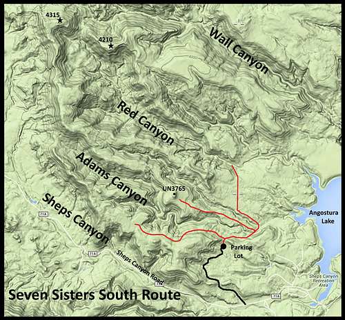
Seven Sisters Range South Route Options
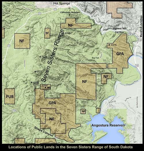
Seven Sisters Public Lands
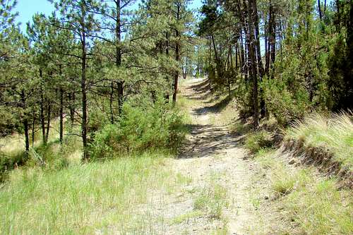
The route map on this page is useful for locating the old roadway route from the trailhead north into the range, which will then branch to three old roads that can be used as starter trails into the range. The southern branch road fades away after about 1 mile along the upper southern side of Adams Canyon. The central road branch follows the ridge line between Adams Canyon and Red Canyon for about 1 mile to an unnamed summit (UN3765). The roadway that is left becomes the northern road and goes up to the mouth of Red Canyon where it fades out. While these roads are not maintained and continue to deteriorate, they are still useful to the careful observer in providing a mostly visible pathway (though some sections will test your detective skills).
To go deep into the Seven Sisters Range will require lots of bushwhacking through rugged and seldom-visited country. The canyon floors can provide well-defined pathways, but sometimes the explorer will encounter large accumulations of flood debris, attesting to the serious potential for flash floods in these canyons. The land ownership map on this page shows where the public lands are. The largest unbroken tracts of public lands are in the southern and eastern sections of the range. At various locations, the state and the national forest service have placed signs showing their boundary lines, helping a little with navigation – especially if you are not using GPS.
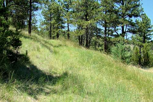
Understanding the system of ridges and canyons in the Seven Sisters Range will go a long way in keeping explorers from getting lost. Cell phones rarely work down into these canyons. Elevations in the Seven Sisters public lands area varies from around 3,200 feet to a little over 4,200 feet.
Essential Gear
Clear Route
Detective skills required
What you have in mind for your hike will determine what you should bring. A compass and GPS would be good, given the total lack of any trail markers or even well-defined trails. Mountain lions inhabit the area, so pepper spray is always a good precaution. For many a camera is also essential. There is often good cell phone reception on the ridge crests, so perhaps that would be an “essential” for some hikers. Footwear with a real grip is essential for going down steep sections that are strewn with loose gravel. In fact, hiking poles might help there too. There are a few springs in the range, but do not depend on these for your water because they can go dry sometimes.
Camping is not allowed on state lands, but primitive camping is allowed on national forest land - except where posted. Be sure you know what kind of land you are on if you choose to set up a campsite here. Forest fires have been a huge concern in the Black Hills in recent years, so if you can camp without a campfire, it will go a long way toward keeping authorities happy.
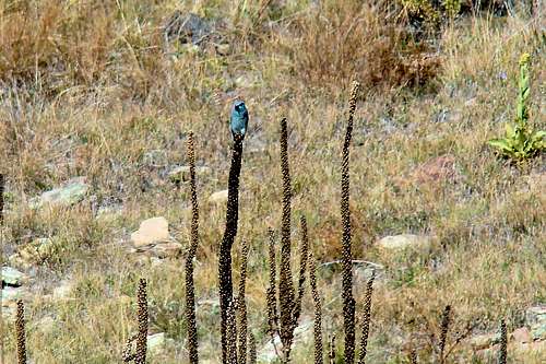
There is abundant wildlife in the range, with many deer and some elk. Hunters travel deeper into the range during turkey seasons than they do for deer or elk seasons and they do not expect to meet hikers. So venturing into the Seven Sisters Range during any hunting season is always the right time to wear plenty of orange. Hikers should always be on the lookout for rattlesnakes. If this is a particular concern, snake-proof boots might be a good idea.
Maps
The Seven Sisters Range South Route is located on the USGS Angostura Reservoir Quad map. The best maps for the Seven Sisters Range include the Black Hills South by National Geographic and the official Black Hills National Forest map. Both can be purchased at most forest service offices, as well as locations at Custer State Park.
External Links
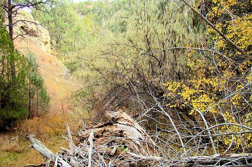
Adams Canyon Flash Flood Debris
Planning your route ahead of time is a good idea. If the route you choose would cross any private property, it would be good to arrange permission ahead of time, rather than risk a confrontation and possibly “burning a bridge” for future hikers. Big game seasons, especially elk and deer can bring many hunters to the area. You can learn more about the South Dakota hunting seasons at this site:
South Dakota Hunting Seasons Information
Blizzards and deep snow, as well as summer hail and lightning are all deterrents to a good hike. Significant snow accumulation will totally obscure the faint trails. You can keep up to date on the area weather forecast and conditions by clicking here:
Seven Sisters – Hot Springs Area Forecast and Conditions
Easy to miss
Forest Service Contact Information:
Hot Springs District Forest Service Office 1801 Highway 18 Hot Springs, SD 57747 (605) 745-4107