
|
|
List |
|---|---|
|
|
Overview
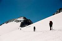
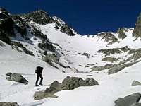
It happens in every mountain range: the most attractive summits can always be classified in two categories. Either the most beautiful mountains or the highest ones. They sometimes belong to both categories, but not always. The highlight of the Himalaya and the Karakorum are the eight-thousanders. Just 14 main summits and a number of secondary shoulders and spots. There are also the andean six-thousanders, all ruled by Cerro Aconcagua from its almost seven thousand meters, the alpine four-thousanders led by the white glimmering dome of Mont-Blanc... and the three thousanders of the Pyrenees. Not as high as mount Everest, not even half as beautiful as the peruvian Cordillera Blanca, obviously not the highest mountains in Europe. But the highest summits of the Pyrenees. 212 summits as a whole. 11 main groups can be considered, and their highest points are(west to east):
1. Balaitous-Picos del Infierno
2. Vignemale
3. Monte Perdido
4. La Munia
5. Neouvielle-Pic Long
6. Culfreda-Bachimala
7. Posets-Eriste
8. Clarabide-Perdiguero-Boum
9. Maladeta-Aneto
10. Besiberri-Comaloforno
11. Pica d'Estats
Area 1: Balaitous-Infierno-Argualas
The first three thousanders of the Pyrenees when coming west to east are placed in the valley of Tena. There are two main massifs in this group:
- On the border between France and Spain, the massif of Balaitús and Frondiellas. Served by the mountain huts of Respomuso (Spain) and Arremoulit (France).
- The area west of Baños de Panticosa shows all other three-thousanders in this sector, their highlight being the three summits of the Picos del Infierno. No high huts in this area, just the one called "Casa de Piedra" and placed at Baños de Panticosa, but I heard there's a project to move it somewhere else (perhaps somewhere on the trail towards the Ibones de Bachimaña?).
The main accesses to the spanish side of the mountains are made by the road to Baños de Panticosa and the GR11 trail towards the Collado del Infierno, or by the dam of La Sarra and the valley of Aguas Limpias towards the Hut of Respomuso.

Balaitous
Picos del Infierno
| A1 | Balaitous-Infiernos-Argualas | Meters |
| 001 | Balaitous | 3.144 |
| 01 | Torre Costerillou | 3.049 |
| 02 | Aguja d'Ussel | 3.022 |
| 03 | Aguja Cadier | 3.022 |
| 04 | Frondiella N | 3.062 |
| 002 | Frondiella | 3.071 |
| 05 | Frondiella Central | 3.055 |
| 003 | Frondiella SW | 3.001 |
| 004 | Gran Facha | 3.005 |
| 005 | Infierno Occidental | 3.073 |
| 006 | Infierno Central | 3.083 |
| 007 | Infierno Oriental | 3.076 |
| 008 | Arnales | 3.006 |
| 06 | Aguja Pondiellos | 3.011 |
| 009 | Garmo Negro | 3.051 |
| 07 | Algas N. | 3.032 |
| 010 | Algas | 3.036 |
| 011 | Argualas | 3.046 |
 |
 |
 |
Area 2: Vignemale
Placed on the very border between France and Spain, the huge massif of Vignemale forms a fortress hosting the second biggest glacier in the Pyrenees and witnessed some of the first historic climbs in this range. Lady Lister signed the first succesful climb of Grand Vignemale via the south face and some years later Count Henry Russell would turn this beatiful massif into some kind of a "country house", renting it for 99 years from the town council of Cauterets and getting locals to dig some caves for his own use and that of his friends. The main huts serving this area are the french ones of Bayssellance and Oulettes de Gaube. The spanish mountain hostel of Bujaruelo might also be a help, though placed a little bit apart from the main routes.
Just a word on terminology: it's not usual to find these names, but in some maps Vignemale might be marked by the old spanish terms of "Viñamala" or "Comachibosa".
Vignemale north face
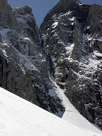
Couloir de Gaube
| A2 | Vignemale | Meters |
| 012 | Grand Vignemale | 3.298 |
| 013 | Pic du Clot de la Hount | 3.289 |
| 08 | Aguja superior del Clot de la Hount | 3.115 |
| 09 | Aguja inferior del Clot de la Hount | 3.043 |
| 014 | Pico de Cerbillona | 3.248 |
| 10 | Aguja SW de Cerbillona | 3.051 |
| 015 | Pico Central | 3.235 |
| 016 | Montferrat | 3.219 |
| 017 | Gran Tapou | 3.150 |
| 11 | Punta superior del Tapou | 3.132 |
| 12 | Punta inferior del Tapou | 3.124 |
| 018 | Pic du Milieu | 3.130 |
| 019 | Piton Carré | 3.197 |
| 020 | Pointe de Chausenque | 3.204 |
| 13 | Espalda de Chausenque | 3.154 |
| 021 | Petit Vignemale | 3.032 |
 |
 |
 |
Area 3: Monte Perdido
The area around Monte Perdido forms kind of a three legged fork, centered by the summit of Marboré. From this point a long ridge goes west towards the area of Vignemale, offering the climber summits such as the Picos de la Cascada, the Torre, the Casco or Taillon. The easternmost arm of this fork is formed by the summits of Grand Astazou and Petit Astazou, linking with the Area of La Munia. It is, nonetheless, the southern arm the one that offers a bigger number of three-thousanders: it includes Cilindro de Marboré, Monte Perdido, Soum de Ramond (Pico de Añisclo) and a number of secondary summits such as the Baudrimonts, the Punta de las Escaleras or the small Pitón SW del Cilindro. A magic kingdom for summitbaggers, indeed. One more thing: the main guarded huts in the mountains are those of Góriz (on the west slopes of Monte Perdido) and Sarradets (just north of the Brèche de Roland). The sector of Pineta and the Astazous has got no guarded huts and therefore calls for better equipment if you foresee a night in the open.
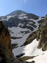
Taillon
Monte Perdido
| A3 | Monte Perdido | Meters |
| 022 | Gabietou Occidental | 3.034 |
| 023 | Gabietou Oriental | 3.031 |
| 024 | Taillon | 3.144 |
| 025 | Casco de Marboré | 3.006 |
| 026 | Torre de Marboré | 3.009 |
| 027 | Espalda del Marboré | 3.073 |
| 028 | Pico Occidental de la Cascada | 3.095 |
| 029 | Pico Central de la Cascada | 3.106 |
| 030 | Pico Oriental de la Cascada | 3.161 |
| 031 | Pico de Marboré | 3.248 |
| 032 | Astazú Occidental (Petit Astazou/Pequeño Astazú) | 3.012 |
| 033 | Astazú Oriental (Grand Astazou/Gran Astazú) | 3.071 |
| 034 | Cilindro de Marboré | 3.328 |
| 035 | Pico de Añisclo (Soum de Ramond) | 3.254 |
| 036 | Baudrimont NW. | 3.045 |
| 037 | Baudrimont SE | 3.026 |
| 038 | Punta de las Olas | 3.002 |
| 039 | Monte Perdido | 3.355 |
| 14 | Espalda de Esparrets | 3.077 |
| 15 | Punta de las Escaleras | 3.027 |
| 16 | Dedo del Monte Perdido | 3.188 |
| 17 | Pitón SW del Cilindro | 3.194 |
 |
 |
 |
 |
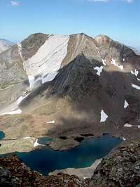
Area 4: La Munia
The Massif of La Munia is quite an unknown area for most people. Its north side overlooks the french Cirque de Troumouse, easily reachable from the villages of Gavarnie or Luz-St Sauveur. The south (spanish) side is also quite isolated, and hides the beautiful lakes of La Munia and the Pico de Robiñera. The closest spanish village is Bielsa, and the normal route to La Munia from the south begins from the beautiful valley of Pineta.
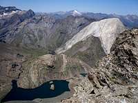
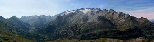
Panorama from Robiñera
| A4 | La Munia | Meters |
| 040 | Pico Heid | 3.022 |
| 041 | Pico de Troumouse | 3.085 |
| 042 | Sierra Morena | 3.090 |
| 043 | La Munia | 3.133 |
| 18 | Pequeña Munia | 3.096 |
| 044 | Robiñera | 3.003 |
 |
 |
 |
 |
Area 5: Néouvielle-Pic Long

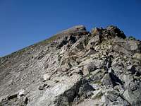
Neouvielle

Badet
Up to my knowledge, this is the only Pyrenees massif with three-thousand meter peaks fully placed in french territory.
| A5 | Néouvielle-Pic Long | Meters |
| 045 | Pic de Néouvielle | 3.091 |
| 046 | Ramougn | 3.011 |
| 047 | Trois Conseillers | 3.039 |
| 048 | Turon de Néouvielle | 3.035 |
| 049 | Pale Crabounnouse | 3.021 |
| 19 | Punta Réboul-Vidal | 3.007 |
| 050 | Bugarret | 3.031 |
| 051 | Dent d’Estibère Male | 3.017 |
| 052 | Pic Long | 3.192 |
| 20 | Aiguille Tourràt | 3.014 |
| 21 | Maubic | 3.058 |
| 053 | Badet | 3.160 |
| 22 | Aiguille Badet | 3.135 |
| 054 | Maou | 3.074 |
| 055 | Campbieil | 3.173 |
| 056 | Estaragne | 3.006 |
 |
 |
 |
 |
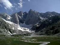
Area 6: Culfreda-Bachimala
This might easily be the most unknown area of the three-thousanders of the Pyrenees. Access is not easy from any of the two sides of the border. The closest spanish villages are Plan and San Juan de Plan, linked to Bielsa and Aínsa by a narrow road of about 14 km. The north face of these massifs can be reached from France via Arreau, Loudenvielle and Tramezaygues(that is, on the western slopes of the Col de Peyresourde). The only guarded hut in the spanish side is Biadós, and there's another one (unguarded) at the close-by (to the west) valley of Tabernes.
Bachimala
| A6 | Culfreda-Bachimala | Meters |
| 057 | Lustou | 3.023 |
| 058 | Culfreda | 3.034 |
| 23 | Culfreda NE | 3.032 |
| 24 | Culfreda Central | 3.028 |
| 059 | Pico Puerto de la Pez | 3.018 |
| 060 | Pico de la Pez | 3.024 |
| 061 | Abeillé | 3.029 |
| 062 | Pico Marcos Feliú | 3.057 |
| 063 | Punta Ledormeur | 3.120 |
| 25 | Pequeño Bachimala | 3.061 |
| 26 | Punta del Ibón | 3.100 |
| 064 | Bachimala / Pico Schrader | 3.177 |
| 065 | Punta del Sabre | 3.074 |
 |
 |
 |
 |
Area 7: Posets-Eriste
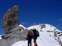
Posets, the second highest summit of the Pyrenees, forms the central nucleus of a wide massif. Placed south of Perdiguero, southeast of the Maladeta Massif and east of Bachimala, it includes 13 main summits and 5 secondary summits over three thousand meters. And the best news is that the closeby Maladeta Massif sometimes concentrates the bigger crowds in these areas (this may be related to the presence of Aneto over there). Therefore, Posets and its surroundings offer beatiful (and not too crowded) climbs of almost every difficulty level.
Main Trailheads: Benasque, Plan.
Main huts: Refugio Angel Orús, Refugio de Estós, Refugio de Biadós.
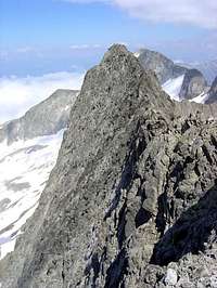
Forqueta
Posets
| A7 | Posets - Eriste | Meters |
| 066 | Pico de los Veteranos | 3.125 |
| 067 | Pico de los Gemelos Ravier | 3.160 |
| 068 | Posets | 3.375 |
| 069 | Pico de la Paúl | 3.078 |
| 27 | Pico inferior de la Paúl | 3.073 |
| 070 | Bardamina | 3.079 |
| 071 | Diente de Llardana | 3.085 |
| 072 | Tuca de Llardaneta | 3.311 |
| 28 | Tuqueta Roya | 3.273 |
| 073 | Las Espadas | 3.332 |
| 074 | Pavots | 3.121 |
| 29 | Tuca del Forau de la Neu | 3.076 |
| 075 | Forqueta | 3.007 |
| 30 | Diente Royo | 3.010 |
| 31 | Forqueta SE | 3.004 |
| 076 | Beraldi | 3.025 |
| 077 | Gran Pico de Eriste | 3.053 |
| 078 | Eriste Sur | 3.045 |
Area 8: Clarabide-Perdiguero-Boum
The Valley of Estós is probably the area where the biggest number of three-thousanders concentrate in the Pyrenees. Its entrance is placed a very short way north of Benasque, and a (private!) dirt road runs along most of the valley floor giving an easy access to the Refugio de Estós.
Main Huts: Refugio de Estós
Gourgs Blancs
Crabioules
Perdiguero
Clarabide
| A8 | Clarabide-Perdiguero-Boum | Meters |
| 079 | Clarabide | 3.020 |
| 32 | Clarabide Occidental | 3.008 |
| 33 | Clarabide Oriental | 3.012 |
| 080 | Gías | 3.011 |
| 081 | Pico Saint-Saud | 3.003 |
| 082 | Camboué | 3.043 |
| 083 | Gourgs Blancs | 3.129 |
| 34 | Punta Lourde-Rocheblave | 3.311 |
| 35 | Torre Armengaud | 3.065 |
| 084 | Pico Jean Arlaud | 3.065 |
| 085 | Pico Belloc | 3.008 |
| 36 | Belloc central | 3.006 |
| 37 | Belloc Sur | 3.007 |
| 086 | Spijeoles | 3.065 |
| 087 | Pico Gourdon | 3.034 |
| 38 | Pico Audoubert | 3.045 |
| 088 | Seil dera Baquo | 3.110 |
| 39 | Cap dera Baquo occidental | 3.097 |
| 40 | Cap dera Baquo oriental | 3.103 |
| 089 | Pico Portillon de Oô | 3.050 |
| 41 | Pequeño Pico del Portillon | 3.110 |
| 090 | Perdiguero | 3.222 |
| 42 | Hito W del Perdiguero | 3.176 |
| 43 | Hito E del Perdiguero | 3.170 |
| 091 | Grand Quayrat | 3.060 |
| 092 | Pico Lézat | 3.107 |
| 44 | Aguja Superior de Lézat | 3.069 |
| 45 | Aguja Central NW de Lézat | 3.058 |
| 46 | Aguja Central SE de Lézat | 3.037 |
| 47 | Aguja Inferior de Lézat | 3.023 |
| 48 | Punta Lacq | 3.010 |
| 49 | Punta Mamy | 3.048 |
| 093 | Crabioules Occidental | 3.106 |
| 094 | Crabioules Oriental | 3.116 |
| 095 | Punta de Lliterola | 3.132 |
| 50 | Aguja de Lliterola | 3.028 |
| 51 | Tuca de Lliterola | 3.095 |
| 52 | Aguja Jean Garnier | 3.025 |
| 53 | Tusse de Remuñé | 3.041 |
| 54 | Pico Rabadá | 3.045 |
| 55 | Pico Navarro | 3.043 |
| 096 | Pico Royo | 3.121 |
| 097 | Maupas | 3.109 |
| 098 | Boum | 3.006 |
Area 9: Maladeta-Aneto
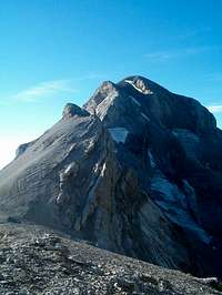
Maladeta and Aneto, the Montes Malditos. The "Damned Mountains". The massif where the highest peak of the Pyrenees can be found, a massif where beatiful granite builds high peaks and rock spires, where some of the big glaciers of the Pyrenees are placed.
Main Huts: La Renclusa

Vallibierna

La Maladeta
Pico de Aneto
Aragüells
Tempestades Ridge
| A9 | Maladeta-Aneto | Meters |
| 099 | Pico de Alba | 3.118 |
| 56 | Gendarme de Alba | 3.054 |
| 100 | Diente de Alba | 3.136 |
| 58 | Muela de Alba | 3.118 |
| 58 | Punta Delmas | 3.170 |
| 101 | Tercer pico occidental de la Maladeta | 3.185 |
| 102 | Segundo pico occidental de la Maladeta | 3.220 |
| 103 | Pico Le Bondidier | 3.185 |
| 104 | Primer pico occidental de la Maladeta | 3.254 |
| 105 | <b%">Pico de La Maladeta | 3.308 |
| 59 | Pico Collado de la Rimaya | 3.265 |
| 60 | Pico Abadías | 3.279 |
| 61 | Gendarme Schmidt-Endell | 3.335 |
| 106 | Pico Maldito | 3.350 |
| 62 | Aguja Haurillon | 3.075 |
| 63 | Aguja Cregüeña | 3.043 |
| 64 | Aguja Juncadella | 3.021 |
| 107 | Pico de Aragüells | 3.037 |
| 108 | Punta d’Astorg | 3.355 |
| 109 | Pico del Medio | 3.346 |
| 110 | Pico de Coronas | 3.293 |
| 111 | Aneto | 3.404 |
| 65 | Tuca del Collado de Coronas | 3.286 |
| 66 | Punta Oliveras-Arenas | 3.298 |
| 112 | Espalda de Aneto | 3.350 |
| 67 | Aguja Daviu | 3.350 |
| 68 | Aguja Escudier | 3.315 |
| 69 | Aguja Franqueville | 3.065 |
| 70 | Aguja Tchihatcheff | 3.052 |
| 71 | Aguja Argarot | 3.035 |
| 113 | Pico de Tempestades | 3.290 |
| 72 | Punta Brecha Tempestades | 3.274 |
| 114 | Pico Margalide | 3.241 |
| 73 | Forca Estasen | 3.028 |
| 74 | Gendarme-Torre de Salenques | 3.111 |
| 75 | Primer resalte de Salenques | 3.127 |
| 76 | Segundo resalte de Salenques | 3.148 |
| 115 | Pico Russell | 3.207 |
| 77 | Punta Brecha Russell | 3.192 |
| 116 | Tuca de Culebres | 3.062 |
| 78 | Russell SE | 3.205 |
| 79 | Aguja Russell Superior | 3.146 |
| 80 | Punta Russell Oriental | 3.034 |
| 81 | Aguja SW de Russell | 3.029 |
| 117 | Pico de Vallibierna /Vallhiverna | 3.067 |
| 118 | Tuc de Mulleres | 3.010 |
 |
 |
 |
 |
Area 10: Besiberri-Comaloforno
Main Huts: Refugio Ventosa i Calvell
Punta Alta
| A10 | Besiberri - Comaloforno | Meters |
| 119 | Besiberri N | 3.014 |
| 120 | Besiberri del Mig N | 3.002 |
| 121 | Besiberri del Mig S | 3.003 |
| 122 | Besiberri S | 3.030 |
| 123 | Comaloforno | 3.033 |
| 124 | Pico Celestin Passet | 3.002 |
| 125 | Punta Alta | 3.014 |
 |
 |
Area 11: Estats
Pica d'Estats
| A11 | Estats | Meters |
| 126 | Pico de Sotllo | 3.072 |
| 127 | Montcalm | 3.077 |
| 128 | Pico Verdaguer | 3.131 |
| 129 | Pica d’Estats | 3.143 |
| 82 | Punta Gabarró | 3.115 |
| 83 | Rodó de Canalbona | 3.004 |
 |
 |
 |
 |
External links
The valley of Benasque: I don't know wether it really is the most complete web guide to the valley of Benasque, but it sure is a good one. Might be helpful if you plan to do some climbing in Areas 7, 8 or 9 (from Posets to Maladeta-Aneto). The only thing is... I have only found spanish language information, sorry about that.
eza - Jul 11, 2007 10:52 am - Hasn't voted
Re: MaupasOK, I already made the changes in the list to link directly to it.
Rafa Bartolome - Aug 7, 2007 3:08 am - Voted 10/10
Argarotla altura de Aguja Argarot es 3035m, has repetido los 3052 de la Tchihafcheff
eza - Aug 7, 2007 9:10 am - Hasn't voted
Re: ArgarotCorregido, muchas gracias. Estás en todo...
visentin - Mar 12, 2009 9:28 am - Voted 10/10
I'd rename itinto the SP language, English : "3000's of the Pyrenees" (without é with accent)