
|
|
Mountain/Rock |
|---|---|
|
|
44.61370°N / 107.43961°W |
|
|
Bighorn |
|
|
Hiking |
|
|
Spring, Summer, Fall, Winter |
|
|
10328 ft / 3148 m |
|
|
Overview
Bruce Mountain is visible from quite a few areas of the western Bighorns. It can be accessed from both Highway 14 and from Forest Service Rd 26 (Red Grade Road) near woodchuck pass. This area marks the last of the granite peaks of the bighorns as the areas to the west transition to dolomite. Bruce mountain has expansive views in all directions.
Getting There
The primary access is from Wyoming Highway 14 which goes from the town of Dayton up and over the western Bighorn Range to the town of Shell. This well-maintained highway is open year-round and is a beautiful drive in and of itself.
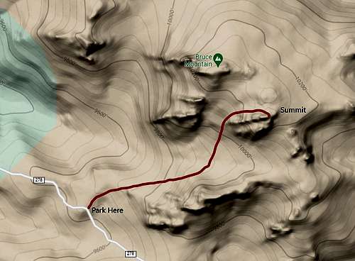
From Highway 14 turn east on Forrest Road 277. Zero your odometer here and continue on FSR 277 passing a gravel pit and several small spur roads. After 1.6 miles turn left on FSR 278. This road is initially steep and rough but gets better as you go. After 1.9 miles you will come to an old blocked ATV road. Park here and hike north following an old two track road. After about 0.5 miles this peters out and the route continues cross country to the summit. Total distance from the parking area is about 1 mile with about 600ft of elevation gain.
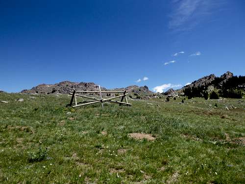
Parking for start of the route off FSR 278
An alternative approach is to take FSR 26 from highway 14. Follow this for 10.4 miles and turn south on FSR 226. This road ascends to the small pass between Bruce Mountain to the west and Dome Peak to the east.
Route
The route starts from was from FSR 278. This starts at an old blocked Jeep/ATV trail. The trail is blocked with some pine poles/posts. From the parking spot follow the old jeep trail for about 0.5 miles as ascends north. Here the two track starts to fade and you veer left ascending to the ascend toward the largest and tallest of the granite fins that make up the summit of Bruch Mountain. You must scramble up the fin to reach the summit. Here a small cairn summit register made of PVC pipe was found.
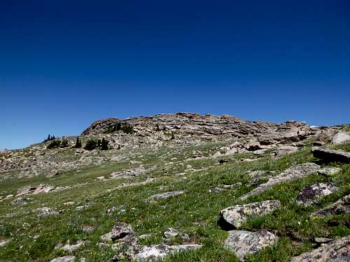
Summit of Bruce Mountain
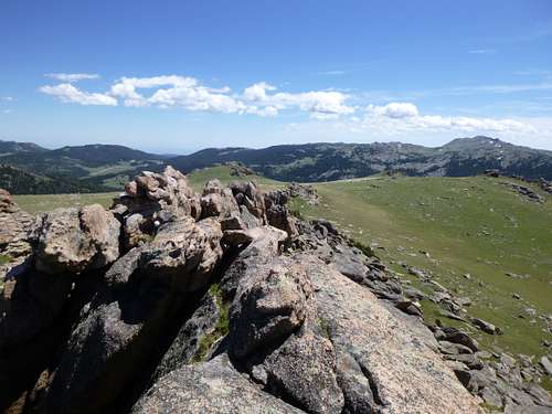
Summit of Bruce Mountain looking east toward Dome Peak
Red Tape
None. No permit required to climb.
When to Climb
May/June thru October are generally best. Winter ascent is possible via skis or snowmobile.
Camping
Primitive dispersed camping is widely available. Tie Flume campground is a very nice facility and in close proximity.
External Links
Add External Links text here.