
|
|
Mountain/Rock |
|---|---|
|
|
46.08058°N / 10.75780°E |
|
|
Trentino |
|
|
Hiking, Scrambling |
|
|
Spring, Summer, Fall, Winter |
|
|
6027 ft / 1837 m |
|
|
Overview
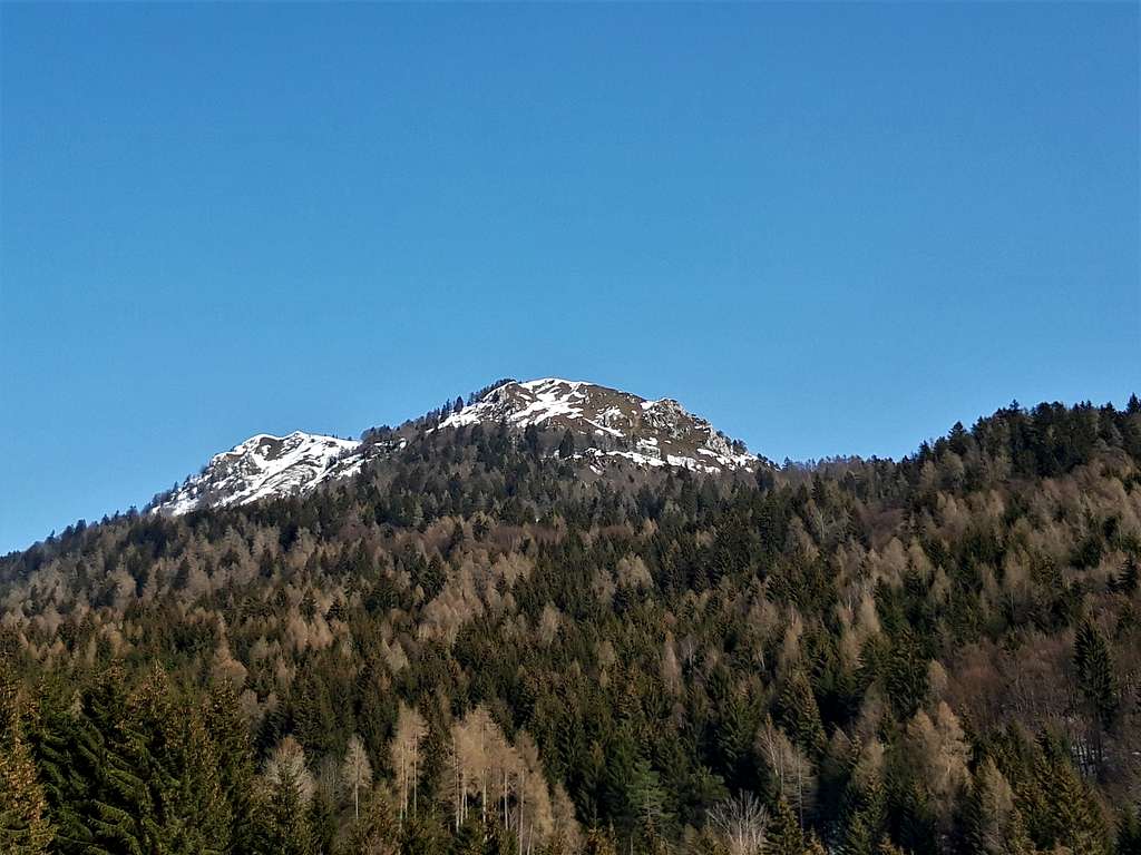
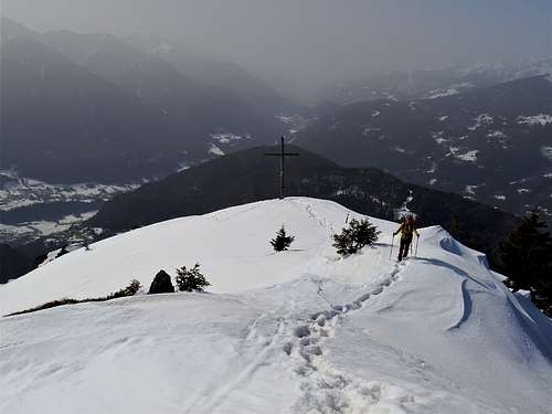
Cima Durmont 1837 m
Cima Durmont 1837 m is not a mountain of great height or even important, but it is a pleasant destination and above all a fabulous panoramic balcony that opens onto the glaciers and the peaks of the Adamello and Presanella groups and beyond.
The mountain is located on the South-Western offshoots of the Brenta Group in the beautiful woods of the Regole di Manez. Anyhow we must note that the morphology of Cima Durmont is completely different from the nature of this famous Dolomite group, which has grandiose peaks, rocky spiers, high walls and small glaciers, while Cima Durmont is quite a minor summit, mainly wooded with some rocky bands.
Getting There
From the A22 Brennero motorway take the Trento Sud exit and follow the state road to Riva del Garda and Sarche. Once you reach this last village take the road to Tione and Madonna di Campiglio. About 1 km from Tione di Trento leave the state road, taking a narrow road on the right which, passing through Preore, reachs the municipality of Montagne. The road rises steeply, leaves the detour to the right to Binio and reaches Passo Daone m 1290, where we find a refuge and various parking possibilities.
Route
Cima Durmont from Passo Daone
Summit elevation: 1837 m
Difficulty: E
Difference in level: 540 m from Passo Daone
Starting point: Passo Daone 1291 m
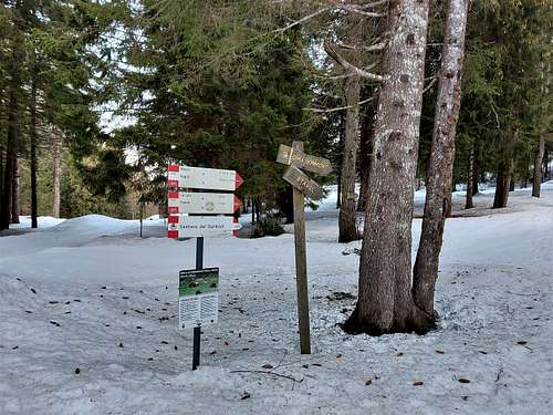
The ascent begins at Passo Daone, near a parking lot under a dense cover of fir trees, where on the right you can see a signpost indicating Cima Durmont. The first short stretch is on a small road, then we turn right onto the path (signpost) with a moderate slope, soon reaching a meadow clearing with an alm (Dotor locality). Continue to climb until you reach a bend in the wide forest road rising up from Binio.
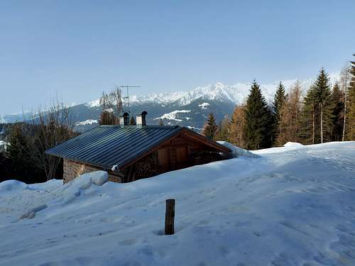
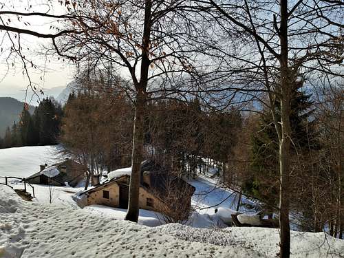
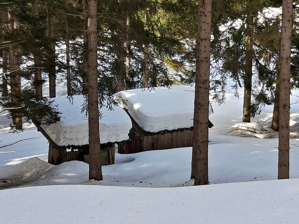
We ignore this forest road and continue to the left, reaching the Masi di Pramarciù 1397 m, located in a splendid meadow context. We continue uphill in the dense forest oblique to the left and keeping the forest road which take us to Stavel 1492 m, where we find two beautiful small alms in a grassy clearing that interrupts the pine forest. Here our eye is drawn to the West by the unmistakable shape of the Caré Alto and its glaciers.
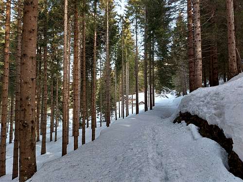
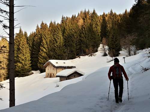
In correspondence with the huts, turn sharply to the right (sign) continuing to climb into the coniferous forest that slowly leave the place for the beech trees.
The climb becomes much more pronounced and the vegetation sparser, until the final exit outdoors, immediately at the base of some rocky walls that characterize the southern slope of Cima Durmont. The itinerary climbs towards the rocks and turns to the right with a sharp oblique, traversing steep terrain.
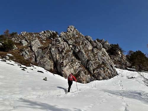
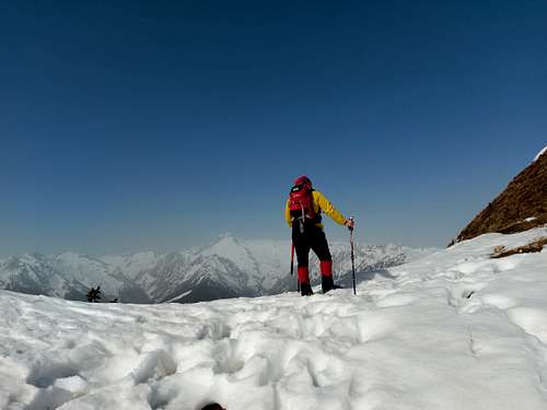
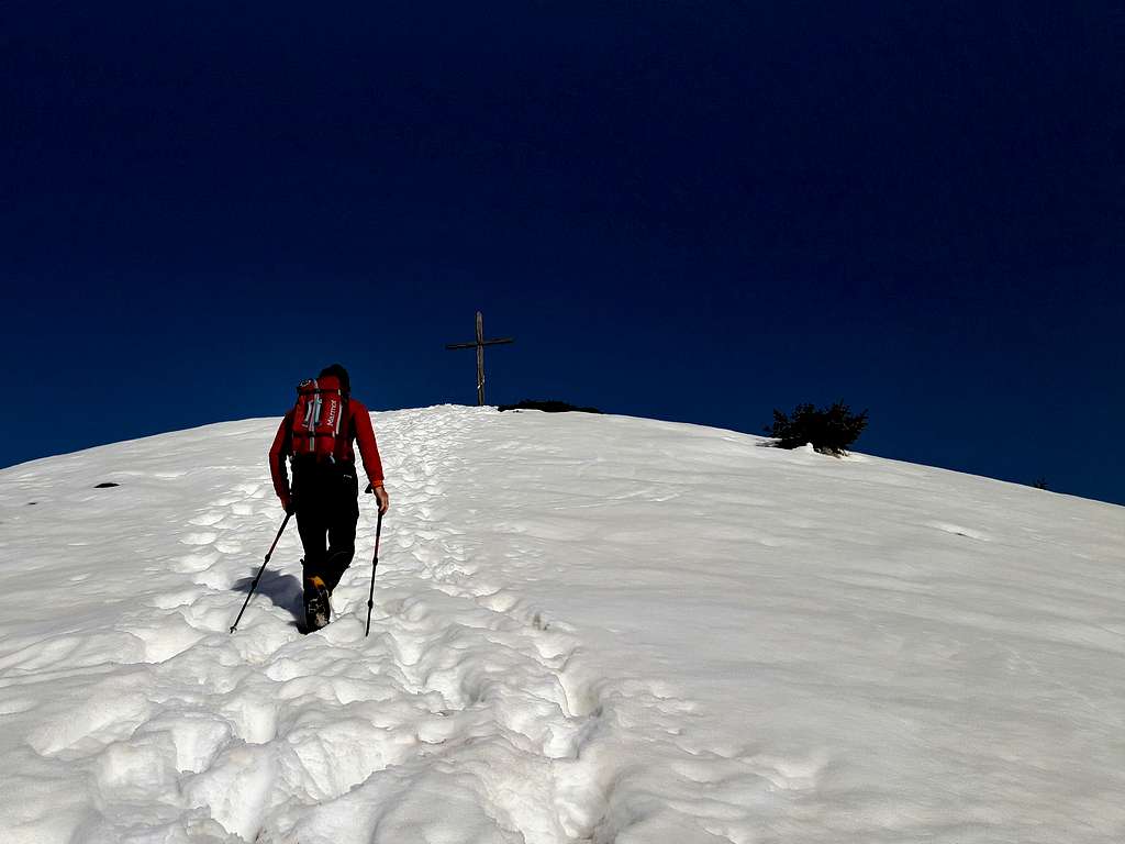
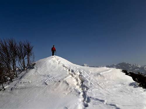
At the end of the traverse, you climb steeply towards the not far above summit which you will soon reach (summit cross and book). It is actually a forerunner, the highest point is located a few tens of meters above the cross along a ridge, which can be reached shortly. To the north, note the glimpse towards the Brenta Dolomites and the Adamello and Presanella glaciers to the west.
Red Tape
No fees no permits required.
When to Climb
The route can be tackled preferably in spring or autumn, however it is feasible all year round, with the warning that summer can be too hot due to the low altitude and winter ascents requires snowshoes or an ice-axe and crampons in the presence of ice. Moreover in the winter season the steepness of the final slope advises to check the state of the snow-cover.
Where to stay
Different possibilities of accomodation in Tione and Val Rendena.