
-
 1681 Hits
-
 79.04% Score
-
 10 Votes
|
|
Mountain/Rock |
|---|---|
|
|
47.14224°N / 13.99279°E |
|
|
7021 ft / 2140 m |
|
|
Topographic isolation: 8 km
Nearest higher peak: Trübeck, 2367 m
Prominence: 906 m
Overview
Murberge is a not very well known but interesting mountain range in Austria. It stretches in 60 km lenght along the valley-system of river Mur. I write the term „valley-system” because there is the current valley of Mur. In parallel with it, in approximately 8 km distance there is another long valley. And the two valleys are interconnected here and there. Likely, when the Alps were formed million years ago, initially the river was cutting the valley that is abandoned now; later due to tectonic movements it changed its position and formed its current valley. The mountain range is between these two valleys. According to some classifications Murberge belongs to Niedere Tauern.
Nevertheless, I intended to write about Gstoder and not about Murberge. Gstoder is the highest peak of Murberge. It’s height is 2140 m. Since it’s the highpoint of a mountain range, we should expect a high prominence here, too. Yeees, it’s 906 m! With this prominence, it’s the 11th most prominent peak of Salzburg province, and the 15th most prominent peak of Styria. It’s possible because the border of these two provinces is across this peak.
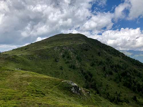
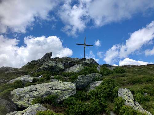
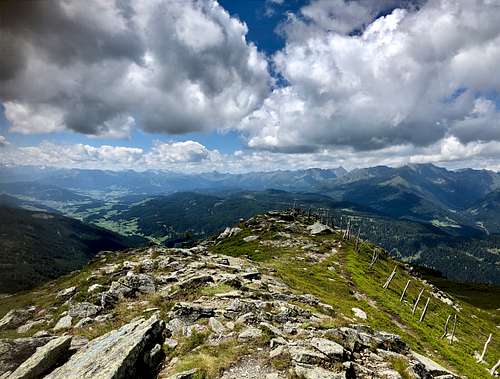
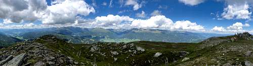
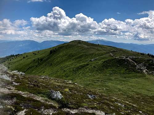
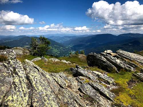
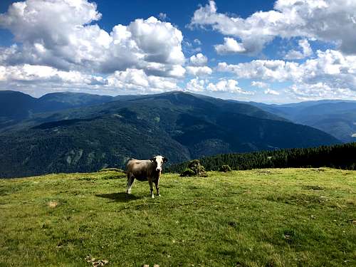
The top of the mountain is a meadow, with some rocks forming the peak. Good view from the peak around, especially towards north where you can see the whole chain of Niedere Tauern:
Besides the main peak of Gstoder the mountain has three subpeaks:
- Dörfler Höhe (1987 m)
- Payerhöhe (1966 m)
- Schober (1881 m)
Dörfler Höhe in itself is not especially interesting. However, since the marked trail from south crosses it, most people find himself on its summit. The best view of the main peak of Gstoder can be seen from here.
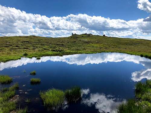
Payerhöhe is a bit aside: it’s 2 km far from the marked normal route. It worth the visit with its nice and lonely landscape. Moreover, there is even a small pond nearby its summit.
Schober is only for specialists! There is no much to see there. It’s already below the tree-line, so even the panoramic view is missing here
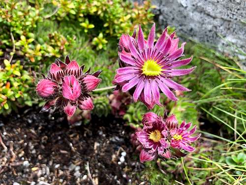
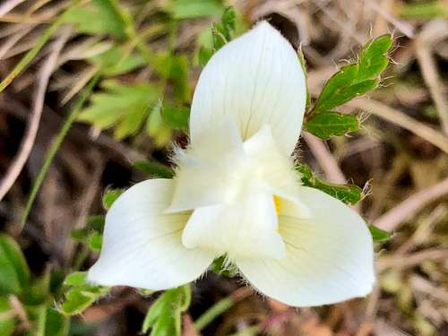
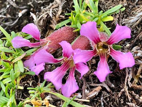
Mountain Flora
I’m sorry for this section for those who are bored of flora photography. But I like it and I insert the photo of some typical flowers that are around the peak:
Getting There
I don’t want to describe how to get to Murau. Anybody can find it with a route-planner (if doesn’t find it by heart).
If you want to ascend the peak on one of the trails from northern direction, then you must take the road B96 from Murau, and drive further 15-20 km – depending on your selected trailhead. That’s OK.
The story is more interesting from the south. The normal route is from here. It’s short version starts from Kaiserhütte (1755 m). But how to get to Kaiserhütte? First take road B97 from Murau. 14 km diving and you are in the village of Sankt Ruprecht ob Murau. In the village center you can find an ascending narrow paved road that is closed by a toll gate. You need 4 Euro in coins to pass this gate. After paying the fee and driving further, it soon turns out that the narrow road is paved only at its beginning. In the next 6 km the quality of the road is not the best. I drove with a standard car and I think that my car got some minor damages due to the bad quality of the road. But the road must be OK for a SUV. One of the few cases when the usage of a SUV van be justified…
Routes
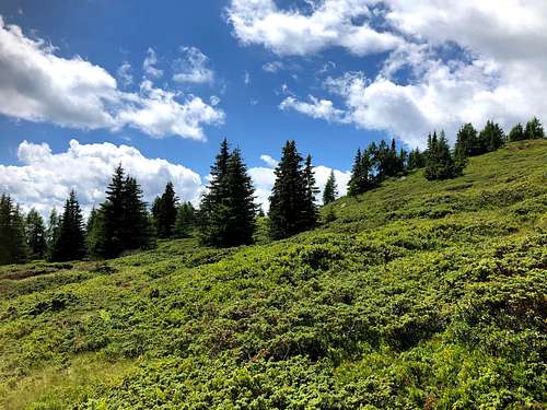
- From Schwarzenbichl (north): 5.6 km distance with 920 m elevation gain
![Beautiful hillside near the normal route]()
Beautiful hillside near the normal route - From Seebach (north): 7.3 km distance with 1175 m elevation gain
- Normal route (south) – short version from Kaiserhütte (1755 m): 2.3 km with 385 m elevation gain
- Normal route (south) – long version from Sankt Ruprecht ob Murau: 10.6 km with 1240 m elevation gain.
Red Tape
Toll gate (4 Euro) for approaching Kaiserhütte with car.
Cattle on the mountain. Dogs must be leash. Or no dogs at all. And take distance from the cattle.
When to Climb
Any season. The easiest is from June to October.