
-
 8723 Hits
-
 84.82% Score
-
 19 Votes
|
|
Mountain/Rock |
|---|---|
|
|
28.35349°N / 16.48078°W |
|
|
Hiking |
|
|
Spring, Summer, Fall, Winter |
|
|
6739 ft / 2054 m |
|
|
Overview
 Montaña La Crucita as seen from the west Montaña La Crucita as seen from the west |
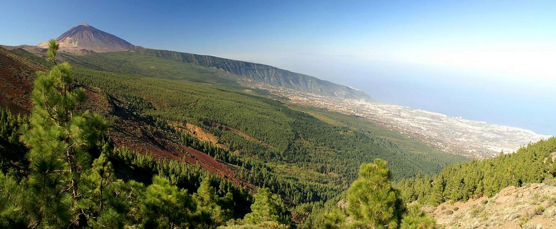
The Cumbre Dorsal Range on the island of Tenerife is one of the younger mountain ranges of the island. It was created about 3 million years ago by cleft volcanism, where lava is emitted a long line of fissures. Over the millennia in which the eruptions took place the range reached an average height of way above 2000m before volcanic activity died down and the hot spots moved westward to create the huge cone of Teide. However, volcanism never left the range and proof is that one of the last eruptions on Tenerife took place here, creating Montaña de las Arenas to the south of the giant ridge. The mountains on the high ridge of the Cumbre Dorsal Range display all kinds of structures, colours and aspects. There are black volcanic cones, red hill-like summits and mountains overgrown with the beautiful Canarian pines.
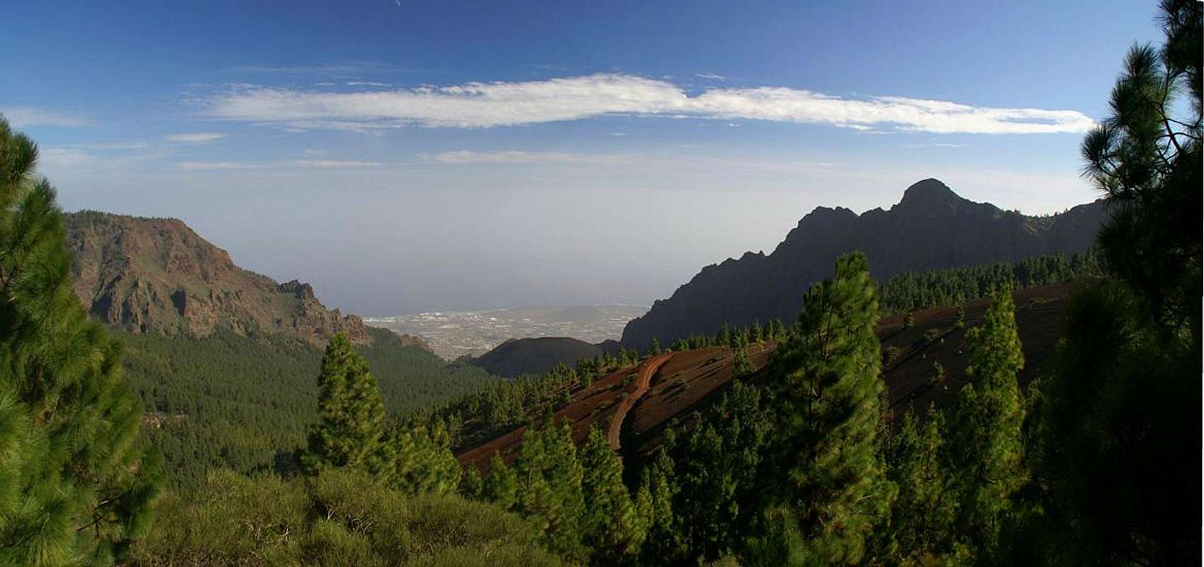
Montaña la Crucita is one of the latter mountains. It is located right in the middle of the range which runs from the town of La Esperanza in the north-east to El Portillo, the portal to the Cañadas del Teide, in the south-west. Since the mountain is located right on the ridge of the Cumbre Dorsal it commands perfect views of both the north and the south coasts of the island. However, due to the pines there is no single place where you can enjoy a 360° view. Instead you have to hunt for the best places to spot Teide, the Orotava and the Guimar Valleys.
 |  |  |
In later days the connection between these two valleys was (and is) used as a pilgrimage trail to the black Madonna de la Candelaria, the patron saint of all the Canarias. The Madonna was a statue shaped volcanic rock, which was found near Candelaria on the south coast of the island. It was worshipped even in pre-Hispanic times by the original inhabitants of the island, the Guanches. The Spaniards and Christianity took over the worship and legions of Canarians must have trooped up and down the pilgrimage trail. In places it is worn into the red volcanic tuff by more than 2m (6 feet). Today's Madonna is a replica after te original one drowned in a flood catastrophe centuries ago.
 |  |  |
Getting There
You can reach the Crucita Saddle from three directions. Either take TF24 from La Esperanza, TF21 from Puerto de la Cruz to El Portillo and TF24 to the saddle or TF523 from Guimar to the Cumbre Dorsal Ridge and TF24 to the saddle.
However, the real experience of climbing Montaña la Crucita is along the pilgrimage trail, either from Aguamansa in the north or Arafo in the south. Therefore the following itineraries describe how you get to the respective trailheads:
- Northern trailhead at La Caldera near Aguamansa
Take motorway TF5 to the exit La Orotava. Turn onto TF21 through La Orotava to Aguamansa. Some 2km after the village there is the huge picnic area of La Caldera, which serves as a trailhead to many hiking routes in the area.
- Southern trailhead in Arafo
The southern trailhead is right in the centre of the town of Arafo. Since it is very low (438m) you might drive up to the upper outskirts of the town. There are no real parking lots but for the town centre so let's assume the climb starts there.
Take motorway TF1 to the exit Arafo. Turn onto TF281, direction La Hidalga and Arafo. A left - right combination takes you onto TF245 to Arafo. In the town look for the town centre near the church. There is a parking lot near a small kiosk.
Red Tape
Accommodation
Of course you can find a lot of hotels, fincas and casas on the island which you can book from any travel office. The nearest towns are Aguamansa in the north and Arafo in the south. Both offer limited accommodation possibilities so it is advisable to stay at one of the resort towns and villages further down the slopes near the coast.Weather Conditions
 The snow covered Teide Summit from Montaña la Crucita
| Month | Jan | Feb | Mar | Apr | May | Jun | Jul | Aug | Sep | Oct | Nov | Dec |
| Avg. day temp.[°C / °F] | 19 / 66 | 19 / 66 | 20 / 68 | 21 / 70 | 22 / 72 | 23 / 73 | 24 / 75 | 26 / 79 | 26 / 79 | 24 / 75 | 22 / 72 | 20 / 68 |
| Avg. night temp.[°C / °F] | 13 / 55 | 13 / 55 | 14 / 57 | 14 / 57 | 16 / 61 | 18 / 64 | 19 / 66 | 20 / 68 | 20 / 68 | 18 / 64 | 17 / 63 | 14 / 57 |
| Water temp.[°C / °F] | 19 / 66 | 19 / 66 | 19 / 66 | 19 / 66 | 20 / 68 | 20 / 68 | 22 / 72 | 23 / 73 | 22 / 72 | 22 / 72 | 21 / 70 | 20 / 68 |
| Rainy days | 10 | 7 | 8 | 4 | 3 | 2 | 1 | 1 | 3 | 5 | 7 | 9 |
The Canarian Islands (as well as Madeira) are located in the trade wind zone. You almost always encounter northeastern winds which carry a lot of humid air. Being forced to climb to higher altitudes this moisture condenses into clouds. This in return means that most of the time the northeastern part of the islands is covered in clouds from altitudes of 1000m through 2000m.
The mountains themselves - being mostly of the same altitude - finally stop the clouds so that on their southeastern slopes the clouds "run out". In the case of Tenerife the Cumbre Dorsal is about the elevation the clouds reach so that you might be disappointed with respect to views. Moreover, the range is almost always swept by very fierce winds!
Maps & Books
Out of the multitude of maps and books I have been using the following. However, so far I have not found a good hiking map of the island. The one posted here is ok but shows only a fraction of the marked hiking trails. Both parts of Camino de la Candelaria are described separately and excellently.- Maps
- Teneriffa
Kompass Map WK233
Kompass Verlag
ISBN: 3-85491-038-X
Books
- Teneriffa, Tenerife
K.Wolfsperger, C. Ade
Rother Walking Guide
Rother Verlag
English - ISBN: 3-7633-4809-3
German - ISBN: 3-7633-4016-5