
|
|
Mountain/Rock |
|---|---|
|
|
42.10203°N / 14.13068°E |
|
|
Abruzzo |
|
|
Hiking, Mountaineering, Mixed, Scrambling, Skiing |
|
|
Spring, Summer, Fall, Winter |
|
|
8980 ft / 2737 m |
|
|
Monte Acquaviva
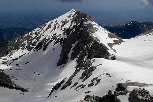
Monte Acquaviva is one of the major peaks of the Majella mountain range (or Maiella massif) and, after Corno Grande (9,554ft / 2,912m) and Monte Amaro (9,163ft / 2,793m), the third highest mountain of the entire Apennines. Both to the south and to the north it is delimited by inaccessible scree ramps and steep or near vertical rock formations. Approaching its double peak is recommendable either via the mountain's east or west ridge. From the west it is necessary to traverse first the foresummit (2,727m / 8,946ft) and the central col before finally facing the easy slope which leads up to the actual main peak (with the summit cross). However, all possible approach routes, without any conceivable exception, are long, quite demanding and will require a considerable physical fitness.
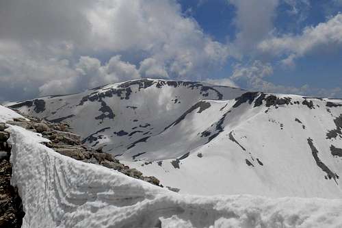
A one-day round trip is well possible, depending on your trailhead. Note also that the major peaks of the Maiella massif, and hence summit and foresummit of Monte Acquaviva, can hold great amounts of sometimes displeasingly wet snow well into the months of summer. A thoughtful preparation and, most important, a fair water supply are essential.
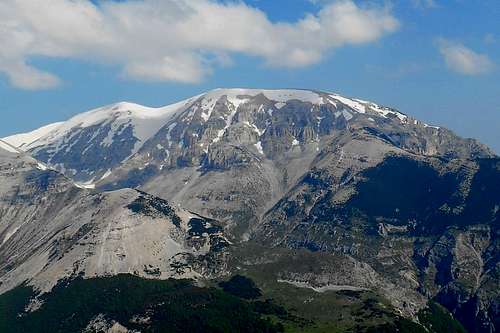 Monte Acquaviva (south face) | 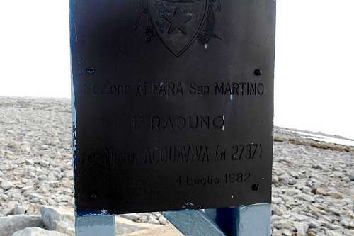 Summit sheet panel | 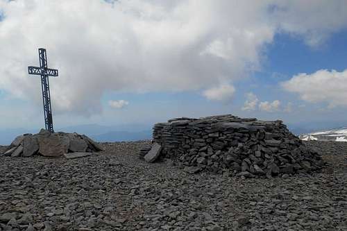 Summit plateau and summit cross |
(N.B. The subsidiary peak of Monte Pizzone (2,214m / 7,263ft) can be reached by traversing the summit plateau and descending the initially broad east shoulder of Monte Acquaviva. Always keeping to the right hand side of the tapering ridge, the whole cliff walk offers varied and imposing views on the subjacent valleys 'Valle delle Mandrelle' (to the south) and 'Valle dell'Acquaviva' (to the north), on Monte Sant'Angelo, Cima Forcone and Monte Martellese, towards the Adriatic Sea and the spectacular ridge line of the valley 'Valle di Macchia'.)
Panorama
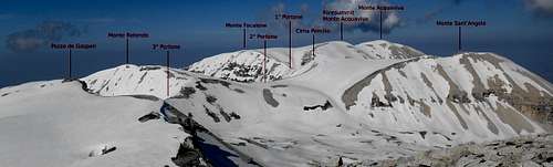
Panorama (seen from the west ridge of Monte Amaro)
Routes
1. From Fara San Martino or Pennapiedimonte - East routes (hiking / scrambling)
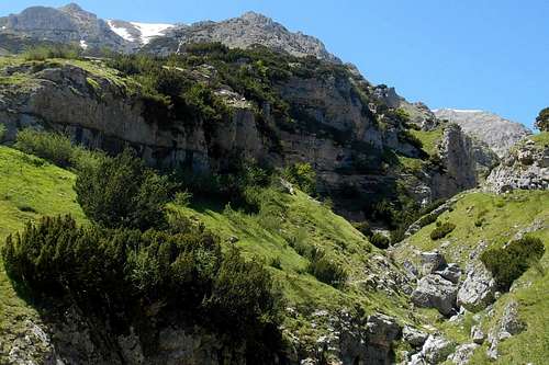
Perhaps the hardest but surely the most rewarding routes to the summit of Monte Acquaviva approaches the mountain from the east. There are two main trailheads: the small villages of Fara San Martino and Pennapiedimonte.
From the latter there are two hiking paths surmisable: (a) from the village take the hiking trail G1, in proximity of the mountain hut Rifugio Peschioli take the deviation G2 for the valley 'Vallone delle Tre Grotte' and follow this trail as it zigzags uphill to the north shoulder of Monte Cavallo, turn left (south) and follow the north route (see below); (b) from the village take the trail G3 and later turn right (west), taking either the easier G4 or the somewhat more attractive G5 for Monte Ugni (2.049m / 6.722ft) and the peaks of Cima Macirenelle, Cima Forcone, Cima Raparo and Monte Martellese (2,259m / 7,411ft), - both trails will conjoin in proximity of the mountain hut Rifugio Martellese, the trail is now skirting the vast valley 'Valle del Forcone' while it ascends towards the summit of Cima delle Murelle (2,596m / 8,517ft), from the summit you will have to descend the craggy south-west ridge to the col and ascend again towards another ridge which runs between Monte Focalone (2,676m / 8,779ft) and the foresummit of Monte Acquaviva.
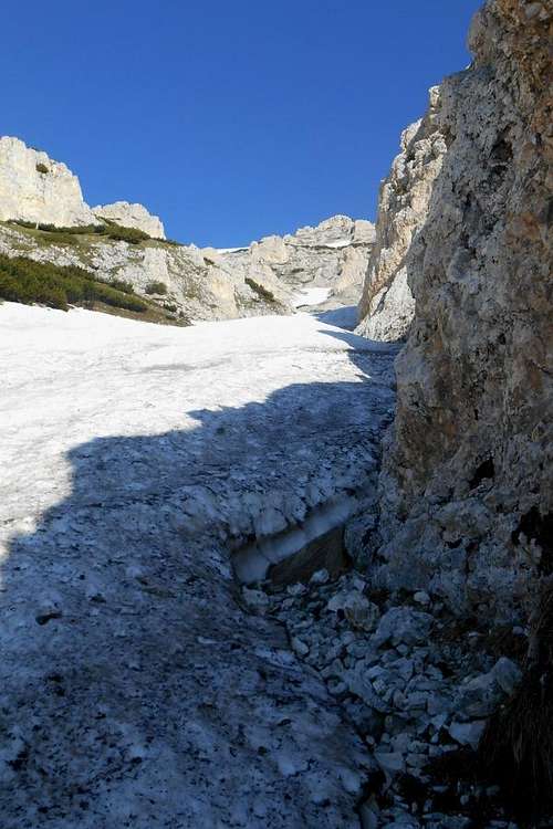 Firn snow gully, east face Monte Acquaviva | 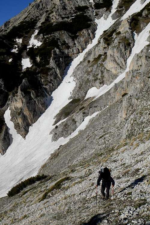 Monte Acquaviva (east route) | 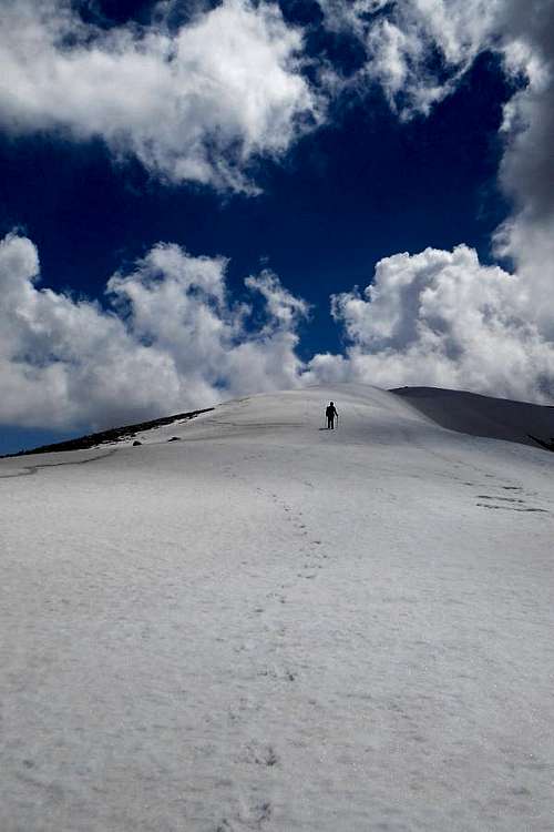 Monte Acquaviva (the central col) |
Perhaps the hardest approach is from Fara San Martino. The first part coincides with one of the normal routes to Monte Amaro and traverses the beautiful valley 'Valle Santo Spirito'. It is well signposted as H1. At the junction 'Bocca dei Valloni' turn right (north) and take the trail G6. While proceeding the trail itself becomes increasingly less evident, so it is imperative to pay close attention. About 100 meters before reaching the well 'Fonte del Pesco' turn left (or refill your water supply at the well before turning back and then right).
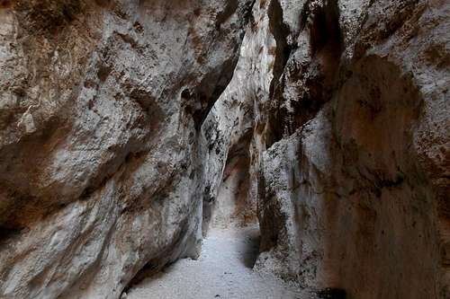 The gorge of Fara San Martino, trail H1 | 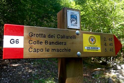 Signpost, trail G6 | 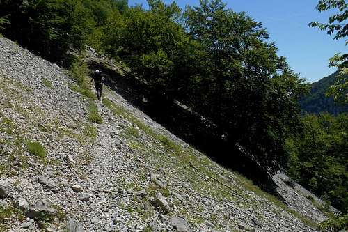 Scree ramp, trail G6 |
The path is now occasionally signposted with F2 and traversing a large beech forest before descending again to the bottom of a valley. The path terminates right at the torrent which can be crossed by bypassing the huge rock on its left hand side. Under overhanging rocks you will find a provisional bivouac (Grotta dei Callarelli). The bivouac itself is located precisely at the junction of two beautiful valleys: Valle dell'Acquaviva (a) and Valle del Forcone (b). Both valleys can be used as an ascent route.
The former (a) is perhaps more demanding and leads to a gully right underneath the east face of Monte Acquaviva. The last tract requires a good sense of direction and holds steep scree ramps, firn, ice and passages of easy climbing (up to II UIAA). Although recently published maps may indicate a hiking path G8, be advised that there is no respective signposting (or any recognizable path). Every now and then, however, you may come upon a faded F2 trail sign (mostly painted on larger rocks).
The latter (b) is a possible alternative route which (technically) might be be less trying. But it is much longer, too, as it is skirting the entire north face of Monte Acquavia before showing a practicable route up to the west ridge.
A third recommendable ascend route from the east is signposted as H2, a deviation of the already mentioned H1. This hiking path traverses the valley 'Valle delle Mandrelle' and runs between the south face of Monte Acquaviva and the north face of Monte Sant'Angelo (2,662m / 8,733ft) before ascending first towards Cima Pomilio.

South face of Monte Sant'Angelo
2. From Rifugio Bruno Pomilio - North route (hiking)
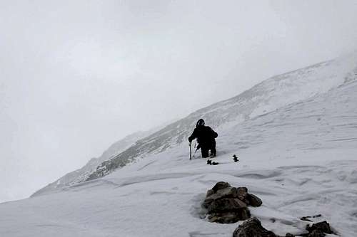
Gale on the ridge (wind speed around 68 mph)
Of course this is also one of the most beaten tracks of the Maiella massif. It seems a reasonable choice for winter ascends, too, as there are also two interesting high alpine ski pistes on the northern slope of this mountain (north and northeastern direction), but after heavy snowfall you might have to park well before reaching the actual trailhead.
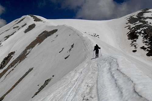
From the mountain hut Rifugio Bruno Pomilio an asphalt road (closed for traffic) and later the actual hiking trail follows the crest which leads up to Monte Blockhaus (2,070m / 6,791ft) and keeps ascending steadily towards Monte Cavallo (2,171m / 7,122ft). Descending towards a col called 'Sella Acquaviva' you will encounter a small well. This is the last possibility to replenish water supplies. From the col the trail gets notably steeper as it leads up to a panoramic ridge on whose east shoulder is located one of the more comfortable bivouacs, Bivacco Fusco.
Keeping to the ridge the path resumes the ascent towards the peak of Monte Focalone (2,676m / 8,779ft). Turn left and simply follow the ridge line in an eastern direction until reaching the foresummit and, finally, the summit cross of Monte Acquaviva.
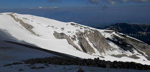
The north route via Monte Blockhaus (background) and Monte Cavallo
However, it is also possible to take the "full tour", starting out directly from the small village of Pennapiedimonte (669 m / 2,194 ft). The rather well signposted hiking trail G1 is absolutely worth the strain. Passing the mountain hut 'Rifugio Peschioli' and traversing the minor peaks of Monte la Rapina (1,489m / 4,885ft) and Monte Rochetta (1,662m / 5,452ft), the entire trail is a pleasurable walk on a prolonged crest.
2.1 From Rifugio Martellese - Canale Claudia (climbing / mixed climbing)
"Canale Claudia", one of the most interesting climbing routes, uses one of the steep gullies of the north-east face of the mountain ("Le pareti"). The route features a few passages on easy rock (II UIAA). It is rated PD+/AD- (55°/60°), depending on the exit, about 700 m long and comes with an elevation gain of about 400 m. From the broad east shoulder of Monte Acquaviva it is an easy walk up to the summit cross.
The long and strenuous approach is from the valley 'Vallone di Palombaro' and the unguarded mountain hut 'Rifugio Martellese' (always open), situated at 2,053 m, right on the col between Monte Ugni and Monte Martellese. There are two possible routes to the mountain hut: one via the beautiful 'Vallone di Palombaro', the other via a dirt track and, later, a hiking path which passes also the mountain huts 'Rifugio di Colle Strozzi' (key required) and 'Rifugio Ugni'. Either way the overall elevation gain from the trailhead to the summit of Monte Acquaviva exceeds 2,000 m.
3. From Caramanico or S. Eufemia a Maiella - West routes (hiking)
Although neither the most beautiful nor the easiest route, it is also well possible to approach Monte Acquaviva from the west. From the mountain hut 'Rifugio Guado S. Antonio' take the hiking trail B5 which winds up towards the ridge. Once traversed the peak of Monte Rapina (2,027m / 6,650ft), this ridge offers truly stunning views over the valley 'Rava del Diavolo' as it leads up to the summit of Pesco Falcone (2,657m / 8,717ft). To the right you can already catch a glimpse of the summit of Monte Amaro, to the left the beautiful south face of Monte Rotondo (2,658m / 8,720ft) can be admired. Descend towards a point where the summit ridge terminates and turn left (east).
Crest of the '3° Portone' (from Monte Rotondo, east ridge) - Monte Amaro (background)
It will be necessary to descent a good deal before reaching a long crest (called 'Tre portoni') which meanders first in direction of Cima Pomilio (2,656m / 8,713ft) and, now in a northeastern direction, towards Monte Focalone. Turn right and follow the ridge line until reaching the foresummit and the summit of Monte Acquaviva.
4. From Campo Di Giove or Palena - South routes (hiking)
An ascend from the south side can be recommended exclusively as part of a tour of several days, with at least one overnight stay at one of the numerous bivouac opportunities. The approach from the south is very long. From the village of Campo di Giove it is possible to take the hiking trail P1 which leads first to Monte Macellaro (2,636m / 8,648ft) and continuous in direction of Monte Amaro. Heading north you will have to pass the crests of 'Tre Portoni' (engl. 'The three portals'), i.e. the peaks of Cime dei Tre Portoni, Cima Pomilio and Monte Focalone, before finally reaching the prolonged west ridge of Monte Acquaviva.
 Ridge between Monte Focalone and Cima Pomilio | 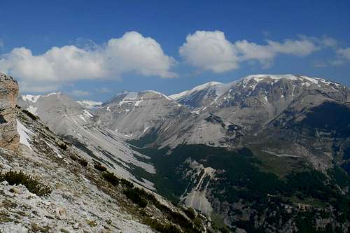 Monte Acquaviva, Mt. Sant'Angelo and Cima dell'Altare (from right to left) |
Instead of leaving your car at Campo di Giove (path P1 from the south-west), you may also start from Palena (path L from the south-east) and follow indications for Guado di Coccia, a known skiing area and the actual trailhead for many excursions to the peaks of the southern part of the Maiella massif and the prolonged ridge of Cima Ogniquota and Monte Porrara. A not always evident trail leads up to the peaks of Tavola Rotonda (2,404m / 7,887ft) and Cima di Femmina Morta (2,423m / 7,949ft), just before conjoining at 'Forchetta di Majella' with the the above mentioned hiking path. From this point the trail ('Sentiero del Parco') is skirting the crests an ridges in direction of Monte Macellaro and Monte Amaro. The bare and lunar landscape of this high plateau holds a fascination all of its own, but keep in mind that no well or any other form of drinkable water is to be found anywhere near.
 Cima delle Murelle (from Monte Acquaviva) | 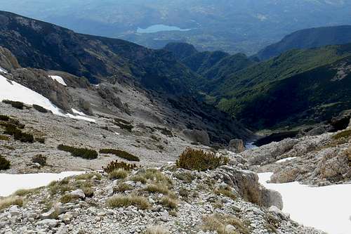 Valle dell'Acquaviva | 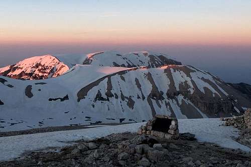 Mt. Aquaviva & Mt. Sant'Angelo (from Monte Amaro) |
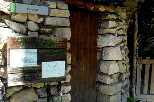 Grotta dei Callarelli (bivouac) | 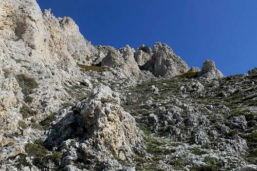 Rock formation (east face) | 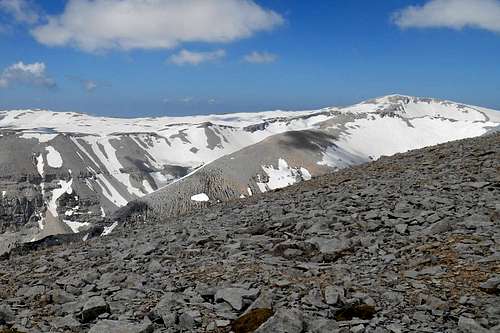 Monte Amaro (from the summit plateau) |
 Valle del Forcone | 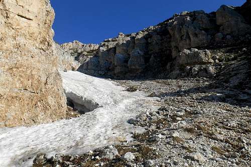 Entrance central gully (east face) | 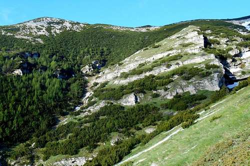 Monte Pizzone and Valle dell'Acquaviva |
Getting there
The closest international airport is Pescara (about 65 km). From Rome and its big international airports it is a considerably longer journey of 180-220 km (depending on the trailhead). Public transport (both bus and train) is limited and should be checked well before embarking on a journey to the Mailella massif. Maiella massif (road map)
- from Pescara (airport): take the the state road SS5, then SS649 and later SS81 in direction of the country road SP214 for Fara San Martino; depending on your trailhead of choice, you may also take the country road SP214 already at Mandrone and follow indications for Pennapiedimonte or Pretoro
- from Ancona (highway E80/A14): take the Exit Pescara Ovest-Chieti and simply follow the road indicated above
- from Bari/Taranto (highway E80/A14): take the Exit 'Val del Sangro' in direction Casoli (state road SS652), at Piane d'Archi-Casoli take the state road SS154 and then SS84 in direction Casoli; from Casoli follow the indications for your trailhead of choice (Fara San Martino, Palombaro etc.)
- from Rome: take the highway E80/A24 and later E80/A25, at Pratola Peligna-Sulmona you may exit the highway for Sulmona and follow indications for Cansano and Campo di Giove
Red Tape
The entire Majella mountain range (or Maiella massif) is an integral part of the Maiella National Park, one of the three national parks of the Abruzzo region. The park was constituted in 1991. The same rules apply as for any other national park in Italy. Free camping is not allowed. There are no fees or permits required.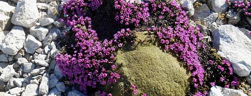
Saxifraga latina (famiglia Saxifragaceae)
The Majella National Park is home to an exceptional varied wild life. For instance, you will almost certainly spot several specimen of the generally shy Chamois (Rupicapra rupicapra), prying human intruders from a save distance or from behind a rock.
When to Climb
Monte Acquaviva is no technical mountain and can be climbed all year round. Because of its proximity to the Adriatic Sea and the overall altitude (between 8,000 and 9,000 ft) substantial snowfalls are very frequent. The summit plateaus hold snow accumulations well into summer.There are many interesting hiking trails to explore. Although most of these trails generally not require mountaineering equipment, the approach to any of the major peaks is very long and physically demanding. Some of these routes are counted among the most arduous of the entire Apennines. To give only one example, the difference in height to be negotiated on the normal route to Monte Amaro alone sums up to almost 8.000 ft (one way).
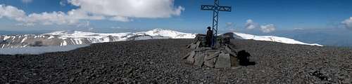
Summit plateau panorama (Monte Acquaviva)
Above the 5,500 ft mark there is almost no possibility to replenish your water supplies; except for melting snow. Winter ascends should always be planned with foresight. They will require basic equipment (crampons, ice axe etc.) as well as getting up very early in the morning. On the steeper slopes occasionally occurring slab avalanches should be taken into account, especially in spring. Late May through late June or September through early October are perhaps the most recommendable periods. However, keep in mind that violent thunderstorms are rather frequent in late spring and early summer, so check the weather forecast for your entire stay on these mountains. In July and August it might be easier to move around on the high plateaus and ridges, but the temperature in the valleys below can become excessive, making an already taxing approach become even more strength sapping.
Accomodation, mountain huts etc.
Unlike other ranges of the Central Apennines, the Majella mountain range offers a large number of frugal bivouac opportunities and unguarded mountain huts. Some of these accommodations are mere shelters without any comfort, others are equipped with a fireplace and a well in the proximity. While the bivoucs are always open, the use of the unguarded mountain huts generally requires a key which can be picked up from the respective proprietor.- Bivacco Fusco - located at 2,455 m, between Cima delle Murelle, Monte Focalone and Monte Cavallo; simple metal sheet hut (painted yellow) - always open, unguarded, no heating or water; for max. 9 guests
- Grotta dei Porci - located at 1,700m, on the high plan of Piano della Casa; natural cave transformed into a simple shepherds hut - always open, unguarded, with a simple fireplace, for max. 3 per., water supply can be refilled on a fountain (Fonte del Milazzo) a few hundred meters before reaching the cave
- Grotta dei Callarelli - located at 1,553m, at the junction of Valle dell'Acquaviva and Valle delle Murelle; another natural cavity - always open, unguarded, with a basic fireplace, water can be found at a nearby spring or taken from the torrent that descends Valle delle Murelle
- Rifugio Bruno Pomilio - located at 1,892m, location 'La Maielletta', at the end of the asphalt road; mountain hut - open all year round, board and lodging, warm showers etc., for room booking call +39 0871 447830, for max. 30 guests. The hut was re-opened, after 8 years, in September 2015 and might be the perfect choice for anyone considering a longer stay.
Maps
There are several guidebooks and detailed maps available for the Majella mountain range. Most maps, however, are "hybrids" based on the original maps by the Military Geographic Istituto Italiano (IGMI - 1:25.000) and updated regarding to changes already conducted or planned (!) by the park authorities. Although the general geographical features are quite accurate, several charted hiking trails do exist only on these maps. Remnants of the old signposting system (yellow numbers on green background) can be found scattered all over the place and should not be confused with the new one (red and white).
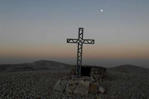
Monte Acquaviva at sunrise
- Parco Nazionale della Majella, Società Editrice Richerche 2008, map scale 1:25.000 (hiking atlas)
- Majella. Carta escursionistica, Edizioni Il Lupo, 2nd edition 1990, map scale 1:25.000 (hiking map)
- Guida all'alta via della Majella, CARSA 2002 (guidebook)
- Parco nazionale della Majella. 30 itinerari scelti nel cuore della Montagna madre, Edizioni Mediterranee 2007, map scale 1:50.000 (comprehensive guidebook with a selection of various itineraries, b/w images)